
Silver Apron
California • Yosemite National Park
By Armen Suny · Last verified Oct 2026
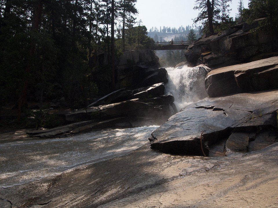


Photo Credits (5)
Difficulty
Moderate
Trail Length
3.5 miles
Trail Type
Out And Back
About Silver Apron
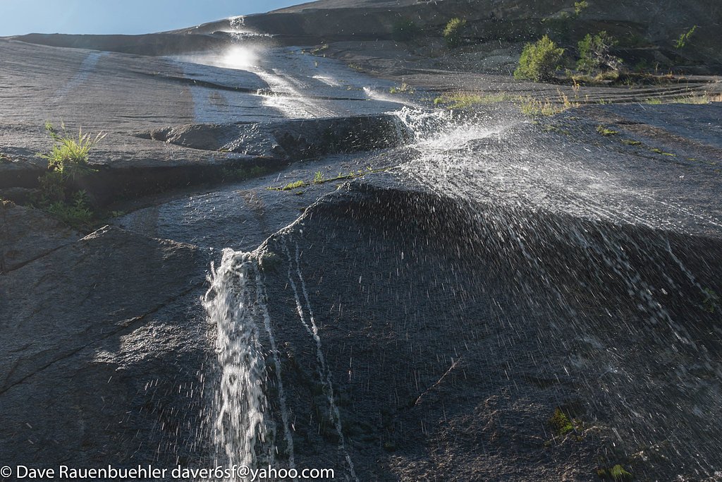
Silver Apron is a smooth granite slope located in Yosemite National Park, California, just downstream of Nevada Fall. It is a popular spot for visitors due to its unique appearance and proximity to other iconic landmarks in the park. The area is known for its natural beauty and the cascading water that flows over the granite surface, especially during the spring and early summer when water levels are higher.
The Setting
Silver Apron sits at 5,102 feet within Yosemite National Park, in the high mountains of California.
Nearby Falls Worth Visiting
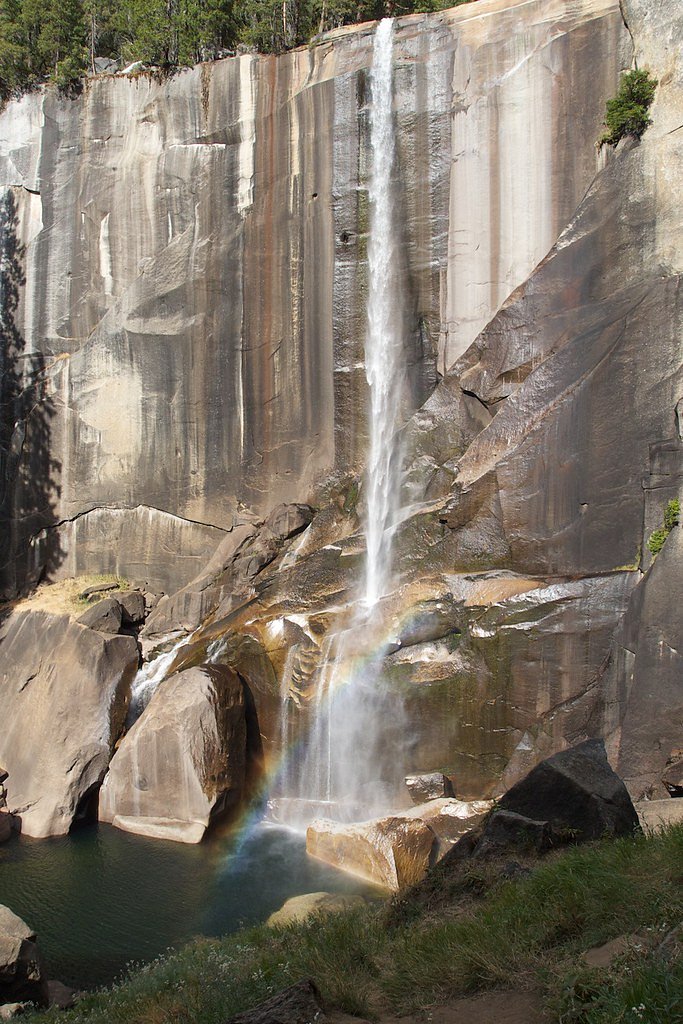
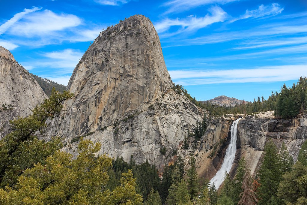
Nevada Fall (594 ft) lies 0.4 miles to the east. Also nearby: Illilouette Falls (370 ft, 1.5 mi) and Vernal Fall (317 ft, 0.3 mi).
Trail & Hike Details
Trail Description
The trail to Silver Apron is part of the Mist Trail, one of Yosemite's most popular hiking routes. It features steep sections, stone steps, and stunning views of Vernal Fall and Nevada Fall. The trail can be slippery, especially near the waterfalls, so caution is advised.
What to Expect
Visitors can expect breathtaking views of cascading waterfalls, granite cliffs, and lush forested areas. Silver Apron itself is a smooth granite slope with water flowing over it, creating a unique and picturesque scene. The area is often crowded during peak seasons.
Accessibility
The trail is not wheelchair accessible. Uneven terrain and elevation changes require steady footing.
Frequently Asked Questions
🐶 Are Dogs Allowed at Silver Apron?
❌ Dogs are not allowed
Pets aren't allowed on Yosemite trails or in wilderness, except the Bridalveil Fall, Lower Yosemite Fall, Cook's Meadow and Wawona Meadow Loop trails.
Are There Any Fees or Permits Required?
🤑 Fee: $35.00
🏊 Is There Swimming at Silver Apron?
❌ Swimming is not allowed
When to Visit
The best time to visit Silver Apron is during late spring or early summer when water levels are higher, and the waterfalls are at their most impressive. Fall offers cooler temperatures and fewer crowds.
Seasonal Access
The best time to visit is Spring, Summer, and Fall. Access roads and trails may close during winter due to snow. Check with Yosemite National Park for current conditions.
Safety Information
Water temperature is currently 44°F — cold enough to cause numbness quickly. Avoid prolonged water contact and use caution near the falls.
The granite surfaces around Silver Apron can be extremely slippery, especially when wet. Stay on designated trails and avoid venturing too close to the water. Be cautious of strong currents and steep drop-offs.
Current Water Conditions
These readings come from the USGS gauge on Merced River A Happy Isles Bridge, 1 miles away, not on Silver Apron's own stream. Use them as a sign of whether the area is running wet or dry.
16 ft³/s
Current discharge — how much water is flowing
About average for this time of year
Based on 111 years of record
1.01 ft
Water depth at gauge
44°F
Very coldExpect numbness within minutes
7-Day Discharge Trend
What does this mean for your visit?
Flow is about average for this time of year. Water temperature is very cold at 44 degrees F, expect numbness within minutes.
About This Gauge
7-Day Flow Outlook
Based on the USGS gauge MERCED R A HAPPY ISLES BRIDGE NR YOSEMITE CA (2 km away).
Today
Barely Flowing
16 cfs
5/10Tomorrow
Barely Flowing
16 cfs
5/10Fri
Low
19 cfs
3/10Sat
Low
20 cfs
4/10Sun
Barely Flowing
20 cfs
5/10Mon
Barely Flowing
21 cfs
2/10Tue
Barely Flowing
23 cfs
2/10Best window: Today — barely flowing flow, sunny (trip score 5/10).
Best time of year: this gauge typically runs highest from early April to early July, peaking in June.
How we calculate this
This is a transparent outlook, not a precise forecast. We take the waterfall's current flow strength (how it ranks against its historical normal for today, from the nearest USGS stream gauge), carry that ranking forward along the gauge's seasonal curve, and nudge it for forecast rain. Confidence is highest for the next day or two and falls further out. Always check official conditions and your own judgment before visiting — high flows can be dangerous.
Know when to go.
Get a free email alert when waterfalls near Yosemite Valley hit peak flow. We only send when conditions are worth the trip — no weekly newsletters, no spam.
Is Silver Apron Frozen?
Updated about 11 hours agoNot frozen highs above freezing lately
Silver Apron is not frozen right now; highs have been above freezing. Yesterday ran 68°F to 46°F.
- Days below freezing
- 0 of the last 14
- Current cold streak
- 0 days
- Freezing days ahead
- 0 of the next 7
- Flow
- 16 ft³/s
Winter safety. Frozen falls are the one waterfall trip with a documented injury pattern: falling ice, and ice-glazed rock and trail. Wear microspikes, keep well back from the base and from overhangs, and never walk out on ice over moving water.
Estimate from Open-Meteo daily temperatures at the falls, the LiDAR-measured facing direction, and the nearest stream gauge. It is a likelihood, not a report from the trail.
Weather Forecast
Location & Access
Getting There
Silver Apron is accessible via the Mist Trail or the John Muir Trail in Yosemite National Park. Visitors typically start from the Happy Isles trailhead in Yosemite Valley. The trail to Silver Apron passes by Vernal Fall and continues toward Nevada Fall.
Get Directions on Google MapsParking
Parking is available at the Yosemite Valley trailhead parking lot near Happy Isles. Arrive early during peak seasons to secure a spot.
Elevation
5,102 feet above sea level
Coordinates
37.726871° N, -119.540717° W
Land Management
Managed by NPS
Visitor Tips & Gear
Start your hike early to avoid crowds and secure parking. Wear sturdy footwear with good grip, as the trail can be slippery. Bring plenty of water and snacks, as the hike involves significant elevation gain.
Where to Stay
Yosemite View Lodge
Big Creek Inn
Tenaya at Yosemite
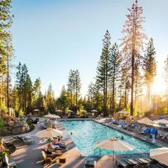
Rush Creek Lodge at Yosemite
Browse vacation cabins and private rentals nearby
Unique outdoor stays — tents, yurts, and treehouses
Rent a campervan or RV for your waterfall road trip
Some links are affiliate links. We may earn a commission at no extra cost to you.
Nearby Campground
Upper Pines Campground
1.3 miles away · 240 sites
Overview Upper Pines campsites are available to reserve up to five months in advance on the 15th of each month at 7:00 a.m. PST. For example, on January 15, arrival dates for the period May 15 to June 14 become available to reserve, and therefore, the full arrival date window would be from January 15 to June 14. Reservation Tips! Campsites in Yosemite are extremely popular and typically sell out in minutes. Login to your account or create a new account before the 7:00 a.m. (PST) release time. Yo
Book on Recreation.govNearby Hot Springs
Hot springs near Arnold, California

Reds Meadow Hot Springs
Reds Meadow Hot Springs flows at an impressive 115°F high in the Eastern Sierra at 7,638 feet elevation, delivering water 72 de...

Fumaroles
Fumaroles vent superheated steam high in the Sierra at 8,167 feet, where the geothermal system expresses itself through mountai...
Unnamed Spring Mono County 7
This 97-degree thermal spring sits at 8,159 feet elevation within Inyo National Forest, running an extraordinary 56.7 degrees a...

Unnamed Spring Mono County 2
At 7,313 feet elevation, this 72-degree thermal spring near Mammoth Lakes flows just 45 meters from El Camino Sierra Road in ha...

Unnamed Spring Mono County 5
This 72-degree thermal spring near Bridgeport sits at 6,383 feet elevation, requiring a short 160-meter walk from the road in M...
Casa Diablo Hot Springs And Geyser
Casa Diablo Hot Springs and Geyser erupts at 199 degrees Fahrenheit—one of California's most extreme geothermal features. Locat...
Looking for a soak after your hike? Explore more hot springs near Arnold, California on SoakingSprings.
Explore California springsAdditional Information
Nearby Attractions
Vernal Fall, Nevada Fall, Half Dome, Yosemite Valley
Wildlife
Visitors may encounter deer, squirrels, and a variety of bird species. Bears are also present in Yosemite, so proper food storage is essential.
Cities near Silver Apron
Nearby Waterfalls
Writing about Silver Apron? Embed this waterfall on your site for free.