
Photo Credits (5)
Difficulty
Moderate
Trail Length
2.4 miles
Trail Type
Out And Back
Elevation Gain
350 ft
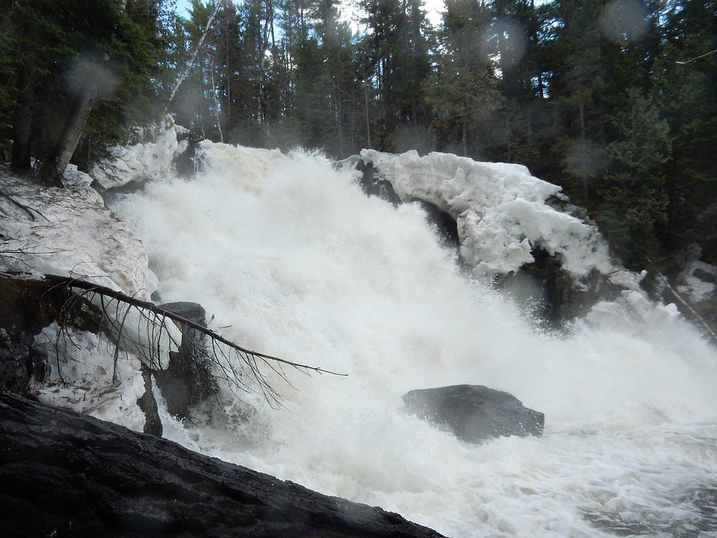
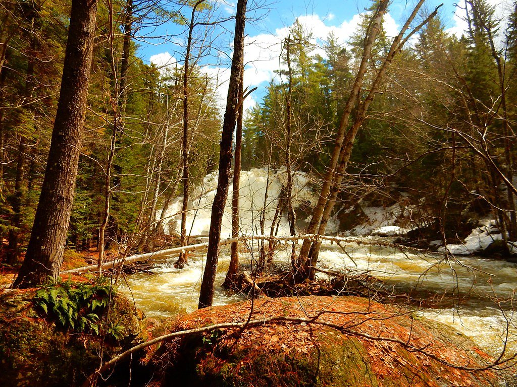
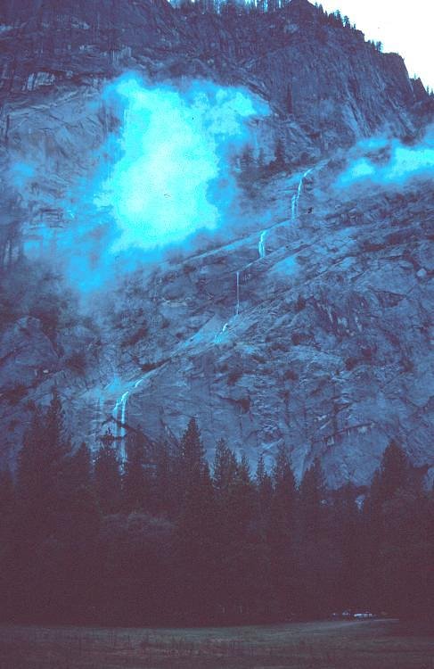
About Shin Falls
Shin Falls sits in the remote township of T6 R7 WELS in northern Maine, a peaceful cascade that tumbles over a series of rocky ledges. The falls are especially photogenic after heavy rains when multiple channels swell and the rocky tiers come alive — a rewarding spot for hikers and photographers seeking a quieter, less-visited natural scene. Visitors commonly reach the falls via a short hike: a 2.4-mile out-and-back route that climbs roughly 350 feet and is typically rated moderate. The approach threads through mixed woods and opens to the waterfall, making Shin Falls an accessible yet secluded destination for day hikers who enjoy a bit of solitude and scenic waterfall views.
The Setting
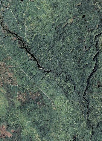
Shin Falls sits at 666 feet along the Seboeis River, in the foothills of Maine.
Trail & Hike Details
The Approach
The moderate 2.4-mile out-and-back trail gains 350 feet of elevation on the way to the falls.
Trail Description
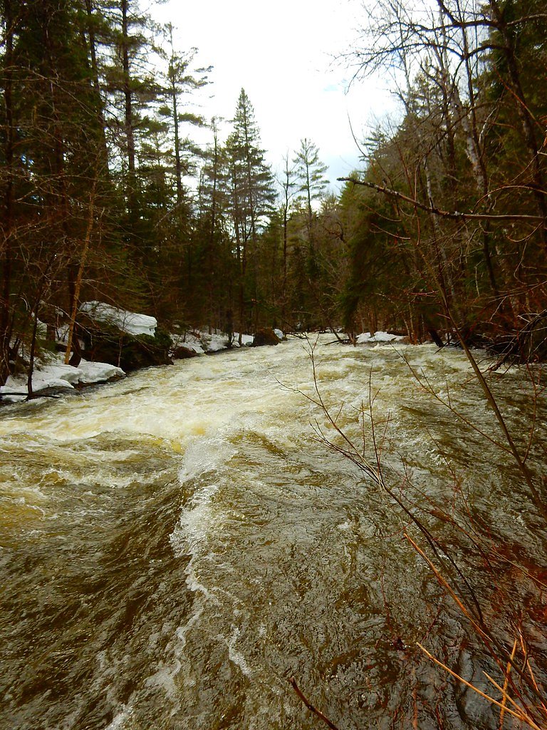
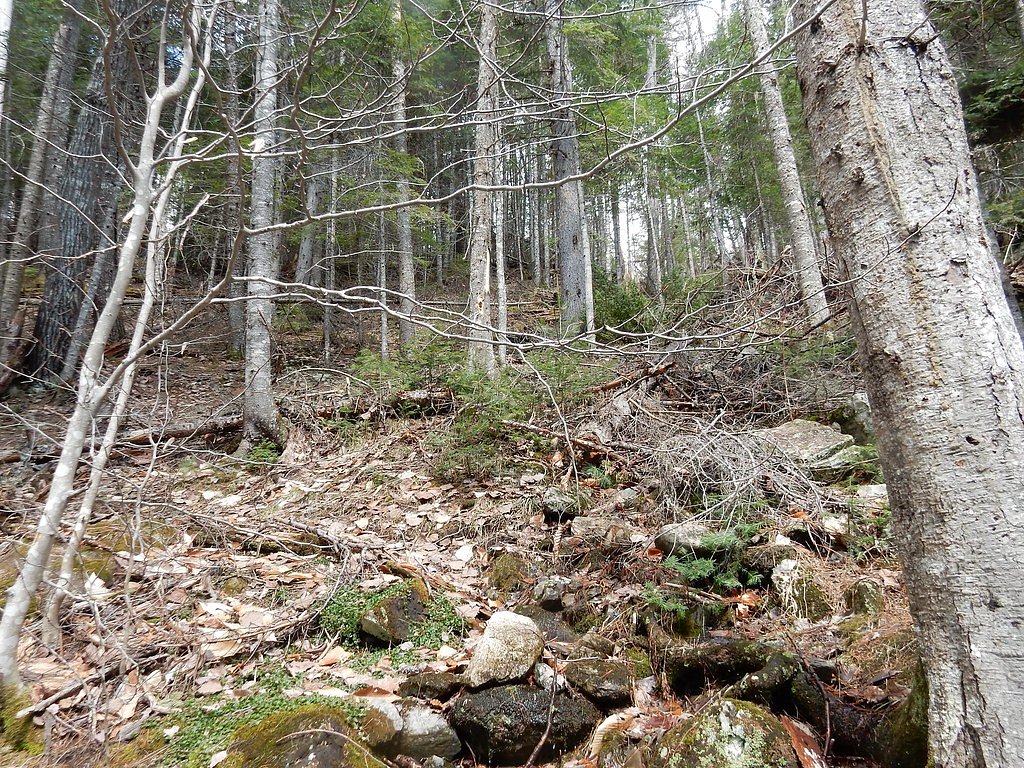
Trail length: 2.4 miles (out-and-back). Elevation gain: ~350 feet. Difficulty: Moderate. The trail is a single, well-defined footpath through wooded terrain with a generally moderate grade and a few short, steeper pitches. Expect uneven, sometimes rocky or root-strewn tread and occasional wet or slippery sections near the water; sturdy footwear is recommended. The route is out-and-back, offering a straightforward approach and return along the same path, with the best views of the cascade at the trail end.
What to Expect
Dogs are welcome.
Accessibility
The trail is not wheelchair accessible. Uneven terrain and elevation changes require steady footing.
Frequently Asked Questions
🐶 Are Dogs Allowed at Shin Falls?
✅ Dogs are allowed
Are There Any Fees or Permits Required?
🆖 No fees required
🏊 Is There Swimming at Shin Falls?
❌ Swimming is not allowed
When to Visit
The best time to visit Shin Falls is in the spring or early summer when water levels are highest. Fall is also a great time to visit, as the surrounding foliage adds to the beauty of the area.
Seasonal Access
The best time to visit is Spring, Summer, and Fall. Winter access may be limited.
Safety Information
Visitors should exercise caution near the falls, as the rocks can be slippery, especially when wet. Be aware of your surroundings and avoid getting too close to the edge.
Current Water Conditions
198 ft³/s
Current discharge — how much water is flowing
About average for this time of year
Based on 28 years of record
5.50 ft
Water depth at gauge
7-Day Discharge Trend
What does this mean for your visit?
Flow is about average for this time of year.
About This Gauge
7-Day Flow Outlook
Based on the USGS gauge Seboeis River near Shin Pond, Maine (2 km away).
Today
Barely Flowing
214 cfs
3/10Tomorrow
Low
249 cfs
3/10Mon
Barely Flowing
261 cfs
4/10Tue
Low
248 cfs
3/10Wed
Low
224 cfs
4/10Thu
Low
226 cfs
3/10Fri
Low
218 cfs
4/10Best window: Mon — barely flowing flow, patchy fog then sunny (trip score 4/10).
Best time of year: this gauge typically runs highest from late March to late May, peaking in April.
How we calculate this
This is a transparent outlook, not a precise forecast. We take the waterfall's current flow strength (how it ranks against its historical normal for today, from the nearest USGS stream gauge), carry that ranking forward along the gauge's seasonal curve, and nudge it for forecast rain. Confidence is highest for the next day or two and falls further out. Always check official conditions and your own judgment before visiting — high flows can be dangerous.
Know when to go.
Get a free email alert when waterfalls near Patten hit peak flow. We only send when conditions are worth the trip — no weekly newsletters, no spam.
Weather Forecast
Location & Access
Getting There
Shin Falls is located in a remote area of northern Maine. Access typically involves driving on logging roads, so a high-clearance vehicle is recommended. Directions can vary depending on the condition of the roads, so it is advisable to consult a map or GPS before heading out.
Get Directions on Google MapsParking
There is a small parking area near the falls, but it may be unmarked and located along a dirt road. Visitors should ensure they do not block any access roads or gates.
Elevation
666 feet above sea level
Coordinates
46.139214° N, -68.613650° W
Visitor Tips & Gear
Bring bug spray during the warmer months, as mosquitoes and black flies can be prevalent. Be prepared for remote conditions, as there are no facilities nearby. Cell service may be limited, so plan accordingly.
As an Amazon Associate, we earn from qualifying purchases.
With 2.4 miles and 350 ft of elevation gain, sturdy boots and trekking poles will help on this moderate trail. Sun exposure on the trail makes good sun protection a must in summer.

Polarized Sunglasses (Knockaround)
Cuts glare off the water so you actually see the falls — and your photos turn out better too.

Columbia Watertight II Rain Jacket
Packs into its own pocket, seam-sealed, and keeps you dry from spray and surprise rain.

Earth Pak Waterproof Dry Bag
Keeps your phone and gear dry when waterfall mist soaks everything else.

Waterproof Phone Pouch (AiRunTech)
Cheap insurance — take photos right next to the falls without killing your phone.

Timberland Euro Sprint Mid Waterproof
Trusted waterproof boot with premium leather and grippy rubber sole — reliable on rocky, wet trails.

TrailBuddy Trekking Poles
Lightweight aluminum, cork grips, and flip-locks that actually hold — a best-seller for good reason.
Where to Stay

Sewall House Yoga Retreat

Mattawamkeag River Cottage

Black Bear Dens

All Season Fun and Cozy Home in Island Falls, ME
Browse vacation cabins and private rentals nearby
Unique outdoor stays — tents, yurts, and treehouses
Rent a campervan or RV for your waterfall road trip
Some links are affiliate links. We may earn a commission at no extra cost to you.
Nearby Campground
Katahdin Woods and Waters National Monument Camping and Huts
9 miles away · 27 sites
Overview Katahdin Woods and Waters National Monument is located in Maine’s north woods. Katahdin Woods and Waters protects part of an extraordinary natural and cultural landscape: the mountains, woods, and waters where the East Branch of the Penobscot River and its tributaries, including the Wassataquoik Stream and the Seboeis River, run freely. Campsites, lean-tos and huts located throughout the monument provide opportunities to stay overnight while hiking, biking, paddling and enjoying other re
Book on Recreation.govAdditional Information
Nearby Attractions
The nearby Allagash Wilderness Waterway offers opportunities for canoeing, fishing, and wildlife viewing.
Wildlife
The area around Shin Falls is home to a variety of wildlife, including moose, deer, and a range of bird species.
Cities near Shin Falls
Nearby Waterfalls
Writing about Shin Falls? Embed this waterfall on your site for free.