Photo Credits (2)
Difficulty
Moderate
Trail Length
2.4 miles
Trail Type
Out And Back
Elevation Gain
350 ft
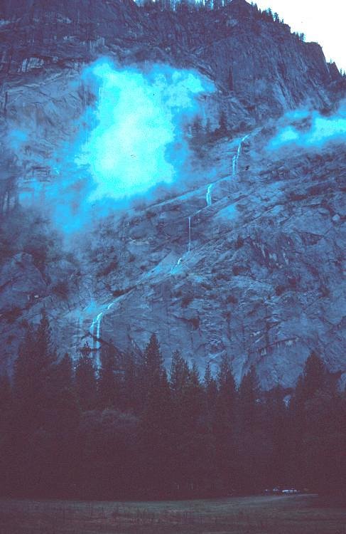
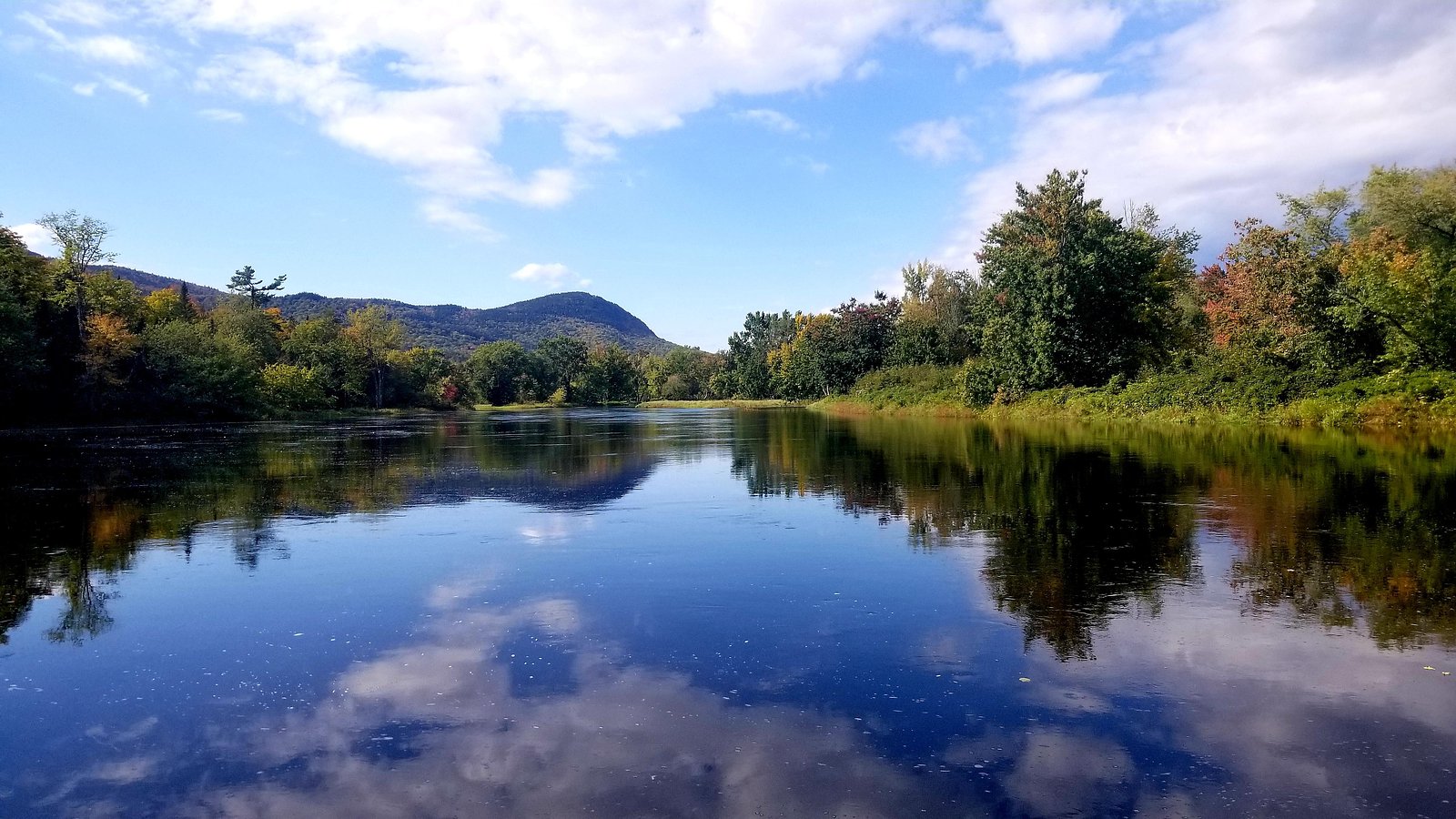
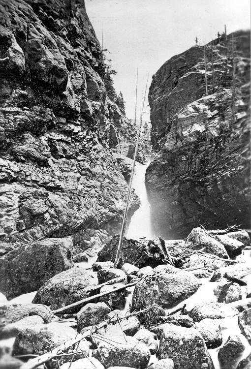
About Bowlin Falls
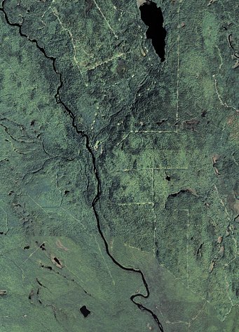
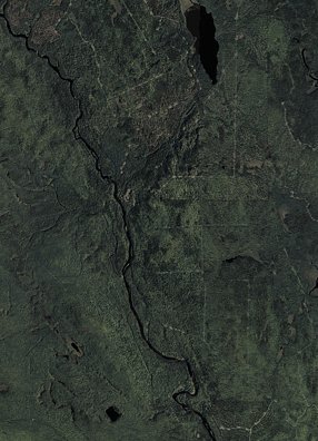
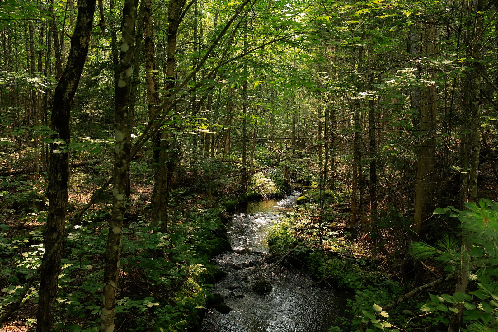
Bowlin Falls tumbles along the East Branch of the Penobscot River, tucked into the deep woods of Katahdin Woods and Waters National Monument in Maine. The falls reward visitors with a picture-postcard cascade set against a remote, forested backdrop—perfect for photographers and hikers looking for a quiet stretch of river scenery within the monument. Accessing Bowlin Falls involves a relatively short outing that still feels wild. The route into the falls is a moderate 2.4-mile out-and-back with about 350 feet of elevation gain, so expect a bit of climb and wooded trail as you approach the river. Nestled within the Katahdin Woods and Waters National Monument, the site invites a half-day visit to enjoy the falls and surrounding wilderness; facilities and formal campgrounds are not immediately adjacent to the trailhead.
The Setting
Bowlin Falls sits at 492 feet along the E. Br. Penobscot River, in the coastal lowlands of Maine.
Trail & Hike Details
The Approach
The moderate 2.4-mile out-and-back trail gains 350 feet of elevation on the way to the falls.
Trail Description
This is an out-and-back route of approximately 2.4 miles round trip with roughly 350 feet of elevation gain. The trail is rated moderate and follows a forested path along the East Branch of the Penobscot River, offering incremental climbs and river views as you approach the cascade. No USFS trail number is listed; the trail is best described as a short, moderately paced hike through wooded terrain to the falls.
What to Expect
Dogs are welcome.
Accessibility
The trail is not wheelchair accessible. Uneven terrain and elevation changes require steady footing.
Frequently Asked Questions
🐶 Are Dogs Allowed at Bowlin Falls?
✅ Dogs are allowed
Are There Any Fees or Permits Required?
🆖 No fees required
🏊 Is There Swimming at Bowlin Falls?
❌ Swimming is not allowed
When to Visit
Spring and early summer are ideal for visiting Bowlin Falls, as the water flow is typically higher due to snowmelt and rainfall.
Seasonal Access
The best time to visit is Spring, Summer, and Fall. Winter access may be limited.
Safety Information
Visitors should be cautious of slippery rocks near the falls and avoid getting too close to the edge. Be prepared for remote conditions and carry a map or GPS device. Cell service may be limited in the area.
Current Water Conditions
1,050 ft³/s
Current discharge — how much water is flowing
About average for this time of year
Based on 2 years of record
3.83 ft
Water depth at gauge
68°F
CoolRefreshing for swimming
7-Day Discharge Trend
What does this mean for your visit?
Flow is about average for this time of year. Water temperature is a refreshing 68 degrees F, good for a quick swim.
About This Gauge
This gauge is on a nearby waterway and may not reflect exact conditions at the falls.
7-Day Flow Outlook
Based on the USGS gauge E. Br. Penobscot River below Grand Lake Matagamon (12 km away).
Today
Moderate
1197 cfs
6/10Tomorrow
Moderate
1127 cfs
8/10Tue
Moderate
1056 cfs
8/10Wed
Moderate
1200 cfs
6/10Thu
Moderate
1457 cfs
6/10Fri
Moderate
1326 cfs
6/10Sat
Moderate
1202 cfs
6/10Best window: Tomorrow — moderate flow, sunny (trip score 8/10).
Best time of year: this gauge typically runs highest from mid March to mid May, peaking in May.
How we calculate this
This is a transparent outlook, not a precise forecast. We take the waterfall's current flow strength (how it ranks against its historical normal for today, from the nearest USGS stream gauge), carry that ranking forward along the gauge's seasonal curve, and nudge it for forecast rain. Confidence is highest for the next day or two and falls further out. Always check official conditions and your own judgment before visiting — high flows can be dangerous.
Know when to go.
Get a free email alert when waterfalls near Patten hit peak flow. We only send when conditions are worth the trip — no weekly newsletters, no spam.
Weather Forecast
Location & Access
Getting There
Bowlin Falls is located within the Katahdin Woods and Waters National Monument. Access is typically via gravel roads, and visitors should check current road conditions before traveling. The falls are near Bowlin Camps, a historic sporting camp in the area.
Get Directions on Google MapsParking
Parking is available near Bowlin Camps or at designated areas within the Katahdin Woods and Waters National Monument. Visitors should confirm parking locations before their trip.
Elevation
492 feet above sea level
Coordinates
46.038658° N, -68.723374° W
Visitor Tips & Gear
Bring bug spray during the summer months as mosquitoes and black flies can be prevalent. Wear sturdy footwear, as the trail may be uneven in some areas. Check road and trail conditions before visiting, especially during winter or after heavy rains.
As an Amazon Associate, we earn from qualifying purchases.
With 2.4 miles and 350 ft of elevation gain, sturdy boots and trekking poles will help on this moderate trail. Sun exposure on the trail makes good sun protection a must in summer.

Polarized Sunglasses (Knockaround)
Cuts glare off the water so you actually see the falls — and your photos turn out better too.

Columbia Watertight II Rain Jacket
Packs into its own pocket, seam-sealed, and keeps you dry from spray and surprise rain.

Earth Pak Waterproof Dry Bag
Keeps your phone and gear dry when waterfall mist soaks everything else.

Waterproof Phone Pouch (AiRunTech)
Cheap insurance — take photos right next to the falls without killing your phone.

Timberland Euro Sprint Mid Waterproof
Trusted waterproof boot with premium leather and grippy rubber sole — reliable on rocky, wet trails.

TrailBuddy Trekking Poles
Lightweight aluminum, cork grips, and flip-locks that actually hold — a best-seller for good reason.
Where to Stay

Katahdin Valley Motel

Family Friendly Lakefront Cottage, Ambajejus Lake

All Season Fun and Cozy Home in Island Falls, ME

Black Bear Dens
Browse vacation cabins and private rentals nearby
Unique outdoor stays — tents, yurts, and treehouses
Rent a campervan or RV for your waterfall road trip
Some links are affiliate links. We may earn a commission at no extra cost to you.
Nearby Campground
Katahdin Woods and Waters National Monument Camping and Huts
7.1 miles away · 27 sites
Overview Katahdin Woods and Waters National Monument is located in Maine’s north woods. Katahdin Woods and Waters protects part of an extraordinary natural and cultural landscape: the mountains, woods, and waters where the East Branch of the Penobscot River and its tributaries, including the Wassataquoik Stream and the Seboeis River, run freely. Campsites, lean-tos and huts located throughout the monument provide opportunities to stay overnight while hiking, biking, paddling and enjoying other re
Book on Recreation.govAdditional Information
Nearby Attractions
Nearby attractions include Bowlin Camps, the East Branch of the Penobscot River, and other trails within the Katahdin Woods and Waters National Monument.
Wildlife
The area is home to a variety of wildlife, including moose, deer, and a range of bird species. Visitors should be cautious and respectful of wildlife.
Cities near Bowlin Falls
Nearby Waterfalls
Writing about Bowlin Falls? Embed this waterfall on your site for free.