Photo Credits (5)
Difficulty
Moderate
Trail Length
2.4 miles
Trail Type
Out And Back
Elevation Gain
350 ft
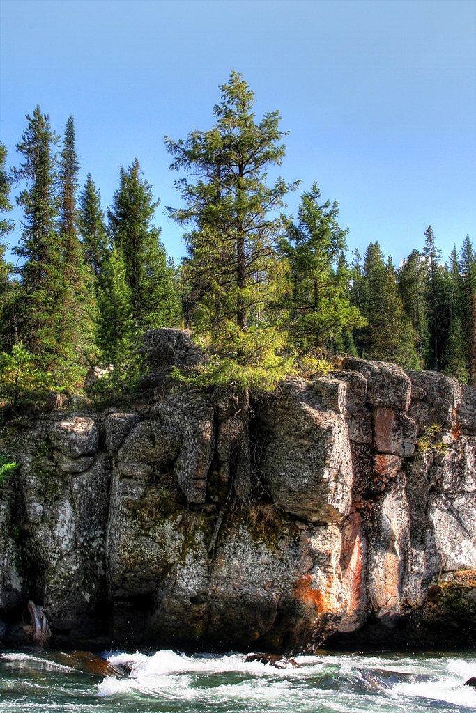
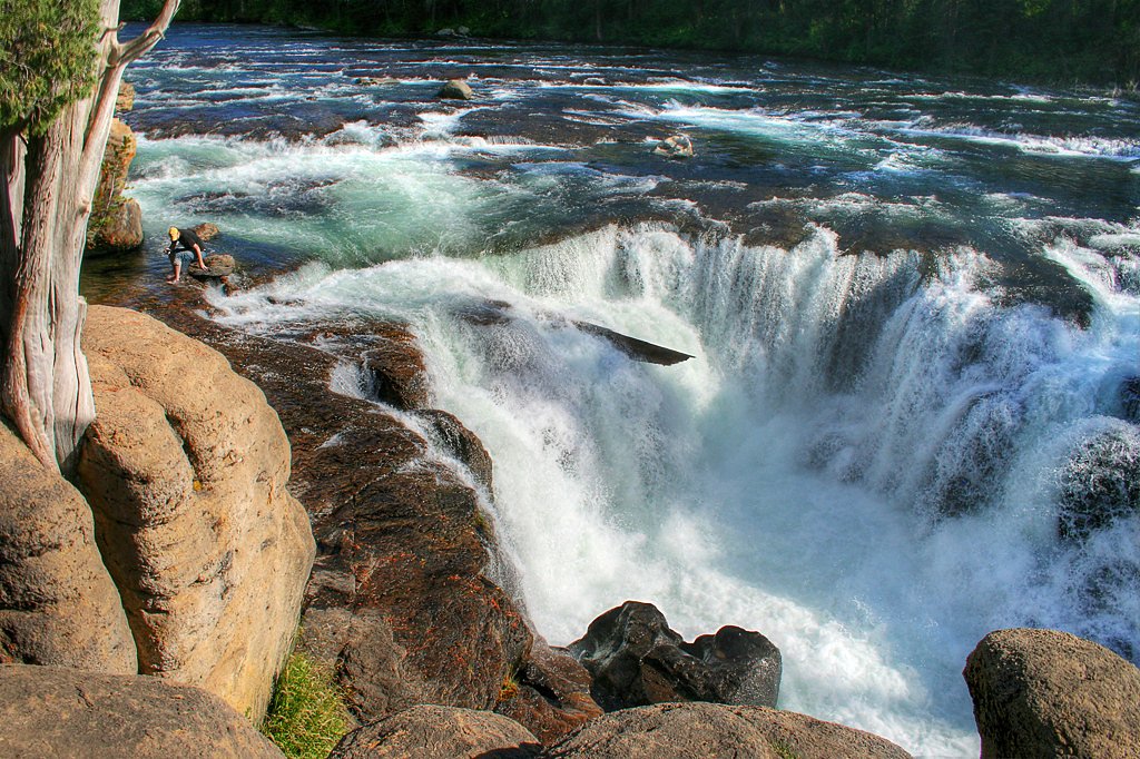
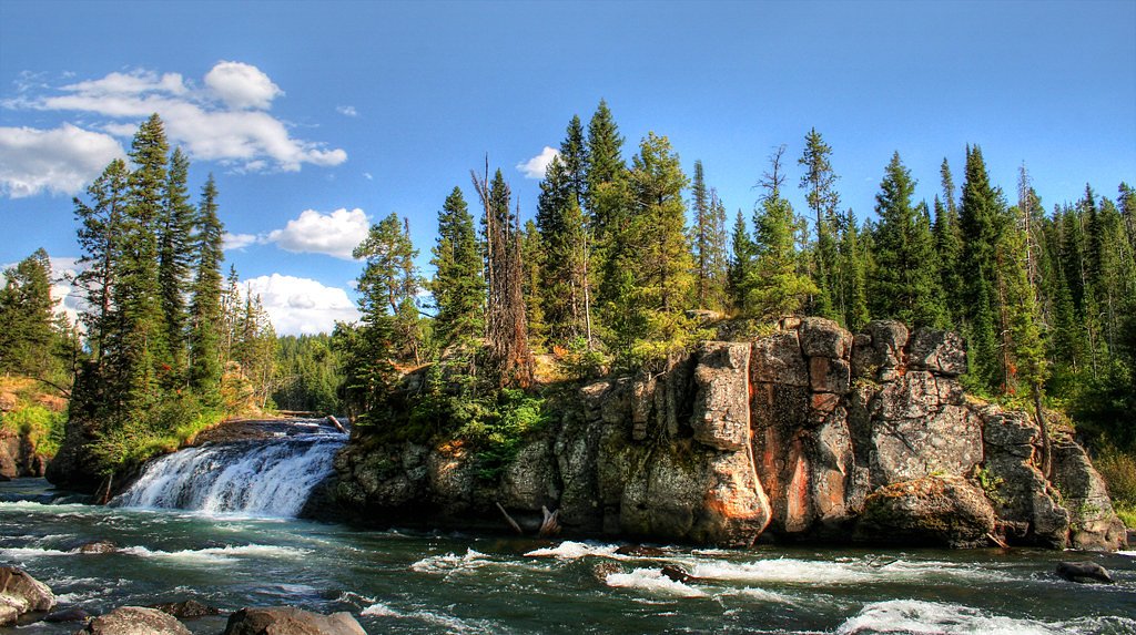
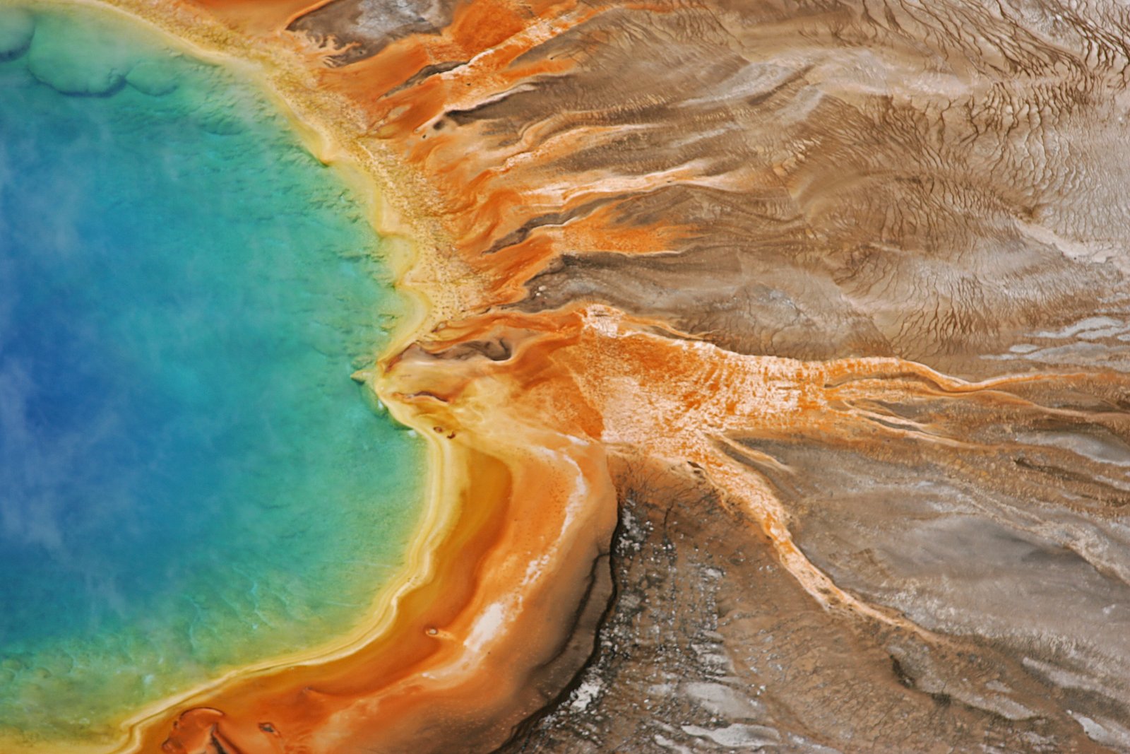
About Sheep Falls
Sheep Falls is a scenic waterfall located on the Snake River in eastern Idaho, nestled within Targhee National Forest and managed by the U.S. Forest Service. Surrounded by forested slopes, the falls provide a peaceful, photogenic stop for hikers and nature lovers looking to experience Idaho’s backcountry without a long approach. The site is accessible via a relatively short hike and makes a great half-day outing; for overnight trips, nearby camping is available at Squirrel Meadows Cabin, approximately 5.9 km from the falls. Whether you’re stopping for photos or combining the visit with a longer Targhee National Forest outing, Sheep Falls offers an inviting, easy-to-reach taste of the region’s scenery.
The Setting
Sheep Falls sits at 5,909 feet within Targhee National Forest, fed by the Fall River, in the high mountains of Idaho.
Trail & Hike Details
The Approach
The moderate 2.4-mile out-and-back trail gains 350 feet of elevation on the way to the falls.
Trail Description
The trail to Sheep Falls is an out-and-back route totaling about 2.4 miles round trip with roughly 350 feet of elevation gain. The USFS rates the route as moderate; the hike features short uphill sections but is suitable for most hikers and family groups comfortable with moderate terrain. USFS surface/grade/class specifics are not provided in the available data, but the trail serves as a straightforward approach to a viewpoint overlooking the falls.
What to Expect
Dogs are welcome.
Accessibility
The trail is not wheelchair accessible. Uneven terrain and elevation changes require steady footing.
Frequently Asked Questions
🐶 Are Dogs Allowed at Sheep Falls?
✅ Dogs are allowed
Are There Any Fees or Permits Required?
🆖 No fees required
🏊 Is There Swimming at Sheep Falls?
❌ Swimming is not allowed
When to Visit
The best time to visit Sheep Falls is during late spring through early fall when the trail is clear of snow and the water flow is at its peak.
Seasonal Access
The best time to visit is Spring, Summer, and Fall. Access roads and trails may close during winter due to snow. Check with Targhee National Forest for seasonal road closures.
Safety Information
Exercise caution near the falls as the rocks can be slippery. Be aware of changing weather conditions and carry bear spray if hiking in the area.
Current Water Conditions
751 ft³/s
Current discharge — how much water is flowing
Lower than usual for this time of year
Based on 32 years of record
6.06 ft
Water depth at gauge
7-Day Discharge Trend
What does this mean for your visit?
Flow is lower than usual for this time of year.
About This Gauge
7-Day Flow Outlook
Based on the USGS gauge FALL RIVER AB YELLOWSTONE CANAL NR SQUIRREL ID (5 km away).
Today
Low
751 cfs
6/10Tomorrow
Low
751 cfs
6/10Tue
Low
751 cfs
6/10Wed
Low
734 cfs
6/10Thu
Low
690 cfs
6/10Fri
Low
668 cfs
6/10Sat
Moderate
722 cfs
4/10Best window: Today — low flow, mostly sunny (trip score 6/10).
Best time of year: this gauge typically runs highest from mid April to mid July, peaking in June.
How we calculate this
This is a transparent outlook, not a precise forecast. We take the waterfall's current flow strength (how it ranks against its historical normal for today, from the nearest USGS stream gauge), carry that ranking forward along the gauge's seasonal curve, and nudge it for forecast rain. Confidence is highest for the next day or two and falls further out. Always check official conditions and your own judgment before visiting — high flows can be dangerous.
Know when to go.
Get a free email alert when waterfalls near Drummond hit peak flow. We only send when conditions are worth the trip — no weekly newsletters, no spam.
Weather Forecast
Location & Access
Getting There
Sheep Falls is located off Highway 20 near Island Park, Idaho. To reach the falls, take the Sheep Falls turnoff and follow the dirt road to the trailhead. A short hike is required to access the falls.
Get Directions on Google MapsParking
There is a small parking area near the trailhead. Parking may be limited during peak seasons.
Elevation
5,909 feet above sea level
Coordinates
44.081032° N, -111.091888° W
Land Management
Managed by USFS
Visitor Tips & Gear
Visit early in the day to avoid crowds, especially during summer. Wear sturdy shoes as the trail may have uneven sections. Bring insect repellent during warmer months.
This trail sits at 5,909 ft above sea level
Elevated TrailUV radiation is roughly 24% stronger at this elevation than at sea level, and the dry air accelerates dehydration. Extra sun protection and fluids go a long way.
As an Amazon Associate, we earn from qualifying purchases.

Coppertone Sport SPF 50 Sunscreen
UV intensity jumps ~4% per 1,000 ft — at this elevation you can burn in half the time.

Sun Bum SPF 30 Lip Balm (3-Pack)
Lips have almost no natural UV protection and burn fast in thin, dry mountain air.

Liquid I.V. Electrolyte Packets
You lose moisture ~2x faster at elevation — electrolytes help you absorb water efficiently.

ROCKNIGHT Polarized UV400 Sunglasses
High-altitude glare off rock and water is intense — UV400 lenses block 99%+ of UVA/UVB.
As an Amazon Associate, we earn from qualifying purchases.
With 2.4 miles and 350 ft of elevation gain, sturdy boots and trekking poles will help on this moderate trail. Sun exposure on the trail makes good sun protection a must in summer.

Polarized Sunglasses (Knockaround)
Cuts glare off the water so you actually see the falls — and your photos turn out better too.

Columbia Watertight II Rain Jacket
Packs into its own pocket, seam-sealed, and keeps you dry from spray and surprise rain.

Earth Pak Waterproof Dry Bag
Keeps your phone and gear dry when waterfall mist soaks everything else.

Waterproof Phone Pouch (AiRunTech)
Cheap insurance — take photos right next to the falls without killing your phone.

Timberland Euro Sprint Mid Waterproof
Trusted waterproof boot with premium leather and grippy rubber sole — reliable on rocky, wet trails.

TrailBuddy Trekking Poles
Lightweight aluminum, cork grips, and flip-locks that actually hold — a best-seller for good reason.
Where to Stay

Super 8 by Wyndham Rexburg

Teton Peaks Resort

Bringham's Mill Apartments Perfect for Groups Full Kitchen Gym and Free Parking

The Raspberry Garden Luxury Hotel & Suites
Browse vacation cabins and private rentals nearby
Unique outdoor stays — tents, yurts, and treehouses
Rent a campervan or RV for your waterfall road trip
Some links are affiliate links. We may earn a commission at no extra cost to you.
Nearby Campground
SQUIRREL MEADOWS CABIN
3.7 miles away · 1 sites
Overview Squirrel Meadows Cabin is located 24 miles east of Ashton, Idaho, just off the Ashton-Flagg Ranch Road. The current cabin was built in 1934, but the site has been used for administrative purposes since 1907. It's listed on the National Register of Historic Places. Only one other cabin in Wyoming was constructed with the same building plan. The 2-room cabin is made of lodgepole pine and features a wood shingled roof. Guests can drive to the cabin from mid-May through mid-November, althoug
Book on Recreation.govNearby Hot Springs
Hot springs near Drummond, Idaho
Boundary Creek Hot Springs
Boundary Creek Hot Springs flows at 181°F in one of Yellowstone's most remote backcountry locations, requiring a 3.8-mile hike ...
Ashton Warm Spring
Ashton Warm Spring emerges at 79 degrees Fahrenheit in Fremont County, placing it below typical soaking temperature but above t...
Jackson Lake Hot Springs
Jackson Lake Hot Springs emerges at 162 degrees Fahrenheit along Jackson Lake's northwestern shore in Grand Teton National Park...
Taylor Springs
Taylor Springs surfaces at 68 degrees Fahrenheit near Victor in Teton County, running 26.7 degrees above ambient air at 6,092 f...
Pincock (Green Canyon) Hot Springs
Pincock Hot Springs, known locally as Green Canyon Hot Springs, flows at 111 degrees Fahrenheit in Fremont County, Idaho, near ...

Imperial Geyser, Spray Geyser
Imperial Geyser and Spray Geyser emerge at 192 degrees Fahrenheit at 7,327 feet elevation, located two miles from road access v...
Looking for a soak after your hike? Explore more hot springs near Drummond, Idaho on SoakingSprings.
Explore Idaho springsAdditional Information
Nearby Attractions
Island Park, Mesa Falls, Harriman State Park
Wildlife
The area is home to a variety of wildlife, including deer, elk, and birds. Be cautious of bears and carry bear spray if hiking in the region.
Cities near Sheep Falls
Nearby Waterfalls
Other waterfalls named Sheep Falls
1 other waterfall shares this name across the U.S.
Writing about Sheep Falls? Embed this waterfall on your site for free.