
Photo Credits (5)
Difficulty
Moderate
Trail Length
2.4 miles
Trail Type
Out And Back
Elevation Gain
350 ft
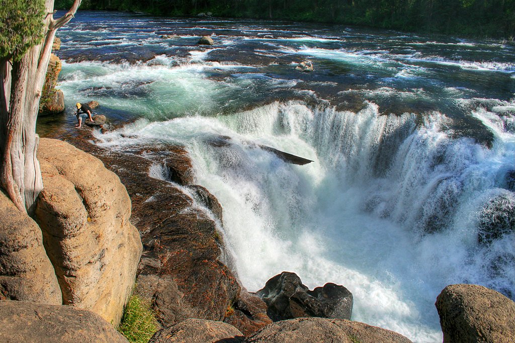
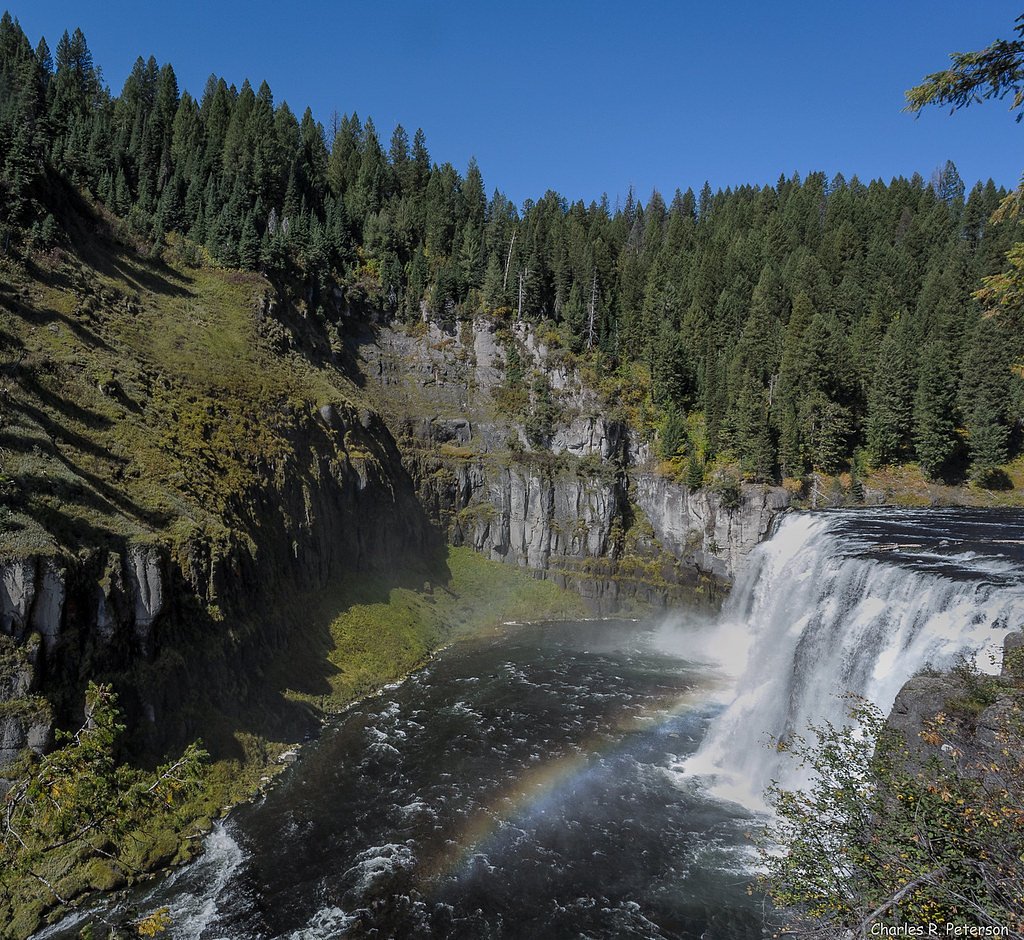
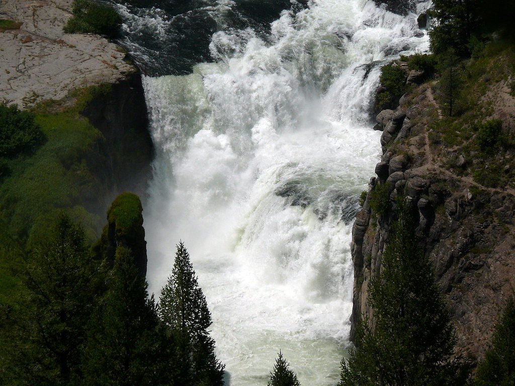
About Sheep Falls
Sheep Falls is a scenic waterfall located on the Henrys Fork of the Snake River in eastern Idaho. It is a popular destination for its natural beauty and relatively easy access. The waterfall is surrounded by lush forest and offers a peaceful retreat for visitors.
The Setting
Sheep Falls sits at 5,820 feet within Targhee National Forest, fed by the Fall River, in the high mountains of Idaho.
Nearby Falls Worth Visiting
Upper Mesa Falls (114 ft) lies 3.3 miles to the east. Also nearby: Lower Mesa Falls (65 ft, 4.0 mi).
Trail & Hike Details
The Approach
The moderate hike follows Sheep Falls (#2012), a 2.4-mile out-and-back trail over natural surface. Expect 350 feet of elevation gain. The trail is moderately developed (Class 2).
USFS Trail
SHEEP FALLS #2012
Trail Class
Moderately Developed
Surface
USFS Segment
0.34 miTrail Description
The trail to Sheep Falls is a short and relatively flat hike through a forested area. It follows a well-maintained path that leads directly to the waterfall. The trail is suitable for most visitors, including families with children.
What to Expect
Dogs are welcome.
Accessibility
The trail is not wheelchair accessible. Uneven terrain and elevation changes require steady footing.
Frequently Asked Questions
🐶 Are Dogs Allowed at Sheep Falls?
✅ Dogs are allowed
Are There Any Fees or Permits Required?
🆖 No fees required
🏊 Is There Swimming at Sheep Falls?
❌ Swimming is not allowed
When to Visit
The best time to visit Sheep Falls is in late spring or early summer when the water flow is at its peak. Fall is also a great time to visit for cooler weather and vibrant foliage.
Seasonal Access
The best time to visit is Spring, Summer, and Fall. Access roads and trails may close during winter due to snow. Check with Targhee National Forest for seasonal road closures.
Safety Information
Exercise caution near the waterfall as the rocks can be slippery. Be aware of changing weather conditions and potential wildlife encounters.
Current Water Conditions
679 ft³/s
Current discharge — how much water is flowing
About average for this time of year
Based on 32 years of record
4.58 ft
Water depth at gauge
7-Day Discharge Trend
What does this mean for your visit?
Flow is about average for this time of year.
About This Gauge
This gauge is on a nearby waterway and may not reflect exact conditions at the falls.
7-Day Flow Outlook
Based on the USGS gauge FALL RIVER NR ASHTON ID (16 km away).
Today
Roaring
719 cfs
6/10Tomorrow
Roaring
687 cfs
9/10Wed
Roaring
707 cfs
6/10Thu
Roaring
613 cfs
9/10Fri
Strong
541 cfs
10/10Sat
Strong
465 cfs
10/10Sun
Strong
470 cfs
10/10Best window: Fri — strong flow, partly sunny (trip score 10/10).
Best time of year: this gauge typically runs highest from early April to early July, peaking in June.
How we calculate this
This is a transparent outlook, not a precise forecast. We take the waterfall's current flow strength (how it ranks against its historical normal for today, from the nearest USGS stream gauge), carry that ranking forward along the gauge's seasonal curve, and nudge it for forecast rain. Confidence is highest for the next day or two and falls further out. Always check official conditions and your own judgment before visiting — high flows can be dangerous.
Know when to go.
Get a free email alert when waterfalls near Ashton hit peak flow. We only send when conditions are worth the trip — no weekly newsletters, no spam.
Weather Forecast
Location & Access
Getting There
Sheep Falls is located approximately 8.5 miles from Ashton, Idaho. To reach the falls, take Highway 20 and turn onto Forest Road 150. Follow the road for about 3 miles to the trailhead.
Get Directions on Google MapsParking
There is a small parking area near the trailhead, but space may be limited during peak seasons.
Elevation
5,820 feet above sea level
Coordinates
44.199916° N, -111.393843° W
Land Management
Managed by USFS
Visitor Tips & Gear
Wear sturdy shoes as the trail may have uneven sections. Bring insect repellent during the summer months. Arrive early to secure parking, especially during weekends and holidays.
This trail sits at 5,820 ft above sea level
Elevated TrailUV radiation is roughly 23% stronger at this elevation than at sea level, and the dry air accelerates dehydration. Extra sun protection and fluids go a long way.
As an Amazon Associate, we earn from qualifying purchases.

Coppertone Sport SPF 50 Sunscreen
UV intensity jumps ~4% per 1,000 ft — at this elevation you can burn in half the time.

Sun Bum SPF 30 Lip Balm (3-Pack)
Lips have almost no natural UV protection and burn fast in thin, dry mountain air.

Liquid I.V. Electrolyte Packets
You lose moisture ~2x faster at elevation — electrolytes help you absorb water efficiently.

ROCKNIGHT Polarized UV400 Sunglasses
High-altitude glare off rock and water is intense — UV400 lenses block 99%+ of UVA/UVB.
As an Amazon Associate, we earn from qualifying purchases.
With 2.4 miles and 350 ft of elevation gain, sturdy boots and trekking poles will help on this moderate trail. Sun exposure on the trail makes good sun protection a must in summer.

Polarized Sunglasses (Knockaround)
Cuts glare off the water so you actually see the falls — and your photos turn out better too.

Columbia Watertight II Rain Jacket
Packs into its own pocket, seam-sealed, and keeps you dry from spray and surprise rain.

Earth Pak Waterproof Dry Bag
Keeps your phone and gear dry when waterfall mist soaks everything else.

Waterproof Phone Pouch (AiRunTech)
Cheap insurance — take photos right next to the falls without killing your phone.

Timberland Euro Sprint Mid Waterproof
Trusted waterproof boot with premium leather and grippy rubber sole — reliable on rocky, wet trails.

TrailBuddy Trekking Poles
Lightweight aluminum, cork grips, and flip-locks that actually hold — a best-seller for good reason.
Where to Stay

Pendleton Pointe

Blue Buffalo Resort

El Paraiso at Island Park

Three Bears Inn
Browse vacation cabins and private rentals nearby
Unique outdoor stays — tents, yurts, and treehouses
Rent a campervan or RV for your waterfall road trip
Some links are affiliate links. We may earn a commission at no extra cost to you.
Nearby Campground
RIVERSIDE (ID - TARGHEE)
5.6 miles away · 58 sites
Overview Riverside Campground is on the banks of the Henry's Fork of the Snake River, just 15 miles north of Ashton, Idaho. Beautiful Island Park is nearby, where visitors enjoy boating, fishing and exploring local trails. Please click here for further information about the facility and recreation opportunities in the area.Recreation Henry's Fork has great fly-fishing for rainbow and brook trout. Tubing, canoeing, kayaking and rafting are also popular activities on the river.Facilities The campgr
Book on Recreation.govNearby Hot Springs
Hot springs near Ashton, Idaho
Ashton Warm Spring
Ashton Warm Spring emerges at 79 degrees Fahrenheit in Fremont County, placing it below typical soaking temperature but above t...
Boundary Creek Hot Springs
Boundary Creek Hot Springs flows at 181°F in one of Yellowstone's most remote backcountry locations, requiring a 3.8-mile hike ...
Pincock (Green Canyon) Hot Springs
Pincock Hot Springs, known locally as Green Canyon Hot Springs, flows at 111 degrees Fahrenheit in Fremont County, Idaho, near ...
Taylor Springs
Taylor Springs surfaces at 68 degrees Fahrenheit near Victor in Teton County, running 26.7 degrees above ambient air at 6,092 f...

Imperial Geyser, Spray Geyser
Imperial Geyser and Spray Geyser emerge at 192 degrees Fahrenheit at 7,327 feet elevation, located two miles from road access v...
Sloan Cow Camp Spring
Sloan Cow Camp Spring is a warm spring at 86 degrees Fahrenheit on US Forest Service land in the Beaverhead National Forest, Ga...
Looking for a soak after your hike? Explore more hot springs near Ashton, Idaho on SoakingSprings.
Explore Idaho springsAdditional Information
Nearby Attractions
Nearby attractions include Mesa Falls, Harriman State Park, and Island Park Reservoir.
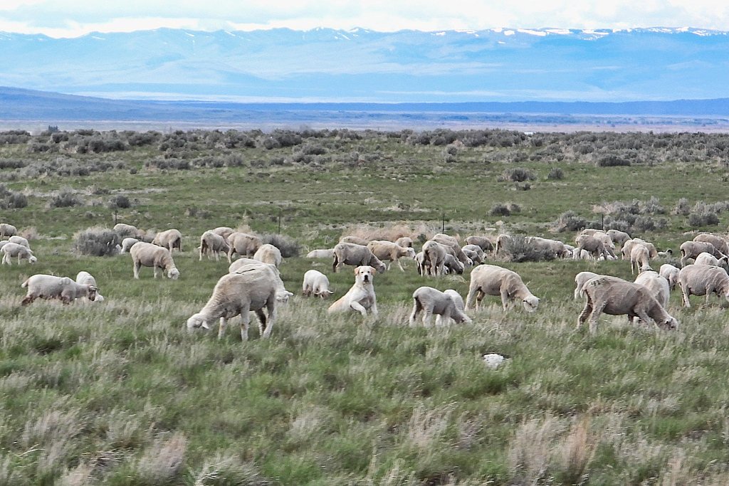
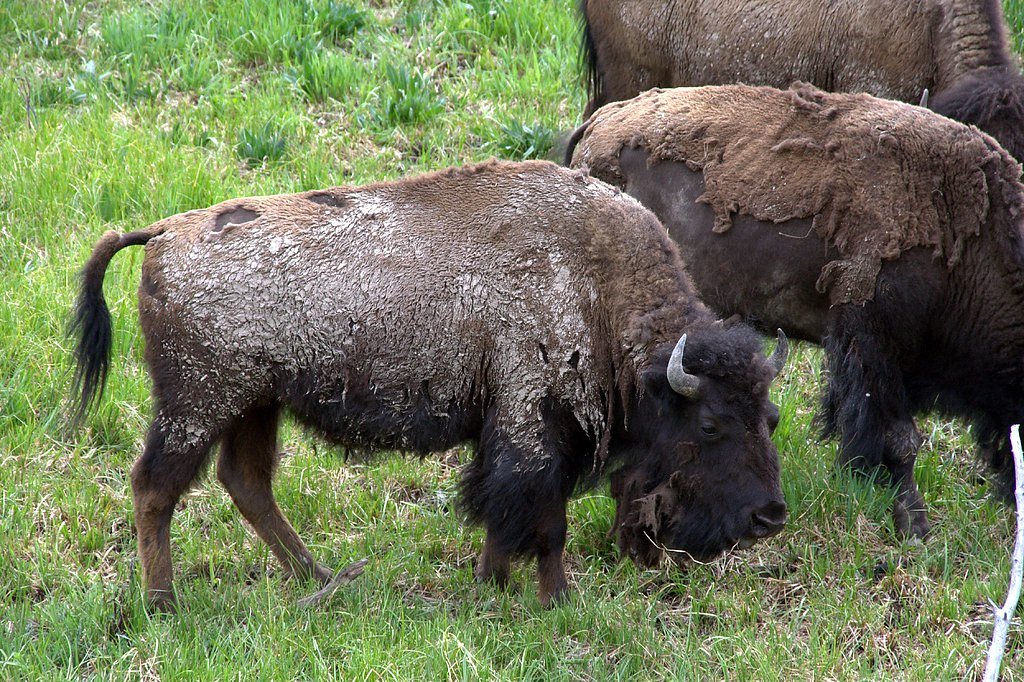
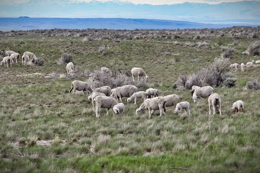
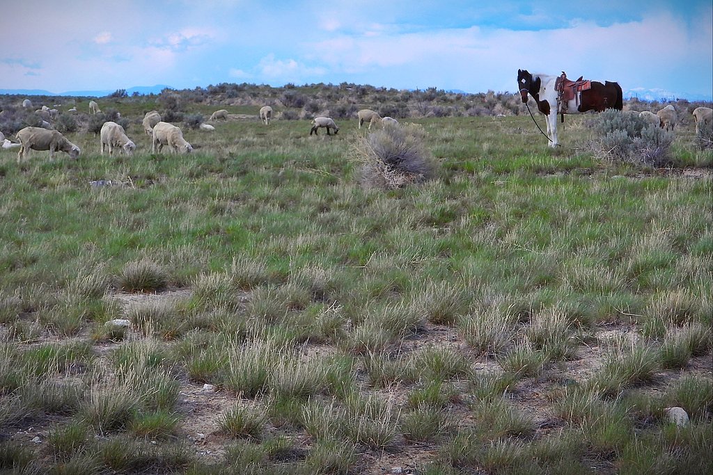
Wildlife
The area is home to a variety of wildlife, including deer, elk, and birds. Visitors should be cautious of bears and carry bear spray if hiking in the region.
Cities near Sheep Falls
Nearby Waterfalls
Other waterfalls named Sheep Falls
1 other waterfall shares this name across the U.S.
Writing about Sheep Falls? Embed this waterfall on your site for free.