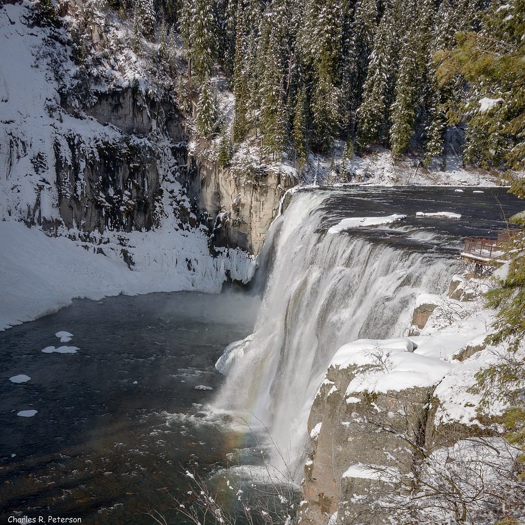
Upper Mesa Falls
Idaho • 114 ft
By Armen Suny · Last verified Mar 2026
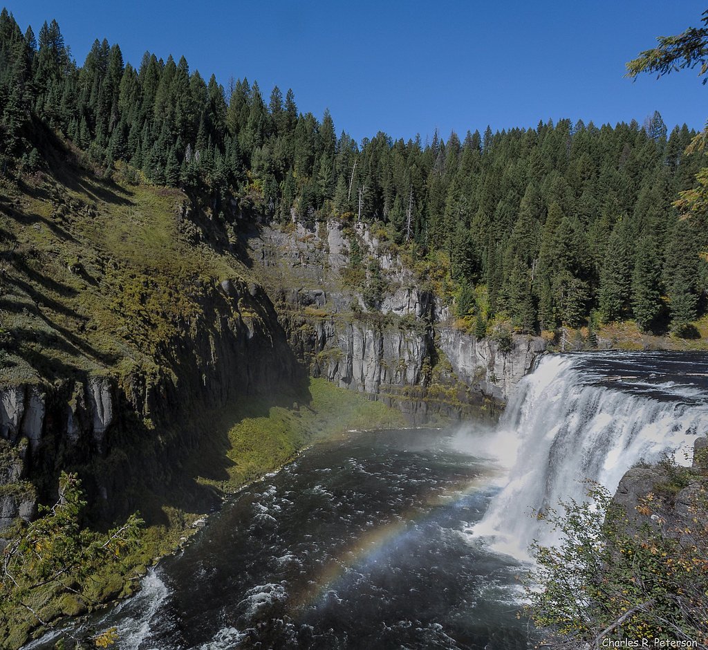
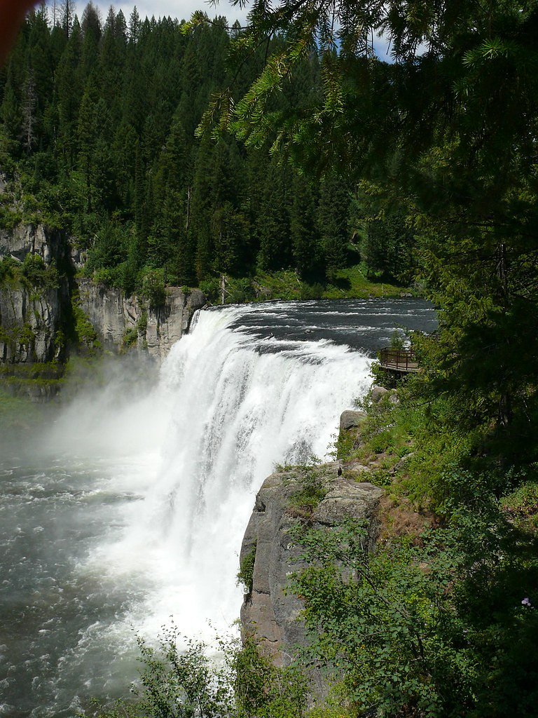
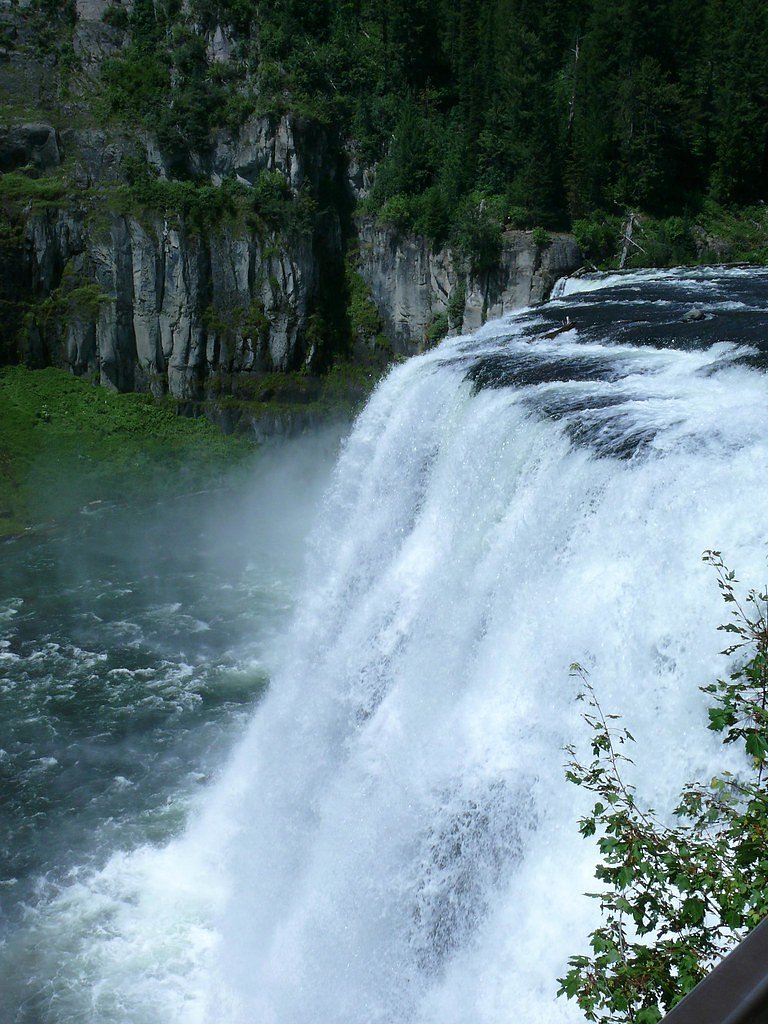
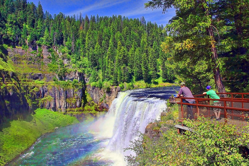

Photo Credits (5)
Difficulty
Drive Up
Trail Length
0.1 miles
Trail Type
Out And Back
Elevation Gain
50 ft
About Upper Mesa Falls
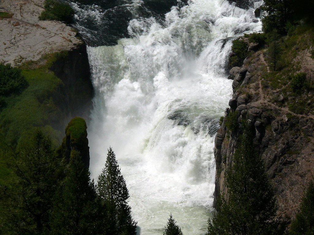
Upper Mesa Falls is a dramatic 114-foot (35 m) waterfall on the Henrys Fork of the Snake River in the Caribou-Targhee National Forest, managed by the U.S. Forest Service. Spanning roughly 200 feet (61 m) across, the falls sit upstream from Lower Mesa Falls and are located about 16 miles (26 km) from Ashton, Idaho, making them one of the most striking river cascades in eastern Idaho’s volcanic canyon country. The site is USFS-managed within Targhee National Forest and offers an accessible, scenic stop for drivers and day hikers. Nearby camping is available at Warm River Cabin, approximately 6.6 km away, so you can easily combine a visit to the falls with an overnight stay. Whether you’re pausing for photos or taking a short stroll to enjoy the mist and basalt-etched gorge, Upper Mesa Falls delivers an impressive, easy-to-reach experience.
The Setting
Upper Mesa Falls sits at 5,614 feet within Targhee National Forest, fed by the Fall River, in the high mountains of Idaho. At 114 feet, it is among the taller waterfalls in Idaho.
Height: 114 feet
Nearby Falls Worth Visiting
Lower Mesa Falls (65 ft) lies 1.0 miles to the southeast.
Trail & Hike Details
The Approach
No hiking required. Upper Mesa Falls is accessible by vehicle with a roadside viewing area.
Trail Description
The primary access route to Upper Mesa Falls is a very short 0.1-mile out-and-back segment with about 50 feet of elevation gain from the parking area to the viewpoint. Classified as "drive_up" difficulty, this route indicates vehicle-accessible parking close to the falls and a minimal walk to the viewing area. Trail type: out-and-back; length: 0.1 miles; elevation gain: ~50 ft; falls height: 114 ft. Surface/grade/class details are not specified in the provided USFS data. Managed by the U.S. Forest Service within the Targhee National Forest.
What to Expect
The falls cascade 114 feet. Dogs are welcome.
Accessibility
This waterfall is viewable from a vehicle-accessible area. No hiking is required.
Frequently Asked Questions
🐶 Are Dogs Allowed at Upper Mesa Falls?
✅ Dogs are allowed
Are There Any Fees or Permits Required?
🤑 Fee: $5.00
🏊 Is There Swimming at Upper Mesa Falls?
❌ Swimming is not allowed
When to Visit
The best time to visit is during late spring and early summer when water flow is at its peak. Fall is also a great time to visit for colorful foliage.
Seasonal Access
The best time to visit is Spring, Summer, and Fall. Access roads and trails may close during winter due to snow. Check with Targhee National Forest for seasonal road closures.
Safety Information
Stay on designated trails and viewing platforms, as the rocks near the falls can be slippery and dangerous. Be cautious of wildlife and avoid feeding animals. In winter, icy conditions may make access hazardous.
Current Water Conditions
666 ft³/s
Current discharge — how much water is flowing
About average for this time of year
Based on 32 years of record
4.56 ft
Water depth at gauge
7-Day Discharge Trend
What does this mean for your visit?
Flow is about average for this time of year.
About This Gauge
This gauge is on a nearby waterway and may not reflect exact conditions at the falls.
7-Day Flow Outlook
Based on the USGS gauge FALL RIVER NR ASHTON ID (15 km away).
Today
Roaring
719 cfs
6/10Tomorrow
Roaring
687 cfs
9/10Wed
Roaring
707 cfs
6/10Thu
Roaring
613 cfs
9/10Fri
Strong
541 cfs
10/10Sat
Strong
465 cfs
10/10Sun
Strong
470 cfs
10/10Best window: Fri — strong flow, partly sunny (trip score 10/10).
Best time of year: this gauge typically runs highest from early April to early July, peaking in June.
How we calculate this
This is a transparent outlook, not a precise forecast. We take the waterfall's current flow strength (how it ranks against its historical normal for today, from the nearest USGS stream gauge), carry that ranking forward along the gauge's seasonal curve, and nudge it for forecast rain. Confidence is highest for the next day or two and falls further out. Always check official conditions and your own judgment before visiting — high flows can be dangerous.
Know when to go.
Get a free email alert when waterfalls near Drummond hit peak flow. We only send when conditions are worth the trip — no weekly newsletters, no spam.
Weather Forecast
Location & Access
Getting There
Upper Mesa Falls is located along the Mesa Falls Scenic Byway, approximately 15 miles northeast of Ashton, Idaho. The falls are easily accessible via Highway 47, with clear signage directing visitors to the parking area.
Get Directions on Google MapsParking
There is a designated parking area near the Upper Mesa Falls Visitor Center, which provides ample space for cars and small RVs. Parking is free, but it may fill up during peak seasons.
Elevation
5,614 feet above sea level
Coordinates
44.187972° N, -111.329951° W
Land Management
Managed by USFS
Visitor Tips & Gear
Arrive early during peak summer months to secure parking and enjoy a quieter experience. Bring a rain jacket or waterproof gear, as the mist from the falls can be heavy near the viewing platforms. Binoculars are recommended for spotting birds and other wildlife in the area.
This trail sits at 5,614 ft above sea level
Elevated TrailUV radiation is roughly 22% stronger at this elevation than at sea level, and the dry air accelerates dehydration. Extra sun protection and fluids go a long way.
As an Amazon Associate, we earn from qualifying purchases.

Coppertone Sport SPF 50 Sunscreen
UV intensity jumps ~4% per 1,000 ft — at this elevation you can burn in half the time.

Sun Bum SPF 30 Lip Balm (3-Pack)
Lips have almost no natural UV protection and burn fast in thin, dry mountain air.

Liquid I.V. Electrolyte Packets
You lose moisture ~2x faster at elevation — electrolytes help you absorb water efficiently.

ROCKNIGHT Polarized UV400 Sunglasses
High-altitude glare off rock and water is intense — UV400 lenses block 99%+ of UVA/UVB.
As an Amazon Associate, we earn from qualifying purchases.
For this easy 0.1 miles trail, lightweight trail shoes and a water bottle are usually sufficient. Sun exposure on the trail makes good sun protection a must in summer.

Polarized Sunglasses (Knockaround)
Cuts glare off the water so you actually see the falls — and your photos turn out better too.

Columbia Watertight II Rain Jacket
Packs into its own pocket, seam-sealed, and keeps you dry from spray and surprise rain.

Earth Pak Waterproof Dry Bag
Keeps your phone and gear dry when waterfall mist soaks everything else.

Waterproof Phone Pouch (AiRunTech)
Cheap insurance — take photos right next to the falls without killing your phone.

JOBY GorillaPod Starter Kit
Wraps around railings and rocks for long-exposure waterfall shots — no flat surface needed.

OR Sombriolet Sun Hat
UPF 50+ sun protection with vents so your head doesn't cook on exposed trail sections.
Where to Stay

Pendleton Pointe

Blue Buffalo Resort

Three Bears Inn

El Paraiso at Island Park
Browse vacation cabins and private rentals nearby
Unique outdoor stays — tents, yurts, and treehouses
Rent a campervan or RV for your waterfall road trip
Some links are affiliate links. We may earn a commission at no extra cost to you.
Nearby Campground
WARM RIVER CABIN
4.1 miles away · 1 sites
Overview Warm River Cabin is located less than 20 miles from Ashton, Idaho, at Warm River Springs. An Idaho fish and game hatchery operated here from the 1930s to the 1950s. The cabin was formerly the hatchery manager's house. It was constructed by the Civilian Conservation Corps (CCC) in 1938.The cabin is open year-round and can be accessed by car in the warmer months. Snowmobiles and cross-country skis are required to access the cabin on a groomed trail from early December through mid-May. The
Book on Recreation.govNearby Hot Springs
Hot springs near Drummond, Idaho
Ashton Warm Spring
Ashton Warm Spring emerges at 79 degrees Fahrenheit in Fremont County, placing it below typical soaking temperature but above t...
Boundary Creek Hot Springs
Boundary Creek Hot Springs flows at 181°F in one of Yellowstone's most remote backcountry locations, requiring a 3.8-mile hike ...
Pincock (Green Canyon) Hot Springs
Pincock Hot Springs, known locally as Green Canyon Hot Springs, flows at 111 degrees Fahrenheit in Fremont County, Idaho, near ...
Taylor Springs
Taylor Springs surfaces at 68 degrees Fahrenheit near Victor in Teton County, running 26.7 degrees above ambient air at 6,092 f...

Imperial Geyser, Spray Geyser
Imperial Geyser and Spray Geyser emerge at 192 degrees Fahrenheit at 7,327 feet elevation, located two miles from road access v...

Rabbit Creek Group
Rabbit Creek Group emerges at 198 degrees Fahrenheit—161 degrees above the 36-degree ambient—at 7,284 feet elevation in Yellows...
Looking for a soak after your hike? Explore more hot springs near Drummond, Idaho on SoakingSprings.
Explore Idaho springsAdditional Information
Nearby Attractions
Lower Mesa Falls, Harriman State Park, Yellowstone National Park (approximately 50 miles away).
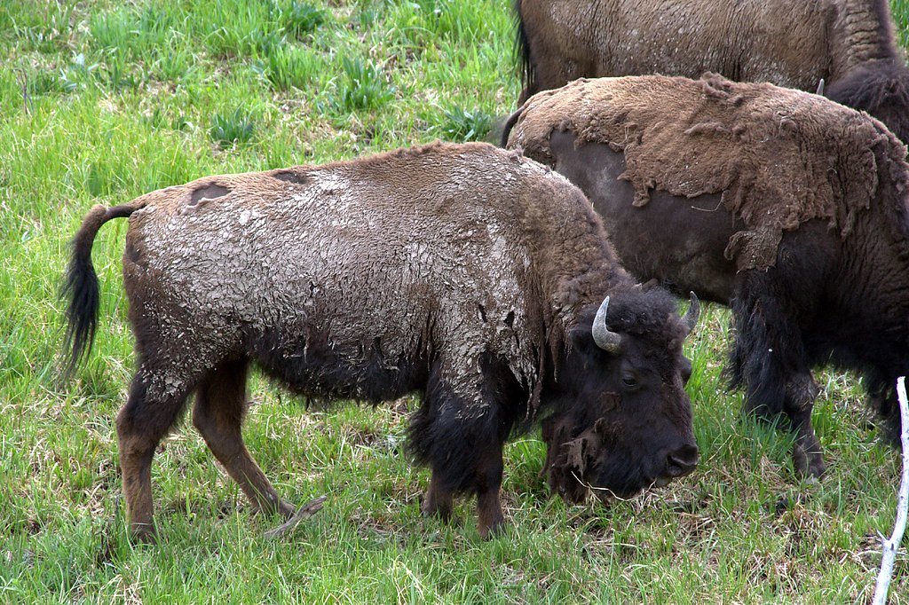
Wildlife
The area is home to a variety of wildlife, including bald eagles, osprey, deer, and occasionally moose. Birdwatchers will enjoy spotting species native to the region.
Cities near Upper Mesa Falls
Nearby Waterfalls
Writing about Upper Mesa Falls? Embed this waterfall on your site for free.