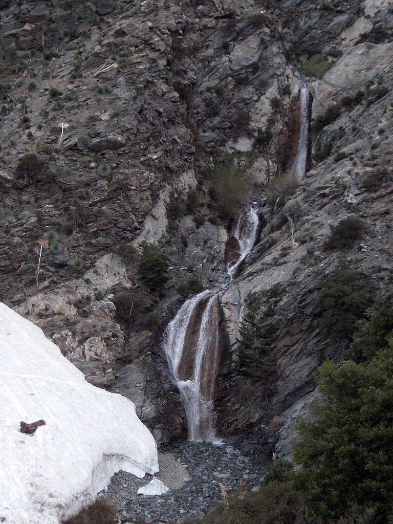
San Antonio Falls
California • 75 ft
By Armen Suny · Last verified Mar 2026
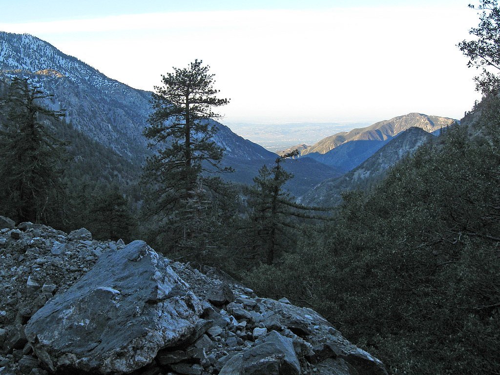
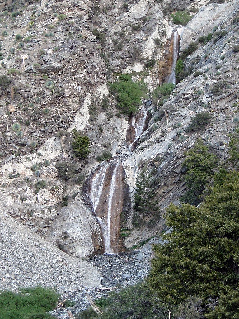
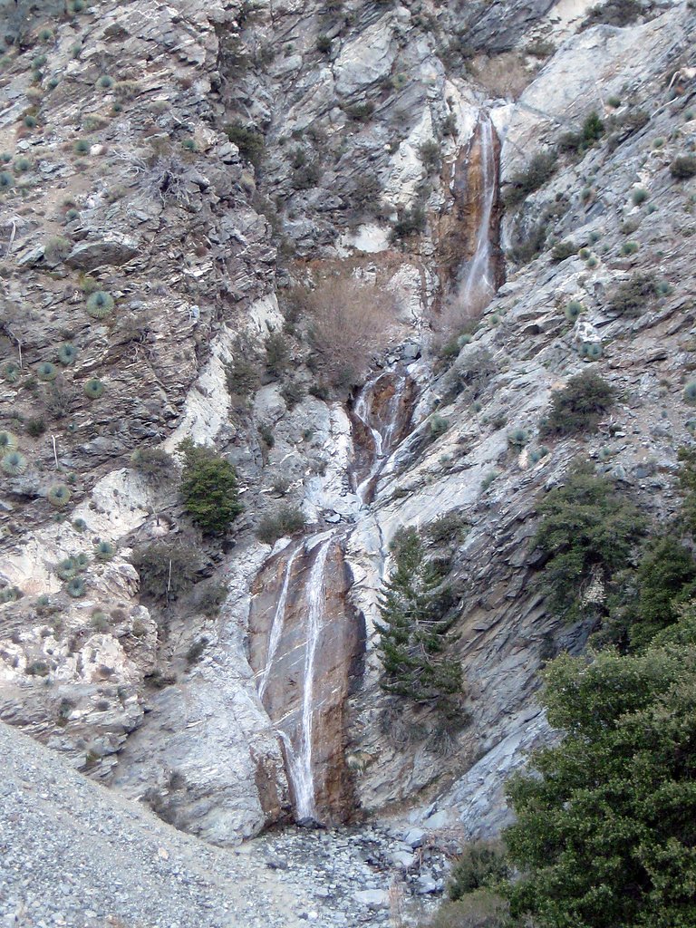
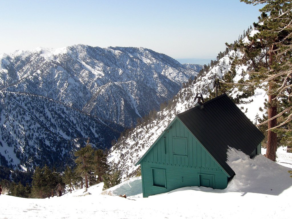

Photo Credits (5)
Difficulty
Easy
Trail Length
1.4 miles
Trail Type
Out And Back
Elevation Gain
300 ft
About San Antonio Falls
San Antonio Falls is a picturesque, multi-tiered cascade tucked into the foothills near Mount San Antonio (commonly called Mount Baldy) in the San Gabriel Mountains. The falls drop roughly 75 feet and sit within the Angeles National Forest and the San Gabriel Mountains National Monument, lands managed by the U.S. Forest Service. Mount San Antonio itself is the range high point at 10,064 ft (3,068 m) and the tallest summit in Los Angeles County and the Los Angeles metropolitan area, so the surrounding ridgelines provide dramatic backdrops for this short outing. The most direct approach follows the USFS Baldy Bowl Trail (Trail #237W02). The Forest Service maps that trail at about 1.07 GIS miles; hikers commonly report roughly a 1.4-mile round-trip with about 300 feet of elevation gain, making this an easy, popular stop for families and day hikers. If you’re planning an overnight, the Stockton Flats Yellow Post Sites are nearby (about 4.89 km away), offering convenient primitive camping within the same National Forest.
The Setting
San Antonio Falls sits at 6,598 feet within Angeles National Forest, in the high mountains of California. The falls drop 75 feet.
Height: 75 feet
Trail & Hike Details
The Approach
The easy hike follows Baldy Bowl Trail (#237W02), a 1.4-mile out-and-back trail over natural surface. Expect 300 feet of elevation gain with grades of 12-20%. The trail is moderately developed (Class 2).
USFS Trail
BALDY BOWL TRAIL #237W02
Trail Class
Moderately Developed
Surface
Avg Grade
USFS Segment
1.07 miTrail Description
Trail: Baldy Bowl Trail (USFS Trail #237W02) — managed by the U.S. Forest Service within Angeles National Forest. Type: out-and-back; reported round-trip length ~1.4 miles with ~300 ft elevation gain; USFS GIS length ~1.07 miles. Difficulty: easy; Class: 2. Surface: native material (the path is short and largely dirt, with paved approaches in places). Typical grade: 12–20%. The route is short and well-used, gaining moderate grade over native-surface tread to reach viewpoints at the falls.
What to Expect
The falls drop 75 feet. Dogs are welcome.
Accessibility
The trail is not wheelchair accessible. Uneven terrain and elevation changes require steady footing.
Frequently Asked Questions
🐶 Are Dogs Allowed at San Antonio Falls?
✅ Dogs are allowed
Are There Any Fees or Permits Required?
🤑 Fee: $5.00
Permit required
A National Forest Adventure Pass is required for parking. Passes can be purchased online or at local vendors.
🏊 Is There Swimming at San Antonio Falls?
❌ Swimming is not allowed
When to Visit
Spring is the best time to visit when the waterfall is at its fullest due to snowmelt. However, the falls can be enjoyed year-round, with reduced flow in late summer and fall.
Seasonal Access
The best time to visit is Spring, Summer, Fall, and Winter. Check with Angeles National Forest for seasonal road closures.
Safety Information
Exercise caution near the falls as rocks can be slippery. Check weather conditions before visiting, as the trail may be icy or muddy during winter and early spring. Always carry sufficient water and be prepared for changing weather conditions.
Current Water Conditions
5 ft³/s
Current discharge — how much water is flowing
About average for this time of year
Based on 47 years of record
16.72 ft
Water depth at gauge
7-Day Discharge Trend
What does this mean for your visit?
Flow is about average for this time of year.
About This Gauge
This gauge is on a nearby waterway and may not reflect exact conditions at the falls.
7-Day Flow Outlook
Based on the USGS gauge CUCAMONGA C NR UPLAND CA (11 km away).
Today
Roaring
5 cfs
9/10Tomorrow
Roaring
5 cfs
9/10Tue
Roaring
5 cfs
9/10Wed
Roaring
4 cfs
9/10Thu
Roaring
4 cfs
9/10Fri
Roaring
4 cfs
9/10Sat
Roaring
4 cfs
9/10Best window: Today — roaring flow, sunny (trip score 9/10).
Best time of year: this gauge typically runs highest from early February to early May, peaking in February.
How we calculate this
This is a transparent outlook, not a precise forecast. We take the waterfall's current flow strength (how it ranks against its historical normal for today, from the nearest USGS stream gauge), carry that ranking forward along the gauge's seasonal curve, and nudge it for forecast rain. Confidence is highest for the next day or two and falls further out. Always check official conditions and your own judgment before visiting — high flows can be dangerous.
Know when to go.
Get a free email alert when waterfalls near Wrightwood hit peak flow. We only send when conditions are worth the trip — no weekly newsletters, no spam.
Weather Forecast
Location & Access
Getting There
San Antonio Falls is located near Mount Baldy Village in the Angeles National Forest. From Mount Baldy Road, park at the Manker Flats Campground area and follow the trailhead leading to the falls.
Get Directions on Google MapsParking
Parking is available at Manker Flats Campground. A National Forest Adventure Pass is required to park in this area.
Elevation
6,598 feet above sea level
Coordinates
34.271949° N, -117.634499° W
Land Management
Managed by USFS
Visitor Tips & Gear
Arrive early to secure parking, especially on weekends. Wear sturdy shoes as the area near the falls can be rocky and uneven. Bring water and sunscreen, as parts of the trail are exposed to the sun.
This trail sits at 6,598 ft above sea level
Elevated TrailUV radiation is roughly 26% stronger at this elevation than at sea level, and the dry air accelerates dehydration. Extra sun protection and fluids go a long way.
As an Amazon Associate, we earn from qualifying purchases.

Coppertone Sport SPF 50 Sunscreen
UV intensity jumps ~4% per 1,000 ft — at this elevation you can burn in half the time.

Sun Bum SPF 30 Lip Balm (3-Pack)
Lips have almost no natural UV protection and burn fast in thin, dry mountain air.

Liquid I.V. Electrolyte Packets
You lose moisture ~2x faster at elevation — electrolytes help you absorb water efficiently.

ROCKNIGHT Polarized UV400 Sunglasses
High-altitude glare off rock and water is intense — UV400 lenses block 99%+ of UVA/UVB.
As an Amazon Associate, we earn from qualifying purchases.
This easy 1.4 miles hike is straightforward — comfortable trail shoes and plenty of water should do. Icy conditions are common in winter — traction cleats are a smart addition.

Columbia Watertight II Rain Jacket
Packs into its own pocket, seam-sealed, and keeps you dry from spray and surprise rain.

Polarized Sunglasses (Knockaround)
Cuts glare off the water so you actually see the falls — and your photos turn out better too.

Earth Pak Waterproof Dry Bag
Keeps your phone and gear dry when waterfall mist soaks everything else.

Waterproof Phone Pouch (AiRunTech)
Cheap insurance — take photos right next to the falls without killing your phone.

Kahtoola MICROspikes
Cult-favorite traction cleats that grip ice and wet rock — essential for winter waterfall hikes.

JOBY GorillaPod Starter Kit
Wraps around railings and rocks for long-exposure waterfall shots — no flat surface needed.
Where to Stay

Holiday Inn Express Hotel & Suites Hesperia by IHG

Best Western Plus Heritage Inn Ontario Rancho Cucamonga

Grand Pine Cabins

DoubleTree by Hilton Claremont
Browse vacation cabins and private rentals nearby
Unique outdoor stays — tents, yurts, and treehouses
Rent a campervan or RV for your waterfall road trip
Some links are affiliate links. We may earn a commission at no extra cost to you.
Nearby Campground
Stockton Flats Yellow Post Sites
3 miles away · 0 sites
These remote camping sites offer isolated scenic locations ideal for tent and car camping or a relaxing picnic far from the crowds. Other than a pit for campfires, these sites do NOT contain the amenities found at developed campgrounds. There is no water, no picnic tables, no restrooms nearby, and no trash containers. Please pack it in - pack it out! All sites are first-come, first-served.Campfire permits are required for any type of fire use - campfires, charcoal BBQ's, or stoves. Campfires m
Book on Recreation.govNearby Hot Springs
Hot springs near Wrightwood, California

Tylers Bath Spring
Tyler's Bath Spring emerges at 92 degrees in the San Bernardino National Forest, producing water 30 degrees warmer than the amb...

Arrowhead Springs, Waterman Hot Spr
Arrowhead Springs and Waterman Hot Springs discharge at 194°F (90°C) in the San Bernardino Mountains, among Southern California...

Warm Spring, Hot Spring
Deep Creek Hot Springs flows at a robust 108°F in the San Bernardino National Forest near Lake Arrowhead. With 352 mg/L total d...
Unnamed Spring San Bernardino County
Deep in the San Bernardino National Forest near Mentone, this 90-degree spring flows 26 degrees above ambient in mountains wher...
Glen Ivy Hot Springs
Glen Ivy Hot Springs emerges at 131 degrees Fahrenheit, the warmest feature among these Riverside County springs and displaying...

Pan Hot Springs
Pan Hot Springs flows at 88 degrees Fahrenheit at 6,717 feet elevation near Big Bear City, creating a 35-degree thermal anomaly...
Looking for a soak after your hike? Explore more hot springs near Wrightwood, California on SoakingSprings.
Explore California springsAdditional Information
Nearby Attractions
Nearby attractions include Mount Baldy, the Baldy Notch Trail, and the Mount Baldy Ski Lifts.
Wildlife
The area is home to various wildlife, including birds, squirrels, and occasionally deer. Be cautious of rattlesnakes during warmer months.
Cities near San Antonio Falls
Nearby Waterfalls
Writing about San Antonio Falls? Embed this waterfall on your site for free.