Photo Credits (5)
Difficulty
Moderate
Trail Length
2.4 miles
Trail Type
Out And Back
Elevation Gain
350 ft
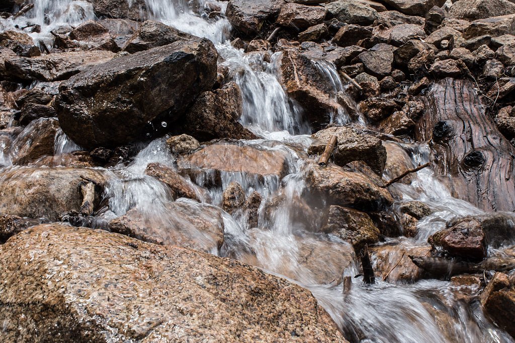
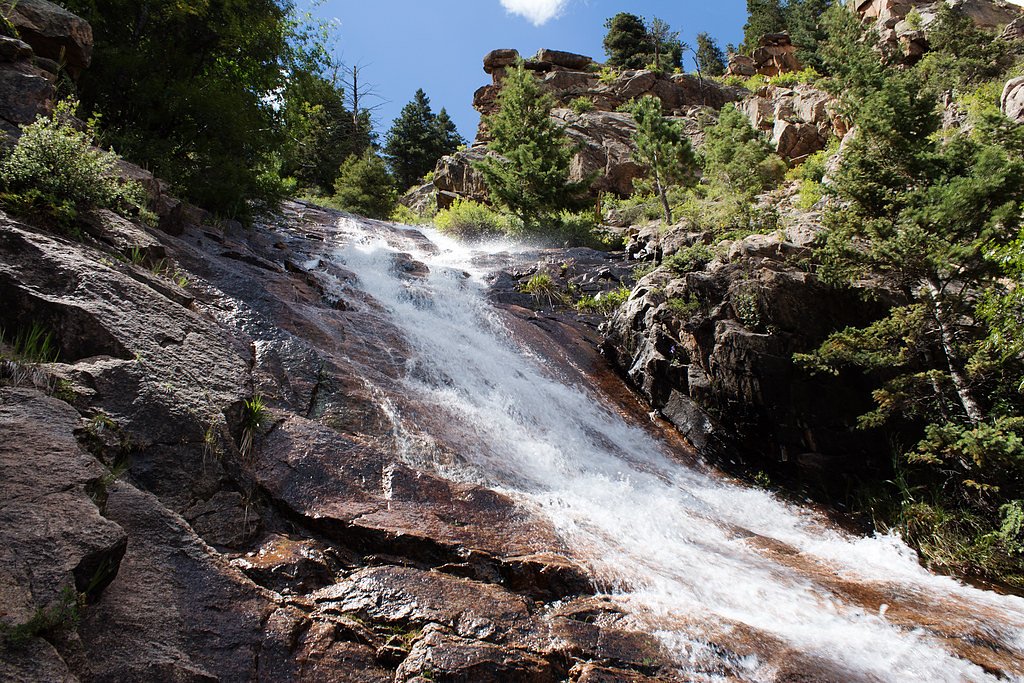
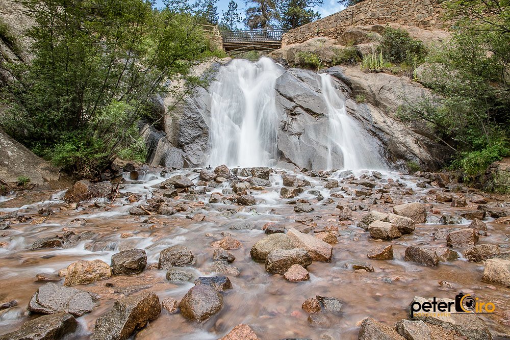
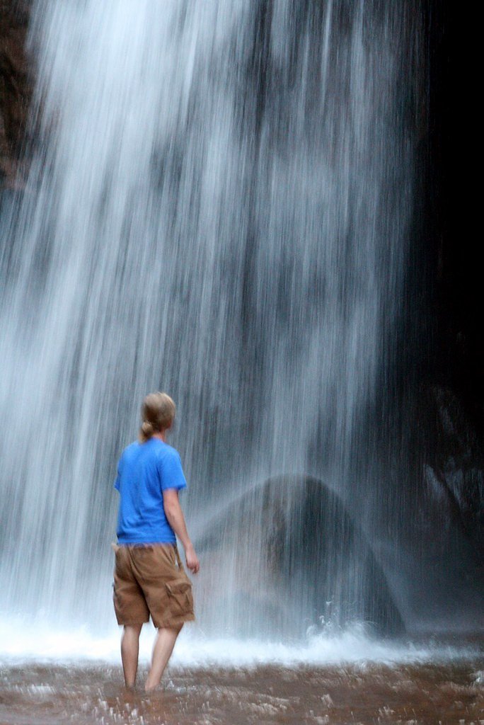
About Saint Marys Falls
Saint Marys Falls is a picturesque waterfall located near Colorado Springs, Colorado, within the Pike National Forest. The waterfall is a popular destination for hikers, offering scenic views and a refreshing escape into nature.
The Setting
Saint Marys Falls sits at 8,934 feet within Pike National Forest, fed by the Cheyenne Creek, in the high alpine of Colorado.
Nearby Falls Worth Visiting
Seven Falls (181 ft) lies 2.1 miles to the east. Also nearby: Helen Hunt Falls (35 ft, 1.5 mi).
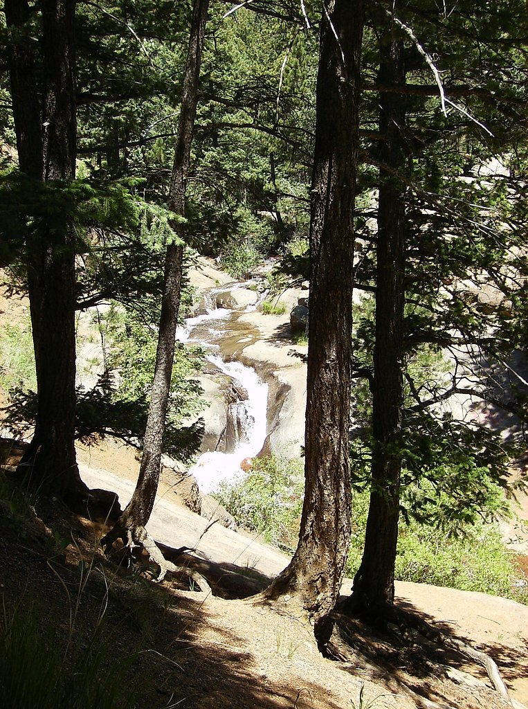
Trail & Hike Details
The Approach
The moderate hike follows Saint Marys Falls (#624), a 2.4-mile out-and-back trail over natural surface. Expect 350 feet of elevation gain. The trail is developed (Class 3).
USFS Trail
SAINT MARYS FALLS #624
Trail Class
Developed
Surface
USFS Segment
2.18 miTrail Description
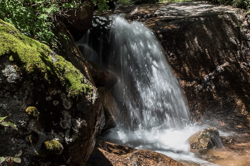
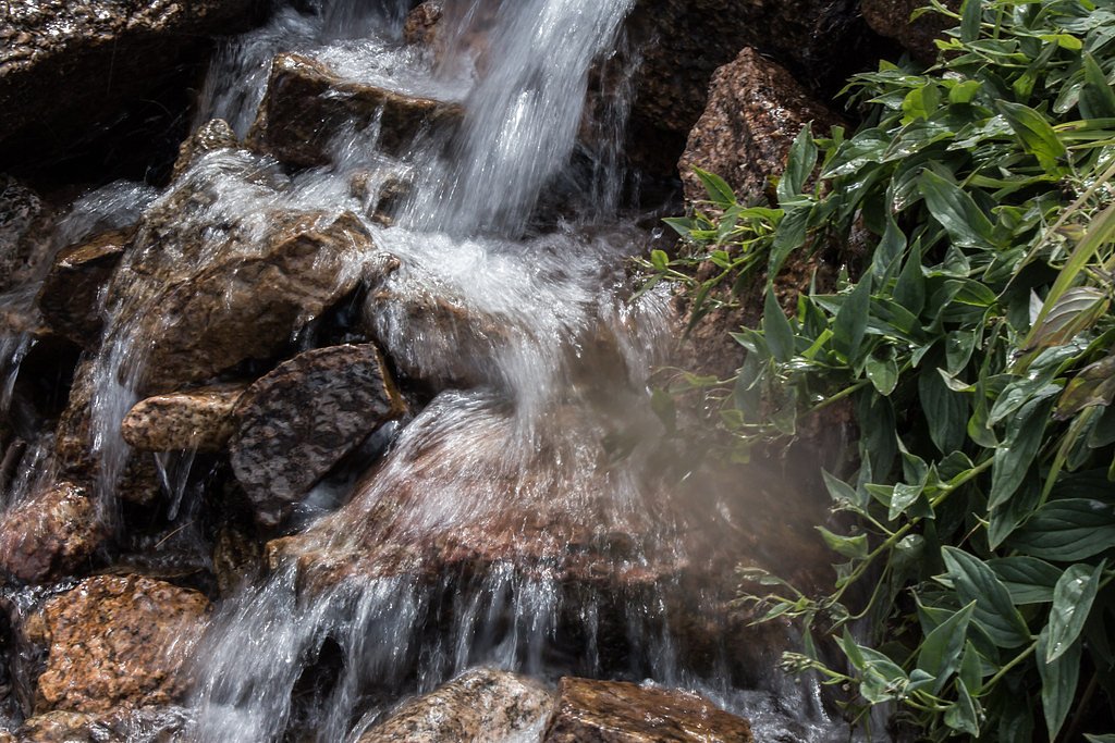
The trail to Saint Marys Falls is a moderately challenging out-and-back hike that follows a well-maintained path through the forest. The trail features a steady incline with some rocky sections and offers beautiful views of the surrounding mountains. The waterfall is the highlight of the hike, cascading down a rocky cliff into a serene pool.
What to Expect
Dogs are welcome.
Accessibility
The trail is not wheelchair accessible. Uneven terrain and elevation changes require steady footing.
Frequently Asked Questions
🐶 Are Dogs Allowed at Saint Marys Falls?
✅ Dogs are allowed
Are There Any Fees or Permits Required?
🆖 No fees required
🏊 Is There Swimming at Saint Marys Falls?
❌ Swimming is not allowed
When to Visit
The best time to visit Saint Marys Falls is during late spring through early fall when the trail is clear of snow and the waterfall flow is at its peak. Summer offers the most accessible conditions, but fall provides stunning foliage views.
Seasonal Access
The best time to visit is Spring, Summer, and Fall. Access roads and trails may close during winter due to snow. Check with Pike National Forest for seasonal road closures.
Safety Information
Be cautious of loose rocks and steep sections on the trail. Carry plenty of water and be prepared for sudden weather changes. Watch for wildlife and avoid feeding or approaching animals.
Current Water Conditions
1 ft³/s
Current discharge — how much water is flowing
About average for this time of year
Based on 34 years of record
1.39 ft
Water depth at gauge
7-Day Discharge Trend
What does this mean for your visit?
Flow is about average for this time of year.
About This Gauge
7-Day Flow Outlook
Based on the USGS gauge CHEYENNE CREEK AT EVANS AVE AT COLORADO SPRINGS,CO (5 km away).
Today
Barely Flowing
1 cfs
5/10Tomorrow
Barely Flowing
1 cfs
5/10Mon
Barely Flowing
1 cfs
5/10Tue
Barely Flowing
1 cfs
5/10Wed
Barely Flowing
1 cfs
5/10Thu
Barely Flowing
1 cfs
5/10Fri
Barely Flowing
1 cfs
5/10Best window: Today — barely flowing flow, sunny (trip score 5/10).
Best time of year: this gauge typically runs highest from late April to late June, peaking in May.
How we calculate this
This is a transparent outlook, not a precise forecast. We take the waterfall's current flow strength (how it ranks against its historical normal for today, from the nearest USGS stream gauge), carry that ranking forward along the gauge's seasonal curve, and nudge it for forecast rain. Confidence is highest for the next day or two and falls further out. Always check official conditions and your own judgment before visiting — high flows can be dangerous.
Know when to go.
Get a free email alert when waterfalls near Manitou Springs hit peak flow. We only send when conditions are worth the trip — no weekly newsletters, no spam.
Weather Forecast
Location & Access
Getting There
Saint Marys Falls can be accessed via the Saint Marys Falls Trail, which begins at the Gold Camp Road parking area near Colorado Springs. The trailhead is located approximately 20 minutes from downtown Colorado Springs.
Get Directions on Google MapsParking
Parking is available at the Gold Camp Road parking area. Arrive early, especially on weekends, as parking can fill up quickly.
Elevation
8,934 feet above sea level
Coordinates
38.770823° N, -104.918307° W
Land Management
Managed by USFS
Visitor Tips & Gear
Start your hike early to avoid crowds and secure parking. Wear sturdy hiking shoes, as the trail can be rocky in some sections. Bring plenty of water, especially during the summer months. Check weather conditions before heading out, as the trail may be icy or muddy in spring and fall.
This trail sits at 8,934 ft — the air is noticeably thinner
High AltitudeSome visitors experience headaches, fatigue, or shortness of breath at this elevation. Take it slow, stay hydrated, and consider supplemental oxygen if you're coming from a lower altitude.
As an Amazon Associate, we earn from qualifying purchases.

Coppertone Sport SPF 50 Sunscreen
UV intensity jumps ~4% per 1,000 ft — at this elevation you can burn in half the time.

Sun Bum SPF 30 Lip Balm (3-Pack)
Lips have almost no natural UV protection and burn fast in thin, dry mountain air.

Liquid I.V. Electrolyte Packets
You lose moisture ~2x faster at elevation — electrolytes help you absorb water efficiently.

ROCKNIGHT Polarized UV400 Sunglasses
High-altitude glare off rock and water is intense — UV400 lenses block 99%+ of UVA/UVB.

Boost Oxygen 10L Canister (2-Pack)
Portable supplemental oxygen for quick relief from headaches and shortness of breath.

Altitude Rx OxyBoost Complex
Antioxidant formula designed to support your body's natural altitude acclimation.
As an Amazon Associate, we earn from qualifying purchases.
With 2.4 miles and 350 ft of elevation gain, sturdy boots and trekking poles will help on this moderate trail. Sun exposure on the trail makes good sun protection a must in summer.

Polarized Sunglasses (Knockaround)
Cuts glare off the water so you actually see the falls — and your photos turn out better too.

Columbia Watertight II Rain Jacket
Packs into its own pocket, seam-sealed, and keeps you dry from spray and surprise rain.

Earth Pak Waterproof Dry Bag
Keeps your phone and gear dry when waterfall mist soaks everything else.

Waterproof Phone Pouch (AiRunTech)
Cheap insurance — take photos right next to the falls without killing your phone.

Timberland Euro Sprint Mid Waterproof
Trusted waterproof boot with premium leather and grippy rubber sole — reliable on rocky, wet trails.

TrailBuddy Trekking Poles
Lightweight aluminum, cork grips, and flip-locks that actually hold — a best-seller for good reason.
Where to Stay

Tiny House Get Away

Quality Inn Colorado Springs South

Days Inn by Wyndham Manitou Springs

Pikes Peak Inn
Browse vacation cabins and private rentals nearby
Unique outdoor stays — tents, yurts, and treehouses
Rent a campervan or RV for your waterfall road trip
Some links are affiliate links. We may earn a commission at no extra cost to you.
Nearby Campground
Rampart Reservoir Recreation Area
14.6 miles away · 0 sites
The area is located 4.2 miles east of Woodland Park on Rampart Range Road, FDR 300. **Be advised that the road is a rough, rutted, washboard, native surface road and the posted speed limit is 20 mph. Hauling boat or camper trailers can make this drive especially difficult and slow.
Book on Recreation.govNearby Hot Springs
Hot springs near Manitou Springs, Colorado
Dakota Hot Springs
Dakota Hot Springs occupies the low-elevation foothills of Fremont County, situated just 49 meters from Malibu Boulevard as a m...
Desert Reef Hot Spring
Desert Reef Hot Spring emerges in Fremont County's high-desert landscape near Penrose as a warm mineral spring characterized by...

Canon City Hot Springs
Canon City Hot Springs emerges at an impressive 104 degrees Fahrenheit near Canon City in Fremont County, just 31 meters from R...

Hartsel Hot Springs
Hartsel Hot Springs emerges at 126 degrees Fahrenheit at 8,954 feet elevation in Park County's South Park basin—one of Colorado...

Valley View Hot Springs
Valley View Hot Springs flows at 99 degrees Fahrenheit from the eastern slopes of the Sangre de Cristo Range at 8,850 feet elev...
Looking for a soak after your hike? Explore more hot springs near Manitou Springs, Colorado on SoakingSprings.
Explore Colorado springsAdditional Information
Nearby Attractions
Nearby attractions include Seven Falls, Helen Hunt Falls, and the Broadmoor area in Colorado Springs.
Wildlife
Wildlife in the area includes deer, squirrels, birds, and occasionally black bears. Be cautious and respect wildlife from a distance.
Cities near Saint Marys Falls
Nearby Waterfalls
Other waterfalls named Saint Marys Falls
2 other waterfalls share this name across the U.S.
Writing about Saint Marys Falls? Embed this waterfall on your site for free.