Helen Hunt Falls
Colorado • 35 ft
By Armen Suny · Last verified Mar 2026
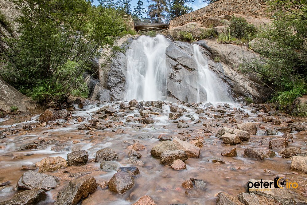
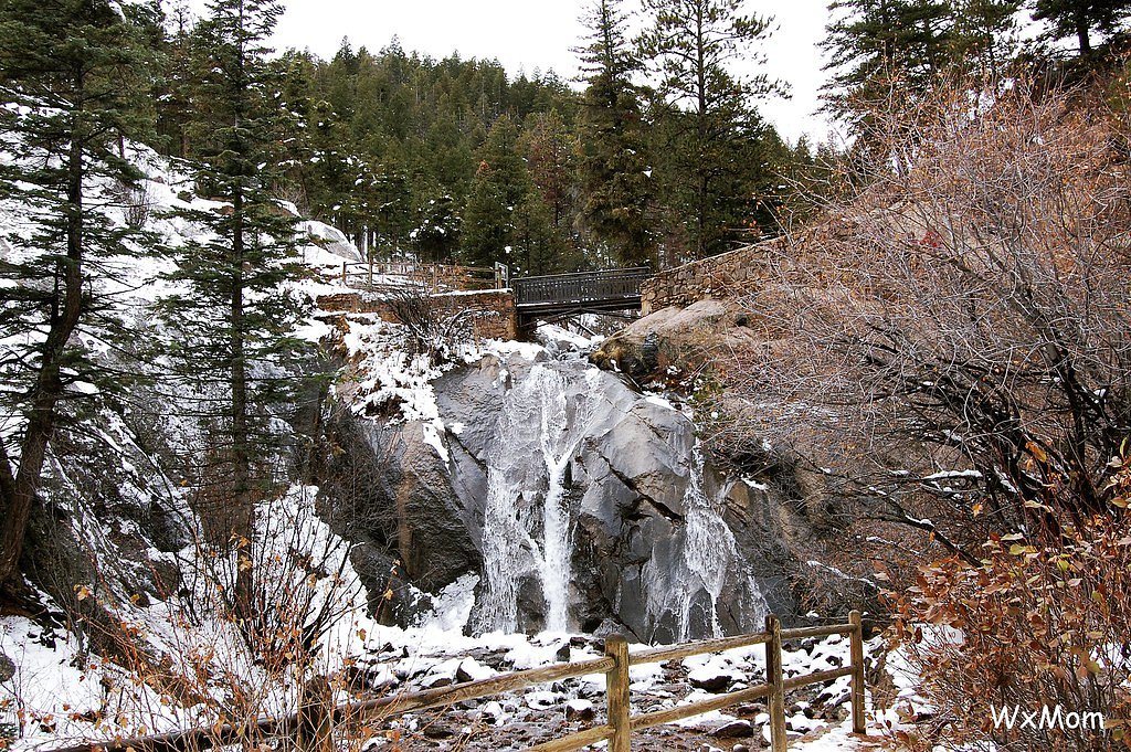
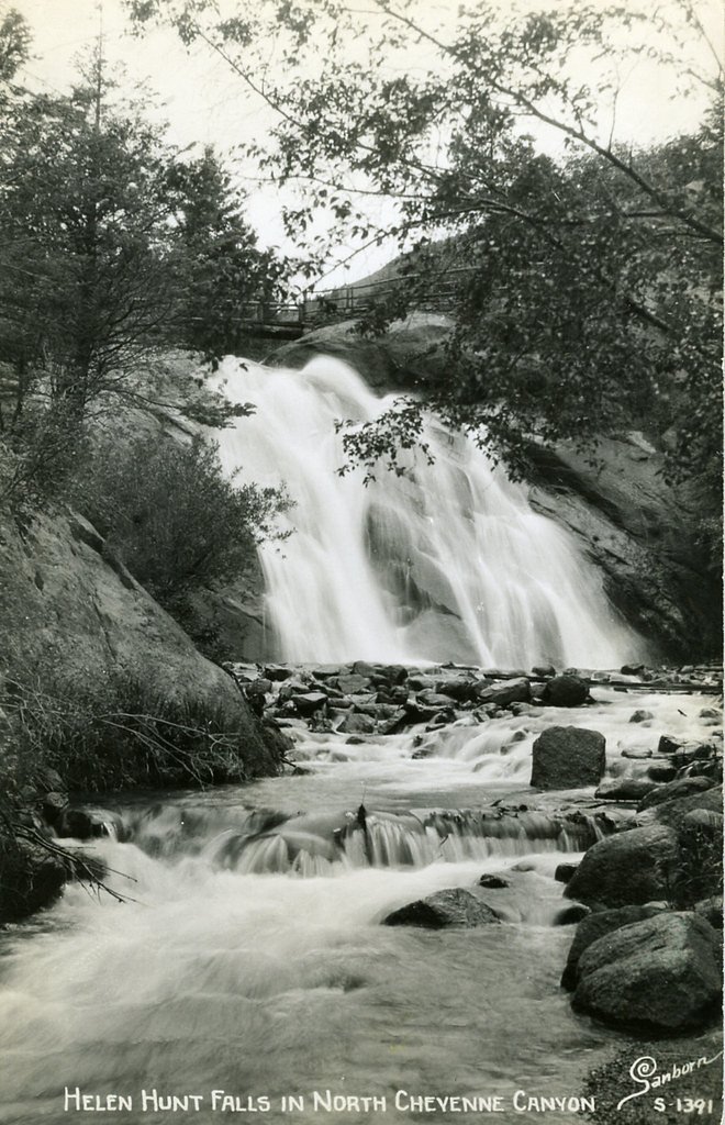
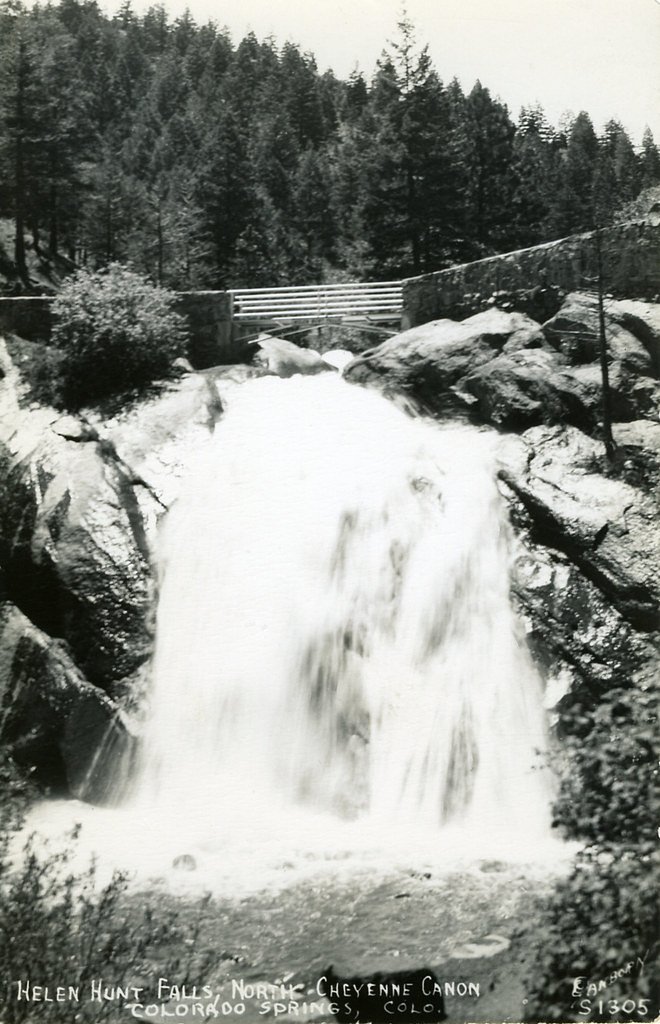

Photo Credits (5)
Difficulty
Drive Up
Trail Length
0.1 miles
Trail Type
Out And Back
Elevation Gain
50 ft
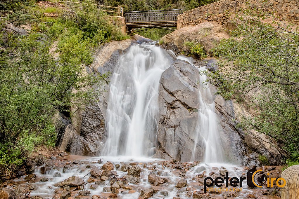
About Helen Hunt Falls
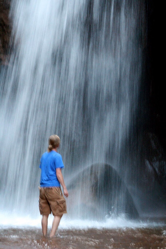
Helen Hunt Falls tumbles about 35 feet on Cheyenne Creek in North Cheyenne Cañon Park, immediately off North Cheyenne Canyon Road in Colorado Springs. Nestled within the city-managed North Cheyenne Canon Park, the cascade is a classic, easy-access scenic stop — there is parking for roughly 30 vehicles at the falls, and the lot often fills up early in the summer when canyon visits are at their peak. As noted on Wikipedia, the falls sit on Cheyenne Creek and are one of the most photographed short stops in the canyon. The setting makes Helen Hunt Falls an ideal quick outing for families, photographers, and visitors looking for a scenic break from a drive through the canyon. The falls are right off the road, and if you want more hiking the Silver Cascade Falls Trail starts nearby and extends the visit into a longer, more strenuous route.
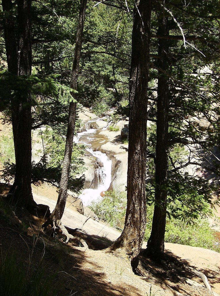
The Setting
Helen Hunt Falls sits at 7,238 feet within North Cheyenne Canon Park, fed by the Cheyenne Creek, in the high mountains of Colorado. The falls drop 35 feet.
Height: 35 feet
Trail & Hike Details
The Approach
No hiking required. Helen Hunt Falls is accessible by vehicle with a roadside viewing area.
Trail Description
The trail to Helen Hunt Falls is extremely short — an out-and-back of about 0.1 miles with roughly 50 feet of elevation gain that leads directly to the base of the 35-foot waterfall. The site is essentially a drive-up destination with a short, steep spur trail from the parking area; the trail type is out-and-back and is commonly described as drive_up difficulty. Limited parking (about 30 spaces) and heavy summer use mean you may want to arrive early; for a longer hike, the Silver Cascade Falls Trail begins nearby.
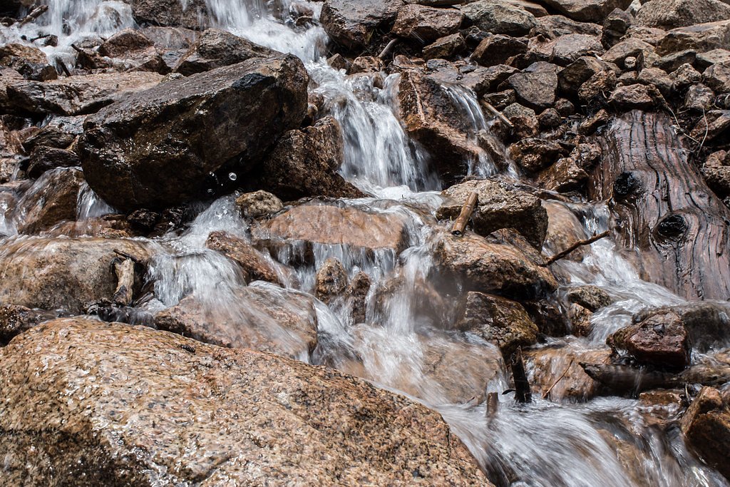
What to Expect
The falls drop 35 feet. Dogs are welcome.
Accessibility
This waterfall is viewable from a vehicle-accessible area. No hiking is required.
Frequently Asked Questions
🐶 Are Dogs Allowed at Helen Hunt Falls?
✅ Dogs are allowed
Are There Any Fees or Permits Required?
🆖 No fees required
🏊 Is There Swimming at Helen Hunt Falls?
❌ Swimming is not allowed
When to Visit
Spring and early summer are ideal times to visit, as snowmelt increases the water flow. Fall offers beautiful foliage, while winter provides a unique view of the falls partially frozen.
Seasonal Access
The best time to visit is Spring, Summer, and Fall. Access roads and trails may close during winter due to snow.
Safety Information
Stay on designated trails and avoid climbing on rocks near the falls, as they can be slippery. Be aware of changing weather conditions, as storms can develop quickly in the area.
Current Water Conditions
1 ft³/s
Current discharge — how much water is flowing
About average for this time of year
Based on 34 years of record
1.39 ft
Water depth at gauge
7-Day Discharge Trend
What does this mean for your visit?
Flow is about average for this time of year.
About This Gauge
7-Day Flow Outlook
Based on the USGS gauge CHEYENNE CREEK AT EVANS AVE AT COLORADO SPRINGS,CO (3 km away).
Today
Barely Flowing
1 cfs
5/10Tomorrow
Barely Flowing
1 cfs
5/10Mon
Barely Flowing
1 cfs
5/10Tue
Barely Flowing
1 cfs
5/10Wed
Barely Flowing
1 cfs
5/10Thu
Barely Flowing
1 cfs
5/10Fri
Barely Flowing
1 cfs
5/10Best window: Today — barely flowing flow, sunny (trip score 5/10).
Best time of year: this gauge typically runs highest from late April to late June, peaking in May.
How we calculate this
This is a transparent outlook, not a precise forecast. We take the waterfall's current flow strength (how it ranks against its historical normal for today, from the nearest USGS stream gauge), carry that ranking forward along the gauge's seasonal curve, and nudge it for forecast rain. Confidence is highest for the next day or two and falls further out. Always check official conditions and your own judgment before visiting — high flows can be dangerous.
Know when to go.
Get a free email alert when waterfalls near Manitou Springs hit peak flow. We only send when conditions are worth the trip — no weekly newsletters, no spam.
Weather Forecast
Location & Access
Getting There
Helen Hunt Falls is located in North Cheyenne Cañon Park, approximately 7 miles southwest of downtown Colorado Springs. Visitors can reach the falls by driving along North Cheyenne Canyon Road, which is well-marked and paved.
Get Directions on Google MapsParking
There is a small parking lot near the falls, but it can fill up quickly during peak times. Additional parking may be available along the road.
Elevation
7,238 feet above sea level
Coordinates
38.788601° N, -104.903030° W
Land Management
Managed by CITY
Visitor Tips & Gear
Arrive early to secure parking, especially during weekends and summer months. Wear sturdy shoes if you plan to explore beyond the base of the falls. Bring water and sunscreen, as the area can get warm during the day.
This trail sits at 7,238 ft above sea level
Elevated TrailUV radiation is roughly 29% stronger at this elevation than at sea level, and the dry air accelerates dehydration. Extra sun protection and fluids go a long way.
As an Amazon Associate, we earn from qualifying purchases.

Coppertone Sport SPF 50 Sunscreen
UV intensity jumps ~4% per 1,000 ft — at this elevation you can burn in half the time.

Sun Bum SPF 30 Lip Balm (3-Pack)
Lips have almost no natural UV protection and burn fast in thin, dry mountain air.

Liquid I.V. Electrolyte Packets
You lose moisture ~2x faster at elevation — electrolytes help you absorb water efficiently.

ROCKNIGHT Polarized UV400 Sunglasses
High-altitude glare off rock and water is intense — UV400 lenses block 99%+ of UVA/UVB.
As an Amazon Associate, we earn from qualifying purchases.
For this easy 0.1 miles trail, lightweight trail shoes and a water bottle are usually sufficient. Sun exposure on the trail makes good sun protection a must in summer.

Polarized Sunglasses (Knockaround)
Cuts glare off the water so you actually see the falls — and your photos turn out better too.

Columbia Watertight II Rain Jacket
Packs into its own pocket, seam-sealed, and keeps you dry from spray and surprise rain.

Earth Pak Waterproof Dry Bag
Keeps your phone and gear dry when waterfall mist soaks everything else.

Waterproof Phone Pouch (AiRunTech)
Cheap insurance — take photos right next to the falls without killing your phone.

JOBY GorillaPod Starter Kit
Wraps around railings and rocks for long-exposure waterfall shots — no flat surface needed.

OR Sombriolet Sun Hat
UPF 50+ sun protection with vents so your head doesn't cook on exposed trail sections.
Where to Stay

Tiny House Get Away

Quality Inn Colorado Springs South

Days Inn by Wyndham Manitou Springs

Pikes Peak Inn
Browse vacation cabins and private rentals nearby
Unique outdoor stays — tents, yurts, and treehouses
Rent a campervan or RV for your waterfall road trip
Some links are affiliate links. We may earn a commission at no extra cost to you.
Nearby Campground
Rampart Reservoir Recreation Area
13.6 miles away · 0 sites
The area is located 4.2 miles east of Woodland Park on Rampart Range Road, FDR 300. **Be advised that the road is a rough, rutted, washboard, native surface road and the posted speed limit is 20 mph. Hauling boat or camper trailers can make this drive especially difficult and slow.
Book on Recreation.govNearby Hot Springs
Hot springs near Manitou Springs, Colorado
Dakota Hot Springs
Dakota Hot Springs occupies the low-elevation foothills of Fremont County, situated just 49 meters from Malibu Boulevard as a m...
Desert Reef Hot Spring
Desert Reef Hot Spring emerges in Fremont County's high-desert landscape near Penrose as a warm mineral spring characterized by...

Canon City Hot Springs
Canon City Hot Springs emerges at an impressive 104 degrees Fahrenheit near Canon City in Fremont County, just 31 meters from R...

Hartsel Hot Springs
Hartsel Hot Springs emerges at 126 degrees Fahrenheit at 8,954 feet elevation in Park County's South Park basin—one of Colorado...

Valley View Hot Springs
Valley View Hot Springs flows at 99 degrees Fahrenheit from the eastern slopes of the Sangre de Cristo Range at 8,850 feet elev...
Looking for a soak after your hike? Explore more hot springs near Manitou Springs, Colorado on SoakingSprings.
Explore Colorado springsAdditional Information
Nearby Attractions
Silver Cascade Falls, Seven Falls, Garden of the Gods, and Pikes Peak.
Wildlife
Visitors may encounter deer, squirrels, and a variety of birds. Be cautious of bears and other wildlife in the area.
Cities near Helen Hunt Falls
Nearby Waterfalls
Writing about Helen Hunt Falls? Embed this waterfall on your site for free.