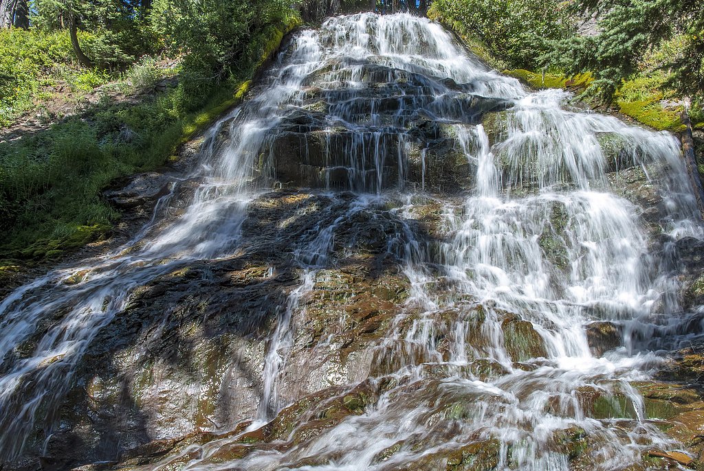
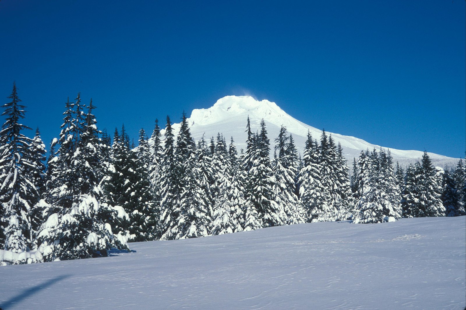
Ramona Falls
Oregon • 120 ft
By Armen Suny · Last verified Mar 2026
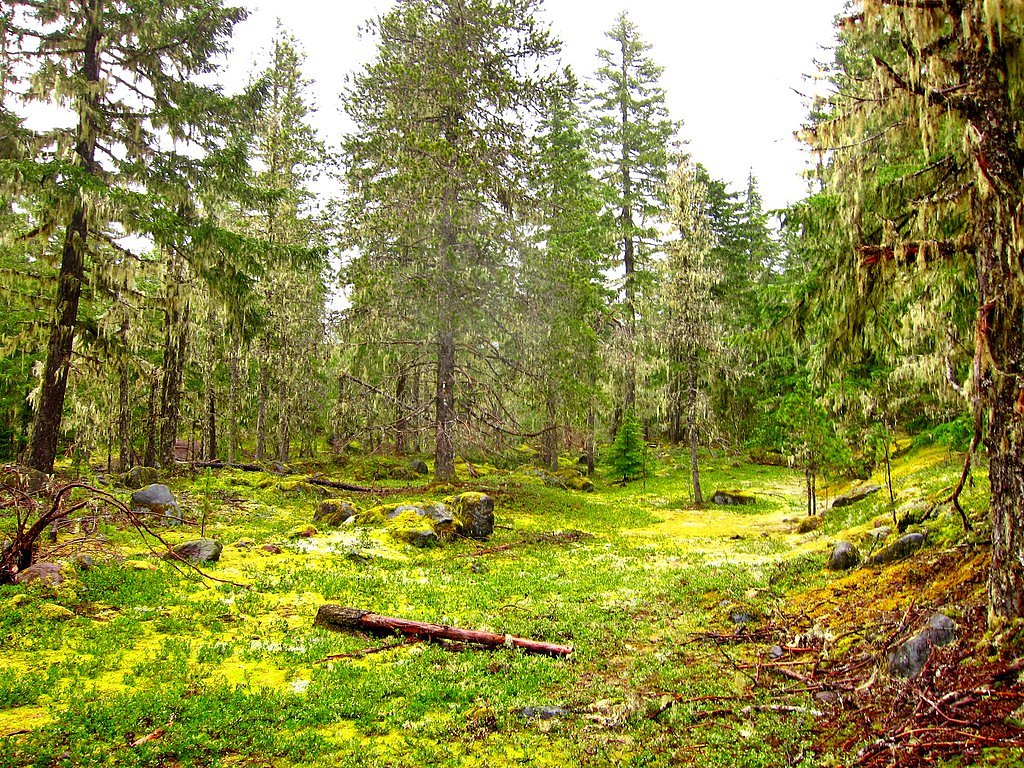
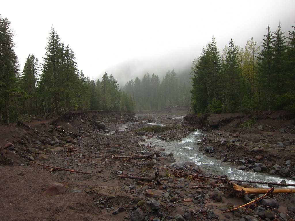
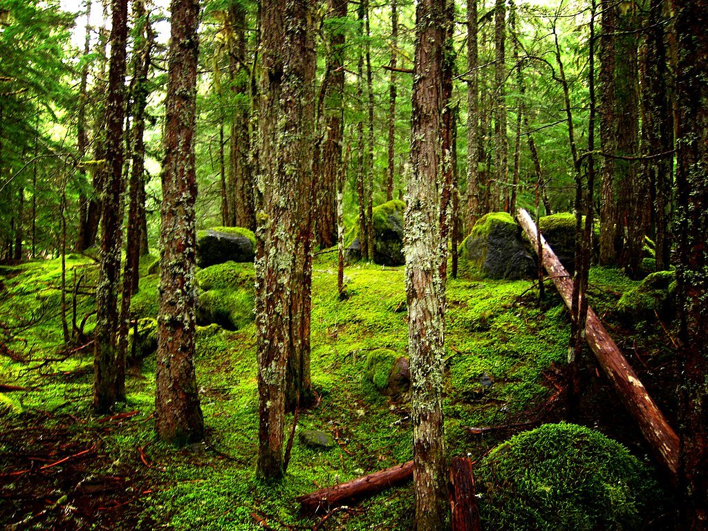

Photo Credits (5)
Difficulty
Hard
Trail Length
7.0 miles
Trail Type
Loop
Elevation Gain
800 ft
About Ramona Falls
Ramona Falls is a stunning 120-foot cascading waterfall located on the western side of Mount Hood in Oregon. The waterfall is known for its unique, fan-shaped appearance as water flows over a basalt rock face, creating a mesmerizing curtain-like effect.
The Setting
Ramona Falls sits at 3,560 feet within Mt. Hood National Forest, fed by the Blazed Alder Creek, in the mountains of Oregon. At 120 feet, it is among the taller waterfalls in Oregon.
Height: 120 feet
Nearby Falls Worth Visiting
Sahale Falls (140 ft) lies 7.8 miles to the southeast. Also nearby: Wallalute Falls (124 ft, 6.2 mi) and Umbrella Falls (60 ft, 6.6 mi).
Trail & Hike Details
The Approach
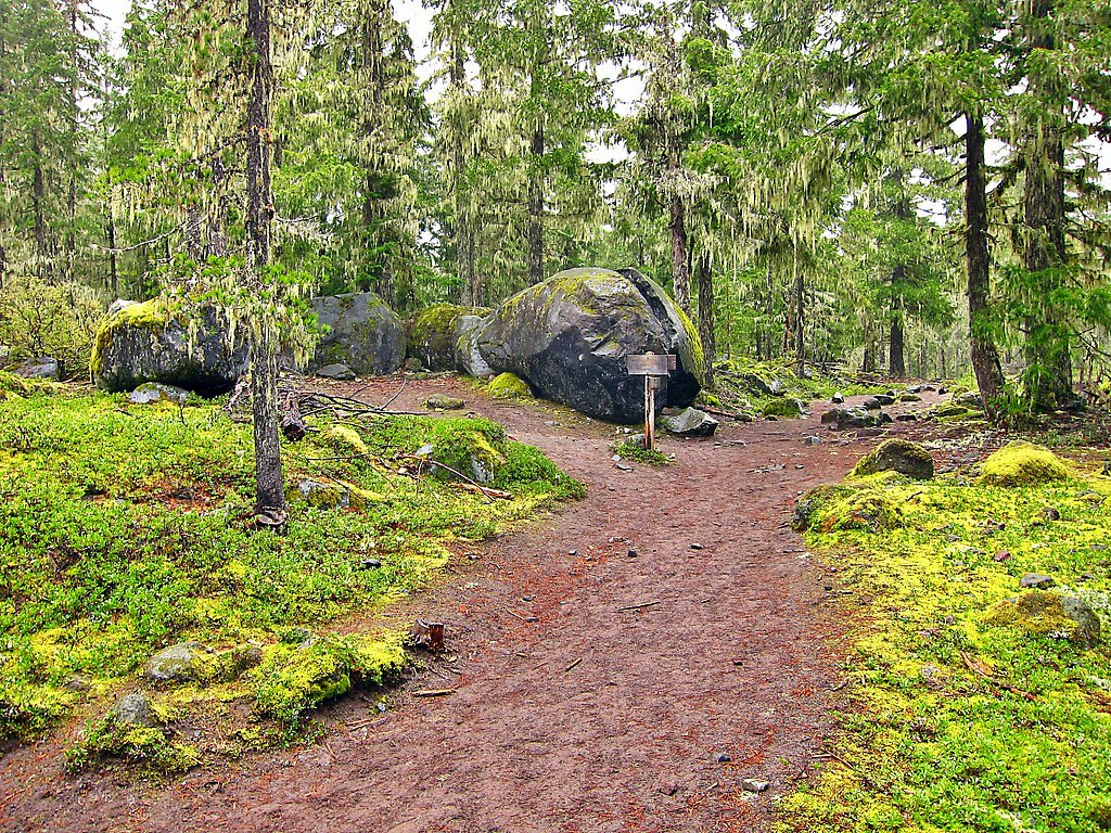
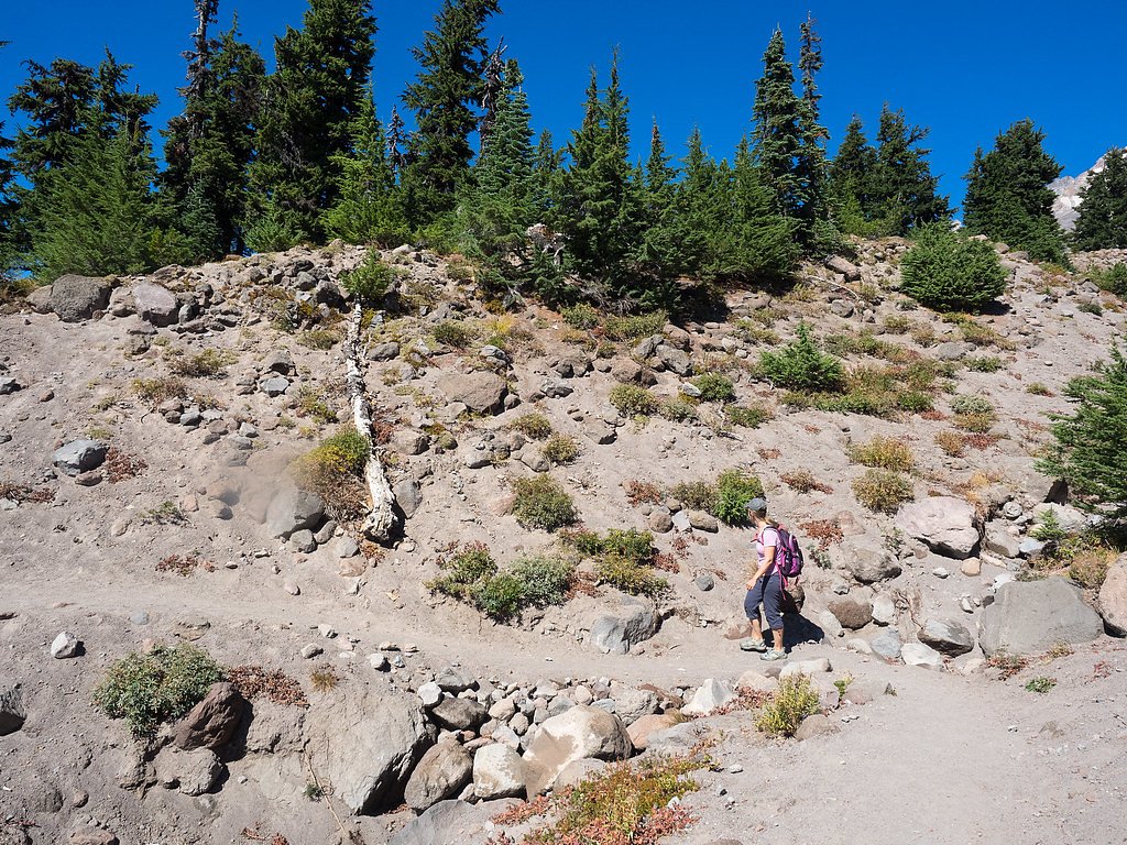
The hard hike follows Ramona Falls (#797), a 7.0-mile loop trail over natural surface. Expect 800 feet of elevation gain with grades of 8-10%. The trail is developed (Class 3).
USFS Trail
RAMONA FALLS #797
Trail Class
Developed
Surface
Avg Grade
USFS Segment
0.63 miTrail Description
The trail to Ramona Falls is a scenic loop that follows the Sandy River and passes through lush forests of Douglas fir and hemlock. The trail includes a crossing of the Sandy River, which can be challenging during high water levels. The final approach to the falls offers breathtaking views of the cascading water.
What to Expect
The falls cascade 120 feet. Dogs are welcome.
Accessibility
The trail involves steep, uneven terrain with significant elevation change and is not accessible to mobility devices.
Frequently Asked Questions
🐶 Are Dogs Allowed at Ramona Falls?
✅ Dogs are allowed
Are There Any Fees or Permits Required?
🤑 Fee: $5.00
Permit required
A Northwest Forest Pass or America the Beautiful Pass is required for parking at the trailhead.
🏊 Is There Swimming at Ramona Falls?
❌ Swimming is not allowed
When to Visit
Late spring through early fall is the best time to visit, as the trail is typically snow-free and the river crossing is more manageable. Summer offers the most reliable trail conditions.
Seasonal Access
The best time to visit is Spring, Summer, and Fall. Winter access may be limited. Check with Mt. Hood National Forest for seasonal road closures.
Safety Information
The Sandy River crossing can be dangerous, especially during high water levels. Use caution and avoid crossing if the water is too high or fast-moving. Always check trail conditions before your hike.
Current Water Conditions
9 ft³/s
Current discharge — how much water is flowing
Lower than usual for this time of year
Based on 62 years of record
1.27 ft
Water depth at gauge
7-Day Discharge Trend
What does this mean for your visit?
Flow is lower than usual for this time of year.
About This Gauge
This gauge is on a nearby waterway and may not reflect exact conditions at the falls.
7-Day Flow Outlook
Based on the USGS gauge BLAZED ALDER CREEK NEAR RHODODENDRON, OR (12 km away).
Today
Roaring
10 cfs
6/10Tomorrow
Roaring
10 cfs
6/10Mon
Roaring
9 cfs
6/10Tue
Roaring
9 cfs
6/10Wed
Roaring
8 cfs
6/10Thu
Roaring
9 cfs
6/10Fri
Roaring
8 cfs
6/10Best window: Today — roaring flow, showers and thunderstorms (trip score 6/10).
Best time of year: this gauge typically runs highest from late April to mid May, peaking in April.
How we calculate this
This is a transparent outlook, not a precise forecast. We take the waterfall's current flow strength (how it ranks against its historical normal for today, from the nearest USGS stream gauge), carry that ranking forward along the gauge's seasonal curve, and nudge it for forecast rain. Confidence is highest for the next day or two and falls further out. Always check official conditions and your own judgment before visiting — high flows can be dangerous.
Know when to go.
Get a free email alert when waterfalls near Government Camp hit peak flow. We only send when conditions are worth the trip — no weekly newsletters, no spam.
Weather Forecast
Location & Access
Getting There
Ramona Falls is accessed via the Ramona Falls Trailhead, located off Lolo Pass Road near Zigzag, Oregon. The trailhead is approximately 1.5 hours from Portland by car.
Get Directions on Google MapsParking
There is a parking lot at the Ramona Falls Trailhead. A Northwest Forest Pass or America the Beautiful Pass is required to park here.
Elevation
3,560 feet above sea level
Coordinates
45.380063° N, -121.776079° W
Land Management
Managed by USFS
Visitor Tips & Gear
Wear sturdy hiking shoes, especially for the river crossing. Bring trekking poles for added stability. Visit early in the day to avoid crowds, and check trail conditions before heading out, especially in spring when the river crossing can be hazardous.
As an Amazon Associate, we earn from qualifying purchases.
This challenging 7.0 miles trail gains 800 ft in elevation — come prepared with proper hiking boots and trekking poles. Sun exposure on the trail makes good sun protection a must in summer.

Sawyer Squeeze Water Filter
The backcountry standard — filters 99.9% of bacteria and weighs just 3 oz.

Polarized Sunglasses (Knockaround)
Cuts glare off the water so you actually see the falls — and your photos turn out better too.

Columbia Watertight II Rain Jacket
Packs into its own pocket, seam-sealed, and keeps you dry from spray and surprise rain.

Earth Pak Waterproof Dry Bag
Keeps your phone and gear dry when waterfall mist soaks everything else.

Waterproof Phone Pouch (AiRunTech)
Cheap insurance — take photos right next to the falls without killing your phone.

Timberland Euro Sprint Mid Waterproof
Trusted waterproof boot with premium leather and grippy rubber sole — reliable on rocky, wet trails.
Where to Stay

Mount Hood Village

Mt Air Motel

Best Western Mt. Hood Inn

Whispering Woods Resort
Browse vacation cabins and private rentals nearby
Unique outdoor stays — tents, yurts, and treehouses
Rent a campervan or RV for your waterfall road trip
Some links are affiliate links. We may earn a commission at no extra cost to you.
Nearby Campground
LOST CREEK
2.9 miles away · 15 sites
Overview Lost Creek Campground is a fully accessible campground allowing anyone access to campsites, fishing and a paved nature trail that meanders through the area. The campground is also near the Wild and Scenic Sandy River and not far from the popular Ramona Falls Trailhead. Mt. Hood is just southeast of the campground and is close enough for visitors to enjoy a day trip and sightseeing.Recreation A variety of trails exist within and near the campground, including the accessible Lost Creek Nat
Book on Recreation.govNearby Hot Springs
Hot springs near Government Camp, Oregon

Mount Hood Fumaroles
Mount Hood Fumaroles vent at 194°F from the flanks of Oregon's highest peak, among the state's most extreme geothermal features...

Swim Warm Springs
Swim Warm Springs emerges at 79°F within Mount Hood National Forest at 4,063 feet elevation, flowing just 6.9 meters from White...

Collins Hot Springs
Collins Hot Springs emerges at 122 degrees just 127 feet above sea level in the Columbia River Gorge, producing water 68.4 degr...
St Martins Hot Springs
St. Martins Hot Springs flows at 120 degrees Fahrenheit at just 432 feet elevation in the Columbia River Gorge near Carson in S...
Moffetts (Bonneville) Hot Springs
Moffetts Hot Springs, also called Bonneville Hot Springs, flows at 97 degrees in the Gifford Pinchot National Forest at just 75...
Rock Creek Hot Springs
Rock Creek Hot Springs emerges in the Columbia River Gorge in Skamania County, Washington, with water documented as 'hot' witho...
Looking for a soak after your hike? Explore more hot springs near Government Camp, Oregon on SoakingSprings.
Explore Oregon springsAdditional Information
Nearby Attractions
Nearby attractions include Mount Hood, Trillium Lake, and the Timberline Lodge.
Wildlife
The area is home to deer, squirrels, and a variety of bird species. Bears and cougars are also present in the region, so visitors should exercise caution.
Cities near Ramona Falls
Nearby Waterfalls

Writing about Ramona Falls? Embed this waterfall on your site for free.