
Photo Credits (5)
Difficulty
Moderate
Trail Length
2.4 miles
Trail Type
Out And Back
Elevation Gain
350 ft
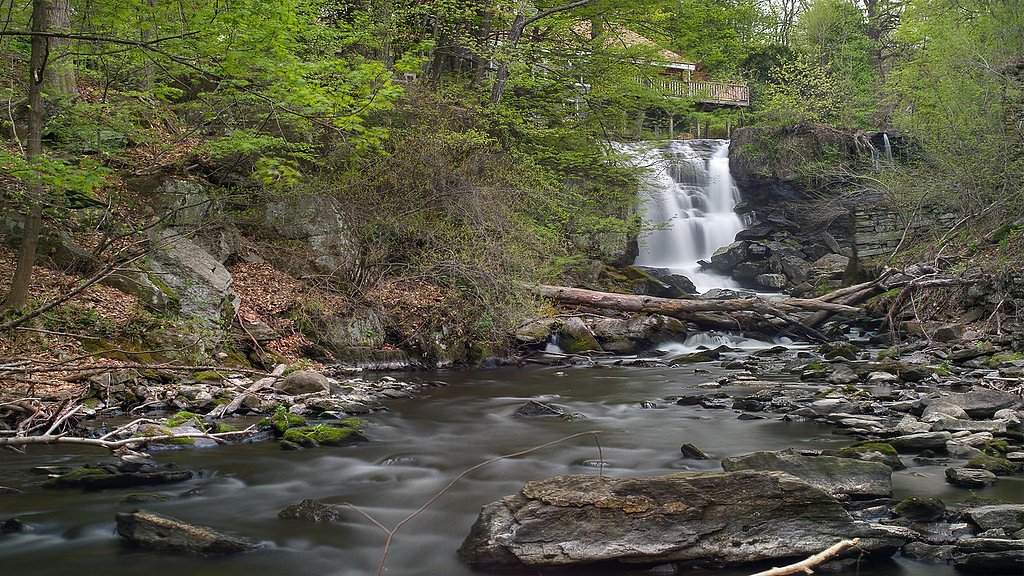
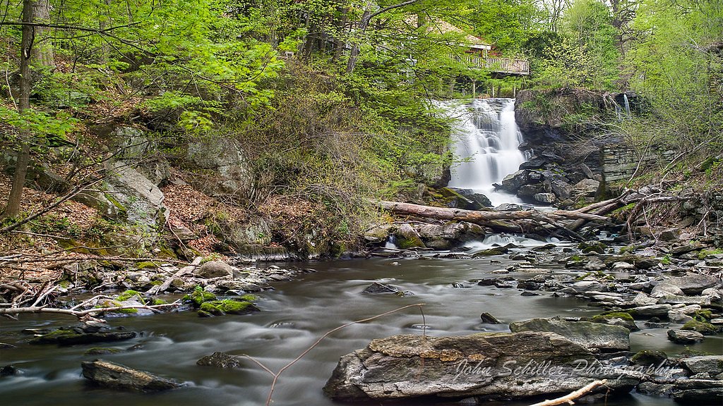
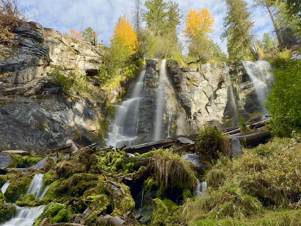
About Preston Falls
Preston Falls is a quietly scenic waterfall tucked into Washington’s forested landscape, a peaceful destination for hikers who prefer a less-crowded outing. The approach is a moderate 2.4-mile out-and-back hike with about 350 feet of elevation gain, making it an achievable half-day trip for many hikers who want a short, rewarding return for their effort. The setting feels intimate and leafy, perfect for photographers and anyone seeking a short nature escape. If you want to extend your visit, Lake Creek Campground on the Entiat River sits roughly 8.6 km (about 5.3 miles) from the falls and provides nearby camping options for an overnight stay. Because official trail identifiers or managing-unit details weren’t provided with the available data, plan ahead and check local resources before you go so you arrive prepared for the trail and conditions.
The Setting
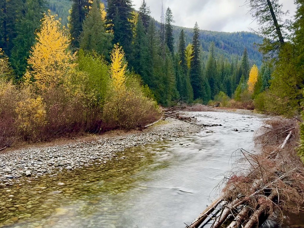
Preston Falls sits at 1,870 feet along the Entiat River, in the hills of Washington.
Trail & Hike Details
The Approach
The moderate 2.4-mile out-and-back trail gains 350 feet of elevation on the way to the falls.
Trail Description
Trail length: 2.4 miles round trip (out-and-back); elevation gain: ~350 feet; difficulty: moderate. The available data does not include a USFS trail name/number, surface type, grade, or official trail class, so hikers should consult local trailheads or land management sources for up-to-date surface and condition information. Expect a moderate forest hike—bring appropriate footwear, water, and a map, and consider nearby Lake Creek Campground (Entiat River) if you plan to camp within about 8.6 km of the falls.
What to Expect
Visitors can expect a tranquil waterfall surrounded by dense forest. The area may be less crowded compared to more popular waterfalls in Washington, making it ideal for those seeking solitude.
Accessibility
The trail is not wheelchair accessible. Uneven terrain and elevation changes require steady footing.
Frequently Asked Questions
🐶 Are Dogs Allowed at Preston Falls?
❌ Dogs are not allowed
Are There Any Fees or Permits Required?
🆖 No fees required
🏊 Is There Swimming at Preston Falls?
❌ Swimming is not allowed
When to Visit
Spring and early summer are ideal times to visit, as the waterfall is likely to have a stronger flow due to seasonal rainfall and snowmelt.
Seasonal Access
The best time to visit is Spring, Summer, and Fall. Winter access may be limited.
Safety Information
Visitors should be cautious of slippery rocks near the waterfall and be prepared for changing weather conditions. Cell phone reception may be limited in the area.
Current Water Conditions
429 ft³/s
Current discharge — how much water is flowing
Lower than usual for this time of year
Based on 68 years of record
2.81 ft
Water depth at gauge
7-Day Discharge Trend
What does this mean for your visit?
Flow is lower than usual for this time of year.
About This Gauge
7-Day Flow Outlook
Based on the USGS gauge ENTIAT RIVER NEAR ARDENVOIR, WA (7 km away).
Today
Moderate
463 cfs
5/10Tomorrow
Moderate
473 cfs
5/10Sat
Low
426 cfs
6/10Sun
Low
388 cfs
6/10Mon
Low
367 cfs
6/10Tue
Low
356 cfs
6/10Wed
Low
351 cfs
6/10Best window: Sat — low flow, partly sunny (trip score 6/10).
Best time of year: this gauge typically runs highest from late April to late July, peaking in June.
How we calculate this
This is a transparent outlook, not a precise forecast. We take the waterfall's current flow strength (how it ranks against its historical normal for today, from the nearest USGS stream gauge), carry that ranking forward along the gauge's seasonal curve, and nudge it for forecast rain. Confidence is highest for the next day or two and falls further out. Always check official conditions and your own judgment before visiting — high flows can be dangerous.
Know when to go.
Get a free email alert when waterfalls near Manson hit peak flow. We only send when conditions are worth the trip — no weekly newsletters, no spam.
Weather Forecast
Location & Access
Getting There
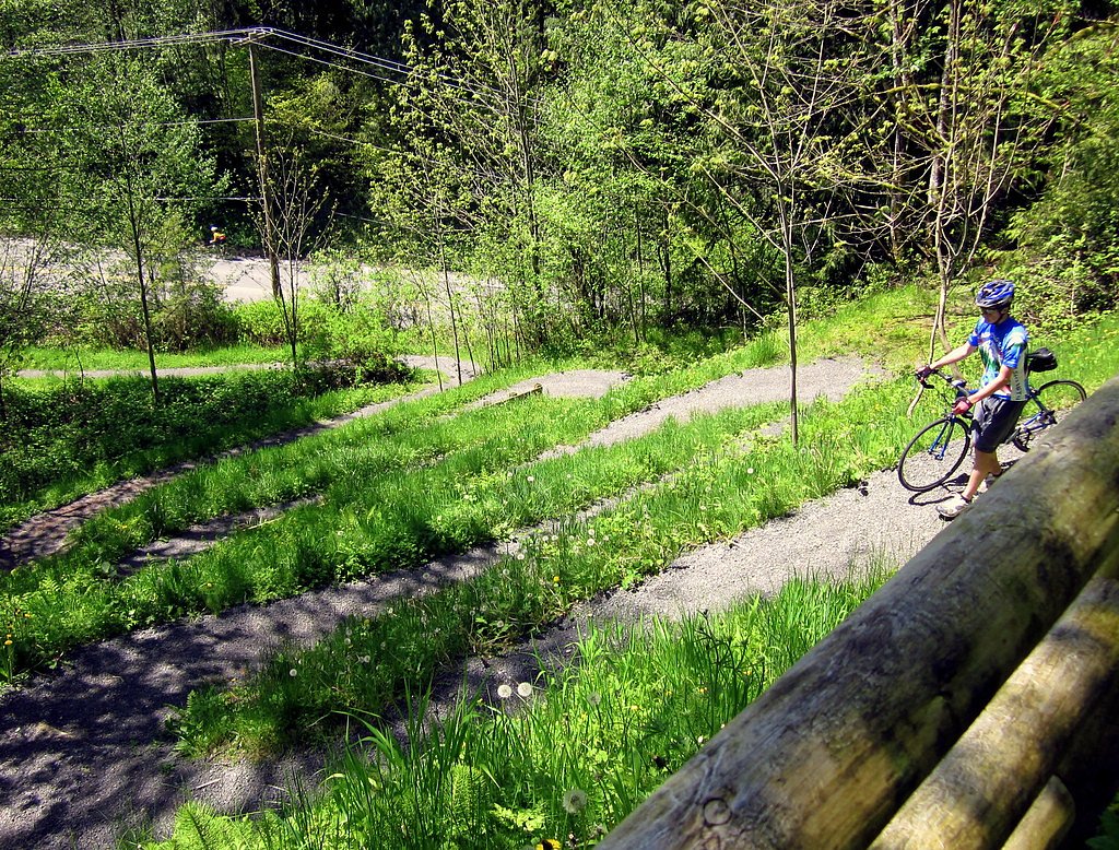
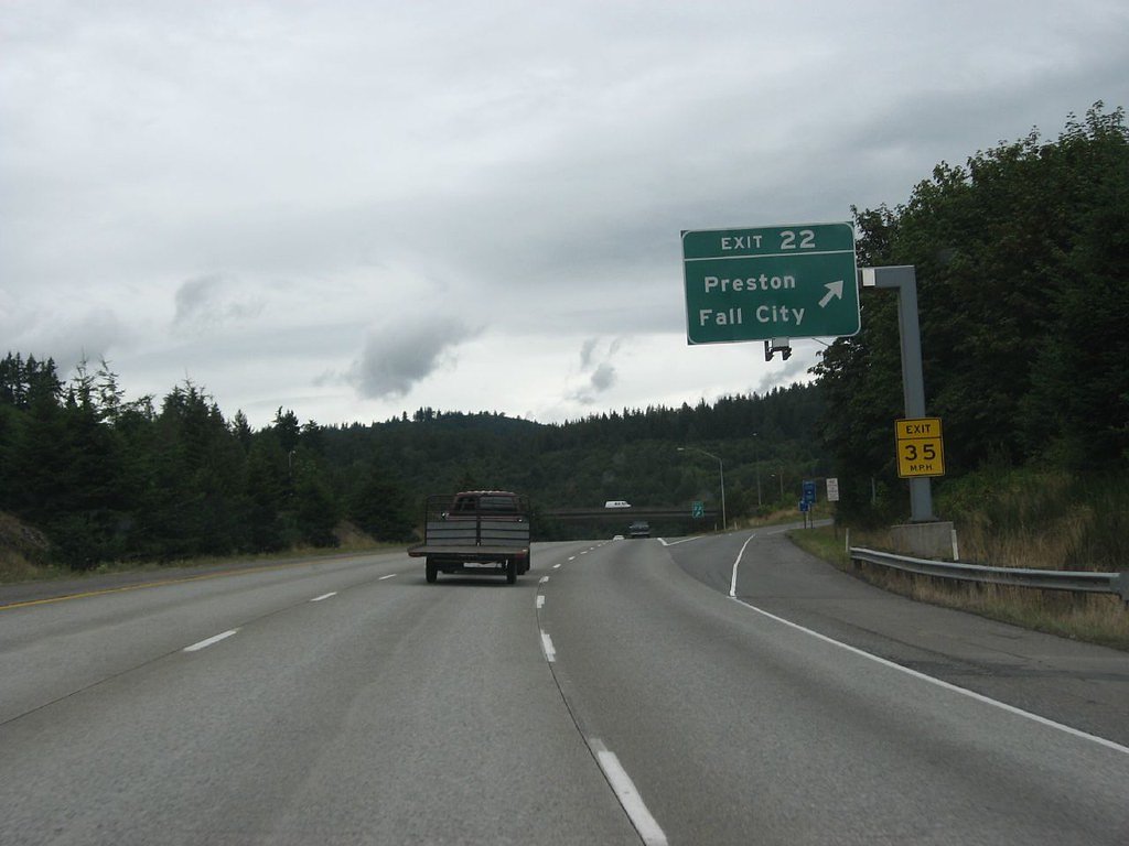
Preston Falls is located near the town of Preston, Washington, and can be accessed via local roads. Specific directions may vary, so it is recommended to use a GPS or consult local maps for the most accurate route.
Get Directions on Google MapsParking
Parking availability is unclear, but visitors may need to park along nearby roads or at designated trailheads if applicable.
Elevation
1,870 feet above sea level
Coordinates
47.882607° N, -120.431367° W
Visitor Tips & Gear
Wear sturdy footwear and bring a map or GPS device, as trail information is limited. Check weather conditions before visiting, as trails may become slippery or muddy after rain.
As an Amazon Associate, we earn from qualifying purchases.
With 2.4 miles and 350 ft of elevation gain, sturdy boots and trekking poles will help on this moderate trail. Sun exposure on the trail makes good sun protection a must in summer.

Polarized Sunglasses (Knockaround)
Cuts glare off the water so you actually see the falls — and your photos turn out better too.

Columbia Watertight II Rain Jacket
Packs into its own pocket, seam-sealed, and keeps you dry from spray and surprise rain.

Earth Pak Waterproof Dry Bag
Keeps your phone and gear dry when waterfall mist soaks everything else.

Waterproof Phone Pouch (AiRunTech)
Cheap insurance — take photos right next to the falls without killing your phone.

Timberland Euro Sprint Mid Waterproof
Trusted waterproof boot with premium leather and grippy rubber sole — reliable on rocky, wet trails.

TrailBuddy Trekking Poles
Lightweight aluminum, cork grips, and flip-locks that actually hold — a best-seller for good reason.
Where to Stay

The Lodge Lake Chelan

Beaver Valley Lodge

Mountain View Lodge

Driftin Cabanas
Browse vacation cabins and private rentals nearby
Unique outdoor stays — tents, yurts, and treehouses
Rent a campervan or RV for your waterfall road trip
Some links are affiliate links. We may earn a commission at no extra cost to you.
Nearby Campground
Lake Creek Campground - Entiat River
5.3 miles away · 18 sites
Overview Nestled in Okanogan-Wenatchee National Forest, Lake Creek (Entiat River) Campground offers visitors some of the stunning scenery in sunny central Washington and easy access to an abundance of recreational activities, such as hiking, dirt biking and mountain biking. Recreation Hiking, horse riding, mountain biking and dirt biking top the list of recreation activities in the area. Three different trails start adjacent to the campground and are open to most activities. The Silver Falls Na
Book on Recreation.govNearby Hot Springs
Hot springs near Manson, Washington
Garland Mineral Springs
Garland Mineral Springs flows at 84 degrees in the Snoqualmie National Forest, producing water 39.6 degrees above ambient tempe...
Scenic Hot Springs
Scenic Hot Springs delivers genuinely hot water at 122 degrees Fahrenheit at 2,246 feet elevation in the Cascade Mountains near...
Gamma Hot Springs
Gamma Hot Springs produces 140-degree water at 5,397 feet elevation in the Mt. Baker National Forest, emerging 104.6 degrees ab...
Kennedy Hot Spring
Kennedy Hot Spring flows at 100 degrees at 3,520 feet elevation in the Mt. Baker National Forest, emerging 58.7 degrees above a...
Sulphur Creek Hot Springs
Sulphur Creek Hot Springs flows at 99 degrees Fahrenheit at 2,973 feet elevation in Mount Baker National Forest's remote backco...
Goldmeyer Hot Springs
Goldmeyer Hot Springs emerges at 127 degrees in the central Cascades, producing water 78.9 degrees above ambient temperature at...
Looking for a soak after your hike? Explore more hot springs near Manson, Washington on SoakingSprings.
Explore Washington springsAdditional Information
Nearby Attractions
Nearby attractions may include other hiking trails and natural areas in the Preston and Snoqualmie region.
Wildlife
The area is home to typical Pacific Northwest wildlife, including birds, deer, and small mammals. Visitors should be aware of potential encounters with bears or other larger animals.
Cities near Preston Falls
Nearby Waterfalls
Other waterfalls named Preston Falls
1 other waterfall shares this name across the U.S.
Writing about Preston Falls? Embed this waterfall on your site for free.