Preston Falls
California • Yosemite National Park
By Armen Suny · Last verified Mar 2026
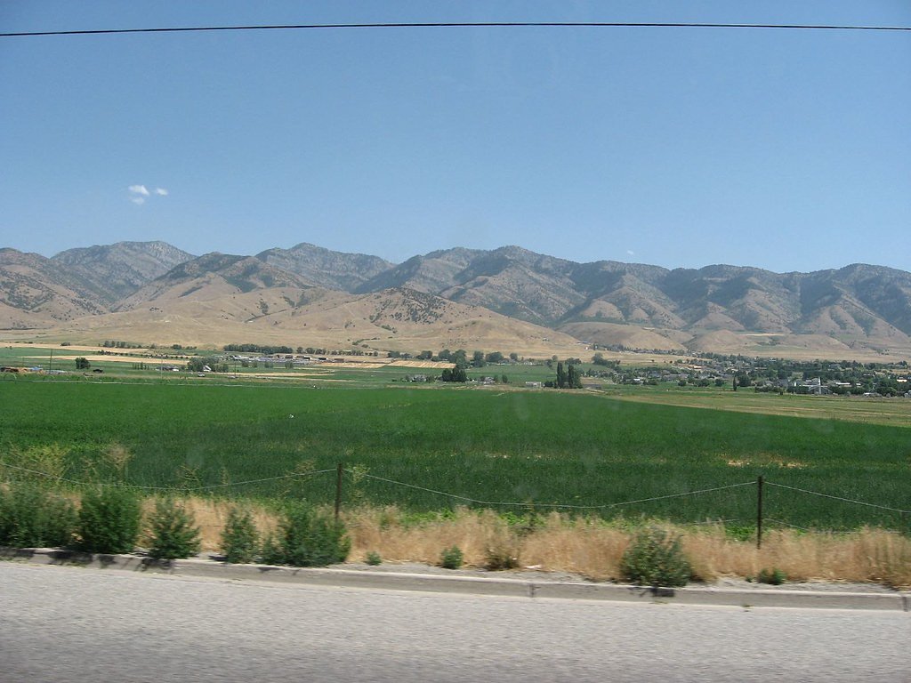
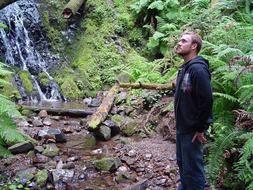
Photo Credits (5)
Difficulty
Moderate
Trail Length
8.0 miles
Trail Type
Out And Back
Elevation Gain
800 ft
About Preston Falls
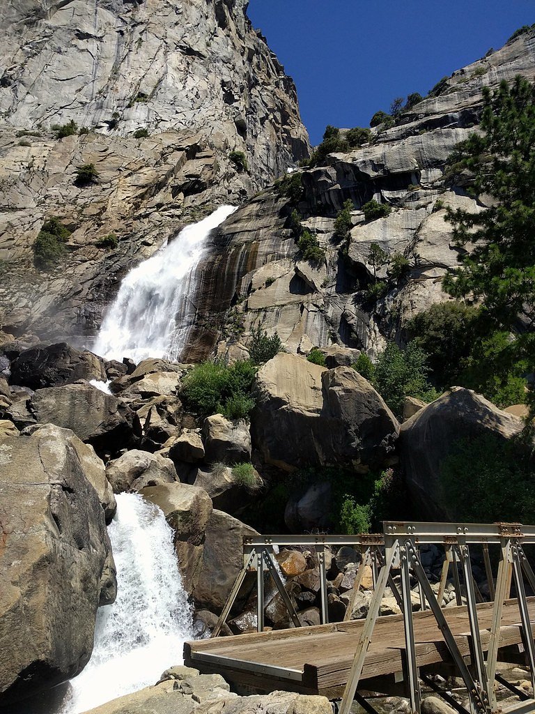
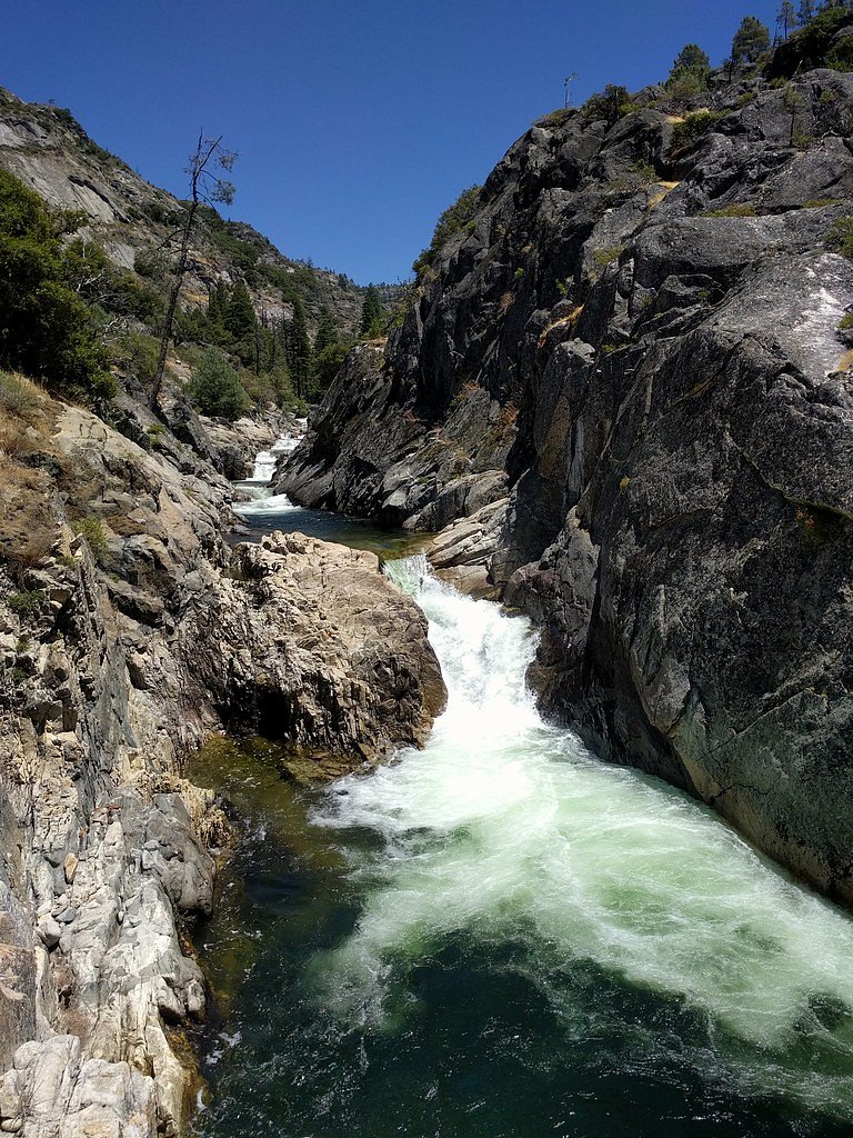
Preston Falls is a scenic waterfall located in the Stanislaus National Forest in California. It is a popular destination for hikers seeking a moderately challenging trail with rewarding views of the falls and surrounding wilderness. The waterfall is nestled along the Middle Fork of the Stanislaus River, offering a serene and picturesque setting.
The Setting
Preston Falls sits at 2,769 feet within Yosemite National Park, in the hills of California.
Nearby Falls Worth Visiting
Tueeulala Falls (880 ft) lies 8.1 miles to the northeast.
Trail & Hike Details
The Approach
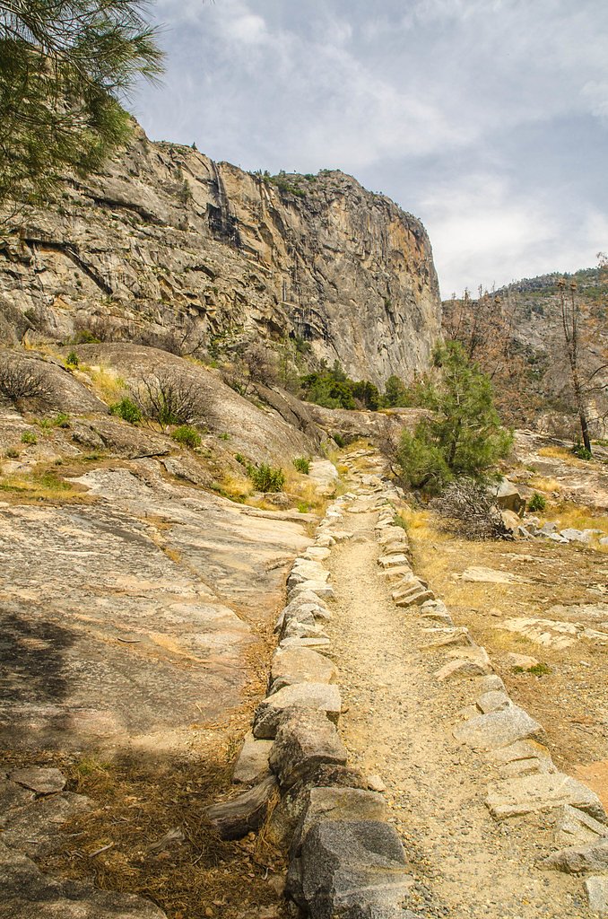
The moderate hike follows Preston Falls (#19E18), a 8.0-mile out-and-back trail over natural surface. Expect 800 feet of elevation gain with grades of +12-20%. The trail is developed (Class 3).
USFS Trail
PRESTON FALLS #19E18
Trail Class
Developed
Surface
Avg Grade
USFS Segment
3.88 miTrail Description
The trail to Preston Falls is a moderately challenging out-and-back hike that follows the Middle Fork of the Stanislaus River. The path is well-marked but includes some rocky and uneven sections. Hikers will enjoy views of the river, forested landscapes, and eventually the waterfall itself, which cascades into a tranquil pool.
What to Expect
Dogs are welcome.
Accessibility
The trail is not wheelchair accessible. Uneven terrain and elevation changes require steady footing.
Frequently Asked Questions
🐶 Are Dogs Allowed at Preston Falls?
✅ Dogs are allowed
Are There Any Fees or Permits Required?
🆖 No fees required
🏊 Is There Swimming at Preston Falls?
❌ Swimming is not allowed
When to Visit
Spring and early summer are the best times to visit, as the waterfall flow is typically strongest due to snowmelt. Fall offers cooler temperatures and beautiful foliage, while summer provides warm weather but may have lower water flow.
Seasonal Access
The best time to visit is Spring, Summer, and Fall. Winter access may be limited. Check with Yosemite National Park for current conditions.
Safety Information
Hikers should be prepared for changing weather conditions and carry sufficient water. Watch for slippery rocks near the waterfall and be cautious of wildlife. Cell service may be limited in the area.
Current Water Conditions
156 ft³/s
Current discharge — how much water is flowing
About average for this time of year
Based on 54 years of record
12.90 ft
Water depth at gauge
62°F
CoolRefreshing for swimming
7-Day Discharge Trend
What does this mean for your visit?
Flow is about average for this time of year. Water temperature is a refreshing 62 degrees F, good for a quick swim.
About This Gauge
7-Day Flow Outlook
Based on the USGS gauge TUOLUMNE R AB EARLY INTAKE NR MATHER CA (6 km away).
Today
Barely Flowing
169 cfs
3/10Tomorrow
Barely Flowing
150 cfs
5/10Mon
Barely Flowing
121 cfs
5/10Tue
Barely Flowing
115 cfs
5/10Wed
Barely Flowing
113 cfs
5/10Thu
Barely Flowing
126 cfs
5/10Fri
Barely Flowing
114 cfs
5/10Best window: Tomorrow — barely flowing flow, sunny (trip score 5/10).
Best time of year: this gauge typically runs highest from mid April to mid July, peaking in June.
How we calculate this
This is a transparent outlook, not a precise forecast. We take the waterfall's current flow strength (how it ranks against its historical normal for today, from the nearest USGS stream gauge), carry that ranking forward along the gauge's seasonal curve, and nudge it for forecast rain. Confidence is highest for the next day or two and falls further out. Always check official conditions and your own judgment before visiting — high flows can be dangerous.
Know when to go.
Get a free email alert when waterfalls near Pine Mountain Lake hit peak flow. We only send when conditions are worth the trip — no weekly newsletters, no spam.
Weather Forecast
Location & Access
Getting There
Preston Falls is accessed via the Preston Falls Trail, which begins near the Donnell Vista area off Highway 108. The trailhead is located in the Stanislaus National Forest, and visitors should follow signs for the trail.
Get Directions on Google MapsParking
Parking is available near the trailhead, but spaces may be limited during peak seasons. Visitors are advised to arrive early to secure a spot.
Elevation
2,769 feet above sea level
Coordinates
37.884368° N, -119.881291° W
Land Management
Managed by USFS
Visitor Tips & Gear
Wear sturdy hiking shoes as the trail can be rocky in places. Bring plenty of water, especially during warmer months, and consider packing snacks for the hike. Arrive early to secure parking and avoid crowds. Check trail conditions before heading out, especially in winter or after heavy rains.
As an Amazon Associate, we earn from qualifying purchases.
With 8.0 miles and 800 ft of elevation gain, sturdy boots and trekking poles will help on this moderate trail. Sun exposure on the trail makes good sun protection a must in summer.

Polarized Sunglasses (Knockaround)
Cuts glare off the water so you actually see the falls — and your photos turn out better too.

Columbia Watertight II Rain Jacket
Packs into its own pocket, seam-sealed, and keeps you dry from spray and surprise rain.

Earth Pak Waterproof Dry Bag
Keeps your phone and gear dry when waterfall mist soaks everything else.

Waterproof Phone Pouch (AiRunTech)
Cheap insurance — take photos right next to the falls without killing your phone.

Timberland Euro Sprint Mid Waterproof
Trusted waterproof boot with premium leather and grippy rubber sole — reliable on rocky, wet trails.

TrailBuddy Trekking Poles
Lightweight aluminum, cork grips, and flip-locks that actually hold — a best-seller for good reason.
Where to Stay

Yosemite Westgate Lodge

Rush Creek Lodge at Yosemite

Yosemite View Lodge

Evergreen Lodge at Yosemite
Browse vacation cabins and private rentals nearby
Unique outdoor stays — tents, yurts, and treehouses
Rent a campervan or RV for your waterfall road trip
Some links are affiliate links. We may earn a commission at no extra cost to you.
Nearby Campground
CHERRY VALLEY
7.3 miles away · 45 sites
Overview Situated in the central Sierra Nevada, camping at Cherry Valley campground offers many beautiful sights. It is located in a forest of mixed conifers about 1.5 miles northeast of Cherry Valley Dam, 1 hour east of Tuolumne City, 1 hour northeast of Groveland, and 2.5 hours from the northwestern border of Yosemite National Park. Lake access is available via a hiking trail. The road to the campground is a winding mountain road and must be taken slowly.Recreation There are unlimited opportuni
Book on Recreation.govNearby Hot Springs
Hot springs near Pine Mountain Lake, California

Unnamed Spring Mono County 5
This 72-degree thermal spring near Bridgeport sits at 6,383 feet elevation, requiring a short 160-meter walk from the road in M...

Unnamed Spring Mono County 6
This 91-degree thermal spring near Mammoth Lakes delivers exceptional warmth, running 42 degrees above the cool ambient air whe...
Unnamed Spring Mono County 7
This 97-degree thermal spring sits at 8,159 feet elevation within Inyo National Forest, running an extraordinary 56.7 degrees a...
Buckeye Hot Spring
Buckeye Hot Spring flows at 140°F from the eastern Sierra Nevada in Mono County at 6,963 feet elevation on US Forest Service la...
Paoha Island Springs
Rising from the volcanic island of Paoha in Mono Lake, Paoha Island Springs reaches 181 degrees Fahrenheit—one of California's ...
Hot Spring
Hot Spring near Bridgeport emerges at 151°F just 130 feet from the road, making it perhaps the most accessible high-temperature...
Looking for a soak after your hike? Explore more hot springs near Pine Mountain Lake, California on SoakingSprings.
Explore California springsAdditional Information
Nearby Attractions
Donnell Vista Point, Pinecrest Lake, and Columns of the Giants are nearby attractions worth visiting.
Wildlife
The area is home to a variety of wildlife, including deer, squirrels, and various bird species. Be cautious of snakes and other potentially hazardous animals.
Cities near Preston Falls
Nearby Waterfalls
Other waterfalls named Preston Falls
1 other waterfall shares this name across the U.S.
Writing about Preston Falls? Embed this waterfall on your site for free.