

Photo Credits (5)
Difficulty
Moderate
Trail Length
3.0 miles
Trail Type
Out And Back
Elevation Gain
500 ft
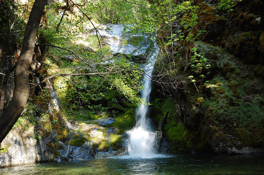
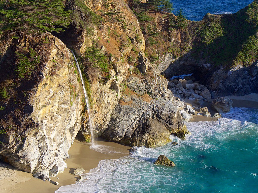
About Pine Falls
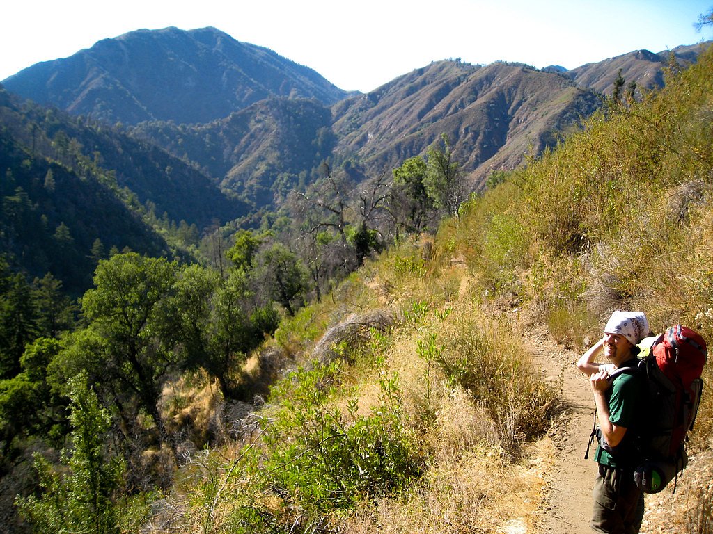
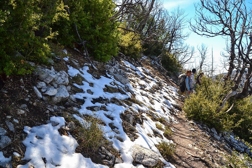
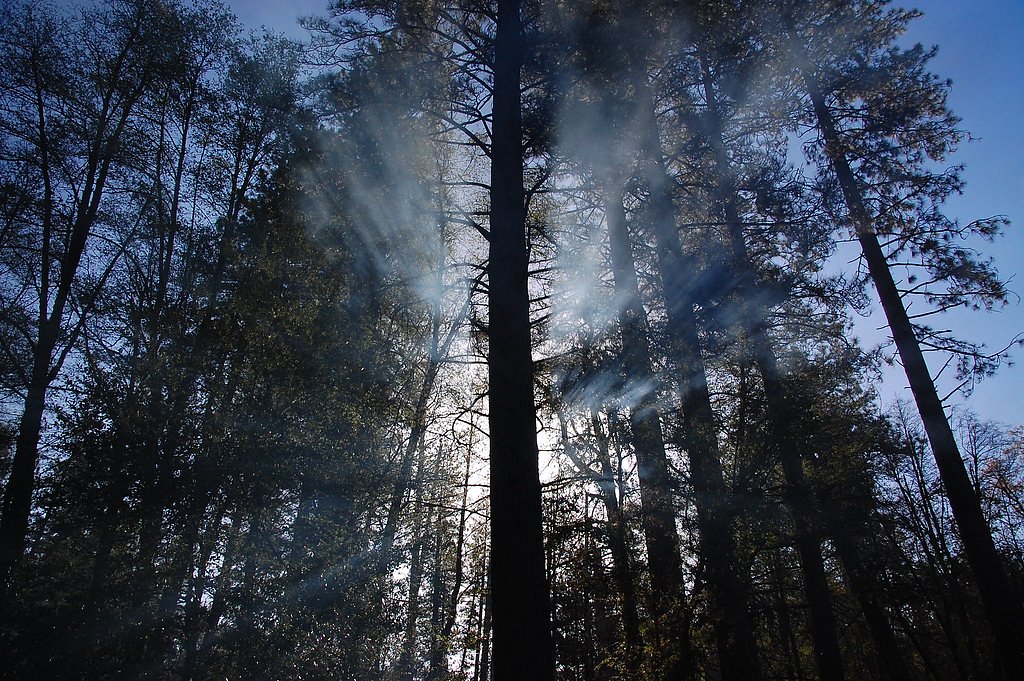
Pine Falls is a peaceful waterfall tucked into the forested slopes of Los Padres National Forest and managed by the U.S. Forest Service. The cascade is best visited in spring when runoff is strongest, and its quiet, pine‑lined surroundings make it a popular day-hike for nature lovers. The route to the falls follows the USFS PINE RIDGE Trail (Trail #3E06); while the full PINE RIDGE corridor measures about 11.29 miles by USFS GIS data, the commonly used approach to Pine Falls is a shorter 3.0‑mile out‑and‑back that gains roughly 500 feet and is rated moderate. Expect a mix of shaded forest and open viewpoints along the way on a trail surfaced with native material. The Forest Service lists the trail as Class 3 with a typical sustained grade of 10–12%, so hikers should be prepared for sustained uphill sections and uneven footing. For overnight options, China Camp Campground lies about 6.99 km away and provides a nearby basecamp for explorers who want to turn the visit into a weekend trip.
The Setting
Pine Falls sits at 2,789 feet within Los Padres National Forest, in the hills of California.
Nearby Falls Worth Visiting
McWay Falls (80 ft) lies 9.9 miles to the south. Also nearby: Pfeiffer Falls (60 ft, 8.2 mi).
Trail & Hike Details
The Approach
The moderate hike follows Pine Ridge (#3E06), a 3.0-mile out-and-back trail over natural surface. Expect 500 feet of elevation gain with grades of 10-12%. The trail is developed (Class 3).
USFS Trail
PINE RIDGE #3E06
Trail Class
Developed
Surface
Avg Grade
USFS Segment
11.29 miTrail Description
USFS Trail: PINE RIDGE (Trail #3E06). Trail type: out‑and‑back to Pine Falls, commonly about 3.0 miles round trip to the falls with roughly 500 ft of elevation gain (the full PINE RIDGE route is 11.29 GIS miles). Surface: native material. Class: 3 (per USFS). Typical grade: 10–12%. The path winds through mixed shaded and open forest, with native‑surface tread that can be rocky and uneven in places—sturdy footwear is recommended. Scenic viewpoints and the waterfall make the steady climb worthwhile.
What to Expect
Visitors can expect a moderately challenging hike with beautiful forest scenery and the sound of rushing water as they approach the falls. The area around the waterfall may be slippery, so caution is advised. The waterfall's flow is most impressive in the spring after seasonal rains.
Accessibility
The trail is not wheelchair accessible. Uneven terrain and elevation changes require steady footing.
Frequently Asked Questions
🐶 Are Dogs Allowed at Pine Falls?
❌ Dogs are not allowed
Are There Any Fees or Permits Required?
🆖 No fees required
🏊 Is There Swimming at Pine Falls?
❌ Swimming is not allowed
When to Visit
Spring is the best time to visit Pine Falls, as the waterfall is typically at its fullest due to seasonal rains. Summer and fall are also good options, but the flow may be reduced.
Seasonal Access
The best time to visit is Spring, Summer, and Fall. Winter access may be limited. Check with Los Padres National Forest for seasonal road closures.
Safety Information
The trail may be slippery after rain, and the area around the waterfall can be hazardous due to wet rocks. Always stay on marked trails and exercise caution near the water. Bring sufficient water and be prepared for changing weather conditions.
Current Water Conditions
24 ft³/s
Current discharge — how much water is flowing
About average for this time of year
Based on 76 years of record
4.35 ft
Water depth at gauge
7-Day Discharge Trend
What does this mean for your visit?
Flow is about average for this time of year.
About This Gauge
This gauge is on a nearby waterway and may not reflect exact conditions at the falls.
7-Day Flow Outlook
Based on the USGS gauge BIG SUR R NR BIG SUR CA (13 km away).
Today
Barely Flowing
24 cfs
5/10Tomorrow
Barely Flowing
23 cfs
5/10Thu
Barely Flowing
23 cfs
5/10Fri
Barely Flowing
23 cfs
5/10Sat
Barely Flowing
23 cfs
5/10Sun
Barely Flowing
23 cfs
5/10Mon
Barely Flowing
22 cfs
5/10Best window: Today — barely flowing flow, sunny (trip score 5/10).
Best time of year: this gauge typically runs highest from mid January to mid April, peaking in February.
How we calculate this
This is a transparent outlook, not a precise forecast. We take the waterfall's current flow strength (how it ranks against its historical normal for today, from the nearest USGS stream gauge), carry that ranking forward along the gauge's seasonal curve, and nudge it for forecast rain. Confidence is highest for the next day or two and falls further out. Always check official conditions and your own judgment before visiting — high flows can be dangerous.
Know when to go.
Get a free email alert when waterfalls near Carmel Valley Village hit peak flow. We only send when conditions are worth the trip — no weekly newsletters, no spam.
Weather Forecast
Location & Access
Getting There
Pine Falls is located within a forested region in California. Access typically involves driving to a trailhead, followed by a hike through wooded trails. Specific directions may vary depending on the starting point, so it is recommended to consult a map or GPS for accurate navigation.
Get Directions on Google MapsParking
Parking is available near the trailhead, but spaces may be limited during peak seasons. Arrive early to secure a spot.
Elevation
2,789 feet above sea level
Coordinates
36.300796° N, -121.645224° W
Land Management
Managed by USFS
Visitor Tips & Gear
Start your hike early to avoid crowds and secure parking. Bring plenty of water, especially during warmer months, and wear sturdy hiking shoes. Check weather conditions before your visit, as the trail may be muddy or slippery after rain.
As an Amazon Associate, we earn from qualifying purchases.
With 3.0 miles and 500 ft of elevation gain, sturdy boots and trekking poles will help on this moderate trail. Sun exposure on the trail makes good sun protection a must in summer.

Polarized Sunglasses (Knockaround)
Cuts glare off the water so you actually see the falls — and your photos turn out better too.

Columbia Watertight II Rain Jacket
Packs into its own pocket, seam-sealed, and keeps you dry from spray and surprise rain.

Earth Pak Waterproof Dry Bag
Keeps your phone and gear dry when waterfall mist soaks everything else.

Waterproof Phone Pouch (AiRunTech)
Cheap insurance — take photos right next to the falls without killing your phone.

Timberland Euro Sprint Mid Waterproof
Trusted waterproof boot with premium leather and grippy rubber sole — reliable on rocky, wet trails.

TrailBuddy Trekking Poles
Lightweight aluminum, cork grips, and flip-locks that actually hold — a best-seller for good reason.
Where to Stay

Fernwood Resort

The Quail Lodge

Carmel Mission Inn

Big Sur Lodge
Browse vacation cabins and private rentals nearby
Unique outdoor stays — tents, yurts, and treehouses
Rent a campervan or RV for your waterfall road trip
Some links are affiliate links. We may earn a commission at no extra cost to you.
Nearby Campground
CHINA CAMP CAMPGROUND
4.3 miles away · 10 sites
Overview Pleasantly nestled under a large canopy of pine trees, China Camp is a campground where peace and quiet is commonplace. The spacious campsites allow you to set up camp with more than enough space between you and your neighbors. As you drive into the campground you are overtaken by the sweet smell of pine and the natural beauty surrounding the campground.Recreation China Camp offers trails along the hillside and a trailhead which begins in the campground. The Pine Ridge trailhead begins a
Book on Recreation.govNearby Hot Springs
Hot springs near Carmel Valley Village, California

Sykes Hot Spring
Sykes Hot Spring flows at warm temperatures in Monterey County's Big Sur backcountry, requiring a substantial 3.4-mile hike thr...

Tassajara Hot Springs
Tassajara Hot Springs emerges at a scalding 144°F within the Ventana Wilderness, one of California's most historically signific...

Slates Hot Springs
Slates Hot Springs, also known as Big Sur Hot Springs, emerges at 122°F on the iconic Big Sur coast at just 4 feet above sea le...
Unnamed Spring Monterey County
This exceptional 114-degree thermal spring near Carmel Valley Village flows at just 255 feet elevation, creating remarkably hot...
Dolans Hot Spring
Dolans Hot Spring flows at 98°F from coastal mountains within the Landels-Hill Big Creek Reserve, a restricted-access research ...
Paraiso Springs (Sulphur Spring)
Paraiso Springs (also called Sulphur Spring) flows at 98 degrees Fahrenheit virtually roadside in Monterey County's wine countr...
Looking for a soak after your hike? Explore more hot springs near Carmel Valley Village, California on SoakingSprings.
Explore California springsAdditional Information
Nearby Attractions
Nearby attractions may include other hiking trails, picnic areas, and scenic viewpoints within the surrounding forest or park.
Wildlife
The area is home to a variety of wildlife, including birds, deer, and small mammals. Be mindful of your surroundings and avoid feeding wildlife.
Cities near Pine Falls
Nearby Waterfalls
Writing about Pine Falls? Embed this waterfall on your site for free.