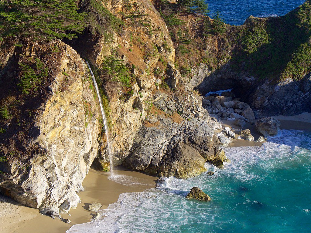
Pfeiffer Falls
California • 60 ft
By Armen Suny · Last verified Mar 2026


Photo Credits (5)
Difficulty
Easy
Trail Length
1.5 miles
Trail Type
Out And Back
Elevation Gain
200 ft
About Pfeiffer Falls
Pfeiffer Falls is a picturesque 60-foot cascade set against the dramatic backdrop of Big Sur, where the Santa Lucia Mountains rise abruptly from the Pacific Ocean. Nestled within Los Padres National Forest and managed by the U.S. Forest Service, the falls sit in a landscape frequently praised for its rugged coastal scenery. The pool and surrounding slopes make for a serene destination that suits photographers and anyone wanting a relatively short taste of Big Sur’s wild character. The most direct access to the falls follows the U.S. Forest Service’s MT. MANUEL Trail (Trail #2E06). The hike is an easy out-and-back of roughly 1.5 miles with about 200 feet of elevation gain, making it a popular quick excursion for day hikers. Expect dramatic views of the steep coastal ridges that define Big Sur along the route and a peaceful waterfall reward at the trail’s end.
The Setting
Pfeiffer Falls sits at 594 feet within Los Padres National Forest, in the foothills of California. The falls drop 60 feet.
Height: 60 feet
Trail & Hike Details
The Approach
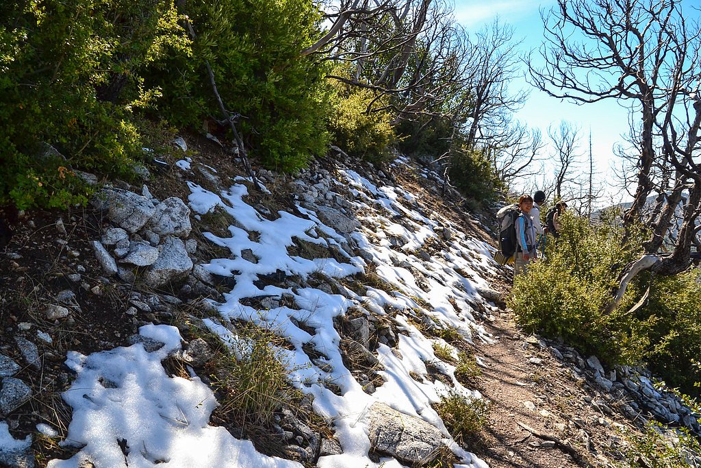
The easy hike follows Mt. Manuel (#2E06), a 1.5-mile out-and-back trail over natural surface. Expect 200 feet of elevation gain with grades of 12-20%. The trail is developed (Class 3).
USFS Trail
MT. MANUEL #2E06
Trail Class
Developed
Surface
Avg Grade
USFS Segment
1.91 miTrail Description
Trail: MT. MANUEL (USFS Trail #2E06). Type: out-and-back; Length: ~1.5 miles (USFS GIS listing: 1.91 miles); Elevation gain: ~200 ft; Difficulty: easy. Surface: native material. Typical grade: 12–20%. Trail class: 3. The path climbs moderately with short steeper sections (12–20% grade) on native tread; watch footing where the trail narrows or crosses root and rock. The route is maintained by the U.S. Forest Service as part of Los Padres National Forest and is suitable for most hikers comfortable with short uphill segments and natural-surface trails.
What to Expect
The falls drop 60 feet.
Accessibility
The trail is not wheelchair accessible. Uneven terrain and elevation changes require steady footing.
Frequently Asked Questions
🐶 Are Dogs Allowed at Pfeiffer Falls?
❌ Dogs are not allowed
Are There Any Fees or Permits Required?
🤑 Fee: $10.00
🏊 Is There Swimming at Pfeiffer Falls?
❌ Swimming is not allowed
When to Visit
Spring is the best time to visit Pfeiffer Falls, as the waterfall is typically at its fullest due to seasonal rains. However, it remains a pleasant destination year-round.
Seasonal Access
The best time to visit is Spring, Summer, Fall, and Winter. Check with Los Padres National Forest for seasonal road closures.
Safety Information
Stay on the designated trail to avoid damaging the environment and for your safety. Be cautious of slippery sections, especially after rain. Poison oak is present in the area, so stay on the path and avoid touching vegetation.
Current Water Conditions
24 ft³/s
Current discharge — how much water is flowing
About average for this time of year
Based on 76 years of record
4.35 ft
Water depth at gauge
7-Day Discharge Trend
What does this mean for your visit?
Flow is about average for this time of year.
About This Gauge
7-Day Flow Outlook
Based on the USGS gauge BIG SUR R NR BIG SUR CA (1 km away).
Today
Barely Flowing
24 cfs
5/10Tomorrow
Barely Flowing
23 cfs
5/10Thu
Barely Flowing
23 cfs
5/10Fri
Barely Flowing
23 cfs
5/10Sat
Barely Flowing
23 cfs
5/10Sun
Barely Flowing
23 cfs
5/10Mon
Barely Flowing
22 cfs
5/10Best window: Today — barely flowing flow, sunny (trip score 5/10).
Best time of year: this gauge typically runs highest from mid January to mid April, peaking in February.
How we calculate this
This is a transparent outlook, not a precise forecast. We take the waterfall's current flow strength (how it ranks against its historical normal for today, from the nearest USGS stream gauge), carry that ranking forward along the gauge's seasonal curve, and nudge it for forecast rain. Confidence is highest for the next day or two and falls further out. Always check official conditions and your own judgment before visiting — high flows can be dangerous.
Know when to go.
Get a free email alert when waterfalls near Carmel Valley Village hit peak flow. We only send when conditions are worth the trip — no weekly newsletters, no spam.
Weather Forecast
Location & Access
Getting There
Pfeiffer Falls is located within Pfeiffer Big Sur State Park, which is accessible via Highway 1 in Big Sur, California. The trailhead for Pfeiffer Falls begins near the park's main parking area.
Get Directions on Google MapsParking
Parking is available at the main parking lot of Pfeiffer Big Sur State Park. A day-use fee is typically required for parking.
Elevation
594 feet above sea level
Coordinates
36.256908° N, -121.781621° W
Land Management
Managed by USFS
Visitor Tips & Gear
Arrive early to secure parking, especially during weekends and holidays. Wear sturdy shoes as the trail may be damp or muddy in some sections. Bring water and a camera to capture the scenic beauty.
As an Amazon Associate, we earn from qualifying purchases.
This easy 1.5 miles hike is straightforward — comfortable trail shoes and plenty of water should do. Icy conditions are common in winter — traction cleats are a smart addition.

Columbia Watertight II Rain Jacket
Packs into its own pocket, seam-sealed, and keeps you dry from spray and surprise rain.

Polarized Sunglasses (Knockaround)
Cuts glare off the water so you actually see the falls — and your photos turn out better too.

Earth Pak Waterproof Dry Bag
Keeps your phone and gear dry when waterfall mist soaks everything else.

Waterproof Phone Pouch (AiRunTech)
Cheap insurance — take photos right next to the falls without killing your phone.

Kahtoola MICROspikes
Cult-favorite traction cleats that grip ice and wet rock — essential for winter waterfall hikes.

JOBY GorillaPod Starter Kit
Wraps around railings and rocks for long-exposure waterfall shots — no flat surface needed.
Where to Stay

Fernwood Resort

Big Sur Lodge

Big Sur Campground and Cabins

The Quail Lodge
Browse vacation cabins and private rentals nearby
Unique outdoor stays — tents, yurts, and treehouses
Rent a campervan or RV for your waterfall road trip
Some links are affiliate links. We may earn a commission at no extra cost to you.
Nearby Campground
CHINA CAMP CAMPGROUND
12.2 miles away · 10 sites
Overview Pleasantly nestled under a large canopy of pine trees, China Camp is a campground where peace and quiet is commonplace. The spacious campsites allow you to set up camp with more than enough space between you and your neighbors. As you drive into the campground you are overtaken by the sweet smell of pine and the natural beauty surrounding the campground.Recreation China Camp offers trails along the hillside and a trailhead which begins in the campground. The Pine Ridge trailhead begins a
Book on Recreation.govNearby Hot Springs
Hot springs near Carmel Valley Village, California

Sykes Hot Spring
Sykes Hot Spring flows at warm temperatures in Monterey County's Big Sur backcountry, requiring a substantial 3.4-mile hike thr...
Unnamed Spring Monterey County
This exceptional 114-degree thermal spring near Carmel Valley Village flows at just 255 feet elevation, creating remarkably hot...

Tassajara Hot Springs
Tassajara Hot Springs emerges at a scalding 144°F within the Ventana Wilderness, one of California's most historically signific...

Slates Hot Springs
Slates Hot Springs, also known as Big Sur Hot Springs, emerges at 122°F on the iconic Big Sur coast at just 4 feet above sea le...
Dolans Hot Spring
Dolans Hot Spring flows at 98°F from coastal mountains within the Landels-Hill Big Creek Reserve, a restricted-access research ...

Sulphur Hot Spring
Sulphur Hot Spring flows at 100 degrees in Monterey County near Seaside at just 36 feet elevation, essentially at-grade with th...
Looking for a soak after your hike? Explore more hot springs near Carmel Valley Village, California on SoakingSprings.
Explore California springsAdditional Information
Nearby Attractions
Nearby attractions include Pfeiffer Beach, McWay Falls, and the Big Sur River Inn.
Wildlife
The area is home to a variety of wildlife, including deer, squirrels, and numerous bird species. Keep an eye out for banana slugs along the trail.
Cities near Pfeiffer Falls
Nearby Waterfalls
Writing about Pfeiffer Falls? Embed this waterfall on your site for free.