McWay Falls
California • 80 ft
By Armen Suny · Last verified Mar 2026
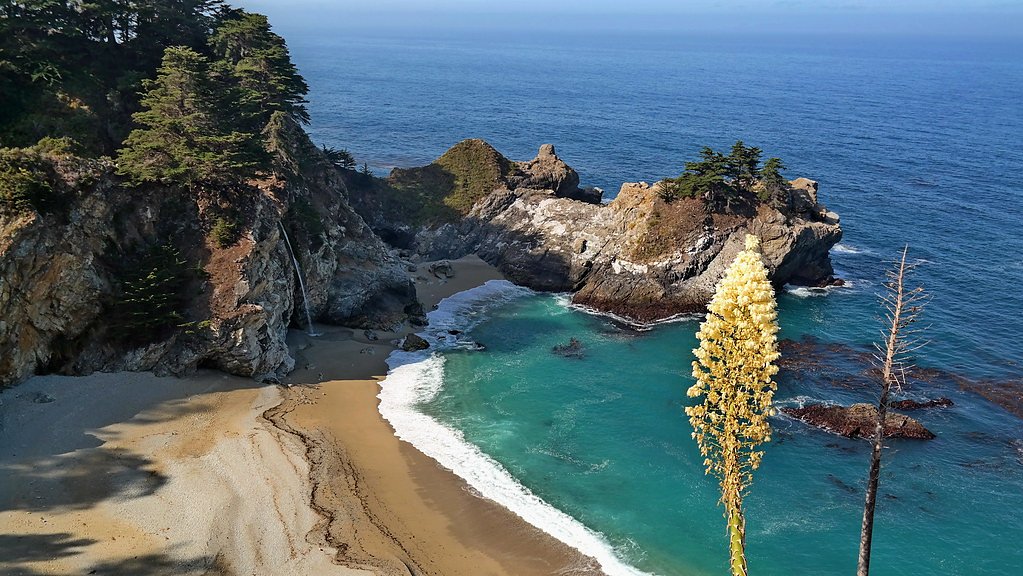
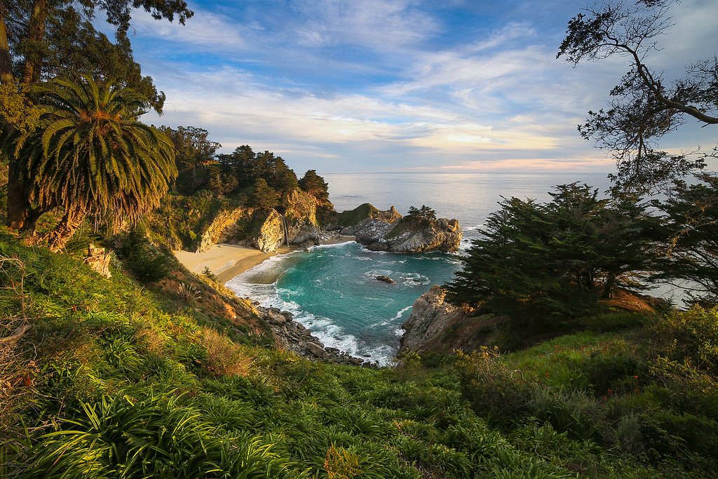
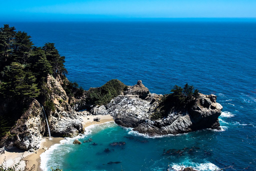
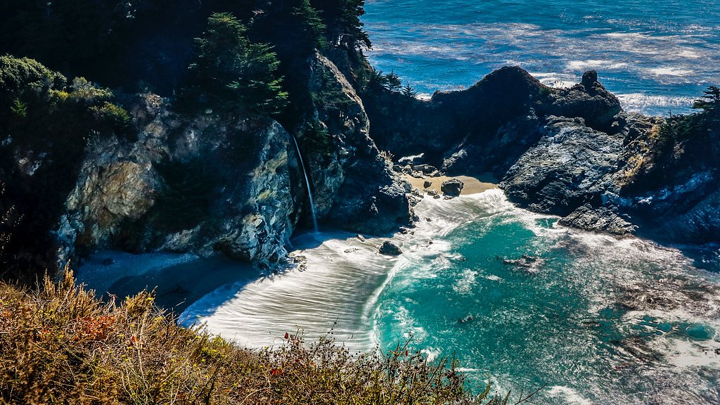

Photo Credits (5)
Difficulty
Easy
Trail Length
0.6 miles
Trail Type
Out And Back
Elevation Gain
100 ft
About McWay Falls
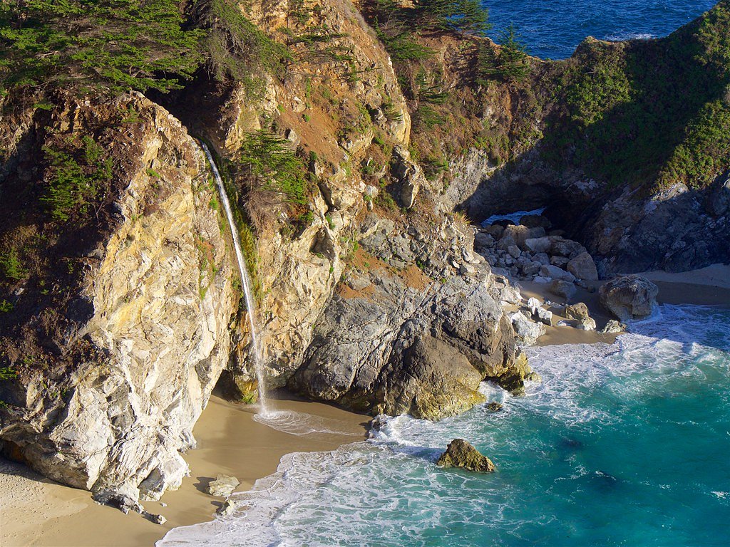
McWay Falls is an iconic 80-foot waterfall located in Julia Pfeiffer Burns State Park along the Big Sur coastline in California. It is one of the few waterfalls in the United States that empties directly into the ocean, creating a stunning and unique view. The waterfall is best known for its picturesque setting and is a popular destination for photographers and nature enthusiasts.
The Setting
McWay Falls sits at 16 feet within Julia Pfeiffer Burns State Park, in the coastal lowlands of California. The falls drop 80 feet.
Height: 80 feet
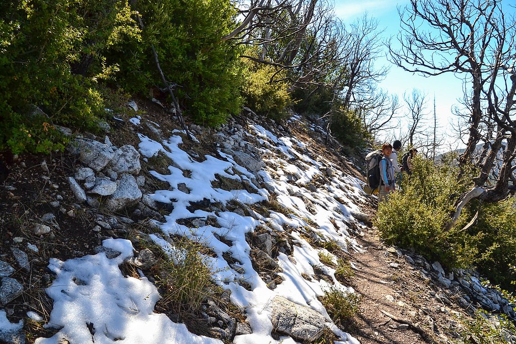
Trail & Hike Details
The Approach
The easy 0.6-mile out-and-back trail gains 100 feet of elevation on the way to the falls.
Trail Description
The trail to McWay Falls is a short and easy walk along the McWay Falls Overlook Trail. The path is well-maintained and mostly flat, making it accessible for most visitors. The trail leads to a viewpoint overlooking the waterfall and the cove below. Note that access to the beach and the base of the waterfall is prohibited to protect the fragile ecosystem.
What to Expect
The falls cascade 80 feet.
Accessibility
The trail is short and relatively flat, but the surface may be uneven. Contact the managing agency for accessibility details.
Frequently Asked Questions
🐶 Are Dogs Allowed at McWay Falls?
❌ Dogs are not allowed
Are There Any Fees or Permits Required?
🤑 Fee: $10.00
🏊 Is There Swimming at McWay Falls?
❌ Swimming is not allowed
When to Visit
McWay Falls is beautiful year-round, but visiting during the spring or after rainfall enhances the waterfall's flow. Early mornings or weekdays are ideal for avoiding crowds.
Seasonal Access
The best time to visit is Spring, Summer, Fall, and Winter.
Safety Information
Stay on designated trails and avoid venturing near cliff edges. Coastal weather can change rapidly, so dress in layers and be cautious of strong winds.
Current Water Conditions
24 ft³/s
Current discharge — how much water is flowing
About average for this time of year
Based on 76 years of record
4.35 ft
Water depth at gauge
7-Day Discharge Trend
What does this mean for your visit?
Flow is about average for this time of year.
About This Gauge
This gauge is on a nearby waterway and may not reflect exact conditions at the falls.
7-Day Flow Outlook
Based on the USGS gauge BIG SUR R NR BIG SUR CA (13 km away).
Today
Barely Flowing
24 cfs
5/10Tomorrow
Barely Flowing
23 cfs
5/10Thu
Barely Flowing
23 cfs
5/10Fri
Barely Flowing
23 cfs
5/10Sat
Barely Flowing
23 cfs
5/10Sun
Barely Flowing
23 cfs
5/10Mon
Barely Flowing
22 cfs
5/10Best window: Today — barely flowing flow, sunny (trip score 5/10).
Best time of year: this gauge typically runs highest from mid January to mid April, peaking in February.
How we calculate this
This is a transparent outlook, not a precise forecast. We take the waterfall's current flow strength (how it ranks against its historical normal for today, from the nearest USGS stream gauge), carry that ranking forward along the gauge's seasonal curve, and nudge it for forecast rain. Confidence is highest for the next day or two and falls further out. Always check official conditions and your own judgment before visiting — high flows can be dangerous.
Know when to go.
Get a free email alert when waterfalls near Carmel Valley Village hit peak flow. We only send when conditions are worth the trip — no weekly newsletters, no spam.
Weather Forecast
Location & Access
Getting There
McWay Falls is located off Highway 1 in Julia Pfeiffer Burns State Park, approximately 37 miles south of Carmel-by-the-Sea and 12 miles south of Big Sur Village. Visitors can park in the designated parking lot within the state park or along the highway shoulder if the lot is full.
Get Directions on Google MapsParking
Parking is available in the Julia Pfeiffer Burns State Park lot for a fee (typically $10 per vehicle). Limited free parking may be available along Highway 1, but this requires walking a short distance to the trailhead.
Elevation
16 feet above sea level
Coordinates
36.158574° N, -121.671615° W
Land Management
Managed by SDOL
Visitor Tips & Gear
Arrive early in the day to secure parking and avoid crowds. Bring a camera to capture the stunning views, and wear comfortable walking shoes. Be prepared for windy conditions along the coast.
As an Amazon Associate, we earn from qualifying purchases.
For this easy 0.6 miles trail, lightweight trail shoes and a water bottle are usually sufficient. Icy conditions are common in winter — traction cleats are a smart addition.

Columbia Watertight II Rain Jacket
Packs into its own pocket, seam-sealed, and keeps you dry from spray and surprise rain.

Polarized Sunglasses (Knockaround)
Cuts glare off the water so you actually see the falls — and your photos turn out better too.

Earth Pak Waterproof Dry Bag
Keeps your phone and gear dry when waterfall mist soaks everything else.

Waterproof Phone Pouch (AiRunTech)
Cheap insurance — take photos right next to the falls without killing your phone.

Kahtoola MICROspikes
Cult-favorite traction cleats that grip ice and wet rock — essential for winter waterfall hikes.

JOBY GorillaPod Starter Kit
Wraps around railings and rocks for long-exposure waterfall shots — no flat surface needed.
Where to Stay

Big Sur Lodge

Alila Ventana Big Sur

5 acres pool/spa, walk to all Big Sur has to offer

Fernwood Resort
Browse vacation cabins and private rentals nearby
Unique outdoor stays — tents, yurts, and treehouses
Rent a campervan or RV for your waterfall road trip
Some links are affiliate links. We may earn a commission at no extra cost to you.
Nearby Campground
Nearby Hot Springs
Hot springs near Carmel Valley Village, California

Slates Hot Springs
Slates Hot Springs, also known as Big Sur Hot Springs, emerges at 122°F on the iconic Big Sur coast at just 4 feet above sea le...

Sykes Hot Spring
Sykes Hot Spring flows at warm temperatures in Monterey County's Big Sur backcountry, requiring a substantial 3.4-mile hike thr...
Dolans Hot Spring
Dolans Hot Spring flows at 98°F from coastal mountains within the Landels-Hill Big Creek Reserve, a restricted-access research ...

Tassajara Hot Springs
Tassajara Hot Springs emerges at a scalding 144°F within the Ventana Wilderness, one of California's most historically signific...
Unnamed Spring Monterey County
This exceptional 114-degree thermal spring near Carmel Valley Village flows at just 255 feet elevation, creating remarkably hot...
Paraiso Springs (Sulphur Spring)
Paraiso Springs (also called Sulphur Spring) flows at 98 degrees Fahrenheit virtually roadside in Monterey County's wine countr...
Looking for a soak after your hike? Explore more hot springs near Carmel Valley Village, California on SoakingSprings.
Explore California springsAdditional Information
Nearby Attractions
Nearby attractions include Pfeiffer Beach, Bixby Creek Bridge, and other scenic stops along the Big Sur coastline.
Wildlife
Visitors may spot coastal birds, sea otters, and occasionally whales or dolphins in the ocean below.
Cities near McWay Falls
Nearby Waterfalls
Writing about McWay Falls? Embed this waterfall on your site for free.