Palisade Falls
Montana • 80 ft
By Armen Suny · Last verified Mar 2026
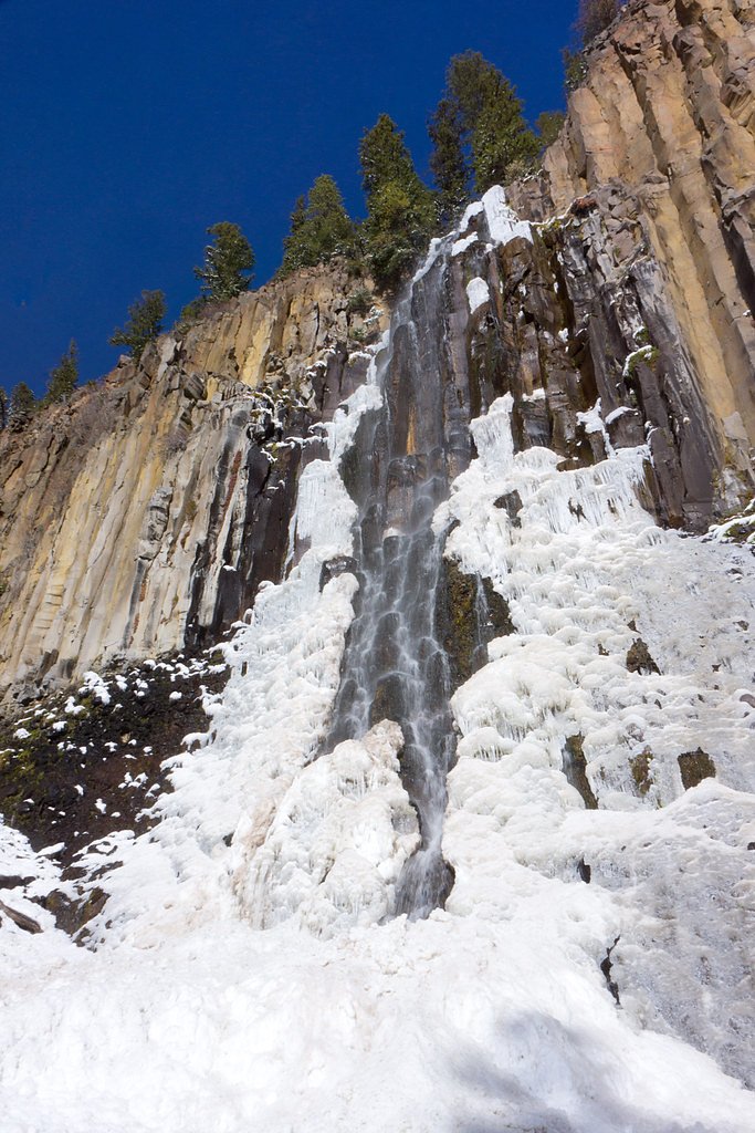
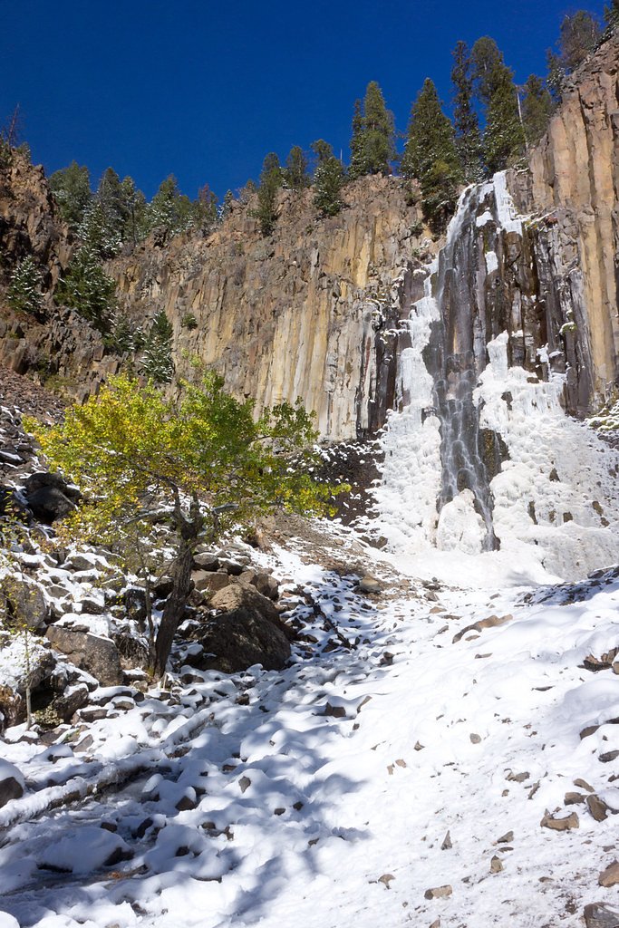
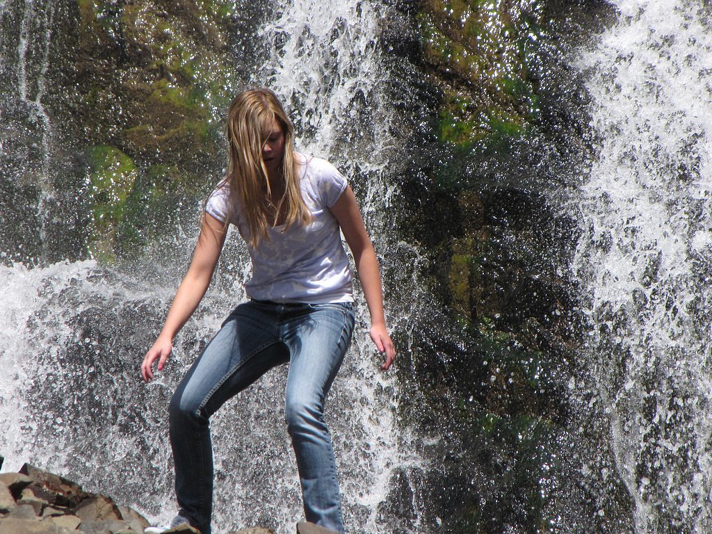
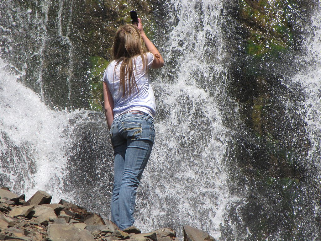

Photo Credits (5)
Difficulty
Easy
Trail Length
1.2 miles
Trail Type
Out And Back
Elevation Gain
200 ft
About Palisade Falls
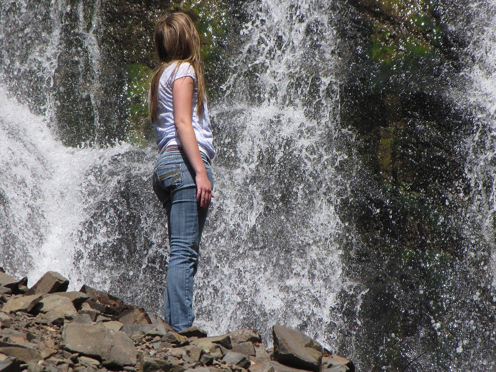
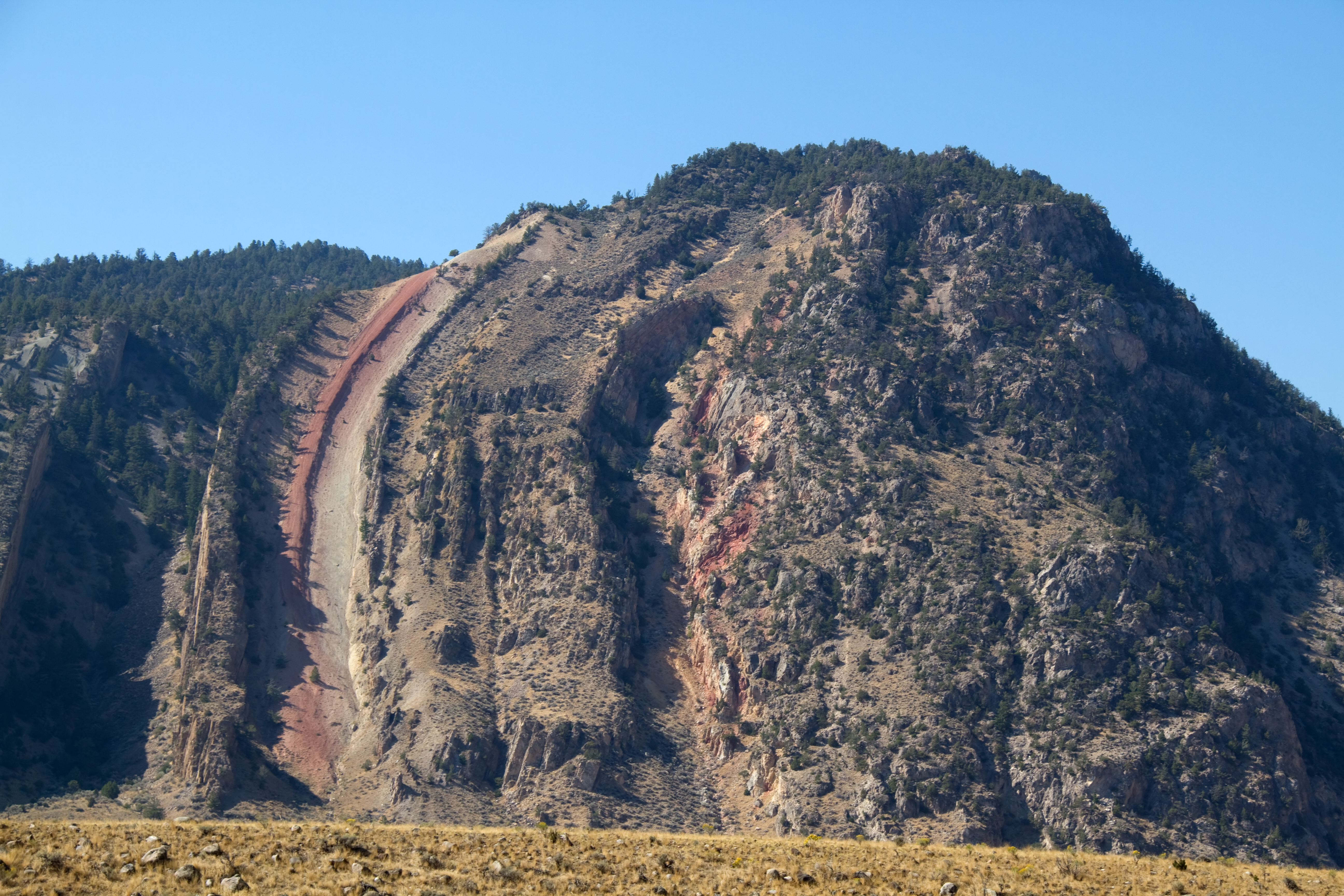
Palisade Falls is a stunning waterfall located in the Gallatin National Forest near Bozeman, Montana. It cascades over a basalt cliff, offering a picturesque view that is popular among hikers and nature enthusiasts.
The Setting
Palisade Falls sits at 7,060 feet within Gallatin National Forest, in the high mountains of Montana. The falls drop 80 feet.
Height: 80 feet
Trail & Hike Details
The Approach
The easy hike follows Palisade Mountain Foothills (#676), a 1.2-mile out-and-back trail over natural surface. Expect 200 feet of elevation gain. The trail is highly developed (Class 4).
USFS Trail
PALISADE MOUNTAIN FOOTHILLS #676
Trail Class
Highly Developed
Surface
USFS Segment
1.13 miTrail Description
The trail to Palisade Falls is a short, paved path that is well-maintained and suitable for most visitors. It winds through a forested area and leads directly to the base of the waterfall, offering beautiful views along the way.
What to Expect
The falls cascade 80 feet. Dogs are welcome.
Accessibility
The trail is not wheelchair accessible. Uneven terrain and elevation changes require steady footing.
Frequently Asked Questions
🐶 Are Dogs Allowed at Palisade Falls?
✅ Dogs are allowed
Are There Any Fees or Permits Required?
🆖 No fees required
🏊 Is There Swimming at Palisade Falls?
❌ Swimming is not allowed
When to Visit
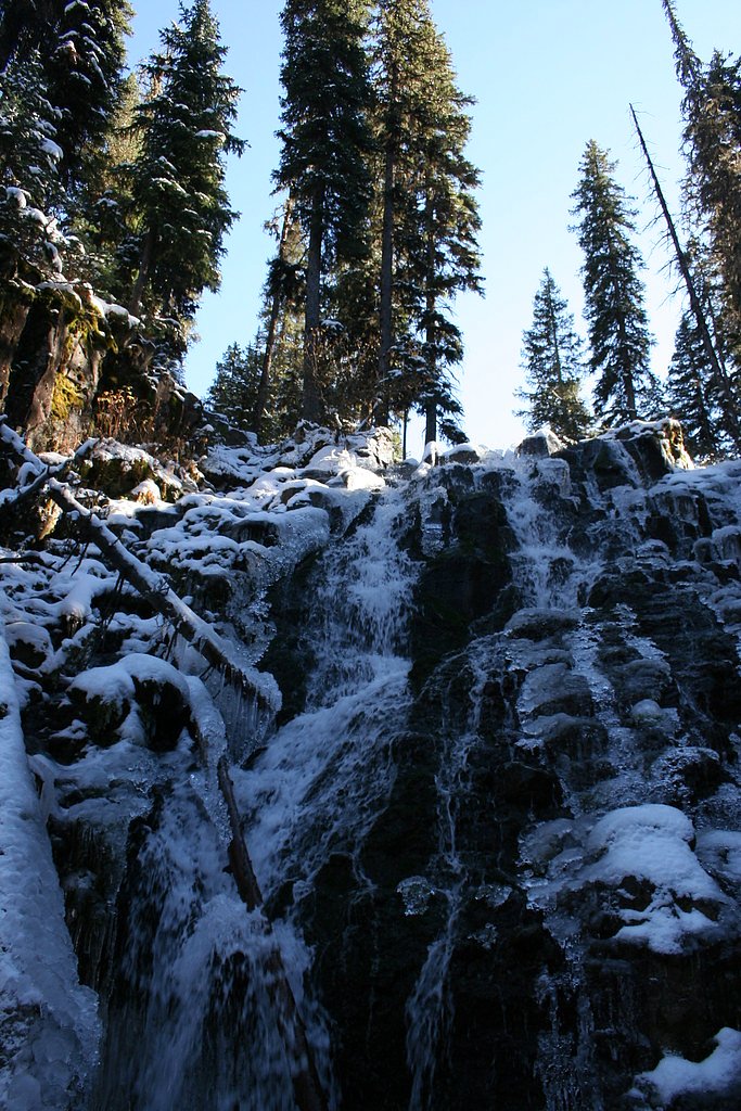
Late spring through early fall is the best time to visit, as the trail is clear and the waterfall flow is typically strong. Winter visits are possible but may require snowshoes or traction devices.
Seasonal Access
The best time to visit is Spring, Summer, and Fall. Access roads and trails may close during winter due to snow. Check with Gallatin National Forest for seasonal road closures.
Safety Information
Be cautious of slippery rocks near the waterfall. In winter, the trail and parking area may be icy. Always check weather and road conditions before visiting.
Current Water Conditions
84 ft³/s
Current discharge — how much water is flowing
Much lower than usual for this time of year
Based on 76 years of record
2.69 ft
Water depth at gauge
7-Day Discharge Trend
What does this mean for your visit?
Flow is well below normal for this time of year, so the waterfall may be a trickle.
About This Gauge
This gauge is on a nearby waterway and may not reflect exact conditions at the falls.
7-Day Flow Outlook
Based on the USGS gauge Hyalite C at Hyalite R S nr Bozeman MT (15 km away).
Today
Low
95 cfs
3/10Tomorrow
Low
101 cfs
3/10Sun
Low
102 cfs
3/10Mon
Low
102 cfs
3/10Tue
Low
97 cfs
3/10Wed
Low
93 cfs
3/10Thu
Barely Flowing
81 cfs
5/10Best window: Thu — barely flowing flow, sunny (trip score 5/10).
Best time of year: this gauge typically runs highest from early May to early August, peaking in June.
How we calculate this
This is a transparent outlook, not a precise forecast. We take the waterfall's current flow strength (how it ranks against its historical normal for today, from the nearest USGS stream gauge), carry that ranking forward along the gauge's seasonal curve, and nudge it for forecast rain. Confidence is highest for the next day or two and falls further out. Always check official conditions and your own judgment before visiting — high flows can be dangerous.
Know when to go.
Get a free email alert when waterfalls near Emigrant hit peak flow. We only send when conditions are worth the trip — no weekly newsletters, no spam.
Weather Forecast
Location & Access
Getting There
Palisade Falls is located about 30 minutes from Bozeman, Montana. From Bozeman, take Hyalite Canyon Road (Forest Road 62) to the East Fork of Hyalite Creek. Follow signs to the Palisade Falls trailhead.
Get Directions on Google MapsParking
There is a designated parking area at the trailhead, which is typically sufficient for visitors. However, it may fill up during peak seasons.
Elevation
7,060 feet above sea level
Coordinates
45.471599° N, -110.936332° W
Land Management
Managed by USFS
Visitor Tips & Gear
Visit early in the morning or on weekdays to avoid crowds. In winter, the trail may be icy, so bring appropriate footwear. Check road conditions during winter months as Hyalite Canyon Road may be snow-covered.
This trail sits at 7,060 ft above sea level
Elevated TrailUV radiation is roughly 28% stronger at this elevation than at sea level, and the dry air accelerates dehydration. Extra sun protection and fluids go a long way.
As an Amazon Associate, we earn from qualifying purchases.

Coppertone Sport SPF 50 Sunscreen
UV intensity jumps ~4% per 1,000 ft — at this elevation you can burn in half the time.

Sun Bum SPF 30 Lip Balm (3-Pack)
Lips have almost no natural UV protection and burn fast in thin, dry mountain air.

Liquid I.V. Electrolyte Packets
You lose moisture ~2x faster at elevation — electrolytes help you absorb water efficiently.

ROCKNIGHT Polarized UV400 Sunglasses
High-altitude glare off rock and water is intense — UV400 lenses block 99%+ of UVA/UVB.
As an Amazon Associate, we earn from qualifying purchases.
This easy 1.2 miles hike is straightforward — comfortable trail shoes and plenty of water should do. Sun exposure on the trail makes good sun protection a must in summer.

Polarized Sunglasses (Knockaround)
Cuts glare off the water so you actually see the falls — and your photos turn out better too.

Columbia Watertight II Rain Jacket
Packs into its own pocket, seam-sealed, and keeps you dry from spray and surprise rain.

Earth Pak Waterproof Dry Bag
Keeps your phone and gear dry when waterfall mist soaks everything else.

Waterproof Phone Pouch (AiRunTech)
Cheap insurance — take photos right next to the falls without killing your phone.

JOBY GorillaPod Starter Kit
Wraps around railings and rocks for long-exposure waterfall shots — no flat surface needed.

Osprey Daylite Daypack
Light, organized, and just the right size for a day hike — fits water, snacks, and layers.
Where to Stay

Field & Stream Lodge Bozeman

Comfort Inn Bozeman near University

Microtel Inn & Suites by Wyndham Bozeman

La Quinta by Wyndham Bozeman
Browse vacation cabins and private rentals nearby
Unique outdoor stays — tents, yurts, and treehouses
Rent a campervan or RV for your waterfall road trip
Some links are affiliate links. We may earn a commission at no extra cost to you.
Nearby Campground
MAXEY CABIN
0.9 miles away · 1 sites
Overview Maxey Cabin offers a quaint mountain retreat that is ideally located in one of Gallatin National Forest's most popular recreation areas. Guests can expect a few creature comforts at the cabin, but they will need to bring some of their own supplies and gear.The cabin is accessible by car in the summer. During the spring (from March 31st through May 16th) the road to the cabin is closed to motorized vehicle traffic every year. Guest should be prepared to hike or bike 12 miles to the cabin
Book on Recreation.govNearby Hot Springs
Hot springs near Emigrant, Montana

Bridger Canyon Warm Spring
Bridger Canyon Warm Spring emerges at 70°F on US Fish and Wildlife Service land within the Bozeman Fish Technology Center in Ga...

Chico Hot Springs
Chico Hot Springs produces 113°F water at 5,336 feet in Park County's Paradise Valley, 30 miles north of Yellowstone National P...
Bozeman Hot Springs
Bozeman Hot Springs delivers 131°F water confirmed by USGS at 54.4°C, with highly alkaline chemistry (pH 9.5) and total dissolv...
Carter Bridge Warm Springs
Carter Bridge Warm Springs surfaces at 82°F in Park County, Montana, at 4,542 feet elevation. Reaching the spring requires a sh...
Laduke (Corwin) Hot Spring
LaDuke Hot Spring, also called Corwin Hot Spring, discharges at 154°F on the Gallatin National Forest in Gallatin County, Monta...

Bear Creek Springs
Bear Creek Springs discharges at 72°F -- only 31 degrees above ambient -- within Gallatin National Forest at 5,423 feet elevati...
Looking for a soak after your hike? Explore more hot springs near Emigrant, Montana on SoakingSprings.
Explore Montana springsAdditional Information
Nearby Attractions
Hyalite Reservoir, Grotto Falls, and other trails in the Hyalite Canyon area.
Wildlife
Visitors may encounter deer, squirrels, and a variety of birds. Bears and other wildlife are present in the area, so carry bear spray and stay alert.
Cities near Palisade Falls
Nearby Waterfalls

Other waterfalls named Palisade Falls
1 other waterfall shares this name across the U.S.
Writing about Palisade Falls? Embed this waterfall on your site for free.