Palisade Falls
By Armen Suny · Last verified Jun 2026
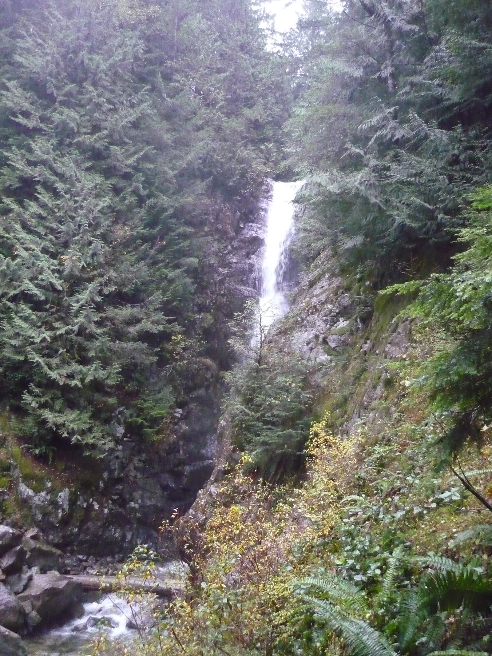
About Palisade Falls
Palisade Falls (coordinates 49.4569, -123.0345) is a coastal temperate rainforest waterfall in the Lower Mainland of British Columbia, north of central Vancouver. It is reached by a short local trail from a roadside or small parking area and drops over bedrock into a creek/river channel. Detailed, official height and hydrology information is not readily available; descriptions from visitors indicate a scenic, forested setting with steady flow in spring and after rain.
Why This Waterfall Exists
Palisade Falls flows over hard intrusive rock laid down about 66-101 million years ago. These resistant rocks form a durable ledge that water cannot easily wear away, creating the falls where softer material downstream has already eroded.
Nearby Falls Worth Visiting
Spray of Pearls Falls (60 m) lies 10.3 kilometres to the east. Also nearby: Norvan Falls (22 m, 4.7 km) and Upper Norvan Falls (20 m, 4.5 km).
Trail & Hike Details
Trail Description
Specific, widely verified trail descriptions for this exact coordinate are limited. Visitor accounts for similar Lower Mainland falls describe a short, often steep or rooty approach from a nearby parking area down to the creekside viewpoint. Trails may be informal, partially maintained, and can include stairs, boardwalks, or primitive sections depending on local stewardship. Expect uneven footing, exposed roots, mud after rain, and narrow viewpoints with limited railings.
What to Expect
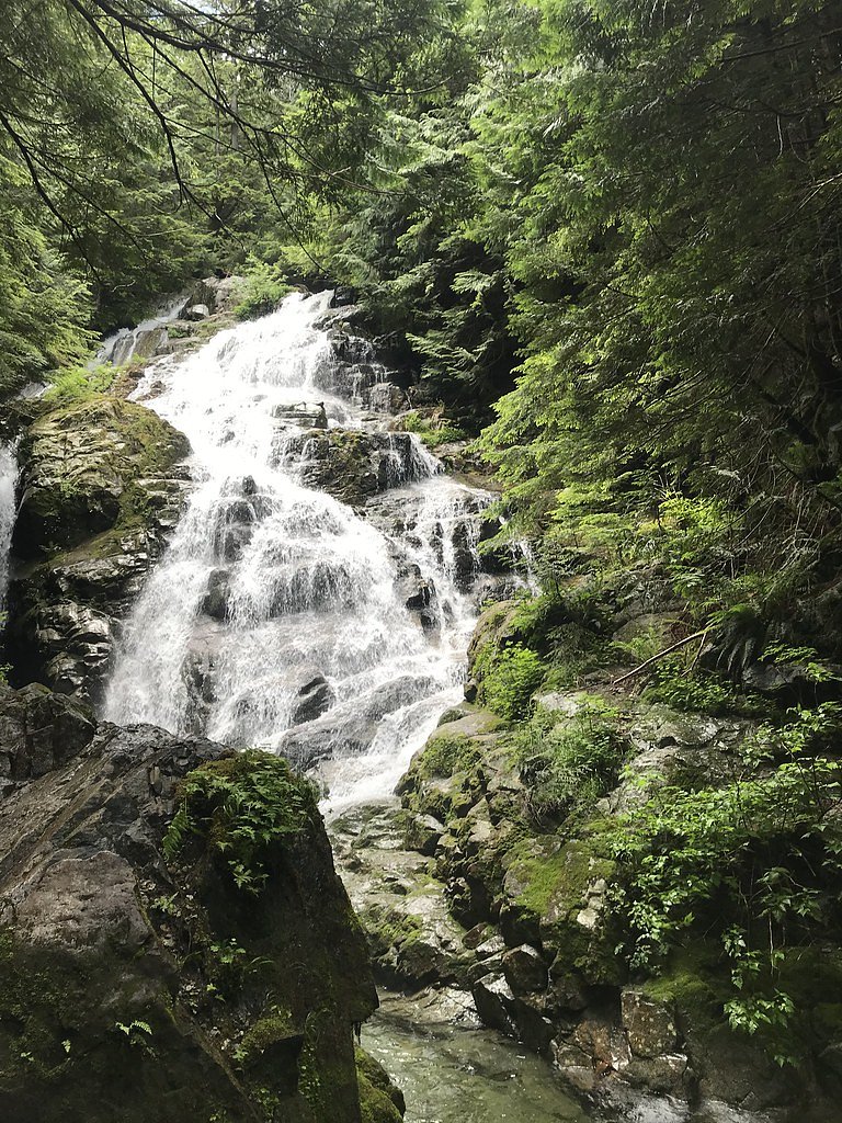
You should expect a forested, coastal-rainforest setting with mossy rocks, ferns and conifers. Water flow is typically highest in spring and after heavy rain; summer flows may be reduced but the site generally remains scenic. The immediate area may be narrow with limited turnout space and potentially no formal facilities (toilet, potable water). Mobile phone coverage can be intermittent depending on provider and location.
Accessibility
No verified information indicates accessible infrastructure (wheelchair-accessible viewpoints or paved trails). Trail and viewpoint likely include uneven surfaces, steps or narrow sections, not suitable for most mobility devices.
Frequently Asked Questions
🐶 Are Dogs Allowed at Palisade Falls?
❌ Dogs are not allowed
Are There Any Fees or Permits Required?
🆖 No fees required
🏊 Is There Swimming at Palisade Falls?
❌ Swimming is not allowed
When to Visit
Spring and early summer for higher flows and lush vegetation. Fall can offer good color and fewer people. Winter visits are possible but may be icy or unsafe; use extra caution and check conditions.
Seasonal Access
The best time to visit is Spring, Summer, Fall, and Winter. Check with the managing park or local authority for current conditions.
Safety Information
Hazards may include slippery rock surfaces, steep drop-offs, unstable or eroding banks, fast-moving water, cold water temperatures, and falling debris after storms. Winter and freeze-thaw conditions can create ice on trails and near the falls. There may be limited or no guardrails and limited cell coverage. Always tell someone your plans, keep a safe distance from edges and the water, and avoid crossing or standing on wet rocks. If conditions are hazardous after heavy rain or snowmelt, postpone your visit.
Current Water Conditions
1.0 m³/s
Current discharge — how much water is flowing
Much lower than usual for this time of year
Based on 13 years of record
1.61 m
Water depth at gauge
7-Day Discharge Trend
What does this mean for your visit?
Flow is well below normal for this time of year, so the waterfall may be a trickle.
About This Gauge
7-Day Flow Outlook
Based on the WSC gauge CAPILANO RIVER ABOVE EASTCAP CREEK (6 km away).
Today
Barely Flowing
0.9 m³/s
4/10Tomorrow
Barely Flowing
1.0 m³/s
4/10Tue
Barely Flowing
1.0 m³/s
4/10Wed
Barely Flowing
1.1 m³/s
4/10Thu
Barely Flowing
0.9 m³/s
4/10Fri
Barely Flowing
0.8 m³/s
4/10Sat
Barely Flowing
0.8 m³/s
3/10Best window: Today — barely flowing flow, fog (trip score 4/10).
Best time of year: this gauge typically runs highest from mid May to mid June, peaking in November.
How we calculate this
This is a transparent outlook, not a precise forecast. We take the waterfall's current flow strength (how it ranks against its historical normal for today, from the nearest WSC stream gauge), carry that ranking forward along the gauge's seasonal curve, and nudge it for forecast rain. Confidence is highest for the next day or two and falls further out. Always check official conditions and your own judgment before visiting — high flows can be dangerous.
Know when to go.
Get a free email alert when waterfalls near Vancouver hit peak flow. We only send when conditions are worth the trip — no weekly newsletters, no spam.
Weather Forecast
Location & Access
Getting There
Located at 49.4569, -123.0345 in the Lower Mainland. From Vancouver the site is roughly 14 miles by road (approximate); use a current mapping service for turn-by-turn directions. Access typically involves driving to a nearby pullout or small parking area and then following an unpaved or mixed trail. Confirm road access and parking before you go, especially in winter or after storms.
Get Directions on Google MapsParking
Parking information is not officially documented. Expect a small roadside pullout or informal gravel lot. Parking may be limited and may not be signed; park legally and avoid blocking private driveways or gates.
Elevation
700 metres above sea level
Coordinates
49.456851° N, -123.034452° W
Visitor Tips & Gear
• Check local maps or a trusted hiking site for the latest trail conditions before visiting. • Wear sturdy, waterproof footwear; trails may be muddy and slippery. • Bring insect repellent in spring and summer. • Park in designated or legal areas only; avoid blocking access. • Avoid getting too close to cliff edges and fast water, rocks are slippery. • Pack out all trash and follow Leave No Trace principles. • If visiting in winter, be prepared for icy conditions and short daylight hours.
Where to Stay
Browse vacation cabins and private rentals nearby
Unique outdoor stays — tents, yurts, and treehouses
Rent a campervan or RV for your waterfall road trip
Some links are affiliate links. We may earn a commission at no extra cost to you.
Nearby Campground
Magnesia Meadows Camp
11.5 km away
Additional Information
Nearby Attractions
The site is in the general North Shore/Lower Mainland area; other regional attractions may include local parks, viewpoints, and established recreation areas. Confirm exact distances and directions with a mapping app before planning multiple stops.
Wildlife
Expect typical Lower Mainland wildlife: songbirds, small mammals (squirrels, raccoons), deer in some areas, and potentially black bears, cougars or coyotes in more remote patches. Keep a respectful distance and store food securely.
Cities near Palisade Falls
Nearby Waterfalls

Other waterfalls named Palisade Falls
1 other waterfall shares this name across Canada.
Writing about Palisade Falls? Embed this waterfall on your site for free.