Photo Credits (2)
Difficulty
Moderate
Trail Length
8.2 miles
Trail Type
Out And Back
Elevation Gain
500 ft
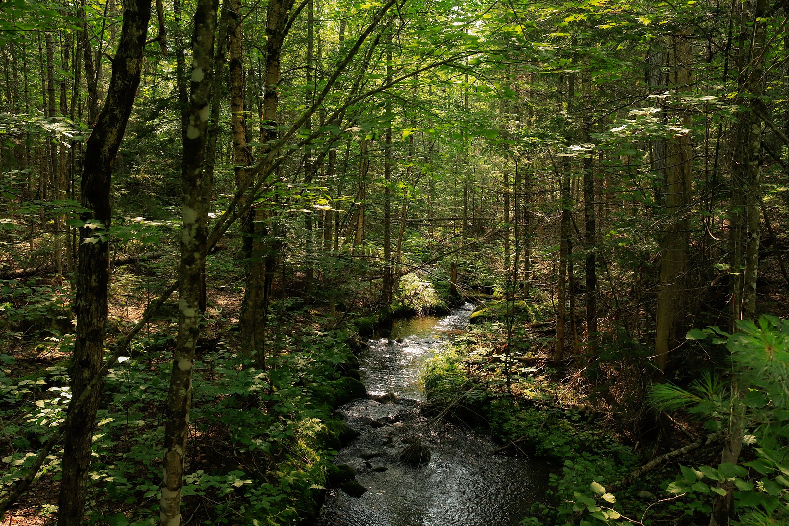
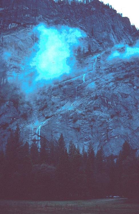
About Orin Falls
Orin Falls is a secluded cascade on the Wassataquoik Stream tucked within Katahdin Woods and Waters National Monument, managed by the National Park Service. The falls drop through a canopy of northern hardwoods and spruce, forming a quiet plunge pool and a photogenic setting that rewards hikers who make the trek through this less-traveled corner of Maine. Access to the falls is along the Wassataquoik Stream Trail; the approach is a true backcountry experience rather than a roadside stop. The round-trip is about 8.2 miles with roughly 500 feet of elevation gain and is typically rated moderate — promising plenty of forest solitude and streamside views. The nearest developed camping and hut network in the monument lies approximately 19.79 km away, so plan for a long day or an overnight in the backcountry if you want to linger by the falls.
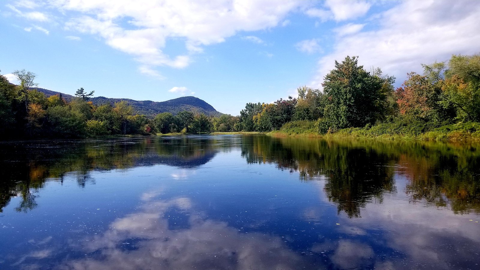
The Setting
Orin Falls sits at 643 feet within Katahdin Woods and Waters National Monument, fed by the E. Br. Penobscot River, in the foothills of Maine.
Trail & Hike Details
The Approach
The moderate 8.2-mile out-and-back trail gains 500 feet of elevation on the way to the falls.
Trail Description
Follow the Wassataquoik Stream Trail on an 8.2-mile out-and-back route (approximately 500 feet total elevation gain). The trail is generally well-maintained yet remote, winding through dense forest and offering occasional views of the stream before you reach Orin Falls. Expect a mix of flat and gently sloping tread with some rocky sections underfoot; the route is considered moderate in difficulty and is suitable for fit day-hikers comfortable with longer backcountry walks. Because services and camp facilities are not nearby, carry water, basic navigation, and layered clothing for changing conditions.
What to Expect
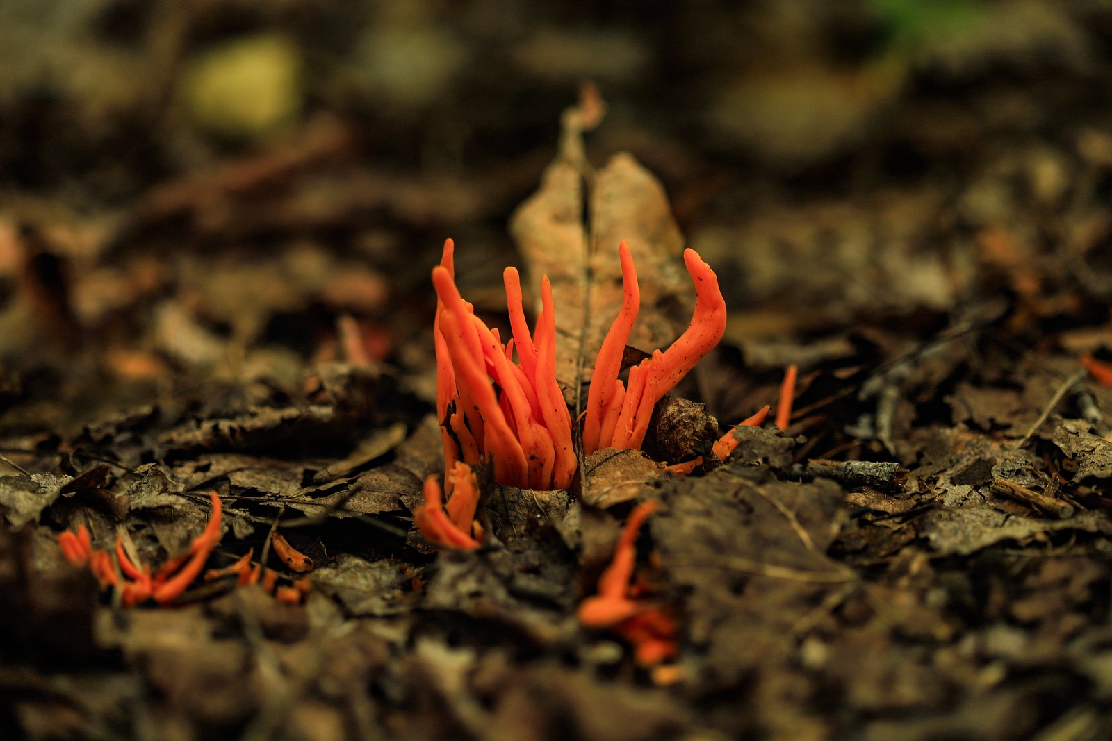
Visitors can expect a peaceful hike through a remote area of Baxter State Park. Orin Falls is a cascading waterfall surrounded by forest, offering a tranquil spot to relax and enjoy nature. Wildlife sightings are possible along the trail.
Accessibility
The trail is not wheelchair accessible. Uneven terrain and elevation changes require steady footing.
Frequently Asked Questions
🐶 Are Dogs Allowed at Orin Falls?
❌ Dogs are not allowed
Are There Any Fees or Permits Required?
🤑 Fee: $15.00
Permit required
A day-use or camping permit is required to enter Baxter State Park. Permits can be obtained online or at the park entrance.
🏊 Is There Swimming at Orin Falls?
❌ Swimming is not allowed
When to Visit
The best time to visit Orin Falls is during late spring through early fall, when the trail is most accessible and the weather is favorable. Fall offers stunning foliage, while spring provides higher water flow in the falls.
Seasonal Access
The best time to visit is Spring, Summer, and Fall. Winter access may be limited. Check the National Park Service website for current conditions.
Safety Information
The trail is remote, so hikers should be prepared for emergencies. Carry a first aid kit, and let someone know your plans before heading out. Watch for slippery rocks near the falls and be cautious of changing weather conditions.
Current Water Conditions
1,050 ft³/s
Current discharge — how much water is flowing
About average for this time of year
Based on 2 years of record
3.83 ft
Water depth at gauge
70°F
CoolRefreshing for swimming
7-Day Discharge Trend
What does this mean for your visit?
Flow is about average for this time of year. Water temperature is a refreshing 70 degrees F, good for a quick swim.
About This Gauge
This gauge is on a nearby waterway and may not reflect exact conditions at the falls.
7-Day Flow Outlook
Based on the USGS gauge E. Br. Penobscot River below Grand Lake Matagamon (21 km away).
Today
Moderate
1197 cfs
6/10Tomorrow
Moderate
1127 cfs
8/10Tue
Moderate
1056 cfs
8/10Wed
Moderate
1200 cfs
6/10Thu
Moderate
1457 cfs
6/10Fri
Moderate
1395 cfs
6/10Sat
Moderate
1234 cfs
6/10Best window: Tomorrow — moderate flow, sunny (trip score 8/10).
Best time of year: this gauge typically runs highest from mid March to mid May, peaking in May.
How we calculate this
This is a transparent outlook, not a precise forecast. We take the waterfall's current flow strength (how it ranks against its historical normal for today, from the nearest USGS stream gauge), carry that ranking forward along the gauge's seasonal curve, and nudge it for forecast rain. Confidence is highest for the next day or two and falls further out. Always check official conditions and your own judgment before visiting — high flows can be dangerous.
Know when to go.
Get a free email alert when waterfalls near Patten hit peak flow. We only send when conditions are worth the trip — no weekly newsletters, no spam.
Weather Forecast
Location & Access
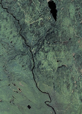
Getting There
Orin Falls is located within Baxter State Park, which requires visitors to follow park regulations. The falls can be accessed via the Wassataquoik Stream Trail, starting from the South Branch Pond Campground. The trail is remote and requires careful planning.
Get Directions on Google MapsParking
Parking is available at the South Branch Pond Campground, which serves as the trailhead for accessing Orin Falls.
Elevation
643 feet above sea level
Coordinates
45.951159° N, -68.747541° W
Land Management
Managed by NPS
Visitor Tips & Gear
Plan ahead and bring a detailed map, as cell service is limited in Baxter State Park. Wear sturdy hiking shoes and bring plenty of water and snacks. Be prepared for changing weather conditions, as the area can be unpredictable.
As an Amazon Associate, we earn from qualifying purchases.
With 8.2 miles and 500 ft of elevation gain, sturdy boots and trekking poles will help on this moderate trail. Sun exposure on the trail makes good sun protection a must in summer.
America the Beautiful Annual Pass
Covers entrance fees at 2,000+ federal recreation sites — required at most National Parks.

Polarized Sunglasses (Knockaround)
Cuts glare off the water so you actually see the falls — and your photos turn out better too.

Columbia Watertight II Rain Jacket
Packs into its own pocket, seam-sealed, and keeps you dry from spray and surprise rain.

Earth Pak Waterproof Dry Bag
Keeps your phone and gear dry when waterfall mist soaks everything else.

Waterproof Phone Pouch (AiRunTech)
Cheap insurance — take photos right next to the falls without killing your phone.

Timberland Euro Sprint Mid Waterproof
Trusted waterproof boot with premium leather and grippy rubber sole — reliable on rocky, wet trails.

TrailBuddy Trekking Poles
Lightweight aluminum, cork grips, and flip-locks that actually hold — a best-seller for good reason.
Where to Stay

Katahdin Valley Motel

Family Friendly Lakefront Cottage, Ambajejus Lake

All Season Fun and Cozy Home in Island Falls, ME

Black Bear Dens
Browse vacation cabins and private rentals nearby
Unique outdoor stays — tents, yurts, and treehouses
Rent a campervan or RV for your waterfall road trip
Some links are affiliate links. We may earn a commission at no extra cost to you.
Nearby Campground
Katahdin Woods and Waters National Monument Camping and Huts
12.3 miles away · 27 sites
Overview Katahdin Woods and Waters National Monument is located in Maine’s north woods. Katahdin Woods and Waters protects part of an extraordinary natural and cultural landscape: the mountains, woods, and waters where the East Branch of the Penobscot River and its tributaries, including the Wassataquoik Stream and the Seboeis River, run freely. Campsites, lean-tos and huts located throughout the monument provide opportunities to stay overnight while hiking, biking, paddling and enjoying other re
Book on Recreation.govAdditional Information
Nearby Attractions
South Branch Pond, Katahdin Lake, and Mount Katahdin are popular nearby attractions within Baxter State Park.
Wildlife
The area is home to a variety of wildlife, including moose, deer, and birds. Visitors should exercise caution and avoid feeding or approaching animals.
Cities near Orin Falls
Nearby Waterfalls
Writing about Orin Falls? Embed this waterfall on your site for free.