
Photo Credits (5)
Difficulty
Moderate
Trail Length
2.4 miles
Trail Type
Out And Back
Elevation Gain
350 ft
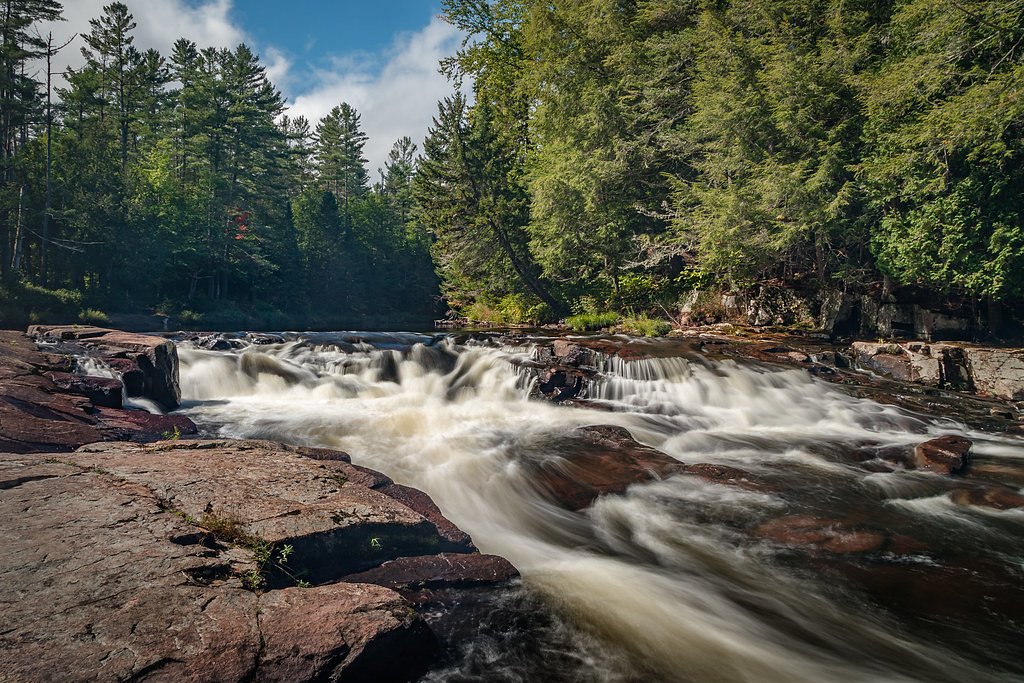
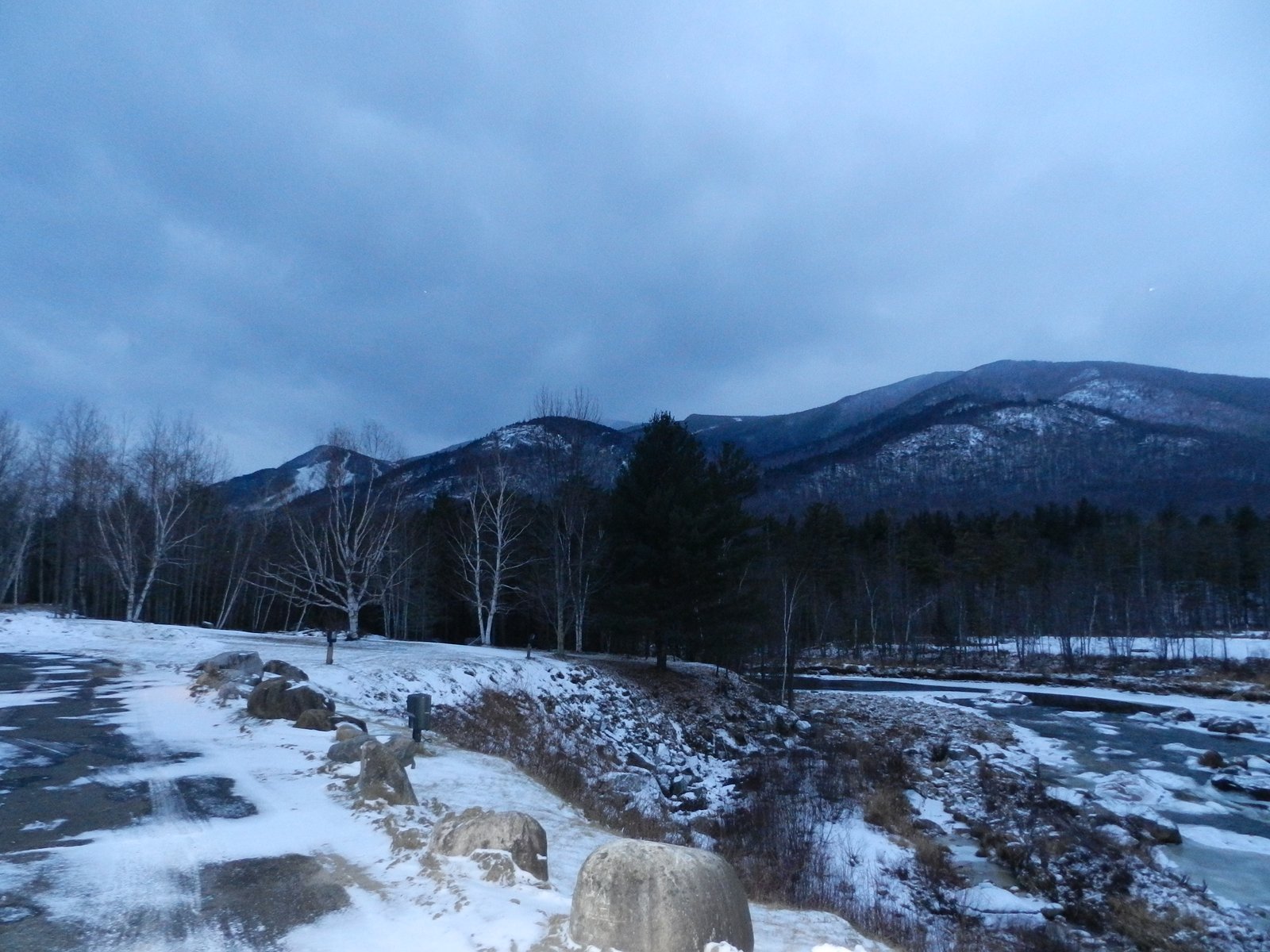
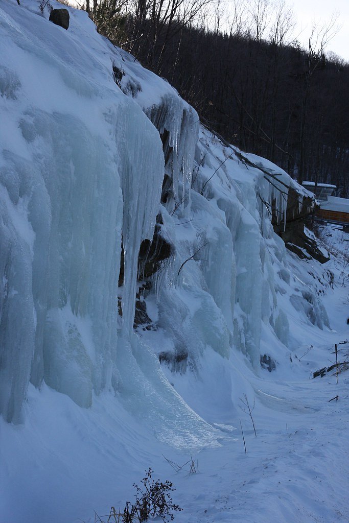
About Monument Falls
Monument Falls is a charming, small cascade on the Ausable River tucked into the Adirondack landscape. Easily enjoyed by casual visitors, the falls offer a peaceful riverside viewpoint framed by the surrounding forest. The site sits within the Saranac Lakes Wild Forest land unit—designated SCA—and is managed by SDC, making it a pleasant stop for photographers, day-trippers, and anyone exploring the region's waterways. While the falls are visible from the roadside and can be appreciated from the nearby parking area or a short stroll along the riverbank, you can also extend the outing with a fuller hike. A 2.4-mile out-and-back route in the same wild forest delivers a more immersive Adirondack experience, trading a brief viewpoint for forested approach and additional riverside scenery for those looking for a moderate outing.
The Setting
Monument Falls sits at 1,617 feet within Saranac Lakes Wild Forest, fed by the White Brook, in the hills of New York.
Trail & Hike Details
The Approach
The moderate 2.4-mile out-and-back trail gains 350 feet of elevation on the way to the falls.
Trail Description
Route type: out-and-back; length: 2.4 miles round trip; elevation gain: ~350 feet; difficulty: moderate. The falls can be viewed directly from the roadside parking area for a no-hike option, or you can follow the longer 2.4-mile trail for a more extended visit. Surface, grade, and official trail class are not specified in the available data; the route is described as a moderate forest hike with roughly 350 feet of climbing and typical Adirondack trail conditions.
What to Expect
Dogs are welcome.
Accessibility
The trail is not wheelchair accessible. Uneven terrain and elevation changes require steady footing.
Frequently Asked Questions
🐶 Are Dogs Allowed at Monument Falls?
✅ Dogs are allowed
Are There Any Fees or Permits Required?
🆖 No fees required
🏊 Is There Swimming at Monument Falls?
❌ Swimming is not allowed
When to Visit
Spring and early summer are the best times to visit, as the water flow is typically strongest during these seasons.
Seasonal Access
The best time to visit is Spring, Summer, and Fall. Winter access may be limited.
Safety Information
Be cautious near the riverbank, as rocks may be slippery. Avoid visiting during heavy rain or flooding conditions.
Current Water Conditions
2 ft³/s
Current discharge — how much water is flowing
About average for this time of year
Based on 3 years of record
4.84 ft
Water depth at gauge
52°F
ColdBracing — limit time in water
7-Day Discharge Trend
What does this mean for your visit?
Flow is about average for this time of year. Water temperature is a bracing 52 degrees F, limit your time in the water.
About This Gauge
This gauge is on a nearby waterway and may not reflect exact conditions at the falls.
7-Day Flow Outlook
Based on the USGS gauge WHITE BROOK NEAR WILMINGTON NY (10 km away).
Today
Barely Flowing
2 cfs
5/10Tomorrow
Barely Flowing
2 cfs
3/10Tue
Low
2 cfs
3/10Wed
Low
2 cfs
3/10Thu
Low
2 cfs
3/10Fri
Low
2 cfs
3/10Sat
Low
2 cfs
4/10Best window: Today — barely flowing flow, sunny (trip score 5/10).
Best time of year: this gauge typically runs highest from mid April to late May, peaking in April.
How we calculate this
This is a transparent outlook, not a precise forecast. We take the waterfall's current flow strength (how it ranks against its historical normal for today, from the nearest USGS stream gauge), carry that ranking forward along the gauge's seasonal curve, and nudge it for forecast rain. Confidence is highest for the next day or two and falls further out. Always check official conditions and your own judgment before visiting — high flows can be dangerous.
Know when to go.
Get a free email alert when waterfalls near Lake Placid hit peak flow. We only send when conditions are worth the trip — no weekly newsletters, no spam.
Weather Forecast
Location & Access
Getting There
Monument Falls is located along Route 86, near Lake Placid, New York. The falls are visible from the roadside, making it a convenient stop for travelers.
Get Directions on Google MapsParking
There is a small pull-off area along Route 86 where visitors can park to view the falls.
Elevation
1,617 feet above sea level
Coordinates
44.311714° N, -73.915146° W
Land Management
Managed by SDC
Visitor Tips & Gear
Visit during the spring or after heavy rainfall for the best water flow. Be cautious when walking near the riverbank, as it may be slippery.
As an Amazon Associate, we earn from qualifying purchases.
With 2.4 miles and 350 ft of elevation gain, sturdy boots and trekking poles will help on this moderate trail. Sun exposure on the trail makes good sun protection a must in summer.

Polarized Sunglasses (Knockaround)
Cuts glare off the water so you actually see the falls — and your photos turn out better too.

Columbia Watertight II Rain Jacket
Packs into its own pocket, seam-sealed, and keeps you dry from spray and surprise rain.

Earth Pak Waterproof Dry Bag
Keeps your phone and gear dry when waterfall mist soaks everything else.

Waterproof Phone Pouch (AiRunTech)
Cheap insurance — take photos right next to the falls without killing your phone.

Timberland Euro Sprint Mid Waterproof
Trusted waterproof boot with premium leather and grippy rubber sole — reliable on rocky, wet trails.

TrailBuddy Trekking Poles
Lightweight aluminum, cork grips, and flip-locks that actually hold — a best-seller for good reason.
Where to Stay

Lake Placid Inn Boutique Hotel

Grandview Lake Placid

Hungry Trout Resort

Grand Adirondack Hotel, Lake Placid, a Tribute Portfolio Hotel
Browse vacation cabins and private rentals nearby
Unique outdoor stays — tents, yurts, and treehouses
Rent a campervan or RV for your waterfall road trip
Some links are affiliate links. We may earn a commission at no extra cost to you.
Additional Information
Nearby Attractions
Lake Placid, Whiteface Mountain, High Falls Gorge, and the Adirondack Wildlife Refuge are all located nearby.
Wildlife
The area is home to a variety of wildlife, including birds, deer, and small mammals. Keep an eye out for bald eagles and other bird species along the river.
Cities near Monument Falls
Nearby Waterfalls


Other waterfalls named Monument Falls
1 other waterfall shares this name across the U.S.
Writing about Monument Falls? Embed this waterfall on your site for free.