
Photo Credits (3)
Difficulty
Easy
Trail Length
1.0 miles
Trail Type
Out And Back
Elevation Gain
200 ft
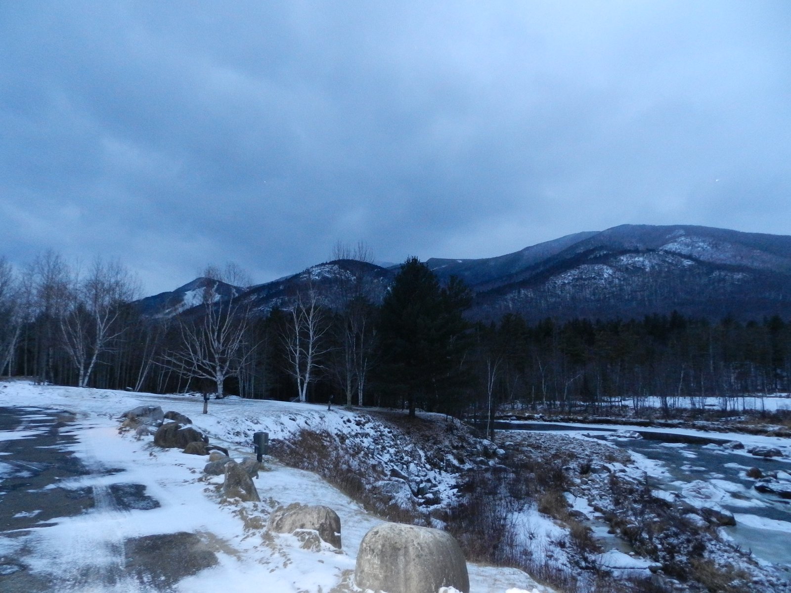
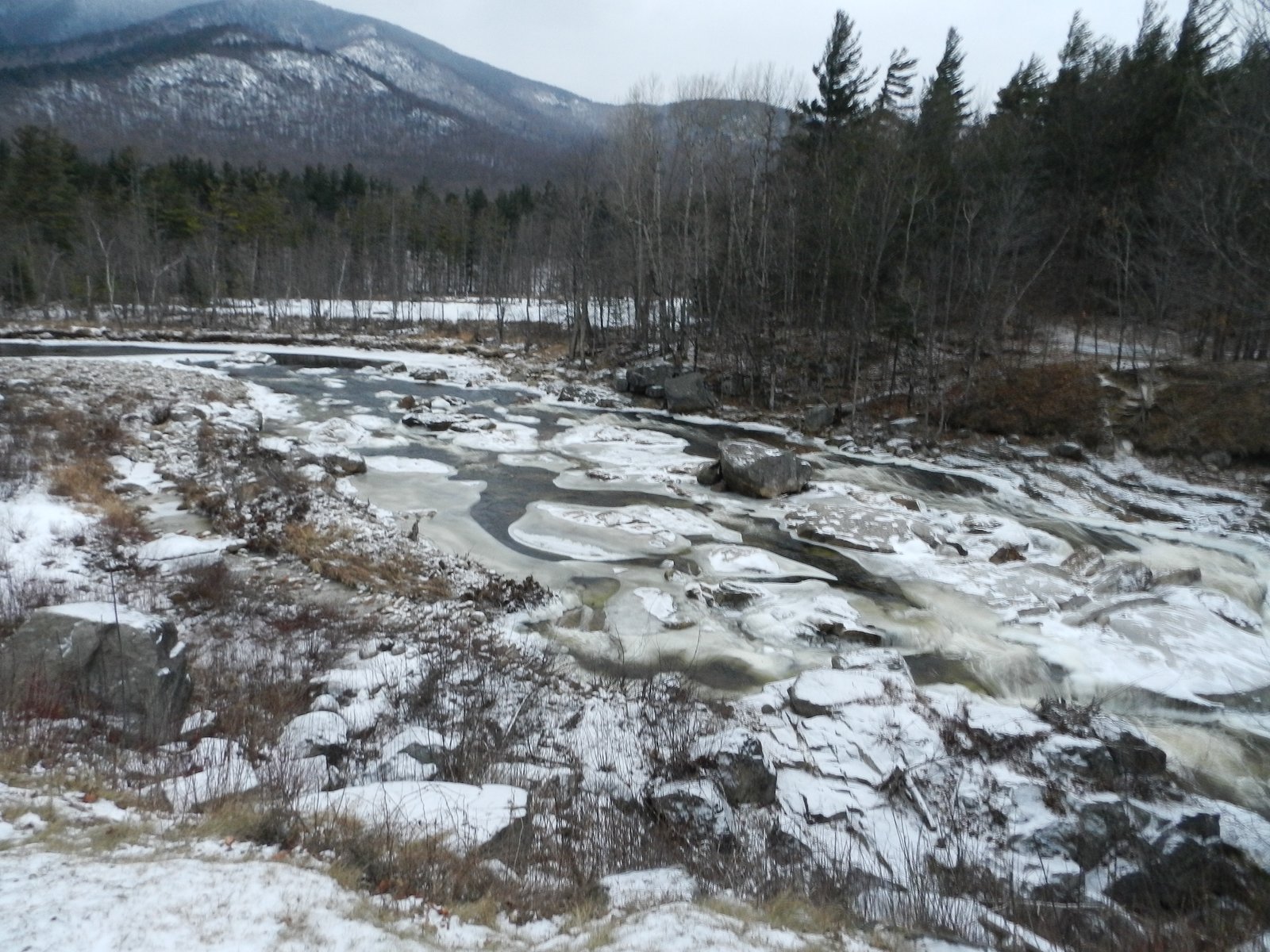
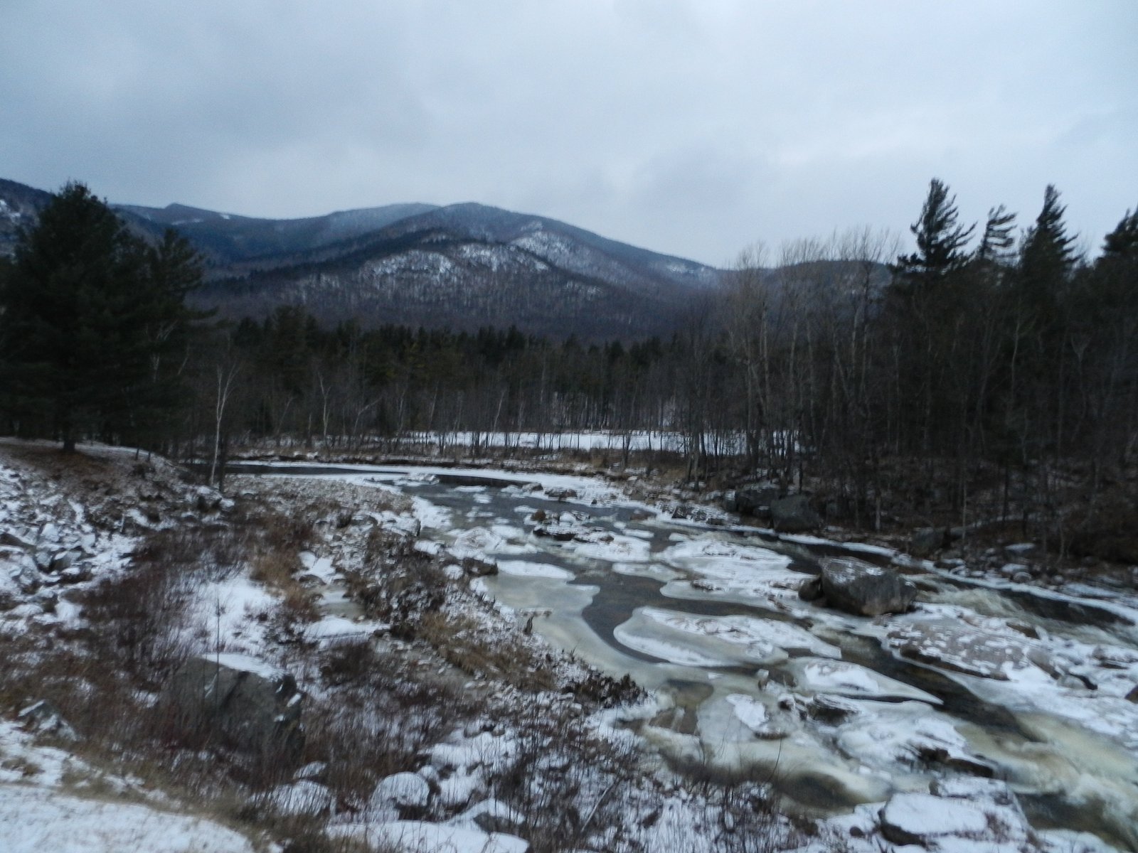
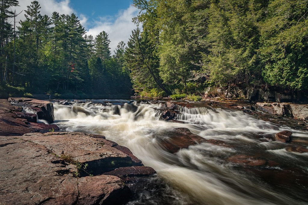
About The Flume Fall
The Flume Fall is a picturesque waterfall tucked near the Ausable River in Wilmington, New York, offering a classic Adirondack stop that rewards a short walk with photogenic cascades and river views. Nestled within the Wilmington Wild Forest, the site sits on land owned and managed by SDC and carries an SCA designation, so visitors should be mindful of the land unit’s stewardship when planning a visit. Its accessibility and scenic setting make it an easy add-on when exploring nearby trails and waterways in the region. This is a popular day-hike destination for families and photographers looking for a brief, scenic outing rather than a strenuous trek. The area’s forested surroundings and river corridor create a peaceful setting for a picnic or a quick nature break between longer outings in the Adirondacks.
The Setting
The Flume Fall sits at 1,089 feet within Wilmington Wild Forest, fed by the White Brook, in the foothills of New York.
Trail & Hike Details
The Approach
The easy 1.0-mile out-and-back trail gains 200 feet of elevation on the way to the falls.
Trail Description
The trail to The Flume Fall is an easy, out-and-back route totaling about 1.0 miles round-trip with roughly 200 feet of elevation gain. The route follows a well-maintained forest path and offers intermittent views of the Ausable River along the way, making it suitable for most visitors and casual hikers. Trail surface is typical maintained natural tread through mixed forest; the short distance and modest gain keep the grade gentle for the majority of the walk.
What to Expect
Dogs are welcome.
Accessibility
The trail is not wheelchair accessible. Uneven terrain and elevation changes require steady footing.
Frequently Asked Questions
🐶 Are Dogs Allowed at The Flume Fall?
✅ Dogs are allowed
Are There Any Fees or Permits Required?
🆖 No fees required
🏊 Is There Swimming at The Flume Fall?
❌ Swimming is not allowed
When to Visit
Spring and early summer are ideal for visiting, as the waterfall is typically at its fullest due to snowmelt and rainfall. Fall offers stunning foliage, while winter provides a unique view of the frozen waterfall.
Seasonal Access
The best time to visit is Spring, Summer, Fall, and Winter.
Safety Information
Exercise caution near the waterfall, as rocks can be slippery. Be aware of changing weather conditions and avoid the area during heavy rain or snowmelt, as water levels may rise rapidly.
Current Water Conditions
2 ft³/s
Current discharge — how much water is flowing
About average for this time of year
Based on 3 years of record
4.84 ft
Water depth at gauge
51°F
WarmVery comfortable
7-Day Discharge Trend
What does this mean for your visit?
Flow is about average for this time of year. Water temperature is a bracing 51 degrees F, limit your time in the water.
About This Gauge
7-Day Flow Outlook
Based on the USGS gauge WHITE BROOK NEAR WILMINGTON NY (3 km away).
Today
Barely Flowing
2 cfs
5/10Tomorrow
Low
3 cfs
3/10Wed
Low
2 cfs
3/10Thu
Barely Flowing
2 cfs
5/10Fri
Low
2 cfs
3/10Sat
Low
2 cfs
3/10Sun
Low
2 cfs
3/10Best window: Today — barely flowing flow, sunny (trip score 5/10).
Best time of year: this gauge typically runs highest from mid April to late May, peaking in April.
How we calculate this
This is a transparent outlook, not a precise forecast. We take the waterfall's current flow strength (how it ranks against its historical normal for today, from the nearest USGS stream gauge), carry that ranking forward along the gauge's seasonal curve, and nudge it for forecast rain. Confidence is highest for the next day or two and falls further out. Always check official conditions and your own judgment before visiting — high flows can be dangerous.
Know when to go.
Get a free email alert when waterfalls near Lake Placid hit peak flow. We only send when conditions are worth the trip — no weekly newsletters, no spam.
Weather Forecast
Location & Access
Getting There
The Flume Fall is located off Route 86 in Wilmington, New York. It is easily accessible by car and is situated near the Flume Trails network.
Get Directions on Google MapsParking
There is a small parking area available near the Flume Trails trailhead on Route 86. Parking may be limited during peak seasons.
Elevation
1,089 feet above sea level
Coordinates
44.366436° N, -73.840143° W
Land Management
Managed by SDC
Visitor Tips & Gear
Visit early in the morning or on weekdays to avoid crowds. Wear sturdy footwear, as the trail may be muddy or slippery, especially after rain. Bring insect repellent during the summer months.
As an Amazon Associate, we earn from qualifying purchases.
This easy 1.0 miles hike is straightforward — comfortable trail shoes and plenty of water should do. Icy conditions are common in winter — traction cleats are a smart addition.

Columbia Watertight II Rain Jacket
Packs into its own pocket, seam-sealed, and keeps you dry from spray and surprise rain.

Polarized Sunglasses (Knockaround)
Cuts glare off the water so you actually see the falls — and your photos turn out better too.

Earth Pak Waterproof Dry Bag
Keeps your phone and gear dry when waterfall mist soaks everything else.

Waterproof Phone Pouch (AiRunTech)
Cheap insurance — take photos right next to the falls without killing your phone.

Kahtoola MICROspikes
Cult-favorite traction cleats that grip ice and wet rock — essential for winter waterfall hikes.

JOBY GorillaPod Starter Kit
Wraps around railings and rocks for long-exposure waterfall shots — no flat surface needed.
Where to Stay

Hungry Trout Resort

NewVida Preserve

Lake Placid Inn Boutique Hotel

The Wilderness Inn: Chalets
Browse vacation cabins and private rentals nearby
Unique outdoor stays — tents, yurts, and treehouses
Rent a campervan or RV for your waterfall road trip
Some links are affiliate links. We may earn a commission at no extra cost to you.
Additional Information
Nearby Attractions
Nearby attractions include Whiteface Mountain, High Falls Gorge, and the Flume Trails network for hiking and mountain biking.
Wildlife
The area is home to a variety of wildlife, including birds, deer, and small mammals. Be cautious of black bears, which may be present in the region.
Cities near The Flume Fall
Nearby Waterfalls


Writing about The Flume Fall? Embed this waterfall on your site for free.