
Photo Credits (5)
Difficulty
Easy
Trail Length
0.6 miles
Trail Type
Out And Back
Elevation Gain
100 ft
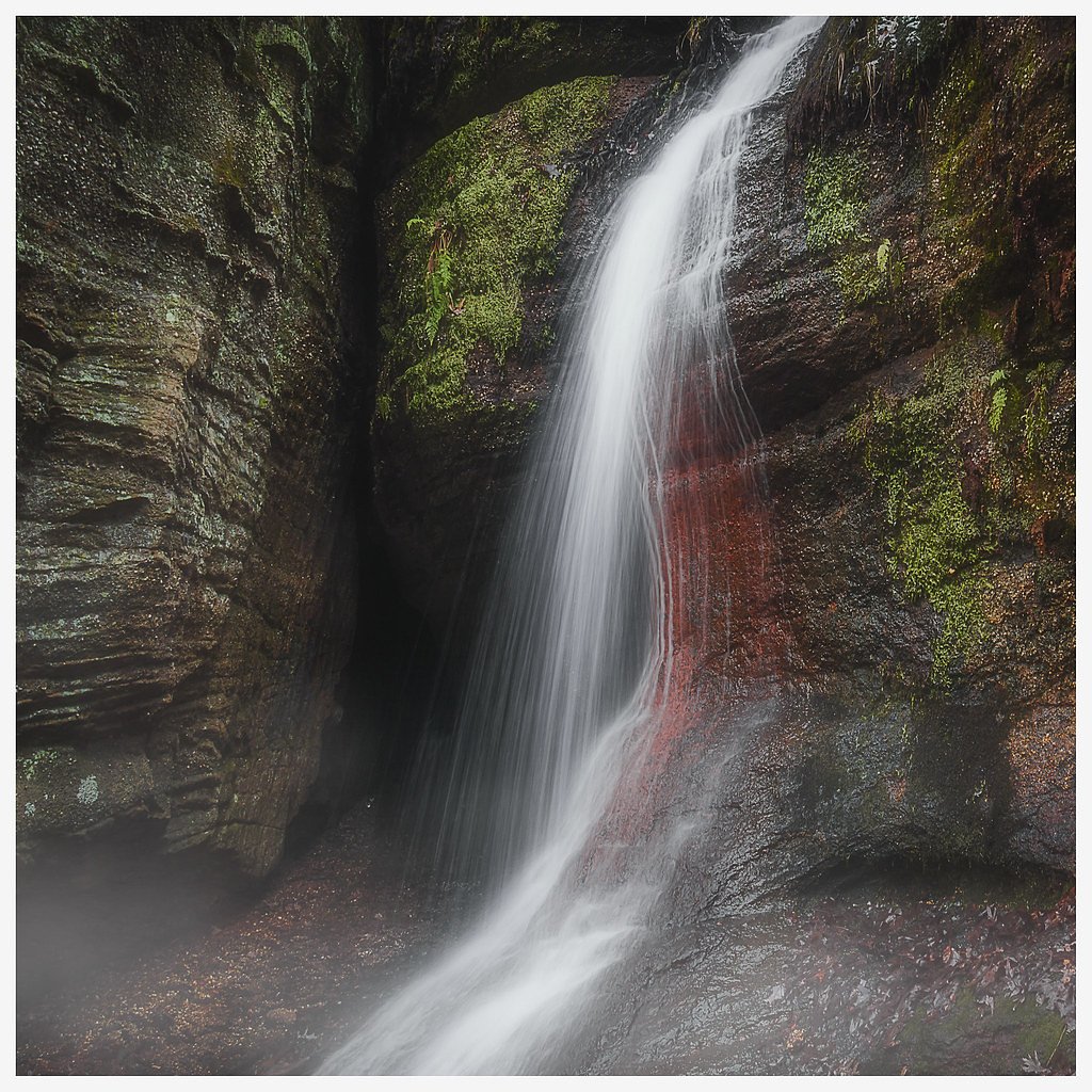
About Minnehaha Falls
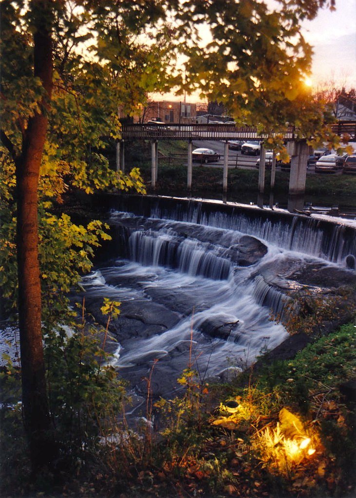
Minnehaha Falls is a small, picturesque cascade tucked inside Nelson-Kennedy Ledges State Park, a state park managed by SDNR (designation: SP). Surrounded by lush forest, the falls make a rewarding short destination for photographers and nature lovers looking for a quiet woodland setting rather than a long backcountry trek. The site’s compact scale and leafy surroundings offer pleasant seasonal contrasts in flow and color. Access is straightforward: the falls are reached on a short hike that suits families and casual walkers. The park’s ledge-rich landscape provides scenic framing, and the nearby trails make Minnehaha Falls an easy stop on a half-day visit to the state park under SDNR management.
The Setting
Minnehaha Falls sits at 961 feet within Nelson-Kennedy Ledges State Park, fed by the Eagle Creek, in the foothills of Ohio.
Trail & Hike Details
The Approach
The easy 0.6-mile out-and-back trail gains 100 feet of elevation on the way to the falls.
Trail Description
This is a 0.6-mile out-and-back route with about 100 feet of elevation gain, rated easy. The trail is short and relatively easy, traversing wooded terrain within Nelson-Kennedy Ledges State Park; the path is well-suited to casual hikers and leads to the falls via a brief side spur from the main route.
What to Expect
Dogs are welcome.
Accessibility
The trail is short and relatively flat, but the surface may be uneven. Contact the managing agency for accessibility details.
Frequently Asked Questions
🐶 Are Dogs Allowed at Minnehaha Falls?
✅ Dogs are allowed
Are There Any Fees or Permits Required?
🆖 No fees required
🏊 Is There Swimming at Minnehaha Falls?
❌ Swimming is not allowed
When to Visit
Spring and early summer are the best times to visit, as the water flow is typically strongest during these seasons.
Seasonal Access
The best time to visit is Spring, Summer, and Fall. Winter access may be limited.
Safety Information
Exercise caution near the falls, as rocks can be slippery. Avoid visiting during heavy rain or icy conditions, as the trail may become hazardous.
Current Water Conditions
26 ft³/s
Current discharge — how much water is flowing
About average for this time of year
Based on 97 years of record
3.95 ft
Water depth at gauge
7-Day Discharge Trend
What does this mean for your visit?
Flow is about average for this time of year.
About This Gauge
This gauge is on a nearby waterway and may not reflect exact conditions at the falls.
7-Day Flow Outlook
Based on the USGS gauge Eagle Creek at Phalanx Station OH (10 km away).
Today
Low
26 cfs
5/10Tomorrow
Low
27 cfs
6/10Wed
Low
28 cfs
6/10Thu
Low
26 cfs
6/10Fri
Moderate
28 cfs
4/10Sat
Moderate
29 cfs
4/10Sun
Moderate
27 cfs
5/10Best window: Tomorrow — low flow, mostly sunny (trip score 6/10).
Best time of year: this gauge typically runs highest from mid February to late April, peaking in March.
How we calculate this
This is a transparent outlook, not a precise forecast. We take the waterfall's current flow strength (how it ranks against its historical normal for today, from the nearest USGS stream gauge), carry that ranking forward along the gauge's seasonal curve, and nudge it for forecast rain. Confidence is highest for the next day or two and falls further out. Always check official conditions and your own judgment before visiting — high flows can be dangerous.
Know when to go.
Get a free email alert when waterfalls near Parkman hit peak flow. We only send when conditions are worth the trip — no weekly newsletters, no spam.
Weather Forecast
Location & Access
Getting There
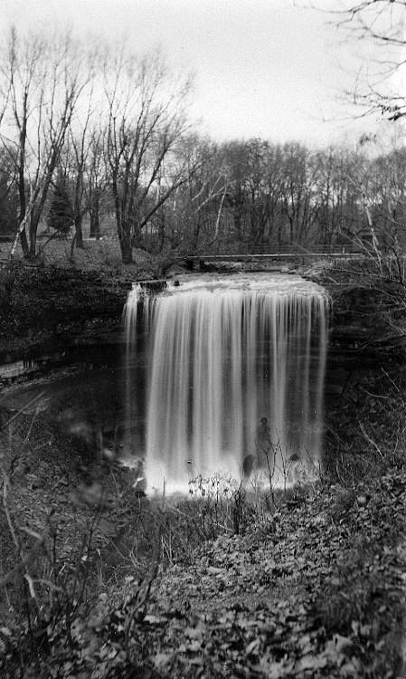
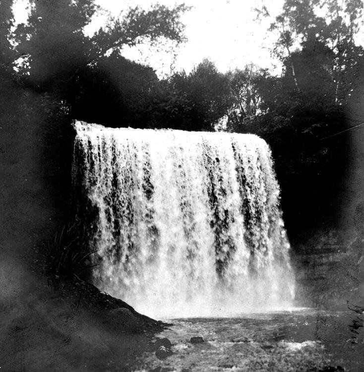
Minnehaha Falls is located in the South Chagrin Reservation near Bentleyville, Ohio. The falls can be accessed via the Squaw Rock Trail, which begins at the Squaw Rock Picnic Area.
Get Directions on Google MapsParking
Parking is available at the Squaw Rock Picnic Area, which serves as the trailhead for accessing the falls.
Elevation
961 feet above sea level
Coordinates
41.325889° N, -81.037872° W
Land Management
Managed by SDNR
Visitor Tips & Gear
Wear sturdy shoes as the trail may be muddy after rain. Visit after a period of rainfall for the best water flow at the falls. Early mornings or weekdays are less crowded.
As an Amazon Associate, we earn from qualifying purchases.
For this easy 0.6 miles trail, lightweight trail shoes and a water bottle are usually sufficient. Sun exposure on the trail makes good sun protection a must in summer.

Polarized Sunglasses (Knockaround)
Cuts glare off the water so you actually see the falls — and your photos turn out better too.

Columbia Watertight II Rain Jacket
Packs into its own pocket, seam-sealed, and keeps you dry from spray and surprise rain.

Earth Pak Waterproof Dry Bag
Keeps your phone and gear dry when waterfall mist soaks everything else.

Waterproof Phone Pouch (AiRunTech)
Cheap insurance — take photos right next to the falls without killing your phone.

JOBY GorillaPod Starter Kit
Wraps around railings and rocks for long-exposure waterfall shots — no flat surface needed.

Osprey Daylite Daypack
Light, organized, and just the right size for a day hike — fits water, snacks, and layers.
Where to Stay

Holiday Inn Express Lordstown-Newton Falls/Warren by IHG

Holiday Inn Express Hotel & Suites Youngstown North-Warren/Niles by IHG

Fairfield Inn by Marriott Warren Niles

Fairfield by Marriott Youngstown/Austintown
Browse vacation cabins and private rentals nearby
Unique outdoor stays — tents, yurts, and treehouses
Rent a campervan or RV for your waterfall road trip
Some links are affiliate links. We may earn a commission at no extra cost to you.
Nearby Campground
West Branch State Park
13.5 miles away · 0 sites
This recreation area is part of Michael J Kirwan Lake
Book on Recreation.govAdditional Information
Nearby Attractions
Nearby attractions include the Squaw Rock Picnic Area, the Chagrin River, and other trails within the South Chagrin Reservation.
Wildlife
The area is home to a variety of wildlife, including birds, deer, and small mammals. Keep an eye out for native plants and wildflowers along the trail.
Cities near Minnehaha Falls
Nearby Waterfalls
Other waterfalls named Minnehaha Falls
1 other waterfall shares this name across the U.S.
Writing about Minnehaha Falls? Embed this waterfall on your site for free.