Minnehaha Falls
Minnesota • 53 ft
By Armen Suny · Last verified May 2026
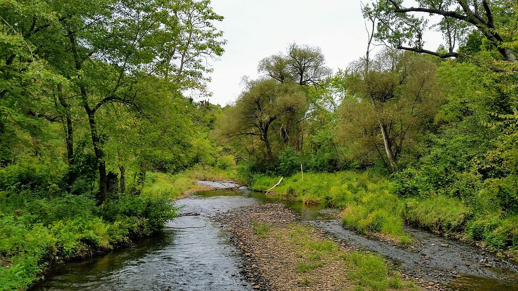
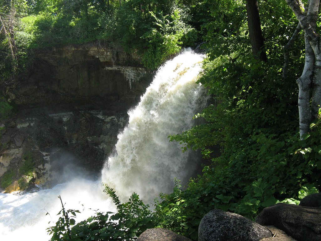
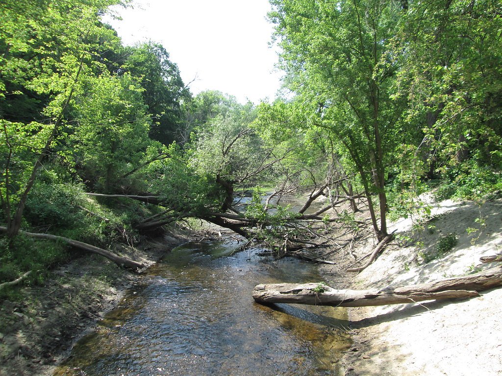
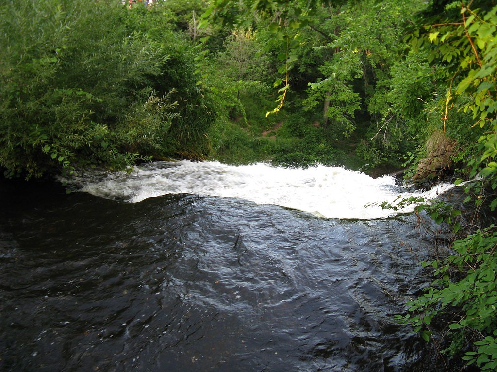
Photo Credits (5)
Difficulty
Easy
Trail Length
0.4 miles
Trail Type
Out And Back
Elevation Gain
50 ft
About Minnehaha Falls
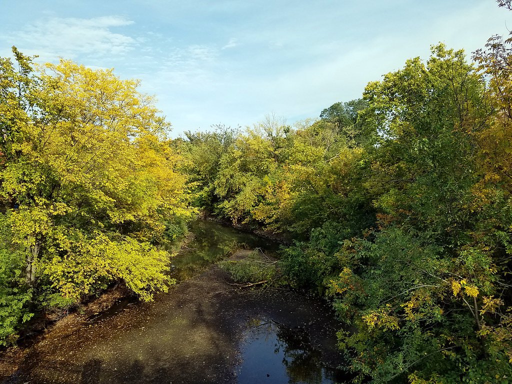
Minnehaha Falls drops 53 feet inside Minnehaha Regional Park, a beloved city park in Minneapolis where the lower reaches of Minnehaha Creek tumble toward the Mississippi. The cascade flows year‑round and offers especially dramatic displays during spring snowmelt or when sections freeze into ice in winter. The park is managed by the City as part of the Minneapolis Park and Recreation Board system and lies within the Mississippi National River and Recreation Area, giving this urban green space a surprisingly wild feel; the landscape was originally designed by landscape architect Horace W.S.
The Setting
Minnehaha Falls sits at 810 feet within Minnehaha Park, fed by the Minnehaha Creek, in the foothills of Minnesota. The falls drop 53 feet.
Height: 53 feet
Trail & Hike Details
The Approach
The easy 0.4-mile out and back trail gains 50 feet of elevation on the way to the falls.
Trail Description
The primary approach to Minnehaha Falls is a short, well‑maintained walk from nearby parking to the main viewing platform. The out-and-back route is approximately 0.4 miles round trip with roughly 50 feet of elevation gain and is rated easy, making it accessible for families and most visitors. Trails around the falls are mostly paved and connect along Minnehaha Creek down to the Mississippi River, offering additional scenic strolls beyond the main viewpoint.
What to Expect
The falls drop 53 feet. Dogs are welcome.
Accessibility
The trail is short and relatively flat, but the surface may be uneven. Contact the managing agency for accessibility details.
Frequently Asked Questions
🐶 Are Dogs Allowed at Minnehaha Falls?
✅ Dogs are allowed
Are There Any Fees or Permits Required?
🤑 Fee: $1.50
🏊 Is There Swimming at Minnehaha Falls?
❌ Swimming is not allowed
When to Visit
Spring and summer are ideal for lush greenery and flowing water, while winter offers a unique view of the frozen falls. Fall provides beautiful autumn foliage.
Seasonal Access
The best time to visit is Spring, Summer, Fall, and Winter.
Safety Information
Stay on designated trails and viewing platforms. Do not climb on rocks near the falls, as they can be slippery and dangerous. Be cautious during winter, as icy conditions may make paths slippery.
Current Water Conditions
36 ft³/s
Current discharge — how much water is flowing
About average for this time of year
Based on 20 years of record
12.78 ft
Water depth at gauge
71°F
ComfortablePleasant for swimming
7-Day Discharge Trend
What does this mean for your visit?
Flow is about average for this time of year. The water is a comfortable 71 degrees F, pleasant for swimming. Mineral content is moderate.
Water Quality
Conductance
Dissolved minerals in the water
About This Gauge
7-Day Flow Outlook
Based on the USGS gauge MINNEHAHA CREEK AT HIAWATHA AVE. IN MINNEAPOLIS,MN (0 km away).
Today
Moderate
36 cfs
8/10Tomorrow
Moderate
35 cfs
6/10Mon
Moderate
37 cfs
8/10Tue
Moderate
34 cfs
6/10Wed
Moderate
30 cfs
6/10Thu
Moderate
26 cfs
6/10Fri
Moderate
26 cfs
6/10Best window: Today — moderate flow, sunny (trip score 8/10).
Best time of year: this gauge typically runs highest from early May to early July, peaking in June.
How we calculate this
This is a transparent outlook, not a precise forecast. We take the waterfall's current flow strength (how it ranks against its historical normal for today, from the nearest USGS stream gauge), carry that ranking forward along the gauge's seasonal curve, and nudge it for forecast rain. Confidence is highest for the next day or two and falls further out. Always check official conditions and your own judgment before visiting — high flows can be dangerous.
Know when to go.
Get a free email alert when waterfalls near Mendota hit peak flow. We only send when conditions are worth the trip — no weekly newsletters, no spam.
Weather Forecast
Location & Access
Getting There
Minnehaha Falls is located within Minnehaha Regional Park in Minneapolis, Minnesota. The park is easily accessible by car, bike, or public transportation. The address is 4801 Minnehaha Ave, Minneapolis, MN 55417.
Get Directions on Google MapsParking
There is a parking lot near the falls, and metered parking is available. Parking can fill up quickly during peak times, so arriving early is recommended.
Hours
Elevation
810 feet above sea level
Coordinates
44.914688° N, -93.209945° W
Land Management
Managed by CITY
Visitor Tips & Gear
Visit early in the morning or on weekdays to avoid crowds. Wear comfortable walking shoes if you plan to explore the trails. Bring a camera to capture the beauty of the falls and surrounding park.
As an Amazon Associate, we earn from qualifying purchases.
For this easy 0.4 miles trail, lightweight trail shoes and a water bottle are usually sufficient. Icy conditions are common in winter — traction cleats are a smart addition.

Columbia Watertight II Rain Jacket
Packs into its own pocket, seam-sealed, and keeps you dry from spray and surprise rain.

Polarized Sunglasses (Knockaround)
Cuts glare off the water so you actually see the falls — and your photos turn out better too.

Earth Pak Waterproof Dry Bag
Keeps your phone and gear dry when waterfall mist soaks everything else.

Waterproof Phone Pouch (AiRunTech)
Cheap insurance — take photos right next to the falls without killing your phone.

Kahtoola MICROspikes
Cult-favorite traction cleats that grip ice and wet rock — essential for winter waterfall hikes.

JOBY GorillaPod Starter Kit
Wraps around railings and rocks for long-exposure waterfall shots — no flat surface needed.
Where to Stay

Hyatt Place Minneapolis Airport South

Country Inn & Suites by Radisson, Bloomington at Mall of America, MN

Embassy Suites by Hilton Minneapolis Airport

Cambria Hotel Bloomington Mall of America Minneapolis Airport
Browse vacation cabins and private rentals nearby
Unique outdoor stays — tents, yurts, and treehouses
Rent a campervan or RV for your waterfall road trip
Some links are affiliate links. We may earn a commission at no extra cost to you.
Additional Information
Nearby Attractions
Nearby attractions include the Mississippi River, Fort Snelling State Park, and the Minneapolis Chain of Lakes.
Wildlife
Visitors may see birds, squirrels, and other small wildlife in the park.
Cities near Minnehaha Falls
Nearby Waterfalls
 CC
CC
Other waterfalls named Minnehaha Falls
1 other waterfall shares this name across the U.S.
Writing about Minnehaha Falls? Embed this waterfall on your site for free.