

Photo Credits (5)
Difficulty
Moderate
Trail Length
2.4 miles
Trail Type
Out And Back
Elevation Gain
350 ft
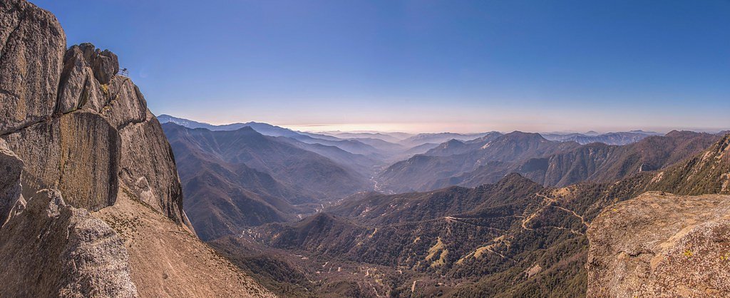
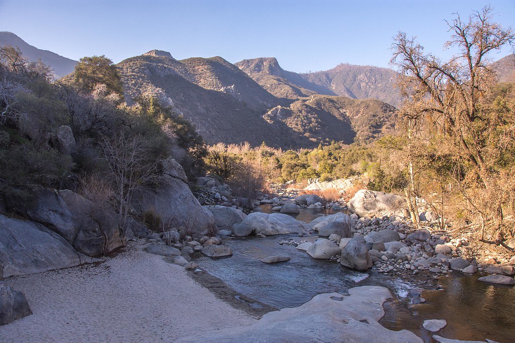
About Marble Falls
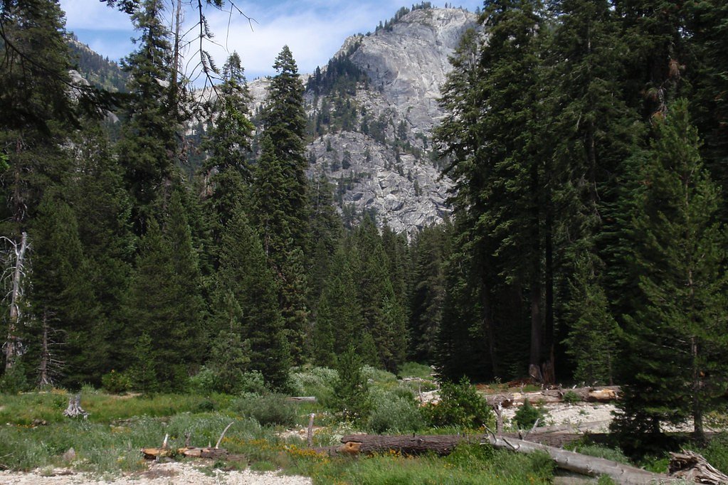
Marble Falls is a scenic waterfall located in Sequoia National Park, California. It is known for its cascading waters flowing over smooth granite rocks, surrounded by lush vegetation and offering stunning views of the surrounding wilderness.
The Setting
Marble Falls sits at 4,259 feet within Sequoia National Park, fed by the Marble Fork Kaweah R, in the mountains of California.
Trail & Hike Details
The Approach
The moderate 2.4-mile out-and-back trail gains 350 feet of elevation on the way to the falls.
Trail Description
The Marble Falls Trail is a moderately challenging hike that takes visitors through oak woodlands and chaparral before reaching the waterfall. The trail features steady elevation gain and some rocky sections, making sturdy footwear essential. The waterfall is most impressive in spring when water flow is at its peak.
What to Expect
Visitors can expect a moderately strenuous hike with rewarding views of Marble Falls at the end. The trail offers opportunities to see wildflowers in spring and wildlife such as deer and birds. The waterfall itself is a serene spot, perfect for photography or a picnic.
Accessibility
The trail is not wheelchair accessible. Uneven terrain and elevation changes require steady footing.
Frequently Asked Questions
🐶 Are Dogs Allowed at Marble Falls?
❌ Dogs are not allowed
Are There Any Fees or Permits Required?
🤑 Fee: $35.00
🏊 Is There Swimming at Marble Falls?
❌ Swimming is not allowed
When to Visit
Spring is the best time to visit Marble Falls, as the waterfall is at its fullest due to snowmelt. Summer and fall are also good options, but the water flow may be reduced.
Seasonal Access
The best time to visit is Spring, Summer, and Fall. Winter access may be limited. Check the National Park Service website for current conditions.
Safety Information
Be cautious of poison oak and rattlesnakes along the trail. Carry plenty of water to stay hydrated, especially in warmer months. Watch for loose rocks and uneven footing.
Current Water Conditions
10 ft³/s
Current discharge — how much water is flowing
About average for this time of year
Based on 12 years of record
7.25 ft
Water depth at gauge
58°F
ColdBracing — limit time in water
7-Day Discharge Trend
What does this mean for your visit?
Flow is about average for this time of year. Water temperature is a bracing 58 degrees F, limit your time in the water.
About This Gauge
This gauge is on a nearby waterway and may not reflect exact conditions at the falls.
7-Day Flow Outlook
Based on the USGS gauge MARBLE FORK KAWEAH R AB HORSE C NR LODGEPOLE CA (10 km away).
Today
Barely Flowing
10 cfs
5/10Tomorrow
Barely Flowing
9 cfs
5/10Mon
Barely Flowing
9 cfs
5/10Tue
Barely Flowing
7 cfs
5/10Wed
Barely Flowing
7 cfs
5/10Thu
Barely Flowing
8 cfs
5/10Fri
Barely Flowing
7 cfs
5/10Best window: Today — barely flowing flow, sunny (trip score 5/10).
Best time of year: this gauge typically runs highest from late March to late June, peaking in June.
How we calculate this
This is a transparent outlook, not a precise forecast. We take the waterfall's current flow strength (how it ranks against its historical normal for today, from the nearest USGS stream gauge), carry that ranking forward along the gauge's seasonal curve, and nudge it for forecast rain. Confidence is highest for the next day or two and falls further out. Always check official conditions and your own judgment before visiting — high flows can be dangerous.
Know when to go.
Get a free email alert when waterfalls near Three Rivers hit peak flow. We only send when conditions are worth the trip — no weekly newsletters, no spam.
Weather Forecast
Location & Access
Getting There
Marble Falls is accessed via the Marble Falls Trail, which begins near the Potwisha Campground in Sequoia National Park. The trailhead is located off the Generals Highway.
Get Directions on Google MapsParking
Parking is available near the Potwisha Campground. Visitors should ensure they park in designated areas to avoid fines.
Elevation
4,259 feet above sea level
Coordinates
36.552971° N, -118.792207° W
Land Management
Managed by NPS
Visitor Tips & Gear
Start early in the day to avoid the heat, especially in summer. Bring plenty of water, as the trail can be exposed to the sun. Watch for poison oak along the trail and stay on marked paths.
As an Amazon Associate, we earn from qualifying purchases.
With 2.4 miles and 350 ft of elevation gain, sturdy boots and trekking poles will help on this moderate trail. Sun exposure on the trail makes good sun protection a must in summer.
America the Beautiful Annual Pass
Covers entrance fees at 2,000+ federal recreation sites — required at most National Parks.

Polarized Sunglasses (Knockaround)
Cuts glare off the water so you actually see the falls — and your photos turn out better too.

Columbia Watertight II Rain Jacket
Packs into its own pocket, seam-sealed, and keeps you dry from spray and surprise rain.

Earth Pak Waterproof Dry Bag
Keeps your phone and gear dry when waterfall mist soaks everything else.

Waterproof Phone Pouch (AiRunTech)
Cheap insurance — take photos right next to the falls without killing your phone.

Timberland Euro Sprint Mid Waterproof
Trusted waterproof boot with premium leather and grippy rubber sole — reliable on rocky, wet trails.

TrailBuddy Trekking Poles
Lightweight aluminum, cork grips, and flip-locks that actually hold — a best-seller for good reason.
Where to Stay

Escape to Muniz Village Unit D Family

Lazy J Ranch Motel

Soleil Luna 2 miles from Sequoia Park Entrance

Muniz Village
Browse vacation cabins and private rentals nearby
Unique outdoor stays — tents, yurts, and treehouses
Rent a campervan or RV for your waterfall road trip
Some links are affiliate links. We may earn a commission at no extra cost to you.
Nearby Campground
STONY CREEK SEQUOIA
8.1 miles away · 48 sites
Overview Stony Creek Campground sits at an elevation of approximatly 6,500 feet in the Sierra Nevada mountains. It's nestled among Sigar Pines, Jeffrey Pines, Red Firs and the scenic Stony Creek is just steps away. This campground is ideally located along the Generals Highway, in between Sequoia and Kings Canyon National Parks, near the Jennie Lakes Wilderness, and tucked within the heart of Hume Lake Ranger Districts Sequoia National Forest. Recreation Hume Lake is a popular recreation destinat
Book on Recreation.govNearby Hot Springs
Hot springs near Three Rivers, California
Kern Hot Spring
Kern Hot Spring emerges at 109°F in Sequoia National Park at 6,908 feet elevation, accessible only via backcountry hiking. Prot...

Soda Spring
Soda Spring emerges at 72°F in the Tulare County foothills near East Porterville, offering modest thermal warmth just 8 degrees...
Ward Spring
Ward Spring flows at 70 degrees in Tulare County's southern Sierra Nevada foothills, producing water only 9.9 degrees above amb...

Jordan Hot Springs
Jordan Hot Springs delivers 124-degree water from the Golden Trout Wilderness at 6,533 feet elevation, ranking among California...

Blaney Meadows Hot Springs
Blaney Meadows Hot Springs emerges at 109 degrees Fahrenheit from the Sierra National Forest at 7,676 feet elevation, deliverin...
California Hot Springs
California Hot Springs emerges at 122°F from the Sierra Nevada's western slope in Kern County at 3,178 feet elevation. Located ...
Looking for a soak after your hike? Explore more hot springs near Three Rivers, California on SoakingSprings.
Explore California springsAdditional Information
Nearby Attractions
Nearby attractions include the Giant Forest, home to the General Sherman Tree, and the Tokopah Falls Trail.
Wildlife
Wildlife in the area includes deer, black bears, and a variety of birds. Visitors should store food properly to avoid attracting bears.
Cities near Marble Falls
Nearby Waterfalls
Other waterfalls named Marble Falls
1 other waterfall shares this name across the U.S.
Writing about Marble Falls? Embed this waterfall on your site for free.