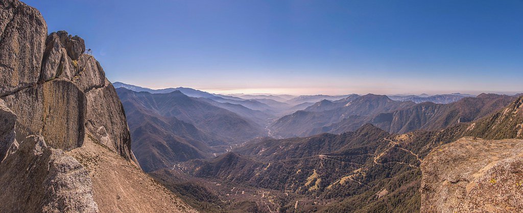
Tokopah Falls
California • 1200 ft
By Armen Suny · Last verified Mar 2026
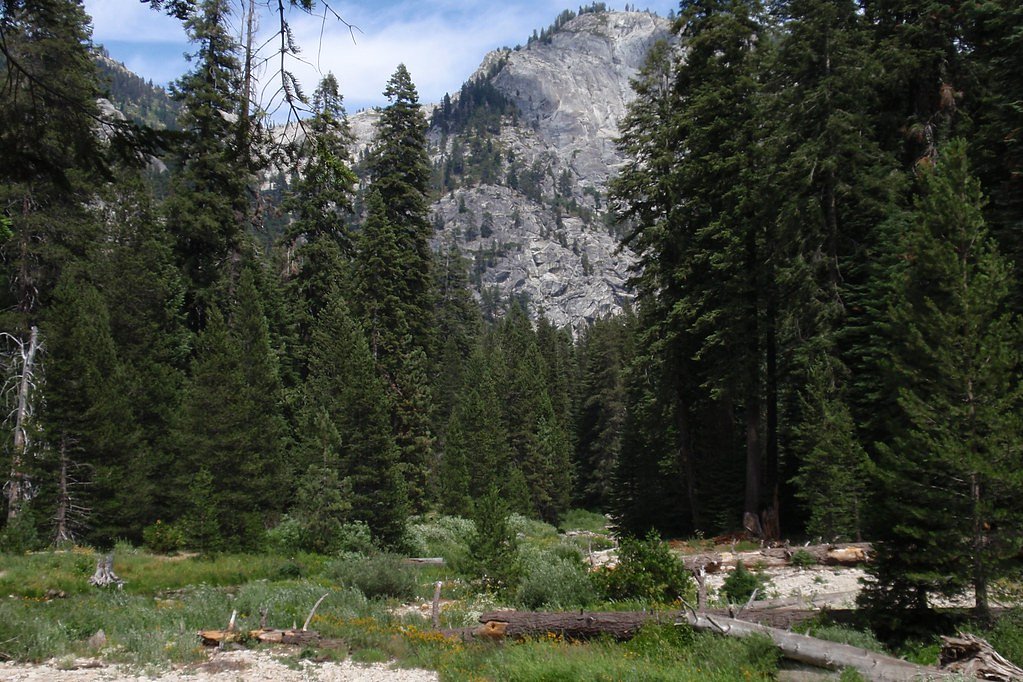

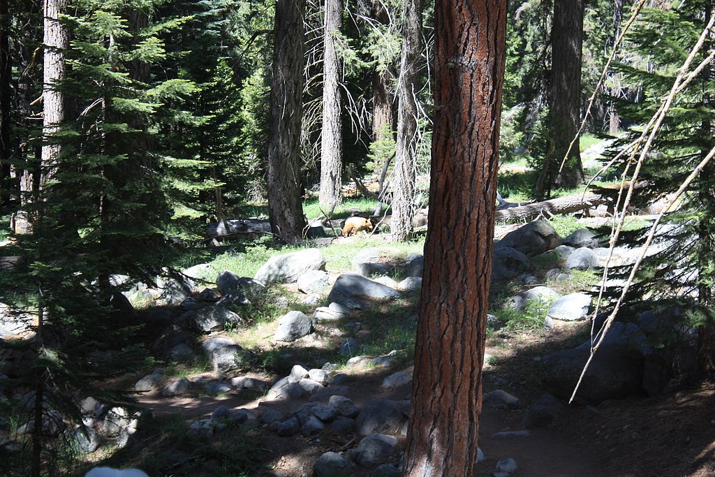
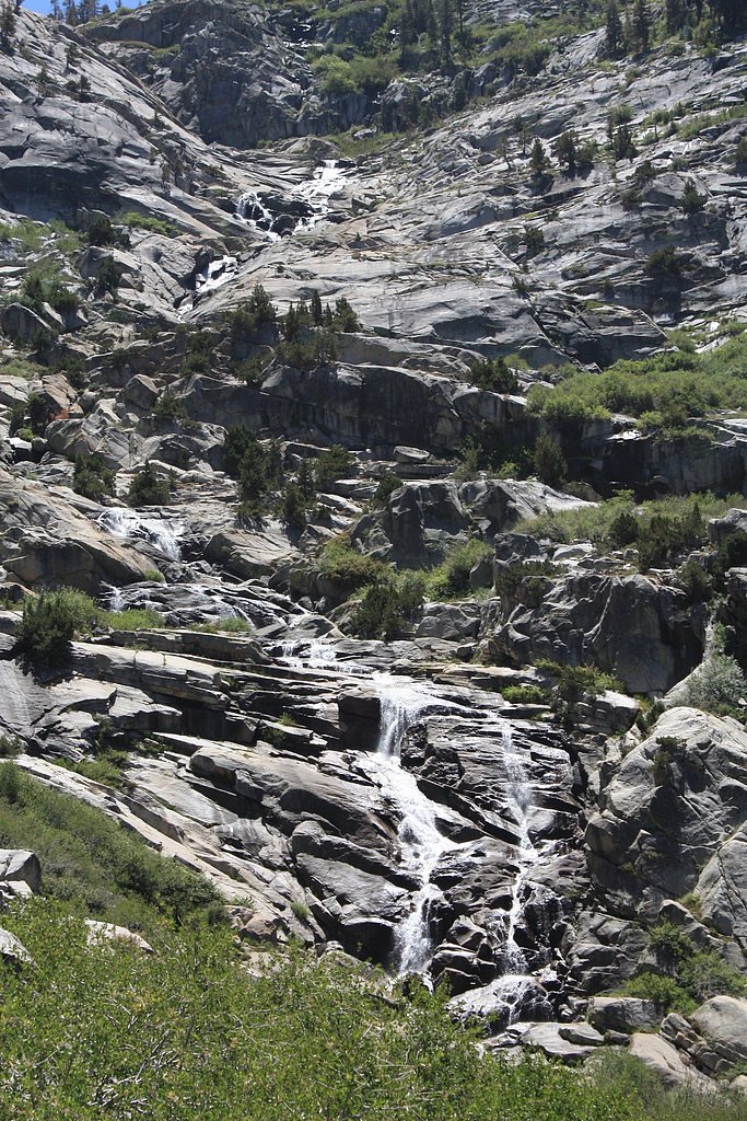

Photo Credits (5)
Difficulty
Moderate
Trail Length
4.0 miles
Trail Type
Out And Back
Elevation Gain
500 ft
About Tokopah Falls
Tokopah Falls is a stunning 1,200-foot cascading waterfall located in Sequoia National Park, California. It is fed by the Marble Fork of the Kaweah River and is particularly impressive during the spring and early summer when snowmelt is at its peak.
The Setting
Tokopah Falls sits at 8,107 feet within Sequoia National Park, fed by the Marble Fork Kaweah R, in the high alpine of California. At 1,200 feet, it is among the taller waterfalls in California.
Height: 1200 feet
Trail & Hike Details
The Approach
The moderate 4.0-mile out-and-back trail gains 500 feet of elevation on the way to the falls.
Trail Description
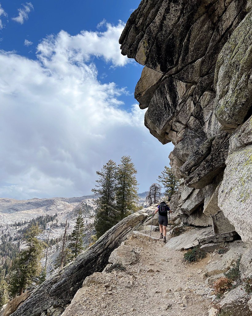
The Tokopah Falls Trail is a scenic out-and-back hike that follows the Marble Fork of the Kaweah River. The trail features granite cliffs, lush meadows, and occasional wildlife sightings. The path is well-maintained but includes some rocky sections and moderate elevation gain.
What to Expect
The falls plunge a dramatic 1200 feet.
Accessibility
The trail is not wheelchair accessible. Uneven terrain and elevation changes require steady footing.
Frequently Asked Questions
🐶 Are Dogs Allowed at Tokopah Falls?
❌ Dogs are not allowed
Are There Any Fees or Permits Required?
🤑 Fee: $35.00
🏊 Is There Swimming at Tokopah Falls?
❌ Swimming is not allowed
When to Visit
The best time to visit Tokopah Falls is in late spring or early summer when the waterfall is at its fullest due to snowmelt. Fall offers cooler temperatures and fewer crowds, but the waterfall may have a reduced flow.
Seasonal Access
The best time to visit is Spring, Summer, and Fall. Access roads and trails may close during winter due to snow. Check the National Park Service website for current conditions.
Safety Information
Be cautious of slippery rocks near the waterfall and along the trail, especially after rain. Carry bear spray and store food properly, as black bears are common in the area. Stay on marked trails to avoid getting lost.
Current Water Conditions
10 ft³/s
Current discharge — how much water is flowing
About average for this time of year
Based on 12 years of record
7.24 ft
Water depth at gauge
56°F
ColdBracing — limit time in water
7-Day Discharge Trend
What does this mean for your visit?
Flow is about average for this time of year. Water temperature is a bracing 56 degrees F, limit your time in the water.
About This Gauge
7-Day Flow Outlook
Based on the USGS gauge MARBLE FORK KAWEAH R AB HORSE C NR LODGEPOLE CA (1 km away).
Today
Barely Flowing
10 cfs
5/10Tomorrow
Barely Flowing
9 cfs
5/10Mon
Barely Flowing
8 cfs
5/10Tue
Barely Flowing
7 cfs
5/10Wed
Barely Flowing
6 cfs
5/10Thu
Barely Flowing
8 cfs
5/10Fri
Barely Flowing
7 cfs
5/10Best window: Today — barely flowing flow, sunny (trip score 5/10).
Best time of year: this gauge typically runs highest from late March to late June, peaking in June.
How we calculate this
This is a transparent outlook, not a precise forecast. We take the waterfall's current flow strength (how it ranks against its historical normal for today, from the nearest USGS stream gauge), carry that ranking forward along the gauge's seasonal curve, and nudge it for forecast rain. Confidence is highest for the next day or two and falls further out. Always check official conditions and your own judgment before visiting — high flows can be dangerous.
Know when to go.
Get a free email alert when waterfalls near Three Rivers hit peak flow. We only send when conditions are worth the trip — no weekly newsletters, no spam.
Weather Forecast
Location & Access
Getting There
Tokopah Falls is accessed via the Tokopah Falls Trail, which begins near the Lodgepole Campground in Sequoia National Park. The trailhead is well-marked and located near the Marble Fork Bridge.
Get Directions on Google MapsParking
Parking is available at the Lodgepole Campground area. During peak seasons, parking may fill up quickly, so arriving early is recommended.
Elevation
8,107 feet above sea level
Coordinates
36.608951° N, -118.690504° W
Land Management
Managed by NPS
Visitor Tips & Gear
Start your hike early to avoid crowds and secure parking. Wear sturdy hiking shoes, as the trail can be rocky in places. Bring plenty of water, especially during warmer months. Check weather conditions before your visit, as the trail may be slippery after rain.
This trail sits at 8,107 ft — the air is noticeably thinner
High AltitudeSome visitors experience headaches, fatigue, or shortness of breath at this elevation. Take it slow, stay hydrated, and consider supplemental oxygen if you're coming from a lower altitude.
As an Amazon Associate, we earn from qualifying purchases.

Coppertone Sport SPF 50 Sunscreen
UV intensity jumps ~4% per 1,000 ft — at this elevation you can burn in half the time.

Sun Bum SPF 30 Lip Balm (3-Pack)
Lips have almost no natural UV protection and burn fast in thin, dry mountain air.

Liquid I.V. Electrolyte Packets
You lose moisture ~2x faster at elevation — electrolytes help you absorb water efficiently.

ROCKNIGHT Polarized UV400 Sunglasses
High-altitude glare off rock and water is intense — UV400 lenses block 99%+ of UVA/UVB.

Boost Oxygen 10L Canister (2-Pack)
Portable supplemental oxygen for quick relief from headaches and shortness of breath.

Altitude Rx OxyBoost Complex
Antioxidant formula designed to support your body's natural altitude acclimation.
As an Amazon Associate, we earn from qualifying purchases.
With 4.0 miles and 500 ft of elevation gain, sturdy boots and trekking poles will help on this moderate trail. Sun exposure on the trail makes good sun protection a must in summer.
America the Beautiful Annual Pass
Covers entrance fees at 2,000+ federal recreation sites — required at most National Parks.

Polarized Sunglasses (Knockaround)
Cuts glare off the water so you actually see the falls — and your photos turn out better too.

Columbia Watertight II Rain Jacket
Packs into its own pocket, seam-sealed, and keeps you dry from spray and surprise rain.

Earth Pak Waterproof Dry Bag
Keeps your phone and gear dry when waterfall mist soaks everything else.

Waterproof Phone Pouch (AiRunTech)
Cheap insurance — take photos right next to the falls without killing your phone.

Timberland Euro Sprint Mid Waterproof
Trusted waterproof boot with premium leather and grippy rubber sole — reliable on rocky, wet trails.

TrailBuddy Trekking Poles
Lightweight aluminum, cork grips, and flip-locks that actually hold — a best-seller for good reason.
Where to Stay

Comfort Inn & Suites Sequoia Kings Canyon

Escape to Muniz Village Unit D Family

Lazy J Ranch Motel

Soleil Luna 2 miles from Sequoia Park Entrance
Browse vacation cabins and private rentals nearby
Unique outdoor stays — tents, yurts, and treehouses
Rent a campervan or RV for your waterfall road trip
Some links are affiliate links. We may earn a commission at no extra cost to you.
Nearby Campground
STONY CREEK SEQUOIA
8.8 miles away · 48 sites
Overview Stony Creek Campground sits at an elevation of approximatly 6,500 feet in the Sierra Nevada mountains. It's nestled among Sigar Pines, Jeffrey Pines, Red Firs and the scenic Stony Creek is just steps away. This campground is ideally located along the Generals Highway, in between Sequoia and Kings Canyon National Parks, near the Jennie Lakes Wilderness, and tucked within the heart of Hume Lake Ranger Districts Sequoia National Forest. Recreation Hume Lake is a popular recreation destinat
Book on Recreation.govNearby Hot Springs
Hot springs near Three Rivers, California
Kern Hot Spring
Kern Hot Spring emerges at 109°F in Sequoia National Park at 6,908 feet elevation, accessible only via backcountry hiking. Prot...
Ward Spring
Ward Spring flows at 70 degrees in Tulare County's southern Sierra Nevada foothills, producing water only 9.9 degrees above amb...

Soda Spring
Soda Spring emerges at 72°F in the Tulare County foothills near East Porterville, offering modest thermal warmth just 8 degrees...

Jordan Hot Springs
Jordan Hot Springs delivers 124-degree water from the Golden Trout Wilderness at 6,533 feet elevation, ranking among California...

Blaney Meadows Hot Springs
Blaney Meadows Hot Springs emerges at 109 degrees Fahrenheit from the Sierra National Forest at 7,676 feet elevation, deliverin...

Springs
This 86-degree spring emerges at 3,601 feet in the arid Owens Valley, where the City of Los Angeles owns vast tracts of land fo...
Looking for a soak after your hike? Explore more hot springs near Three Rivers, California on SoakingSprings.
Explore California springsAdditional Information
Nearby Attractions
Nearby attractions include the Giant Forest, home to the General Sherman Tree, and the Marble Fork Bridge. Lodgepole Visitor Center is also close by for park information and amenities.
Wildlife
Wildlife in the area includes marmots, deer, black bears, and various bird species. Always maintain a safe distance from animals.
Cities near Tokopah Falls
Nearby Waterfalls
Writing about Tokopah Falls? Embed this waterfall on your site for free.