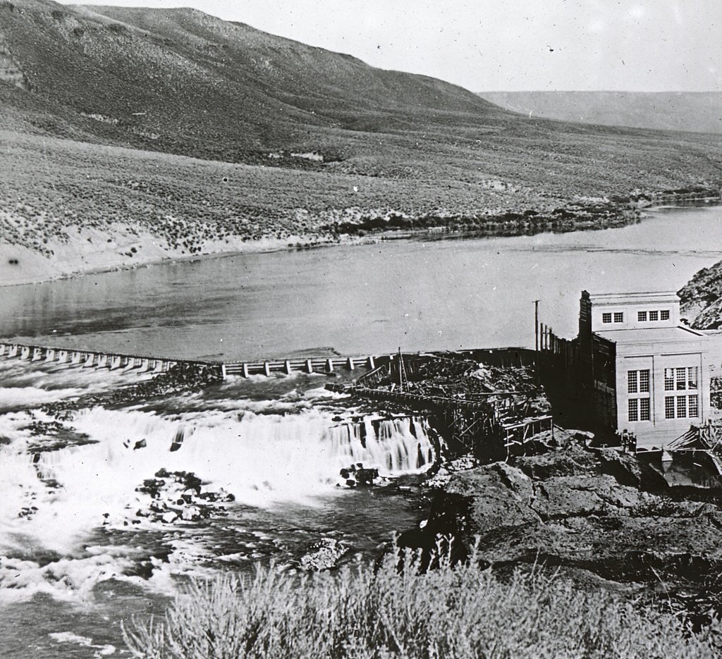
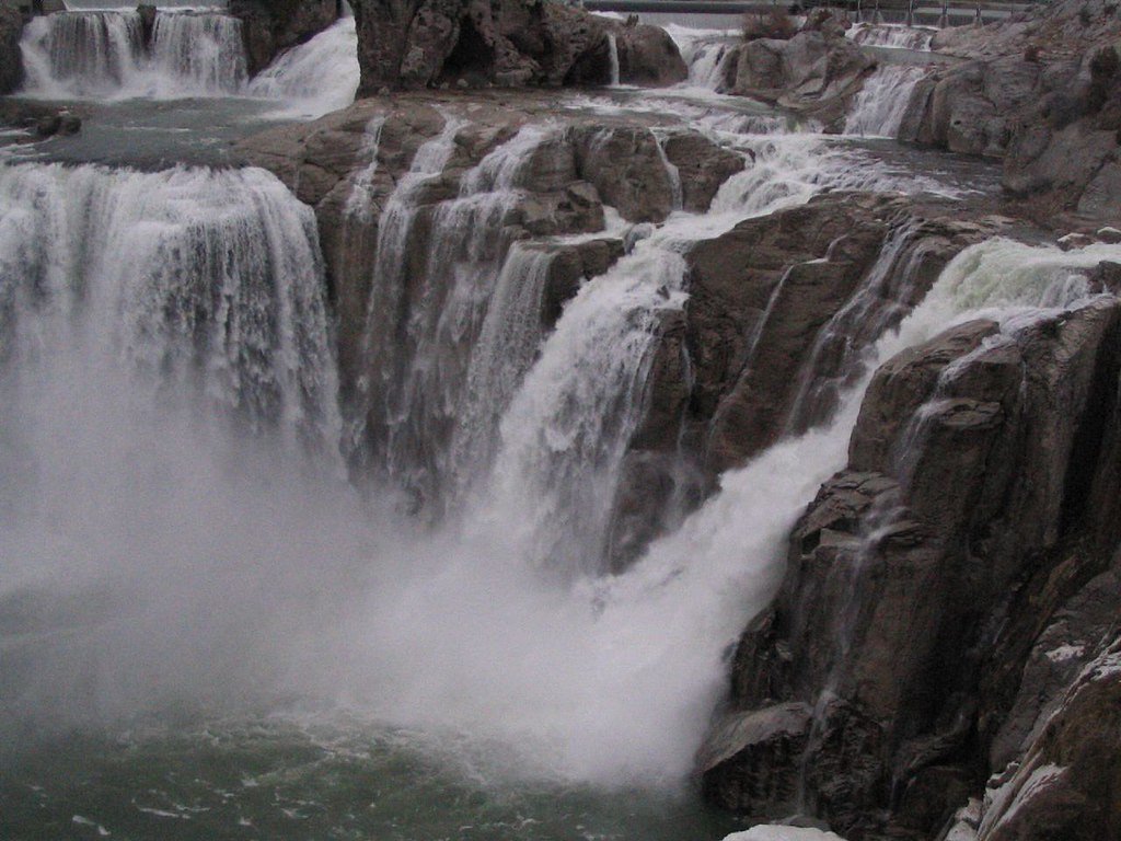
Lower Salmon Falls
By Armen Suny · Last verified May 2026
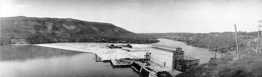
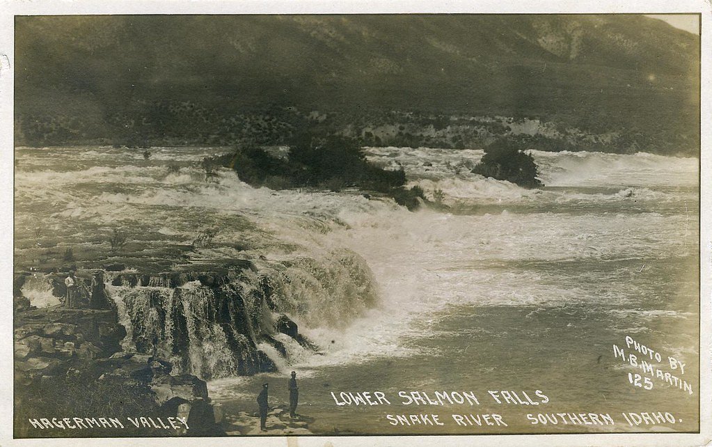
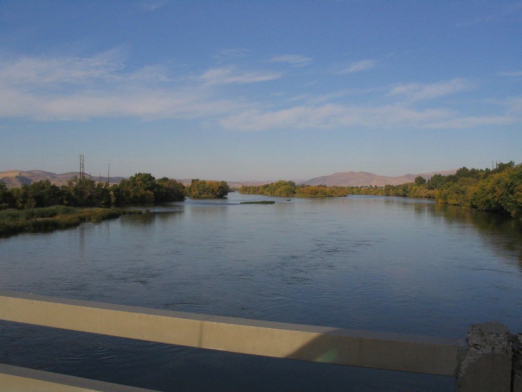
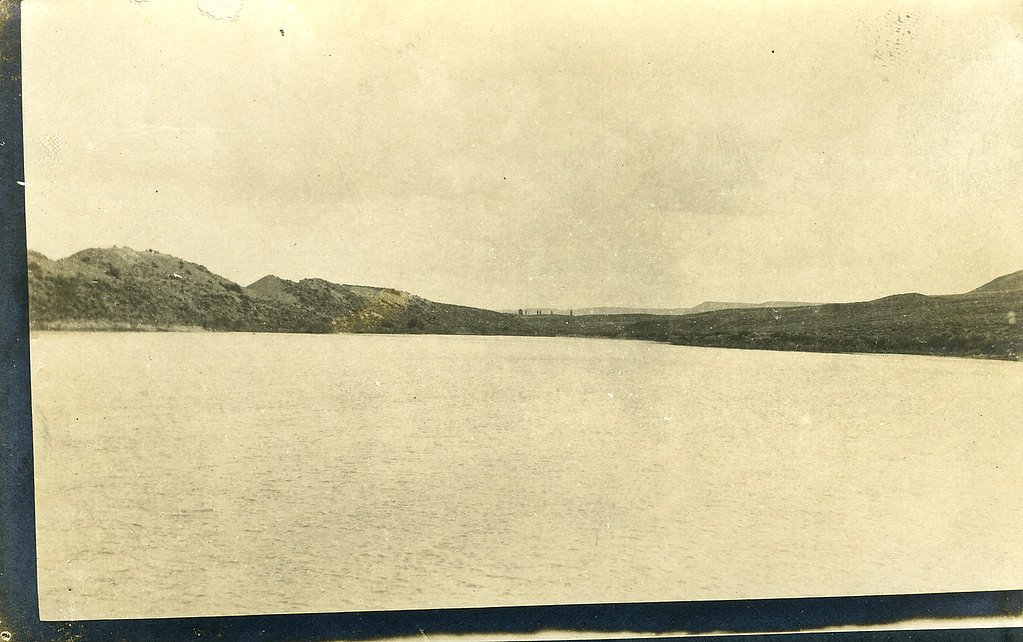

Photo Credits (5)
Difficulty
Easy
Trail Length
0.6 miles
Trail Type
Out And Back
Elevation Gain
100 ft
About Lower Salmon Falls
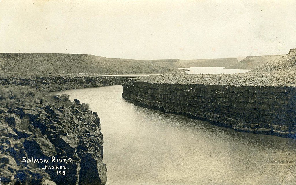
Lower Salmon Falls is a scenic waterfall located on the Snake River in Idaho. It is part of a series of waterfalls along the river and is known for its picturesque views and accessibility. The waterfall is often visited by those exploring the Snake River Canyon.
The Setting
Lower Salmon Falls sits at 2,657 feet within Snake River, fed by the Malad River, in the hills of Idaho.
Trail & Hike Details
The Approach
The easy 0.6-mile out-and-back trail gains 100 feet of elevation on the way to the falls.
Trail Description
The trail to Lower Salmon Falls is short and easy, making it accessible for most visitors. It is a well-maintained path that leads to viewpoints of the falls and the surrounding Snake River Canyon.
What to Expect
Dogs are welcome.
Accessibility
The trail is short and relatively flat, but the surface may be uneven. Contact the managing agency for accessibility details.
Frequently Asked Questions
🐶 Are Dogs Allowed at Lower Salmon Falls?
✅ Dogs are allowed
Are There Any Fees or Permits Required?
🆖 No fees required
🏊 Is There Swimming at Lower Salmon Falls?
❌ Swimming is not allowed
When to Visit
Spring and early summer are the best times to visit, as the water flow is usually strongest during these seasons.
Seasonal Access
The best time to visit is Spring, Summer, and Fall. Winter access may be limited.
Safety Information
Be cautious near the water as rocks can be slippery. Strong currents in the river can pose a hazard. Always supervise children and pets.
Current Water Conditions
381 ft³/s
Current discharge — how much water is flowing
Higher than usual for this time of year
Based on 109 years of record
3.17 ft
Water depth at gauge
7-Day Discharge Trend
What does this mean for your visit?
The water is flowing higher than usual for this time of year.
About This Gauge
This gauge is on a nearby waterway and may not reflect exact conditions at the falls.
7-Day Flow Outlook
Based on the USGS gauge MALAD RIVER NR GOODING ID (10 km away).
Today
Moderate
381 cfs
9/10Tomorrow
Moderate
373 cfs
9/10Thu
Moderate
325 cfs
9/10Fri
Moderate
325 cfs
9/10Sat
Moderate
322 cfs
9/10Sun
Moderate
337 cfs
9/10Mon
Moderate
353 cfs
9/10Best window: Today — moderate flow, sunny (trip score 9/10).
Best time of year: this gauge typically runs highest from early April to mid June, peaking in April.
How we calculate this
This is a transparent outlook, not a precise forecast. We take the waterfall's current flow strength (how it ranks against its historical normal for today, from the nearest USGS stream gauge), carry that ranking forward along the gauge's seasonal curve, and nudge it for forecast rain. Confidence is highest for the next day or two and falls further out. Always check official conditions and your own judgment before visiting — high flows can be dangerous.
Know when to go.
Get a free email alert when waterfalls near Hagerman hit peak flow. We only send when conditions are worth the trip — no weekly newsletters, no spam.
Weather Forecast
Location & Access
Getting There
Lower Salmon Falls is located near Hagerman, Idaho, along the Snake River. It can be accessed via local roads off US-30. The area is well-marked with signs leading to the falls.
Get Directions on Google MapsParking
There is a parking area near the falls, which is typically sufficient for visitors. However, it may be limited during peak seasons.
Elevation
2,657 feet above sea level
Coordinates
42.842958° N, -114.904225° W
Land Management
Managed by BLM
Visitor Tips & Gear
Visit during the spring or early summer when water flow is typically at its peak. Bring a camera to capture the scenic views. Be cautious near the water as rocks may be slippery.
As an Amazon Associate, we earn from qualifying purchases.
For this easy 0.6 miles trail, lightweight trail shoes and a water bottle are usually sufficient. Sun exposure on the trail makes good sun protection a must in summer.

Polarized Sunglasses (Knockaround)
Cuts glare off the water so you actually see the falls — and your photos turn out better too.

Columbia Watertight II Rain Jacket
Packs into its own pocket, seam-sealed, and keeps you dry from spray and surprise rain.

Earth Pak Waterproof Dry Bag
Keeps your phone and gear dry when waterfall mist soaks everything else.

Waterproof Phone Pouch (AiRunTech)
Cheap insurance — take photos right next to the falls without killing your phone.

JOBY GorillaPod Starter Kit
Wraps around railings and rocks for long-exposure waterfall shots — no flat surface needed.

Osprey Daylite Daypack
Light, organized, and just the right size for a day hike — fits water, snacks, and layers.
Where to Stay

Hagerman Valley Inn

Billingsley Creek

Downtown Hagerman Hot Springs Getaway

La Quinta by Wyndham Twin Falls
Browse vacation cabins and private rentals nearby
Unique outdoor stays — tents, yurts, and treehouses
Rent a campervan or RV for your waterfall road trip
Some links are affiliate links. We may earn a commission at no extra cost to you.
Nearby Hot Springs
Hot springs near Hagerman, Idaho
Salmon Falls Hot Spring
Salmon Falls Hot Spring pushes 153-degree water to the surface just six feet from North 1000 East road in Twin Falls County, on...
Hot Sulphur (Miracle Hot) Springs
Known locally as Miracle Hot Springs, this Twin Falls County source flows at 131 degrees Fahrenheit near Buhl in the Snake Rive...
Poison Springs
Poison Springs sits on BLM land near Buhl in Twin Falls County, Idaho, at 3,388 feet elevation. The original temperature was re...
Banbury Hot Spring
Banbury Hot Spring fires out at 138 degrees Fahrenheit near Buhl in Twin Falls County, one of the hottest thermal features in t...
Hot Sulphur Lake
Hot Sulphur Lake sits right off the road near Gooding at 81 degrees Fahrenheit, making it one of the more accessible and mildly...
White Arrow Hot Spring
White Arrow Hot Spring reaches 145°F, making it dangerously hot for direct contact. Located at 3,300 feet in Gooding County's h...
Looking for a soak after your hike? Explore more hot springs near Hagerman, Idaho on SoakingSprings.
Explore Idaho springsAdditional Information
Nearby Attractions
Nearby attractions include Thousand Springs State Park, Hagerman Fossil Beds National Monument, and other waterfalls along the Snake River.
Wildlife
The area is home to various bird species, including herons and eagles, as well as fish and other river wildlife.
Cities near Lower Salmon Falls
Nearby Waterfalls
Writing about Lower Salmon Falls? Embed this waterfall on your site for free.