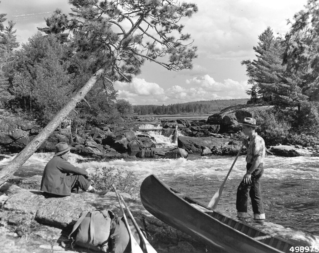
Lower Basswood Falls
By Armen Suny · Last verified Mar 2026
Photo Credits (1)
Difficulty
Moderate
Trail Length
2.4 miles
Trail Type
Out And Back
Elevation Gain
300 ft
About Lower Basswood Falls
Lower Basswood Falls is a scenic waterfall located along the U.S.-Canada border in the Boundary Waters Canoe Area Wilderness (BWCAW) in Minnesota. It is part of the Basswood River and features cascading rapids and falls surrounded by pristine wilderness. The area is popular among canoeists and hikers for its natural beauty and remote setting.
The Setting
Lower Basswood Falls sits at 1,257 feet within Boundary Waters Canoe Area Wilderness, fed by the Basswood River, in the foothills of Minnesota.
Trail & Hike Details
The Approach
The moderate 2.4-mile out-and-back trail gains 300 feet of elevation on the way to the falls.
Trail Description
The journey to Lower Basswood Falls involves paddling through interconnected lakes and completing portages between them. The portages can be rugged and require carrying gear and canoes over uneven terrain. The falls themselves are located in a remote wilderness area, offering a serene and picturesque setting.
What to Expect
Swimming is permitted. Dogs are welcome.
Accessibility
The trail is not wheelchair accessible. Uneven terrain and elevation changes require steady footing.
Frequently Asked Questions
🐶 Are Dogs Allowed at Lower Basswood Falls?
✅ Dogs are allowed
Are There Any Fees or Permits Required?
🤑 Fee: $0.00
Permit required
A BWCAW permit is required for all visitors. Permits must be reserved in advance through Recreation.gov, and quotas are in place to limit the number of visitors.
🏊 Is There Swimming at Lower Basswood Falls?
✅ Swimming is allowed
When to Visit
The best time to visit is late spring through early fall when the weather is mild, and the waterways are accessible. Summer is the most popular season, but fall offers stunning foliage and fewer bugs.
Seasonal Access
The best time to visit is Spring, Summer, and Fall. Winter access may be limited.
Safety Information
Visitors should be prepared for wilderness conditions, including unpredictable weather, potential wildlife encounters, and the physical demands of portaging. Always carry a first aid kit and inform someone of your travel plans.
Current Water Conditions
1,110 ft³/s
Current discharge — how much water is flowing
Lower than usual for this time of year
Based on 95 years of record
3.51 ft
Water depth at gauge
7-Day Discharge Trend
What does this mean for your visit?
Flow is lower than usual for this time of year.
About This Gauge
7-Day Flow Outlook
Based on the USGS gauge BASSWOOD RIVER NEAR WINTON, MN (6 km away).
Today
Barely Flowing
1199 cfs
3/10Tomorrow
Low
1243 cfs
4/10Mon
Low
1317 cfs
3/10Tue
Low
1343 cfs
3/10Wed
Low
1277 cfs
4/10Thu
Low
1275 cfs
3/10Fri
Low
1301 cfs
3/10Best window: Tomorrow — low flow, chance rain showers (trip score 4/10).
Best time of year: this gauge typically runs highest from late April to late July, peaking in May.
How we calculate this
This is a transparent outlook, not a precise forecast. We take the waterfall's current flow strength (how it ranks against its historical normal for today, from the nearest USGS stream gauge), carry that ranking forward along the gauge's seasonal curve, and nudge it for forecast rain. Confidence is highest for the next day or two and falls further out. Always check official conditions and your own judgment before visiting — high flows can be dangerous.
Know when to go.
Get a free email alert when waterfalls near Winton hit peak flow. We only send when conditions are worth the trip — no weekly newsletters, no spam.
Weather Forecast
Location & Access
Getting There
Lower Basswood Falls is accessible primarily by canoe or kayak as it is located within the Boundary Waters Canoe Area Wilderness. Visitors typically launch from entry points such as Moose Lake or Fall Lake and paddle through a series of lakes and portages to reach the falls. Hiking access is limited and challenging due to the remote location.
Get Directions on Google MapsParking
Parking is available at designated BWCAW entry points, such as Moose Lake or Fall Lake. Visitors must plan their route and secure permits in advance.
Elevation
1,257 feet above sea level
Coordinates
48.113505° N, -91.711515° W
Land Management
Managed by USFS
Visitor Tips & Gear
Plan your trip carefully, including securing the required BWCAW permits. Bring a detailed map and compass or GPS, as cell service is unreliable. Be prepared for portages and pack light but with all necessary gear. Bug spray is essential during summer months.
As an Amazon Associate, we earn from qualifying purchases.
With 2.4 miles and 300 ft of elevation gain, sturdy boots and trekking poles will help on this moderate trail. Sun exposure on the trail makes good sun protection a must in summer.

Polarized Sunglasses (Knockaround)
Cuts glare off the water so you actually see the falls — and your photos turn out better too.

Columbia Watertight II Rain Jacket
Packs into its own pocket, seam-sealed, and keeps you dry from spray and surprise rain.

Earth Pak Waterproof Dry Bag
Keeps your phone and gear dry when waterfall mist soaks everything else.

Waterproof Phone Pouch (AiRunTech)
Cheap insurance — take photos right next to the falls without killing your phone.

Timberland Euro Sprint Mid Waterproof
Trusted waterproof boot with premium leather and grippy rubber sole — reliable on rocky, wet trails.

TrailBuddy Trekking Poles
Lightweight aluminum, cork grips, and flip-locks that actually hold — a best-seller for good reason.
Where to Stay

Paddle Inn

Stay Inn Ely

Adventure Inn

Grand Ely Lodge
Browse vacation cabins and private rentals nearby
Unique outdoor stays — tents, yurts, and treehouses
Rent a campervan or RV for your waterfall road trip
Some links are affiliate links. We may earn a commission at no extra cost to you.
Nearby Campground
FALL LAKE
11.1 miles away · 66 sites
Overview Fall Lake Campground is located on the shores of Fall Lake and provides direct access into the Boundary Waters Canoe Area Wilderness (BWCAW). The campground opens in early May in time for walleye fishing season, making it a popular place for anglers. Others are drawn to Fall Lake for its birding, swimming, hiking and boating opportunities. Superior National Forest, located in northeastern Minnesota's arrowhead region, is comprised of 3 million acres. The forest spans 150 miles along the
Book on Recreation.govAdditional Information
Nearby Attractions
Other notable features in the BWCAW include Crooked Lake, Curtain Falls, and the many interconnected lakes and rivers that make up the wilderness area.
Wildlife
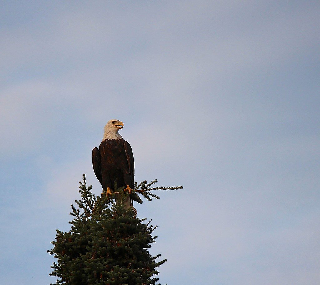
The area is home to a variety of wildlife, including moose, black bears, beavers, loons, and bald eagles.
Cities near Lower Basswood Falls
Nearby Waterfalls

Other waterfalls named Lower Basswood Falls
1 other waterfall shares this name across the U.S.
Writing about Lower Basswood Falls? Embed this waterfall on your site for free.