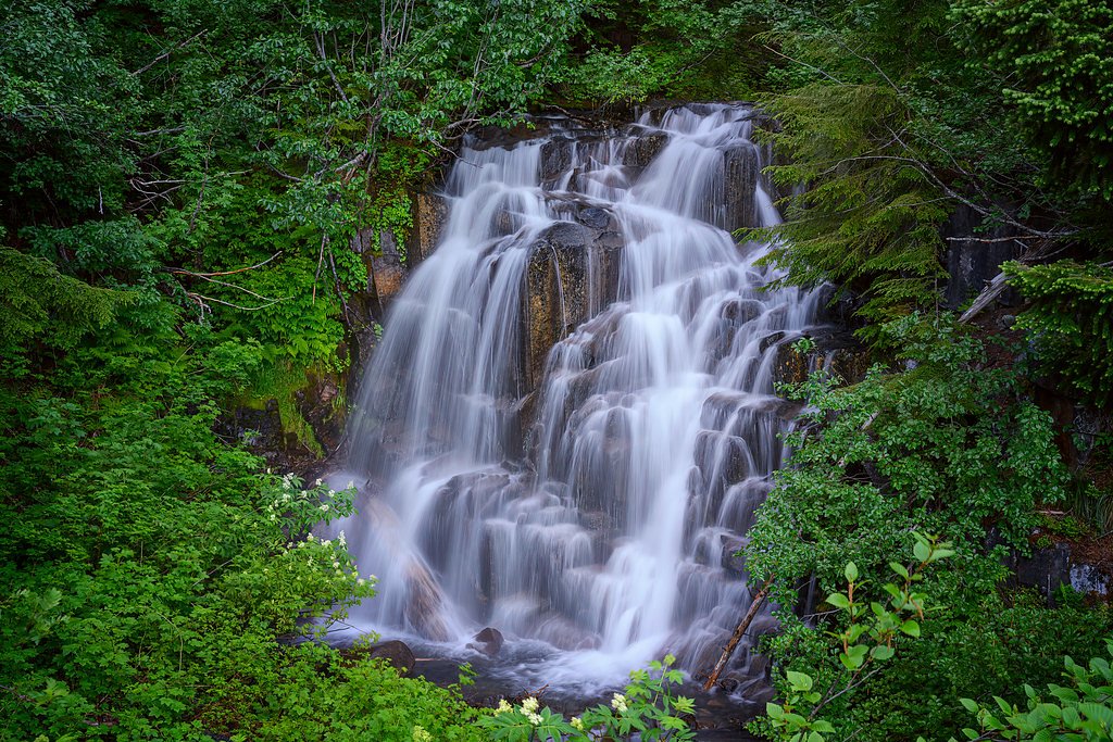
Loowit Falls
By Armen Suny · Last verified Mar 2026
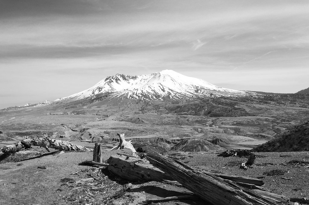
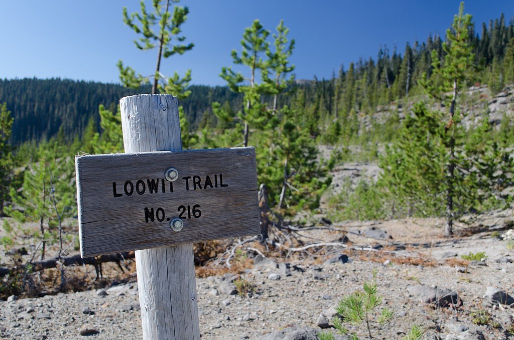
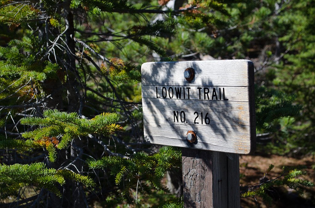
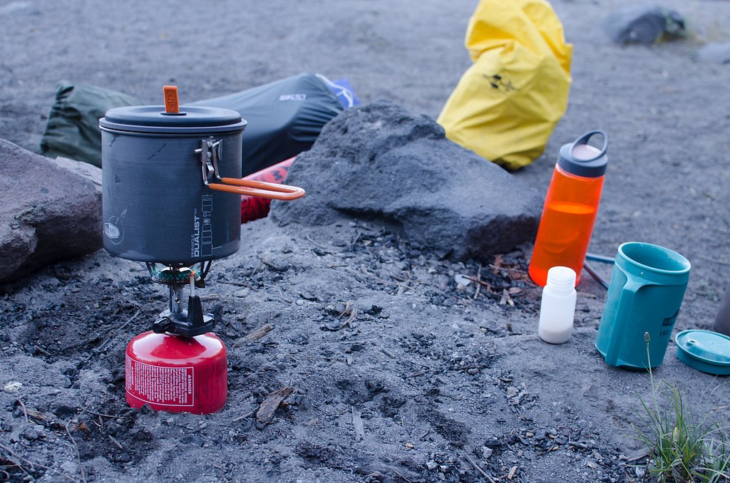

Photo Credits (5)
Difficulty
Moderate
Trail Length
2.4 miles
Trail Type
Out And Back
Elevation Gain
350 ft
About Loowit Falls
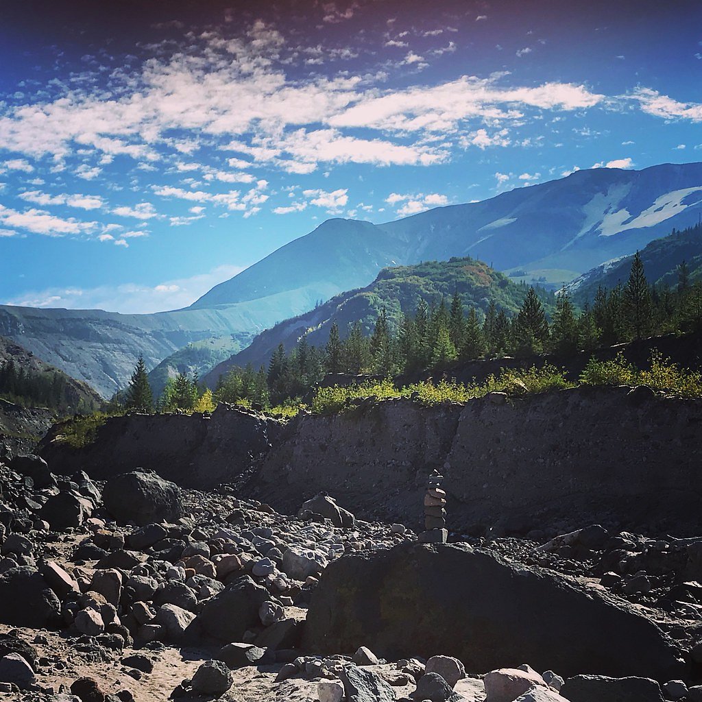
Loowit Falls is a striking waterfall located on the north side of Mount St. Helens in Washington. It is fed by glacial meltwater and runoff from the volcanic landscape, offering a unique and dramatic setting. The waterfall is part of the Mount St. Helens National Volcanic Monument and is a popular destination for hikers exploring the area.
The Setting
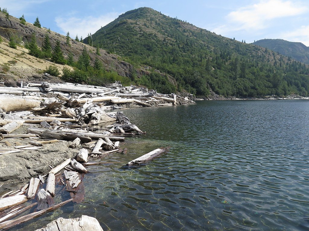
Loowit Falls sits at 4,954 feet within Gifford Pinchot National Forest, fed by the Muddy River, in the mountains of Washington.
Trail & Hike Details
The Approach
The moderate hike follows Loowit (#216), a 2.4-mile out-and-back trail over natural surface. Expect 350 feet of elevation gain with grades of 5-8%. The trail is moderately developed (Class 2).
USFS Trail
LOOWIT #216
Trail Class
Moderately Developed
Surface
Avg Grade
USFS Segment
17.40 miTrail Description
The trail to Loowit Falls traverses volcanic terrain, including ash fields, rocky paths, and exposed ridges. Hikers will experience stunning views of Mount St. Helens, the surrounding blast zone, and the waterfall itself. The trail is challenging, with uneven footing and little shade, so proper preparation is essential.
What to Expect
Expect a strenuous hike through a unique volcanic landscape. The trail offers breathtaking views of Mount St. Helens and the surrounding area, but it can be exposed to the elements, with little shade and potentially strong winds. Loowit Falls is a rewarding sight, cascading down the rugged terrain.
Accessibility
The trail is not wheelchair accessible. Uneven terrain and elevation changes require steady footing.
Frequently Asked Questions
🐶 Are Dogs Allowed at Loowit Falls?
❌ Dogs are not allowed
Are There Any Fees or Permits Required?
🤑 Fee: $0.00
Permit required
A Northwest Forest Pass or equivalent is required for parking. Additional permits may be required for certain activities within the Mount St. Helens National Volcanic Monument.
🏊 Is There Swimming at Loowit Falls?
❌ Swimming is not allowed
When to Visit
The best time to visit is late spring through early fall, when the trail is typically free of snow and the weather is more favorable. Summer offers the clearest views, but fall can provide cooler temperatures and fewer crowds.
Seasonal Access
The best time to visit is Spring, Summer, and Fall. Winter access may be limited. Check with Gifford Pinchot National Forest for seasonal road closures.
Safety Information
Hikers should be prepared for exposed conditions, including strong winds and intense sun. Volcanic terrain can be unstable, so stay on marked trails. Carry plenty of water and be aware of your physical limits. Check weather and trail conditions before your hike.
Current Water Conditions
191 ft³/s
Current discharge — how much water is flowing
Much lower than usual for this time of year
Based on 68 years of record
14.29 ft
Water depth at gauge
7-Day Discharge Trend
What does this mean for your visit?
Flow is well below normal for this time of year, so the waterfall may be a trickle.
About This Gauge
This gauge is on a nearby waterway and may not reflect exact conditions at the falls.
7-Day Flow Outlook
Based on the USGS gauge MUDDY RIVER BELOW CLEAR CREEK NEAR COUGAR, WA (22 km away).
Today
Low
206 cfs
4/10Tomorrow
Low
214 cfs
3/10Sun
Low
215 cfs
4/10Mon
Low
196 cfs
4/10Tue
Low
189 cfs
4/10Wed
Low
183 cfs
4/10Thu
Low
180 cfs
4/10Best window: Today — low flow, rain showers (trip score 4/10).
Best time of year: this gauge typically runs highest from late March to late May, peaking in May.
How we calculate this
This is a transparent outlook, not a precise forecast. We take the waterfall's current flow strength (how it ranks against its historical normal for today, from the nearest USGS stream gauge), carry that ranking forward along the gauge's seasonal curve, and nudge it for forecast rain. Confidence is highest for the next day or two and falls further out. Always check official conditions and your own judgment before visiting — high flows can be dangerous.
Know when to go.
Get a free email alert when waterfalls near Cougar hit peak flow. We only send when conditions are worth the trip — no weekly newsletters, no spam.
Weather Forecast
Location & Access
Getting There
Loowit Falls is accessed via the Loowit Trail, which encircles Mount St. Helens. The most common starting point is the Johnston Ridge Observatory or other trailheads within the Mount St. Helens National Volcanic Monument. The trail to the falls requires a significant hike through rugged volcanic terrain.
Get Directions on Google MapsParking
Parking is available at designated trailheads, such as the Johnston Ridge Observatory. Parking may require a Northwest Forest Pass or other applicable permits.
Elevation
4,954 feet above sea level
Coordinates
46.223620° N, -122.183601° W
Land Management
Managed by USFS
Visitor Tips & Gear
Start early to avoid the heat and ensure you have enough time to complete the hike. Bring plenty of water, as there are no reliable water sources along the trail. Wear sturdy hiking boots and be prepared for uneven, rocky terrain. Check trail conditions before heading out, as volcanic terrain can be unstable.
As an Amazon Associate, we earn from qualifying purchases.
With 2.4 miles and 350 ft of elevation gain, sturdy boots and trekking poles will help on this moderate trail. Sun exposure on the trail makes good sun protection a must in summer.

Polarized Sunglasses (Knockaround)
Cuts glare off the water so you actually see the falls — and your photos turn out better too.

Columbia Watertight II Rain Jacket
Packs into its own pocket, seam-sealed, and keeps you dry from spray and surprise rain.

Earth Pak Waterproof Dry Bag
Keeps your phone and gear dry when waterfall mist soaks everything else.

Waterproof Phone Pouch (AiRunTech)
Cheap insurance — take photos right next to the falls without killing your phone.

Timberland Euro Sprint Mid Waterproof
Trusted waterproof boot with premium leather and grippy rubber sole — reliable on rocky, wet trails.

TrailBuddy Trekking Poles
Lightweight aluminum, cork grips, and flip-locks that actually hold — a best-seller for good reason.
Where to Stay

Lone Fir Resort

4-Bedroom Chateau in Southern Washington- Luxurious Retreat with Pond & Creek

Explore Mt St Helens A-Frame Chalet with Deck!

Riverfront Woodland Cabin: Wooded & Forested Views
Browse vacation cabins and private rentals nearby
Unique outdoor stays — tents, yurts, and treehouses
Rent a campervan or RV for your waterfall road trip
Some links are affiliate links. We may earn a commission at no extra cost to you.
Nearby Campground
LOWER FALLS CAMPGROUND
15.3 miles away · 44 sites
Overview Lower Falls Campground is located in the Gifford Pinchot National Forest. Visitors enjoy several waterfalls in the area and access to the Lewis River Trail. The campground is open from mid-May through October.Recreation Near the campground are several trailheads that provide visitors with a variety of recreational opportunities. There are hiking trails, mountain bike trails, horse trails, and motorcycle trails within 10 miles of the campground. The Lewis River contains rainbow, cutthroat
Book on Recreation.govNearby Hot Springs
Hot springs near Cougar, Washington

Mt St Helens Fumaroles
Mount St. Helens fumaroles reach 190 degrees at 6,906 feet elevation on the crater rim, emerging 159.1 degrees above ambient in...
Green River Soda Spring
Green River Soda Spring produces 86-degree carbonated water at 1,644 feet elevation, flowing 37.5 degrees above ambient tempera...

Mount Adams Fumaroles
Mount Adams fumaroles reach 150 degrees at 12,269 feet elevation, emerging 136 degrees above ambient on Washington's second-hig...
Orr Creek Warm Springs
Orr Creek Warm Springs emerges at 72 degrees in the Gifford Pinchot National Forest at 2,910 feet elevation, flowing 26.5 degre...
Rock Creek Hot Springs
Rock Creek Hot Springs emerges in the Columbia River Gorge in Skamania County, Washington, with water documented as 'hot' witho...
Moffetts (Bonneville) Hot Springs
Moffetts Hot Springs, also called Bonneville Hot Springs, flows at 97 degrees in the Gifford Pinchot National Forest at just 75...
Looking for a soak after your hike? Explore more hot springs near Cougar, Washington on SoakingSprings.
Explore Washington springsAdditional Information
Nearby Attractions
Nearby attractions include the Johnston Ridge Observatory, Spirit Lake, and other trails within the Mount St. Helens National Volcanic Monument.
Wildlife
Wildlife in the area may include elk, mountain goats, and various bird species. Be cautious of the fragile volcanic ecosystem.
Cities near Loowit Falls
Nearby Waterfalls
Other waterfalls named Loowit Falls
1 other waterfall shares this name across the U.S.
Writing about Loowit Falls? Embed this waterfall on your site for free.