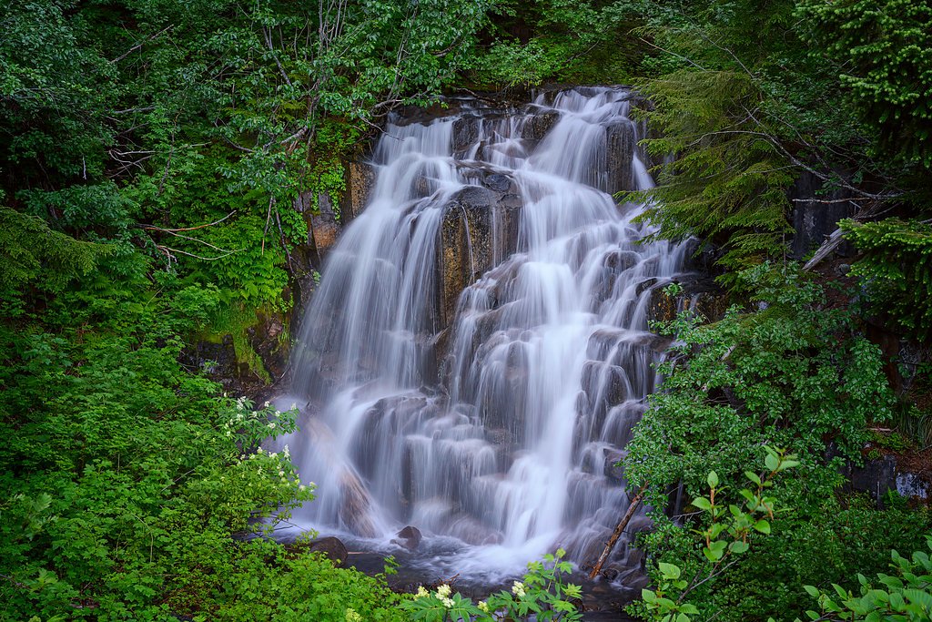
Harmony Falls
By Armen Suny · Last verified Mar 2026
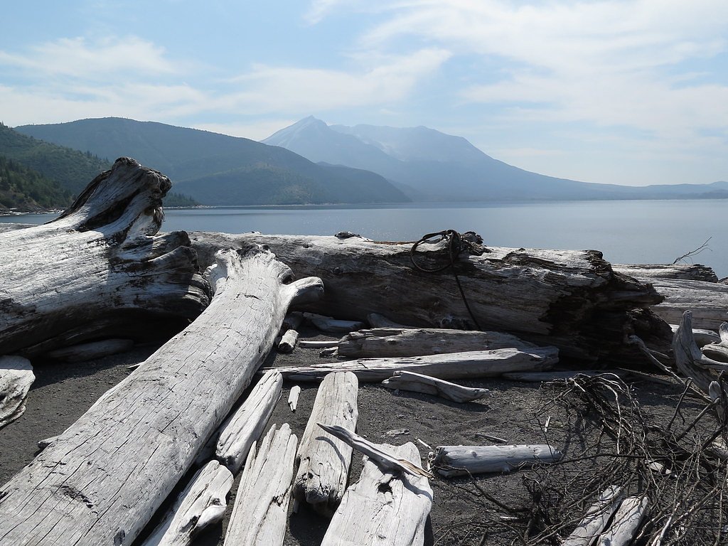
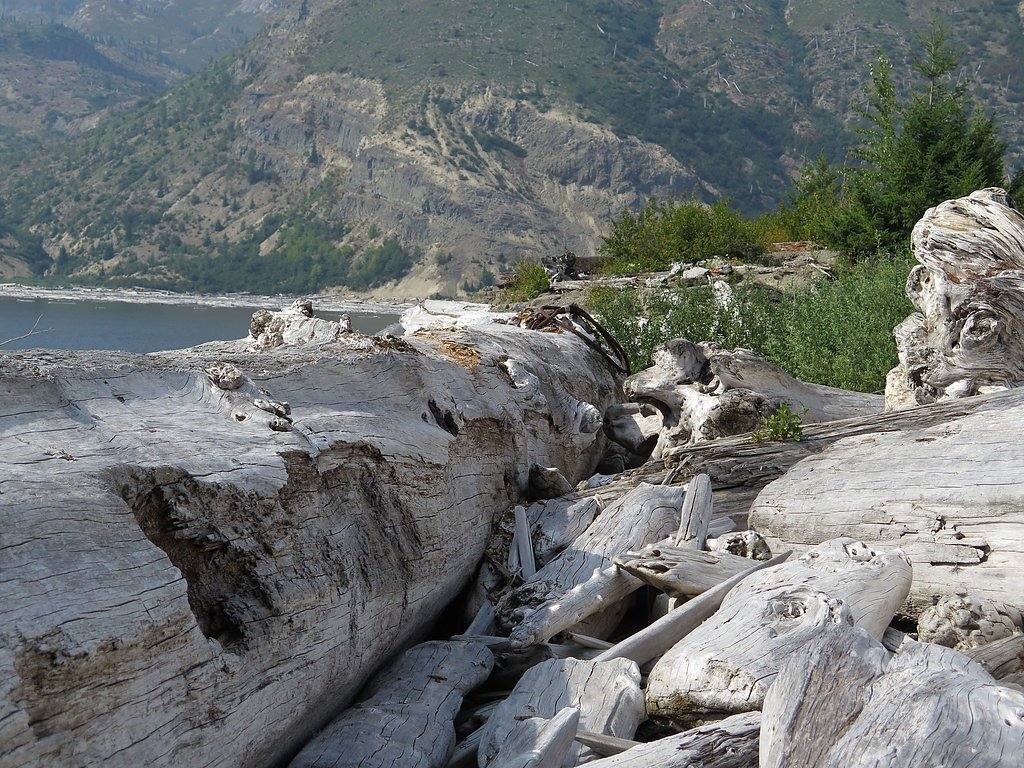
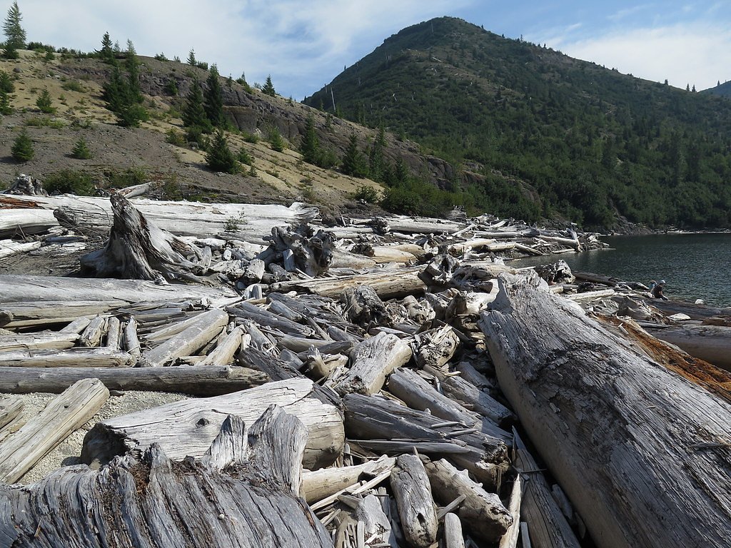
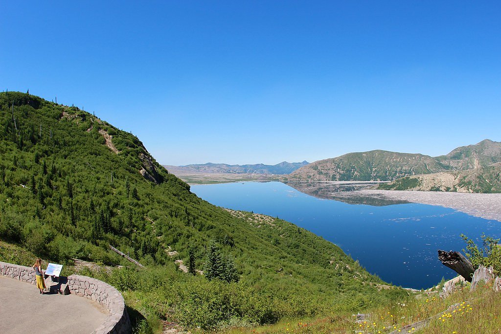

Photo Credits (5)
Difficulty
Moderate
Trail Length
2.4 miles
Trail Type
Out And Back
Elevation Gain
350 ft
About Harmony Falls
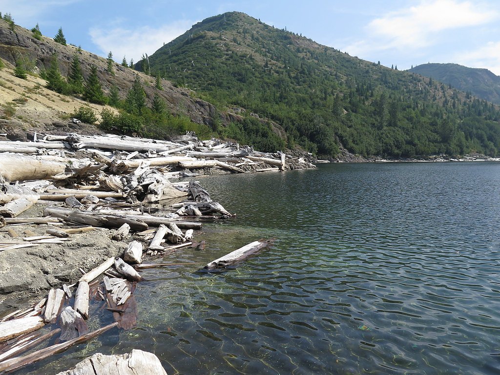
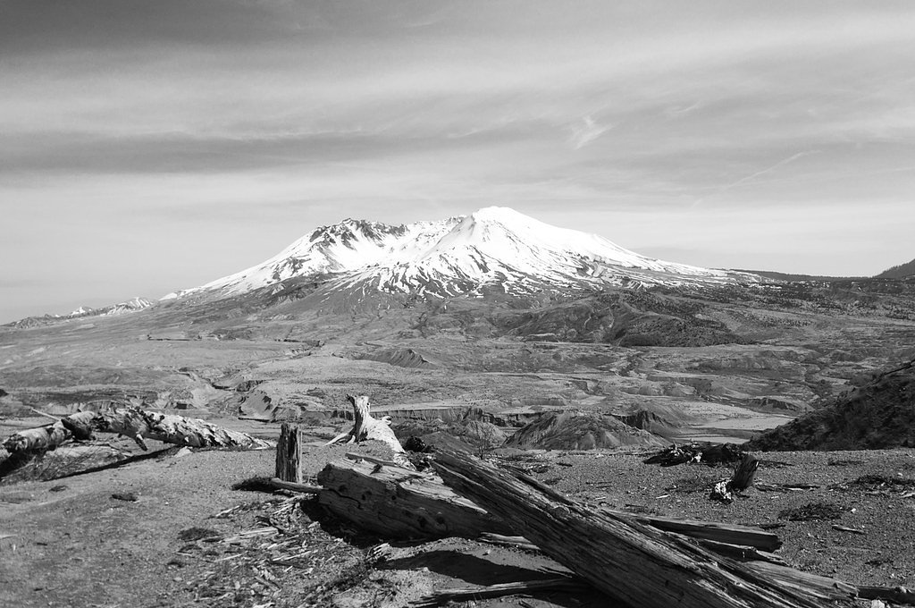
Harmony Falls is a scenic waterfall located on the northeastern shore of Spirit Lake in Washington, within the Mount St. Helens National Volcanic Monument. The waterfall is notable for its proximity to the site of the 1980 Mount St. Helens eruption, which drastically altered the surrounding landscape.
The Setting
Harmony Falls sits at 3,848 feet within Gifford Pinchot National Forest, fed by the Cowlitz River, in the mountains of Washington.
Trail & Hike Details
The Approach
The moderate hike follows Harmony (#224), a 2.4-mile out-and-back trail over natural surface. Expect 350 feet of elevation gain with grades of 12-20%. The trail is developed (Class 3).
USFS Trail
HARMONY #224
Trail Class
Developed
Surface
Avg Grade
USFS Segment
1.05 miTrail Description
There is limited information about a formal trail leading to Harmony Falls. The area around Spirit Lake is heavily regulated due to ecological recovery and safety concerns, and access may be restricted.
What to Expect
Visitors to Harmony Falls should expect a remote and potentially inaccessible location. The waterfall is surrounded by the unique volcanic landscape created by the 1980 eruption of Mount St. Helens, offering a glimpse into the area's natural recovery.
Accessibility
The trail is not wheelchair accessible. Uneven terrain and elevation changes require steady footing.
Frequently Asked Questions
🐶 Are Dogs Allowed at Harmony Falls?
❌ Dogs are not allowed
Are There Any Fees or Permits Required?
🤑 Fee: $5.00
Permit required
Permits may be required to access restricted areas near Spirit Lake, including Harmony Falls. Contact the U.S. Forest Service for details.
🏊 Is There Swimming at Harmony Falls?
❌ Swimming is not allowed
When to Visit
Spring and summer are the best times to visit the Mount St. Helens area, as weather conditions are more favorable and access to nearby trails is typically better.
Seasonal Access
The best time to visit is Spring, Summer, and Fall. Winter access may be limited. Check with Gifford Pinchot National Forest for seasonal road closures.
Safety Information
The area around Spirit Lake is remote and may have unstable terrain. Visitors should exercise caution and be aware of potential hazards such as loose rocks, steep slopes, and restricted access zones.
Current Water Conditions
2,260 ft³/s
Current discharge — how much water is flowing
Much lower than usual for this time of year
Based on 78 years of record
7-Day Discharge Trend
What does this mean for your visit?
Flow is well below normal for this time of year, so the waterfall may be a trickle.
About This Gauge
This gauge is on a nearby waterway and may not reflect exact conditions at the falls.
7-Day Flow Outlook
Based on the USGS gauge COWLITZ RIVER NEAR KOSMOS, WA (20 km away).
Today
Moderate
2576 cfs
4/10Tomorrow
Moderate
2713 cfs
4/10Sun
Moderate
2518 cfs
5/10Mon
Moderate
2373 cfs
5/10Tue
Moderate
2245 cfs
5/10Wed
Moderate
2195 cfs
5/10Thu
Moderate
2185 cfs
5/10Best window: Sun — moderate flow, rain showers likely (trip score 5/10).
Best time of year: this gauge typically runs highest from early April to late June, peaking in June.
How we calculate this
This is a transparent outlook, not a precise forecast. We take the waterfall's current flow strength (how it ranks against its historical normal for today, from the nearest USGS stream gauge), carry that ranking forward along the gauge's seasonal curve, and nudge it for forecast rain. Confidence is highest for the next day or two and falls further out. Always check official conditions and your own judgment before visiting — high flows can be dangerous.
Know when to go.
Get a free email alert when waterfalls near Cougar hit peak flow. We only send when conditions are worth the trip — no weekly newsletters, no spam.
Weather Forecast
Location & Access
Getting There
Access to Harmony Falls is challenging due to its location near Spirit Lake, which is within a restricted area of the Mount St. Helens National Volcanic Monument. The area is not easily accessible by road or trail, and visitors may need special permits or guided tours to approach the site.
Get Directions on Google MapsParking
There is no designated parking area for Harmony Falls due to its remote location. Visitors may need to park at nearby trailheads or visitor centers and plan for alternative access.
Elevation
3,848 feet above sea level
Coordinates
46.282333° N, -122.102872° W
Land Management
Managed by USFS
Visitor Tips & Gear
Check with the Mount St. Helens National Volcanic Monument or the U.S. Forest Service for the latest information on access and permits. Be prepared for rugged terrain and limited facilities in the area.
As an Amazon Associate, we earn from qualifying purchases.
With 2.4 miles and 350 ft of elevation gain, sturdy boots and trekking poles will help on this moderate trail. Sun exposure on the trail makes good sun protection a must in summer.

Polarized Sunglasses (Knockaround)
Cuts glare off the water so you actually see the falls — and your photos turn out better too.

Columbia Watertight II Rain Jacket
Packs into its own pocket, seam-sealed, and keeps you dry from spray and surprise rain.

Earth Pak Waterproof Dry Bag
Keeps your phone and gear dry when waterfall mist soaks everything else.

Waterproof Phone Pouch (AiRunTech)
Cheap insurance — take photos right next to the falls without killing your phone.

Timberland Euro Sprint Mid Waterproof
Trusted waterproof boot with premium leather and grippy rubber sole — reliable on rocky, wet trails.

TrailBuddy Trekking Poles
Lightweight aluminum, cork grips, and flip-locks that actually hold — a best-seller for good reason.
Where to Stay

Seasons Motel

Luxe Lake Cabin Hot tub Grill Firepit EV charger

Explore Mt St Helens A-Frame Chalet with Deck!

Rustic Cougar Cabin with Wood-Burning Fire Pit!
Browse vacation cabins and private rentals nearby
Unique outdoor stays — tents, yurts, and treehouses
Rent a campervan or RV for your waterfall road trip
Some links are affiliate links. We may earn a commission at no extra cost to you.
Nearby Campground
Iron Creek Campground
11.6 miles away · 99 sites
Overview Iron Creek Campground sits near the confluence of Iron Creek and the Cispus River. This large campground winds through a forest of old-growth Douglas firs, cedars and hemlock. Lush vegetation and ample space between sites offers excellent privacy. Recreation Iron Creek provides great fishing for cutthroat trout, whitefish and rainbow trout. Visitors can stroll along the .3-mile Iron Creek Old Growth Trail and weave through the forest and along the Cispus River, or continue on a longer wa
Book on Recreation.govNearby Hot Springs
Hot springs near Cougar, Washington

Mt St Helens Fumaroles
Mount St. Helens fumaroles reach 190 degrees at 6,906 feet elevation on the crater rim, emerging 159.1 degrees above ambient in...
Green River Soda Spring
Green River Soda Spring produces 86-degree carbonated water at 1,644 feet elevation, flowing 37.5 degrees above ambient tempera...
Orr Creek Warm Springs
Orr Creek Warm Springs emerges at 72 degrees in the Gifford Pinchot National Forest at 2,910 feet elevation, flowing 26.5 degre...

Mount Adams Fumaroles
Mount Adams fumaroles reach 150 degrees at 12,269 feet elevation, emerging 136 degrees above ambient on Washington's second-hig...
Packwood Hot Spring
Packwood Hot Spring flows at 100 degrees at 1,002 feet elevation in the lower Cascade foothills near Morton, emerging 49.8 degr...
Rock Creek Hot Springs
Rock Creek Hot Springs emerges in the Columbia River Gorge in Skamania County, Washington, with water documented as 'hot' witho...
Looking for a soak after your hike? Explore more hot springs near Cougar, Washington on SoakingSprings.
Explore Washington springsAdditional Information
Nearby Attractions
Nearby attractions include the Johnston Ridge Observatory, Windy Ridge Viewpoint, and other trails within the Mount St. Helens National Volcanic Monument.
Wildlife
The area around Spirit Lake is home to recovering wildlife populations, including elk, deer, and various bird species.
Cities near Harmony Falls
Nearby Waterfalls
Other waterfalls named Harmony Falls
1 other waterfall shares this name across the U.S.
Writing about Harmony Falls? Embed this waterfall on your site for free.