Photo Credits (3)
Difficulty
Moderate
Trail Length
2.4 miles
Trail Type
Out And Back
Elevation Gain
350 ft
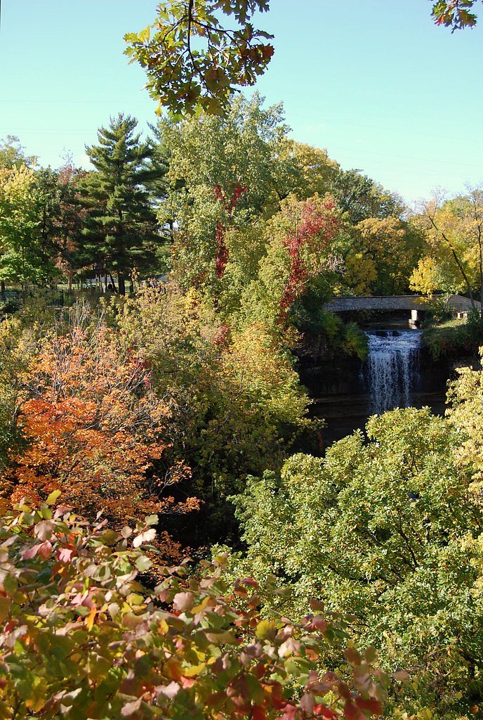
About Little Rock Falls
Little Rock Falls is a small, picturesque cascade on Little Rock Creek tucked into a quiet, forested stretch of Minnesota woodland. The falls reward a short hike with a tranquil scene of rushing water framed by trees and mossy rock—an inviting spot for photographers, birdwatchers, and anyone looking for a peaceful nature outing. The route to the falls is a moderate 2.4-mile out-and-back that climbs roughly 350 feet, making it a satisfying half-day excursion for most hikers.
Trail & Hike Details
The Approach
The moderate 2.4-mile out-and-back trail gains 350 feet of elevation on the way to the falls.
Trail Description
This out-and-back route is 2.4 miles round trip with about 350 feet of elevation gain and is rated moderate. The trail is natural, with potentially uneven footing through forested paths and occasional open stretches—hikers should bring sturdy footwear and be prepared for roots and rocks underfoot. No official USFS trail number, surface/grade, or classification data is provided for this route.
What to Expect
Expect a peaceful and scenic environment with a small waterfall surrounded by natural beauty. The area may be less crowded compared to other popular waterfalls in Minnesota.
Accessibility
The trail is not wheelchair accessible. Uneven terrain and elevation changes require steady footing.
Frequently Asked Questions
🐶 Are Dogs Allowed at Little Rock Falls?
❌ Dogs are not allowed
Are There Any Fees or Permits Required?
🆖 No fees required
🏊 Is There Swimming at Little Rock Falls?
❌ Swimming is not allowed
When to Visit
Spring and early summer are ideal for visiting, as the waterfall may have higher water flow due to snowmelt and rainfall.
Seasonal Access
The best time to visit is Spring, Summer, and Fall. Winter access may be limited.
Safety Information
Visitors should be cautious of slippery rocks near the waterfall and uneven terrain on the trail. Always stay on marked paths and avoid getting too close to the water's edge.
Know when to go.
Get a free email alert when waterfalls near Lutsen hit peak flow. We only send when conditions are worth the trip — no weekly newsletters, no spam.
Weather Forecast
Location & Access
Getting There
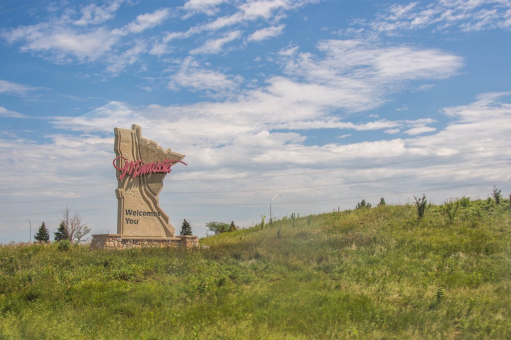
Little Rock Falls is located in central Minnesota. Specific directions may vary depending on your starting location, but it is accessible via local roads. Visitors are advised to use GPS or consult local maps for the most accurate route.
Get Directions on Google MapsParking
Parking availability is not well-documented. Visitors should plan to park in designated areas nearby or along the road if permitted.
Elevation
1,545 feet above sea level
Coordinates
48.118778° N, -90.773999° W
Visitor Tips & Gear
Check weather conditions before visiting, as trails may become muddy or slippery after rain. Bring insect repellent during warmer months to protect against mosquitoes.
As an Amazon Associate, we earn from qualifying purchases.
With 2.4 miles and 350 ft of elevation gain, sturdy boots and trekking poles will help on this moderate trail. Sun exposure on the trail makes good sun protection a must in summer.

Polarized Sunglasses (Knockaround)
Cuts glare off the water so you actually see the falls — and your photos turn out better too.

Columbia Watertight II Rain Jacket
Packs into its own pocket, seam-sealed, and keeps you dry from spray and surprise rain.

Earth Pak Waterproof Dry Bag
Keeps your phone and gear dry when waterfall mist soaks everything else.

Waterproof Phone Pouch (AiRunTech)
Cheap insurance — take photos right next to the falls without killing your phone.

Timberland Euro Sprint Mid Waterproof
Trusted waterproof boot with premium leather and grippy rubber sole — reliable on rocky, wet trails.

TrailBuddy Trekking Poles
Lightweight aluminum, cork grips, and flip-locks that actually hold — a best-seller for good reason.
Where to Stay
Browse vacation cabins and private rentals nearby
Unique outdoor stays — tents, yurts, and treehouses
Rent a campervan or RV for your waterfall road trip
Some links are affiliate links. We may earn a commission at no extra cost to you.
Nearby Campground
TRAILS END CAMPGROUND
6.2 miles away · 33 sites
Overview Trail's End Campground is located next to the Boundary Waters Canoe Area Wilderness (BWCAW) in a remote area of Superior National Forest in northern Minnesota. It is a wonderful place to sit and enjoy life, or get out on the water to canoe and fish. Berry picking and wildlife viewing are also great fun. Recreation Trail's End includes four entry points (54, 55, J and K) into the BWCAW, offering plenty of boating, canoeing and fishing opportunities. Overnight, day use and boat motor permi
Book on Recreation.govAdditional Information
Nearby Attractions
Nearby attractions may include other natural areas and parks in central Minnesota. Specific recommendations are not documented.
Wildlife
The area may feature common Minnesota wildlife such as deer, birds, and small mammals. Visitors should be cautious and avoid feeding wildlife.
Cities near Little Rock Falls
Nearby Waterfalls
Writing about Little Rock Falls? Embed this waterfall on your site for free.