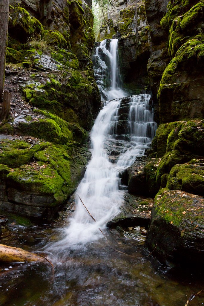
Sutton Creek Falls
By Armen Suny · Last verified May 2026
Difficulty
Moderate
Trail Length
2.0 miles
Trail Type
Out And Back
Elevation Gain
300 ft
About Sutton Creek Falls
Sutton Creek Falls is a tucked-away cascade nestled within the Kootenai National Forest and managed by the U.S. Forest Service. The falls reward hikers with a serene forest setting and a relatively low-traffic experience—perfect for those seeking a peaceful outing rather than a busy landmark. Because the site lies on national forest lands, the setting feels wild and well-preserved, with mature trees framing the creek and the sound of falling water carrying through the canopy. Access is straightforward and family-friendly: the route to the falls is an out-and-back that covers 2.0 miles with about 300 feet of elevation gain and is rated moderate. If you want to make it an overnight trip, the Koocanusa Area campground is nearby (about 5.91 km away), offering a convenient basecamp for morning or evening visits.
The Setting
Sutton Creek Falls sits at 3,612 feet within Kootenai National Forest, fed by the Tobacco River, in the mountains of Montana.
Trail & Hike Details
The Approach
The moderate hike follows Beartrap Ponds (#276), a 2.0-mile out-and-back trail over natural surface. Expect 300 feet of elevation gain with grades of 10-12%. The trail is moderately developed (Class 2).
USFS Trail
BEARTRAP PONDS #276
Trail Class
Moderately Developed
Surface
Avg Grade
USFS Segment
0.09 miTrail Description
The approach to Sutton Creek Falls follows a 2.0-mile out-and-back route with roughly 300 feet of climbing and a moderate difficulty rating. Much of the route is on native-material tread; the U.S. Forest Service lists the main connector as BEARTRAP PONDS Trail #276 (USFS GIS length 0.09 miles), classified as Class 2 with a typical grade of 10–12%. Expect mostly natural surface underfoot and a few short steeper pitches where the grade approaches that 10–12% range. The trail type is out-and-back and is best suited to hikers comfortable on native-surface trails rather than paved paths. Trail conditions will reflect the forest setting and management by the USFS, so wear appropriate footwear and plan for a moderately paced hike to reach the falls.
What to Expect
Visitors can expect a peaceful hike with opportunities to enjoy the sounds of nature and the beauty of the falls. The area is relatively secluded, so it is unlikely to be crowded.
Accessibility
The trail is not wheelchair accessible. Uneven terrain and elevation changes require steady footing.
Frequently Asked Questions
🐶 Are Dogs Allowed at Sutton Creek Falls?
❌ Dogs are not allowed
Are There Any Fees or Permits Required?
🆖 No fees required
🏊 Is There Swimming at Sutton Creek Falls?
❌ Swimming is not allowed
When to Visit
Spring and early summer are ideal times to visit, as the waterfall flow is typically strongest due to snowmelt. Fall offers beautiful foliage, while summer provides warmer weather for hiking.
Seasonal Access
The best time to visit is Spring, Summer, and Fall. Winter access may be limited. Check with Kootenai National Forest for seasonal road closures.
Safety Information
The trail may be slippery near the falls, especially after rain. Visitors should stay on marked paths and avoid getting too close to the edge. Be prepared for changing weather conditions.
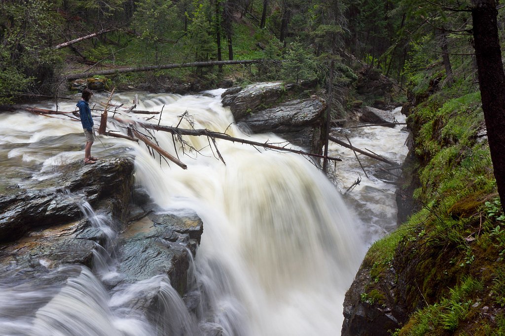
Current Water Conditions
367 ft³/s
Current discharge — how much water is flowing
About average for this time of year
Based on 10 years of record
3.36 ft
Water depth at gauge
7-Day Discharge Trend
What does this mean for your visit?
Flow is about average for this time of year.
About This Gauge
This gauge is on a nearby waterway and may not reflect exact conditions at the falls.
7-Day Flow Outlook
Based on the USGS gauge Tobacco River at Eureka, MT (20 km away).
Today
Low
414 cfs
3/10Tomorrow
Moderate
430 cfs
4/10Mon
Moderate
409 cfs
4/10Tue
Moderate
379 cfs
5/10Wed
Low
317 cfs
6/10Thu
Low
290 cfs
6/10Fri
Low
307 cfs
4/10Best window: Wed — low flow, mostly sunny (trip score 6/10).
Best time of year: this gauge typically runs highest from early April to early July, peaking in May.
How we calculate this
This is a transparent outlook, not a precise forecast. We take the waterfall's current flow strength (how it ranks against its historical normal for today, from the nearest USGS stream gauge), carry that ranking forward along the gauge's seasonal curve, and nudge it for forecast rain. Confidence is highest for the next day or two and falls further out. Always check official conditions and your own judgment before visiting — high flows can be dangerous.
Know when to go.
Get a free email alert when waterfalls near Rexford hit peak flow. We only send when conditions are worth the trip — no weekly newsletters, no spam.
Weather Forecast
Location & Access
Getting There
Sutton Creek Falls is located in a remote area of Montana. Access typically requires driving on unpaved roads, and visitors should ensure their vehicle is suitable for such conditions. Exact directions may vary, so consulting a reliable map or GPS is recommended.
Get Directions on Google MapsParking
Parking availability is limited and may consist of informal pull-offs near the trailhead. Visitors should plan accordingly.
Elevation
3,612 feet above sea level
Coordinates
48.770239° N, -115.266283° W
Land Management
Managed by USFS
Visitor Tips & Gear
Wear sturdy hiking shoes and bring plenty of water. Bug spray is recommended during warmer months. Cell service may be limited, so download maps or directions in advance.
As an Amazon Associate, we earn from qualifying purchases.
With 2.0 miles and 300 ft of elevation gain, sturdy boots and trekking poles will help on this moderate trail. Sun exposure on the trail makes good sun protection a must in summer.

Columbia Watertight II Rain Jacket
Packs into its own pocket, seam-sealed, and keeps you dry from spray and surprise rain.

Earth Pak Waterproof Dry Bag
Keeps your phone and gear dry when waterfall mist soaks everything else.

Waterproof Phone Pouch (AiRunTech)
Cheap insurance — take photos right next to the falls without killing your phone.

Timberland Euro Sprint Mid Waterproof
Trusted waterproof boot with premium leather and grippy rubber sole — reliable on rocky, wet trails.

TrailBuddy Trekking Poles
Lightweight aluminum, cork grips, and flip-locks that actually hold — a best-seller for good reason.

Polarized Sunglasses (Knockaround)
Cuts glare off the water so you actually see the falls — and your photos turn out better too.
Where to Stay

Eureka Vacation Rental Steps to Creek and Fishing!

Stunning Montana Retreat Hot Tub, On-Site Hiking!

Ohana Ranch

Maggies Cabin - Enjoy a Slice of Paradise in Rexford Montana
Browse vacation cabins and private rentals nearby
Unique outdoor stays — tents, yurts, and treehouses
Rent a campervan or RV for your waterfall road trip
Some links are affiliate links. We may earn a commission at no extra cost to you.
Nearby Campground
Koocanusa Area
3.7 miles away · 0 sites
The Koocanusa Area is primarily centered along a narrow 90 mile long Koocanusa Reservoir, formed by Libby Dam. Approximately 60 miles are within the United States. Libby Dam is operated by the US Army Corps of Engineers which provides daily dam tours. Koocanusa Reservoir is the major recreation attraction in this geographic area, providing ideal settings for large watercraft and sailing. The reservoir contains a large and stable population of Kookanee salmon, Kamloops (rainbow) trout, bull tr
Book on Recreation.govAdditional Information
Nearby Attractions
Other hiking trails and natural attractions in the surrounding area may be worth exploring.
Wildlife
The area is home to various wildlife, including deer, birds, and possibly bears. Visitors should practice bear safety and carry bear spray.
Cities near Sutton Creek Falls
Nearby Waterfalls
Writing about Sutton Creek Falls? Embed this waterfall on your site for free.