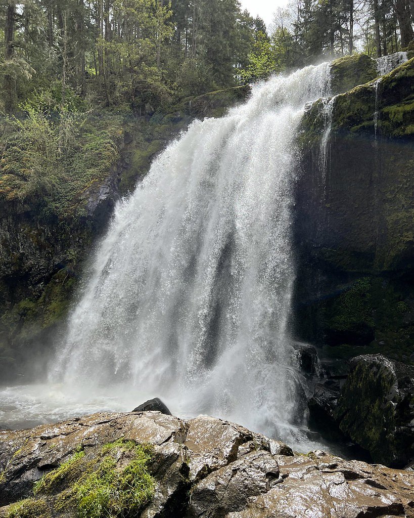
Little Mashel Falls
By Armen Suny · Last verified May 2026
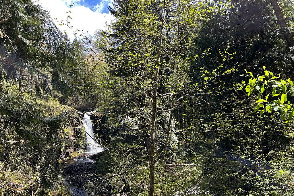
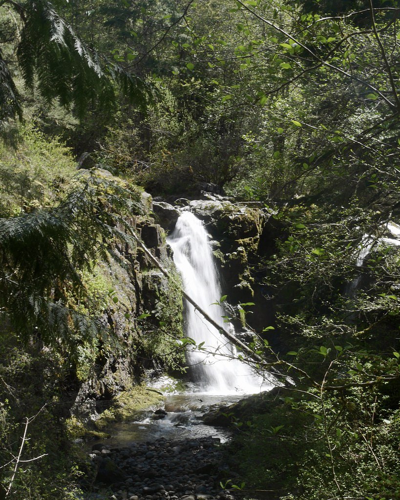
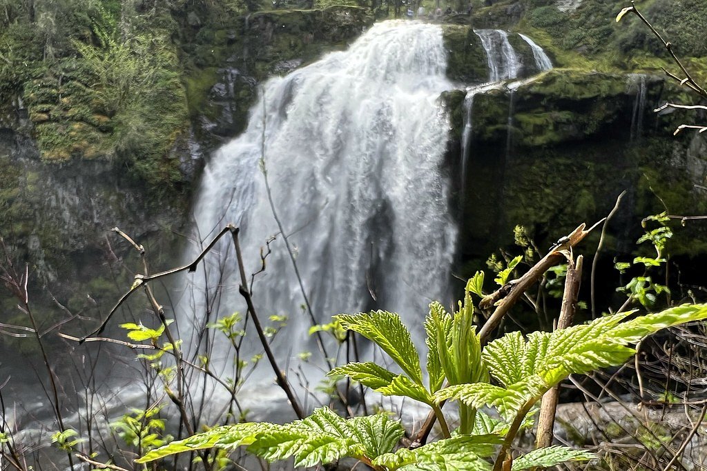
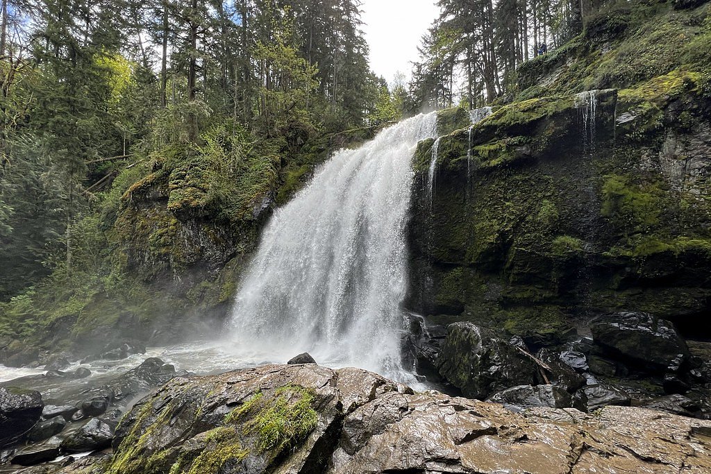
Photo Credits (5)
Difficulty
Moderate
Trail Length
5.3 miles
Trail Type
Out And Back
Elevation Gain
600 ft
About Little Mashel Falls
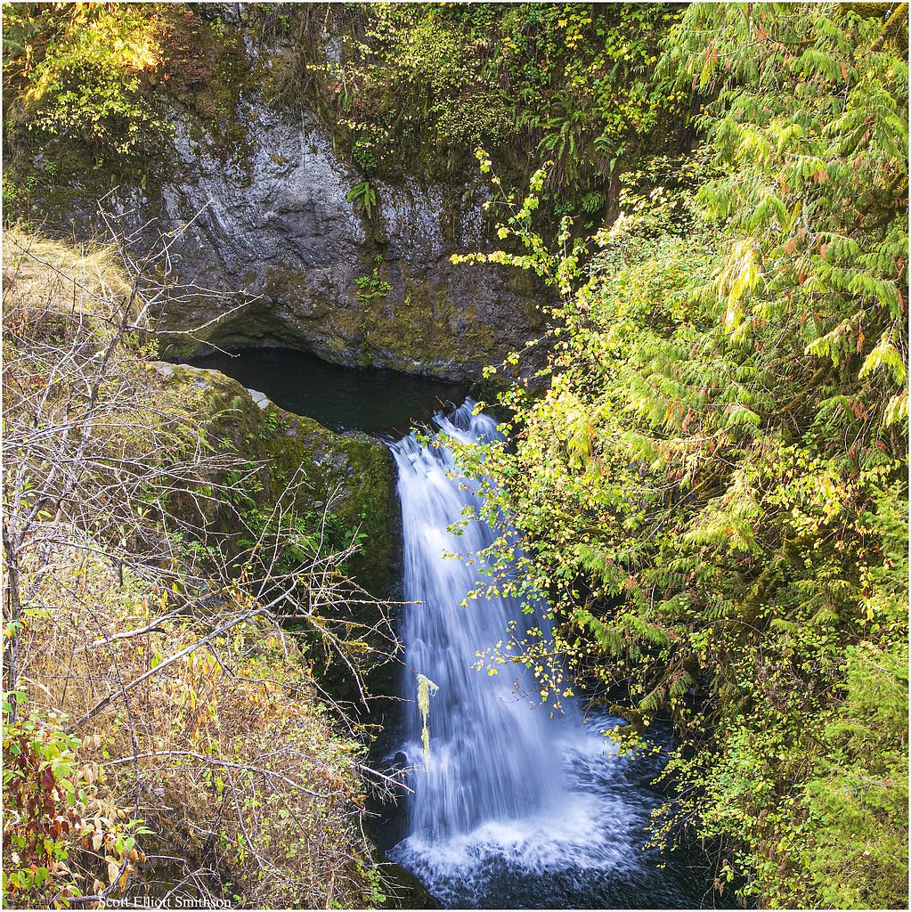
Little Mashel Falls is a photogenic series of three drops on the Little Mashel River tucked into the Pack Forest area of Washington. The falls — commonly described as the Lower, Middle and Upper Falls — plunge through lush, mossy forest within the Charles Lathrop Pack Experimental and Demonstration Forest, a Special Recreation Management Area (SRMA) managed by OTHS. Visitors come for close-up viewpoints of each cascade and the intimate, wooded gorge that frames them. The setting feels wild and green even on busy weekends, with a network of short viewpoints and rough scramble lines that bring you close to roaring water and cliffside pools. The nearest developed camping is Big Creek Campground in the Gifford Pinchot National Forest, roughly 26.3 km away, so most visitors day-hike in from nearby towns. Pack a camera and sturdy shoes — the rewards are dramatic waterfall photography and a peaceful forest atmosphere under the experimental forest’s canopy.
The Setting
Little Mashel Falls sits at 988 feet within Charles Lathrop Pack Experimental and Demonstration Forest, fed by the Mashel River, in the foothills of Washington.
Trail & Hike Details
The Approach
The moderate 5.3-mile out and back trail gains 600 feet of elevation on the way to the falls.
Trail Description
The primary access to Little Mashel Falls is an out-and-back route of about 5.3 miles round trip with approximately 600 feet of elevation gain. Rated moderate, the trail travels through dense, mixed forest and offers multiple viewpoints to the Lower, Middle and Upper Falls. The route includes some steady ups and downs and is generally well-defined, but the final approaches to the cascades involve short steep, sometimes slippery sections and rock scrambles—conditions that worsen after rain. Expect natural tread with roots and wet rock; the trail’s moderate grade is manageable for most day-hikers but requires attention on steeper segments. Because the path follows the river corridor and cliff edges in spots, use caution near viewpoints and avoid venturing onto unrecommended scramble lines.
What to Expect
Dogs are welcome.
Accessibility
The trail is not wheelchair accessible. Uneven terrain and elevation changes require steady footing.
Frequently Asked Questions
🐶 Are Dogs Allowed at Little Mashel Falls?
✅ Dogs are allowed
Are There Any Fees or Permits Required?
🆖 No fees required
🏊 Is There Swimming at Little Mashel Falls?
❌ Swimming is not allowed
When to Visit
Spring and early summer are the best times to visit, as the waterfalls are most powerful due to snowmelt and rainfall.
Seasonal Access
The best time to visit is Spring, Summer, and Fall. Winter access may be limited.
Safety Information
Exercise caution near the falls, as rocks can be slippery and the water currents are strong. Stay on marked trails and avoid venturing too close to the edges. Check weather conditions before your visit, as heavy rain can make the trail hazardous.
Current Water Conditions
25 ft³/s
Current discharge — how much water is flowing
Lower than usual for this time of year
Based on 51 years of record
2.18 ft
Water depth at gauge
7-Day Discharge Trend
What does this mean for your visit?
Flow is lower than usual for this time of year.
About This Gauge
7-Day Flow Outlook
Based on the USGS gauge MASHEL RIVER NEAR LA GRANDE, WA (2 km away).
Today
Moderate
29 cfs
6/10Tomorrow
Moderate
33 cfs
6/10Mon
Moderate
34 cfs
6/10Tue
Moderate
25 cfs
6/10Wed
Moderate
24 cfs
6/10Thu
Moderate
20 cfs
5/10Fri
Moderate
22 cfs
6/10Best window: Today — moderate flow, chance showers and thunderstorms (trip score 6/10).
Best time of year: this gauge typically runs highest from early December to late December, peaking in December.
How we calculate this
This is a transparent outlook, not a precise forecast. We take the waterfall's current flow strength (how it ranks against its historical normal for today, from the nearest USGS stream gauge), carry that ranking forward along the gauge's seasonal curve, and nudge it for forecast rain. Confidence is highest for the next day or two and falls further out. Always check official conditions and your own judgment before visiting — high flows can be dangerous.
Know when to go.
Get a free email alert when waterfalls near Eatonville hit peak flow. We only send when conditions are worth the trip — no weekly newsletters, no spam.
Weather Forecast
Location & Access
Getting There
Little Mashel Falls is located near Eatonville, Washington. The trailhead is accessible via the Pack Forest entrance, and visitors typically park near the 1000 Road or the Bud Blancher Trailhead. Follow signs for the trail leading to the falls.
Get Directions on Google MapsParking
Parking is available at the Bud Blancher Trailhead or along the 1000 Road. Parking may be limited during peak times, so arriving early is recommended.
Hours
Elevation
988 feet above sea level
Coordinates
46.849271° N, -122.272613° W
Land Management
Managed by OTHS
Visitor Tips & Gear
Wear sturdy hiking shoes, as the trail can be muddy or slippery. Bring water and snacks, and consider visiting early in the day to avoid crowds. Cell service may be limited in the area.
As an Amazon Associate, we earn from qualifying purchases.
With 5.3 miles and 600 ft of elevation gain, sturdy boots and trekking poles will help on this moderate trail. Sun exposure on the trail makes good sun protection a must in summer.

Polarized Sunglasses (Knockaround)
Cuts glare off the water so you actually see the falls — and your photos turn out better too.

Columbia Watertight II Rain Jacket
Packs into its own pocket, seam-sealed, and keeps you dry from spray and surprise rain.

Earth Pak Waterproof Dry Bag
Keeps your phone and gear dry when waterfall mist soaks everything else.

Waterproof Phone Pouch (AiRunTech)
Cheap insurance — take photos right next to the falls without killing your phone.

Timberland Euro Sprint Mid Waterproof
Trusted waterproof boot with premium leather and grippy rubber sole — reliable on rocky, wet trails.

TrailBuddy Trekking Poles
Lightweight aluminum, cork grips, and flip-locks that actually hold — a best-seller for good reason.
Where to Stay

Mountain Meadows Inn & Chalet Suites

Lafa Cabin - Luxe A Frame Retreat with Hot Tub, Sauna, Firepit- 5 Min to Mt Rainier

Mt Rainier Retreat 7 Mi to Park Entrance!

Mt Rainier Way Bedroom with Private Full Bath
Browse vacation cabins and private rentals nearby
Unique outdoor stays — tents, yurts, and treehouses
Rent a campervan or RV for your waterfall road trip
Some links are affiliate links. We may earn a commission at no extra cost to you.
Nearby Campground
Big Creek (Gifford Pinchot National Forest, WA)
16.3 miles away · 29 sites
Overview Situated in the vicinity of majestic Mount Rainier, Big Creek is a family campground nestled among Douglas firs, hemlock, alders and maples. The lush vegetation offers plenty of privacy between sites. The sites at Big Creek form a loop, with only a handful of sites sitting along the banks of Big Creek. Open from mid-May through late September, Big Creek provides an alternative to the campgrounds at Mount Rainier National Park, which can get very crowded during the summer. Recreation Angl
Book on Recreation.govNearby Hot Springs
Hot springs near Eatonville, Washington

Mt Rainier Fumaroles
Mount Rainier fumaroles reach 162 degrees at 14,217 feet elevation, emerging 154.8 degrees above ambient at Washington's highes...
Green River Soda Spring
Green River Soda Spring produces 86-degree carbonated water at 1,644 feet elevation, flowing 37.5 degrees above ambient tempera...

Longmire Mineral Springs
Longmire Mineral Springs flows at 77 degrees within Mount Rainier National Park at 2,758 feet elevation, emerging 31.9 degrees ...

Mt St Helens Fumaroles
Mount St. Helens fumaroles reach 190 degrees at 6,906 feet elevation on the crater rim, emerging 159.1 degrees above ambient in...

Ohanapecosh Hot Springs
Ohanapecosh Hot Springs flows at 122 degrees within Mount Rainier National Park at 1,920 feet elevation, emerging 74.5 degrees ...
Packwood Hot Spring
Packwood Hot Spring flows at 100 degrees at 1,002 feet elevation in the lower Cascade foothills near Morton, emerging 49.8 degr...
Looking for a soak after your hike? Explore more hot springs near Eatonville, Washington on SoakingSprings.
Explore Washington springsAdditional Information
Nearby Attractions
Mount Rainier National Park, Eatonville, and Alder Lake are nearby attractions worth exploring.
Wildlife
The area is home to various wildlife, including deer, birds, and small mammals. Be cautious of bears and other larger animals, especially during dawn and dusk.
Cities near Little Mashel Falls
Nearby Waterfalls
Writing about Little Mashel Falls? Embed this waterfall on your site for free.