
Deschutes Falls
By Armen Suny · Last verified Sep 2026
LiDAR & 3D terrain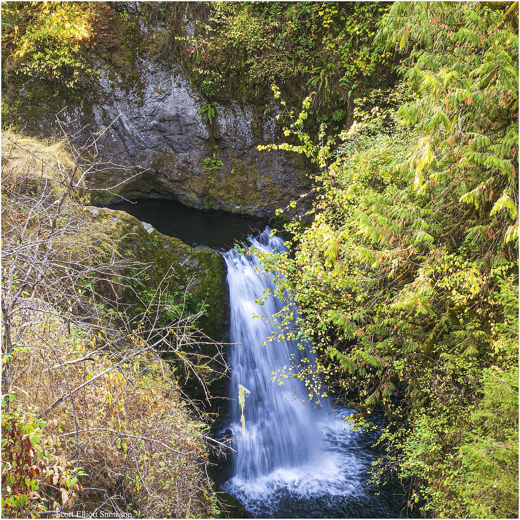
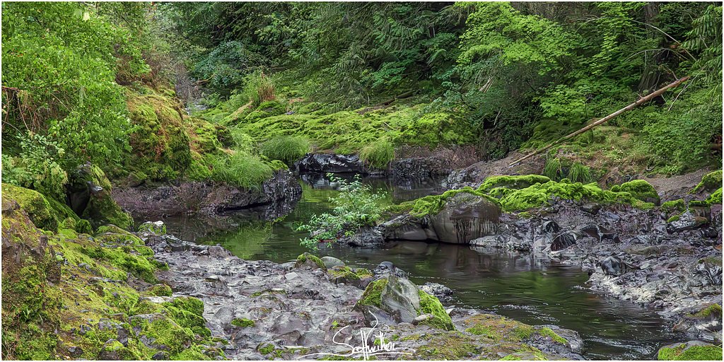
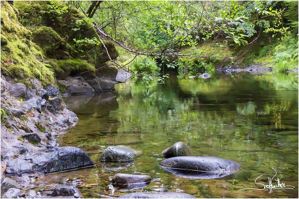
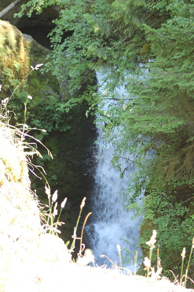
Photo Credits (5)
Difficulty
Easy
Trail Length
0.5 miles
Trail Type
Out And Back
About Deschutes Falls
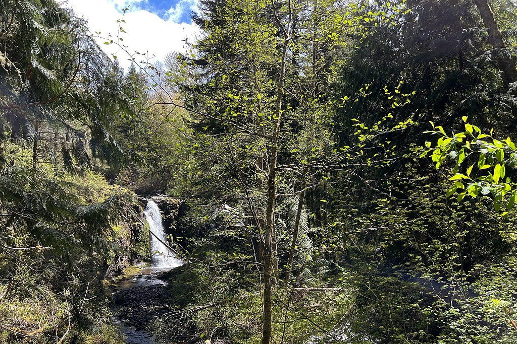
Tucked into Thurston County’s Deschutes Falls County Park and managed by the county, Deschutes Falls is a compact, photogenic cascade set amid lush Pacific Northwest forest. The falls drop into a narrow gorge along the Deschutes River, and easy viewpoints framed by mossy rocks and firs make it a favorite short-stop for hikers, photographers and families looking to soak up river scenery without a long trek. Access is straightforward but rewarding — the route through the county park threads through dense forest and opens onto vantage points that showcase the falls’ tumbling character. The setting feels intimate and wooded, offering a peaceful, close-in waterfall experience that’s especially appealing in spring and after rainy stretches.
The Setting
Deschutes Falls sits at 830 feet within Deschutes Falls County Park, fed by the Nisqually River, in the foothills of Washington.
Trail & Hike Details
Trail Description
The trail to Deschutes Falls is an out-and-back route measuring about 2.4 miles with roughly 350 feet of elevation gain, typically rated moderate. The path is well-maintained and travels through dense forest, with a steady but manageable climb that rewards you with a viewpoint overlooking the cascade. Expect a mix of packed natural tread and occasional roots and rocks; the short distance makes this a solid half-day outing for most moderately fit hikers.
What to Expect
Dogs are welcome.
Accessibility
The trail is short and relatively flat, but the surface may be uneven. Contact the managing agency for accessibility details.
Frequently Asked Questions
🐶 Are Dogs Allowed at Deschutes Falls?
✅ Dogs are allowed
Are There Any Fees or Permits Required?
🆖 No fees required
🏊 Is There Swimming at Deschutes Falls?
❌ Swimming is not allowed
When to Visit
Spring and early summer are ideal times to visit, as the waterfall is typically at its fullest due to snowmelt and seasonal rains. Fall offers beautiful foliage, while winter may provide a quieter experience.
Seasonal Access
The best time to visit is Spring, Summer, Fall, and Winter.
Safety Information
Stay on designated trails and avoid getting too close to the edge of the gorge. The rocks near the waterfall can be slippery, and the currents in the river are strong. Exercise caution, especially with children and pets.
Current Water Conditions
634 ft³/s
Current discharge — how much water is flowing
About average for this time of year
Based on 99 years of record
4.09 ft
Water depth at gauge
7-Day Discharge Trend
What does this mean for your visit?
Flow is about average for this time of year.
About This Gauge
7-Day Flow Outlook
Based on the USGS gauge NISQUALLY RIVER AT LA GRANDE, WA (8 km away).
Today
Roaring
723 cfs
6/10Tomorrow
Roaring
678 cfs
9/10Sun
Strong
634 cfs
10/10Mon
Strong
634 cfs
10/10Tue
Roaring
685 cfs
6/10Wed
Roaring
710 cfs
6/10Thu
Roaring
710 cfs
6/10Best window: Sun — strong flow, mostly sunny (trip score 10/10).
How we calculate this
This is a transparent outlook, not a precise forecast. We take the waterfall's current flow strength (how it ranks against its historical normal for today, from the nearest USGS stream gauge), carry that ranking forward along the gauge's seasonal curve, and nudge it for forecast rain. Confidence is highest for the next day or two and falls further out. Always check official conditions and your own judgment before visiting — high flows can be dangerous.
Know when to go.
Get a free email alert when waterfalls near La Grande hit peak flow. We only send when conditions are worth the trip — no weekly newsletters, no spam.
Weather Forecast
The Terrain, Seen by LiDAR
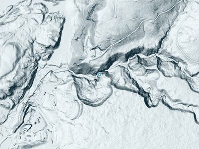
Aircraft-mounted lasers measured this ground to within inches. Trees and buildings are digitally stripped away, leaving the bare shape of the land the water has carved.
1-meter lidar shows the creek losing roughly 67 feet through Deschutes Falls over a long run of ledges. Elevation at the pin is about 828 feet.
The ground changes about 22 feet in the 500 feet above the falls and 55 feet in the 500 feet below. The falls face southwest and glow in afternoon and evening light.
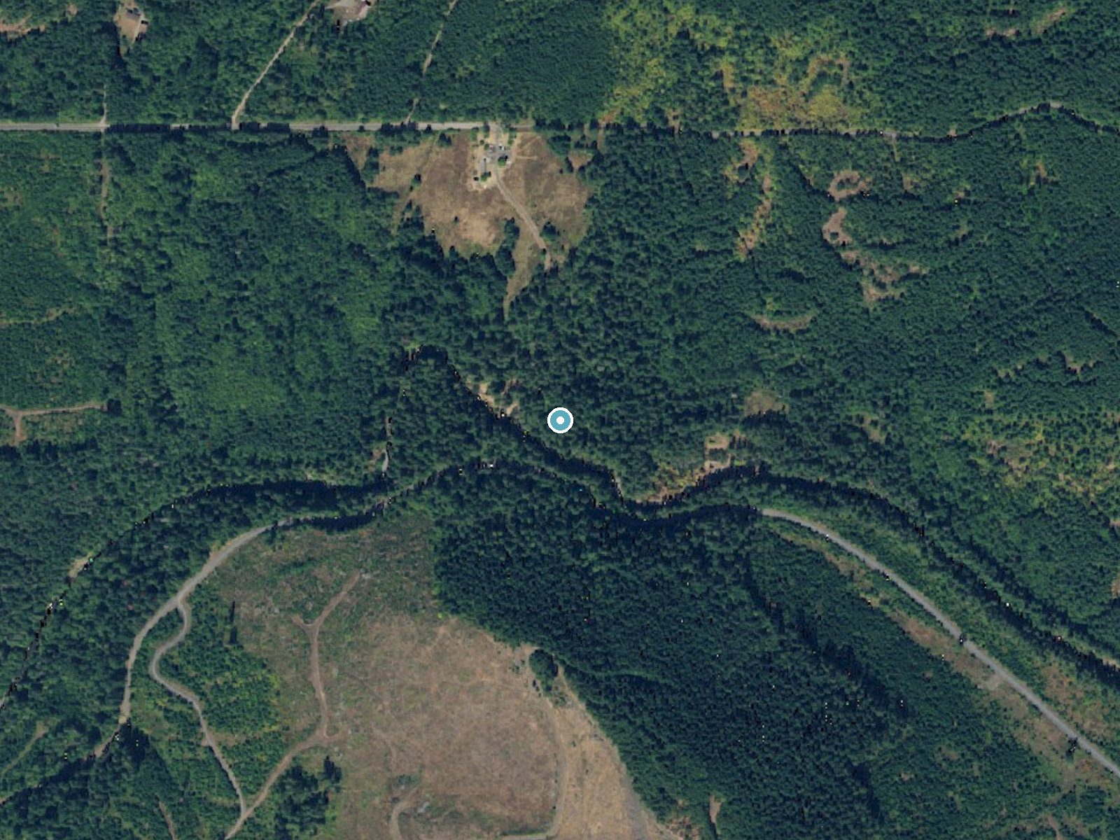
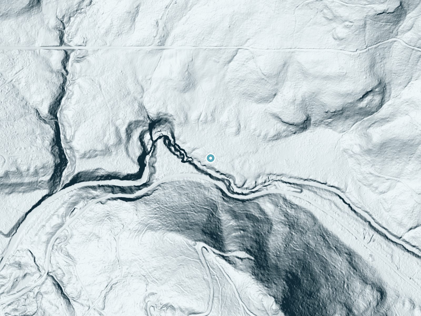
Drag to compare. The dot marks the waterfall. The frame is about a mile across.
- Ground elevation
- 828 feet
- Measured by 1-meter lidar
- Drop at the falls
- About 67 feet
- Change in ground height within ~250 feet of the falls
- Faces
- Southwest
- Glows in afternoon and evening light.
A slice through the lidar ground surface, from above the falls to downstream (heading southwest).
Elevation data: USGS 3D Elevation Program. Aerial imagery: USGS The National Map. Public domain.
Location & Access
Getting There
Deschutes Falls is located within Deschutes Falls Park, approximately 20 miles southeast of Olympia, Washington. The park is accessible via local roads, and visitors can follow signs to the parking area.
Get Directions on Google MapsParking
There is a small parking lot available at Deschutes Falls Park. Parking may be limited during peak times.
Elevation
830 feet above sea level
Coordinates
46.802881° N, -122.414560° W
Land Management
Managed by CNTY
Visitor Tips & Gear
Arrive early during weekends or holidays to secure parking. Wear sturdy shoes as the trail may be muddy or slippery, especially after rain. Bring a camera to capture the scenic views.
Where to Stay
Mountain Meadows Inn & Chalet Suites
La Quinta by Wyndham Tumwater - Olympia

Ramada by Wyndham Olympia

La Quinta Inn & Suites by Wyndham Centralia
Browse vacation cabins and private rentals nearby
Unique outdoor stays — tents, yurts, and treehouses
Rent a campervan or RV for your waterfall road trip
Some links are affiliate links. We may earn a commission at no extra cost to you.
Nearby Campground
Big Creek (Gifford Pinchot National Forest, WA)
21.5 miles away · 29 sites
Overview Situated in the vicinity of majestic Mount Rainier, Big Creek is a family campground nestled among Douglas firs, hemlock, alders and maples. The lush vegetation offers plenty of privacy between sites. The sites at Big Creek form a loop, with only a handful of sites sitting along the banks of Big Creek. Open from mid-May through late September, Big Creek provides an alternative to the campgrounds at Mount Rainier National Park, which can get very crowded during the summer. Recreation Angl
Book on Recreation.govNearby Hot Springs
Hot springs near Mossyrock, Washington
Green River Soda Spring
Green River Soda Spring produces 86-degree carbonated water at 1,644 feet elevation, flowing 37.5 degrees above ambient tempera...

Longmire Mineral Springs
Longmire Mineral Springs flows at 77 degrees within Mount Rainier National Park at 2,758 feet elevation, emerging 31.9 degrees ...

Mt Rainier Fumaroles
Mount Rainier fumaroles reach 162 degrees at 14,217 feet elevation, emerging 154.8 degrees above ambient at Washington's highes...

Mt St Helens Fumaroles
Mount St. Helens fumaroles reach 190 degrees at 6,906 feet elevation on the crater rim, emerging 159.1 degrees above ambient in...

Ohanapecosh Hot Springs
Ohanapecosh Hot Springs flows at 122 degrees within Mount Rainier National Park at 1,920 feet elevation, emerging 74.5 degrees ...
Packwood Hot Spring
Packwood Hot Spring flows at 100 degrees at 1,002 feet elevation in the lower Cascade foothills near Morton, emerging 49.8 degr...
Looking for a soak after your hike? Explore more hot springs near Mossyrock, Washington on SoakingSprings.
Explore Washington springsAdditional Information
Nearby Attractions
Nearby attractions include Millersylvania State Park and the city of Olympia, which offers additional outdoor activities and dining options.
Wildlife
Visitors may encounter birds, deer, and other small wildlife in the area. Be respectful of the natural habitat.
Cities near Deschutes Falls
Nearby Waterfalls
 LiDAR
LiDAR
Writing about Deschutes Falls? Embed this waterfall on your site for free.