Photo Credits (1)
Difficulty
Moderate
Trail Length
3.0 miles
Trail Type
Out And Back
Elevation Gain
500 ft
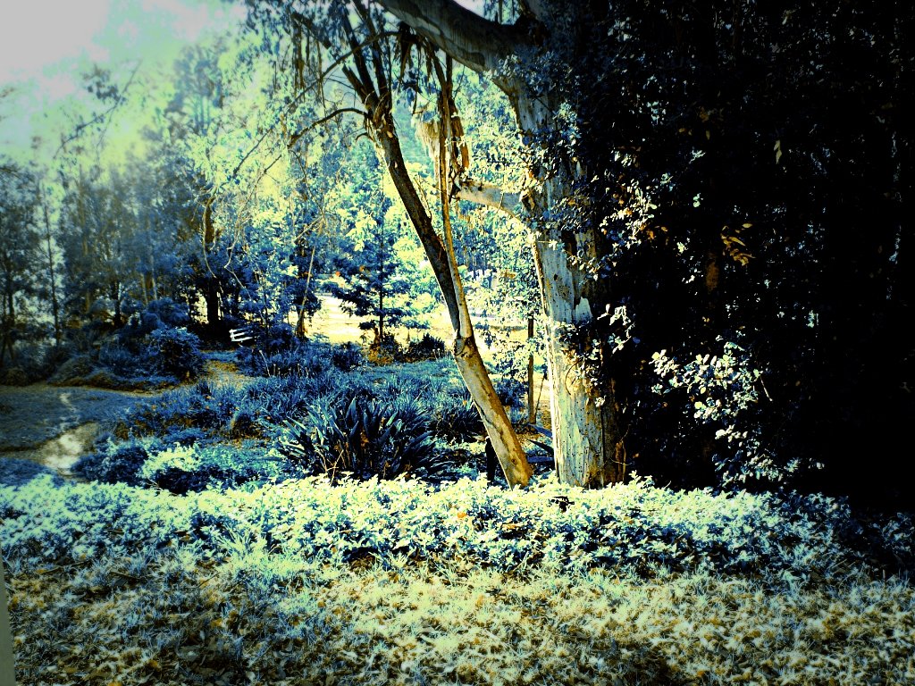
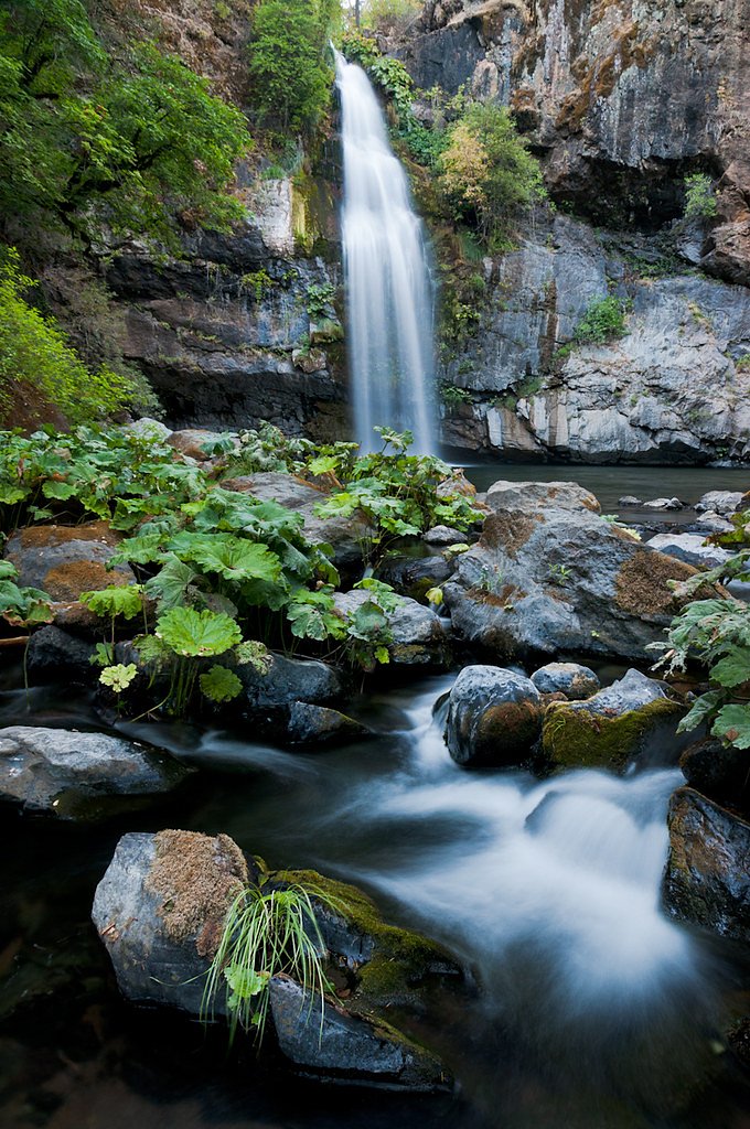
About Lion Wash Falls
Lion Wash Falls is a seasonal waterfall tucked into a remote corner of California, coming to life during the wetter months or after heavy rains. Its quiet setting and rugged surroundings make it a favorite for hikers seeking solitude and a short-but-scenic outing; expect rushing cascades when the water is up and a much more subdued bed during dry spells. The walk to the falls is a moderately challenging 3.0-mile out-and-back with about 500 feet of elevation gain, rewarding hikers with intimate views of the wash and surrounding scrub. Because the flow is ephemeral, plan your visit after recent storms for the best chance of seeing water, and be prepared for uneven, rocky tread and occasional overgrown sections along the route.
Nearby Falls Worth Visiting
Potem Falls (70 ft) lies 7.8 miles to the west. Also nearby: Hatchet Creek Falls (30 ft, 2.9 mi).
Trail & Hike Details
The Approach
The moderate 3.0-mile out-and-back trail gains 500 feet of elevation on the way to the falls.
Trail Description
Out-and-back, 3.0 miles round trip with approximately 500 feet of elevation gain; rated moderate. The route follows dirt paths with rocky sections and can be overgrown in places, so expect uneven footing and occasional brush encroachment. The waterfall is seasonal and may be dry during extended dry periods, so time your visit after rain for the best viewing.
What to Expect
Expect a moderately challenging hike with scenic views of the surrounding landscape. The waterfall may be a trickle or dry during the summer months, so visiting after rainfall is ideal. The area is remote, so cell service may be limited.
Accessibility
The trail is not wheelchair accessible. Uneven terrain and elevation changes require steady footing.
Frequently Asked Questions
🐶 Are Dogs Allowed at Lion Wash Falls?
❌ Dogs are not allowed
Are There Any Fees or Permits Required?
🆖 No fees required
🏊 Is There Swimming at Lion Wash Falls?
❌ Swimming is not allowed
When to Visit
The best time to visit Lion Wash Falls is during the spring or after significant rainfall when the waterfall is most likely to be flowing.
Seasonal Access
The best time to visit is Spring, Summer, and Fall. Winter access may be limited.
Safety Information
Hikers should be cautious of loose rocks, slippery surfaces, and overgrown sections of the trail. Carry a first aid kit and let someone know your plans before heading out. Cell service may be limited in the area.
Know when to go.
Get a free email alert when waterfalls near Montgomery Creek hit peak flow. We only send when conditions are worth the trip — no weekly newsletters, no spam.
Weather Forecast
Location & Access
Getting There
Lion Wash Falls is located in a remote area of California. Access typically requires navigating dirt roads and hiking trails. Visitors should research the exact location and trailhead before planning their trip.
Get Directions on Google MapsParking
Parking availability is limited and may require roadside parking near the trailhead. Visitors should ensure they park in designated areas to avoid fines or towing.
Elevation
3,130 feet above sea level
Coordinates
40.871545° N, -121.885828° W
Visitor Tips & Gear
Wear sturdy hiking shoes and bring plenty of water. Check weather conditions before visiting, as the trail can become muddy or slippery after rain. Start your hike early to avoid the heat and ensure you have enough daylight for the return trip.
As an Amazon Associate, we earn from qualifying purchases.
With 3.0 miles and 500 ft of elevation gain, sturdy boots and trekking poles will help on this moderate trail. Sun exposure on the trail makes good sun protection a must in summer.

Polarized Sunglasses (Knockaround)
Cuts glare off the water so you actually see the falls — and your photos turn out better too.

Columbia Watertight II Rain Jacket
Packs into its own pocket, seam-sealed, and keeps you dry from spray and surprise rain.

Earth Pak Waterproof Dry Bag
Keeps your phone and gear dry when waterfall mist soaks everything else.

Waterproof Phone Pouch (AiRunTech)
Cheap insurance — take photos right next to the falls without killing your phone.

Timberland Euro Sprint Mid Waterproof
Trusted waterproof boot with premium leather and grippy rubber sole — reliable on rocky, wet trails.

TrailBuddy Trekking Poles
Lightweight aluminum, cork grips, and flip-locks that actually hold — a best-seller for good reason.
Where to Stay

Green Gables Motel & Suites

Millz Manor

Shasta Pines Motel & Suites

Burrowdale Inn
Browse vacation cabins and private rentals nearby
Unique outdoor stays — tents, yurts, and treehouses
Rent a campervan or RV for your waterfall road trip
Some links are affiliate links. We may earn a commission at no extra cost to you.
Nearby Campground
Shasta Lake Area
14.7 miles away · 0 sites
** Due to fluctuating water levels on Shasta Lake, visitors are encouraged to contact the Shasta Recreation Company (concessionaire to the Forest Service) @ 530-275-8113 or the Shasta-Triinity National Forest, Shasta Lake Ranger Station at (530) 275-1587 for possible temporary campground closures. **The Shasta Unit is one of three units that comprise the Whiskeytown - Shasta-Trinity National Recreation Area. It was established by Congress in 1965. These areas were recognized for their unique and
Book on Recreation.govNearby Hot Springs
Hot springs near Montgomery Creek, California
Big Bend, California
Big Bend sits along a dramatic curve of the Pit River in Shasta County at 1,720 feet elevation, occupying territory historicall...
Big Bend Hot Springs
Big Bend Hot Springs surges at a scalding 180 degrees Fahrenheit from volcanic terrain at just 1,644 feet elevation, creating o...
Hunt Hot Spring
Hunt Hot Spring produces 136-degree water from the forested slopes near McCloud in Siskiyou County at just 1,712 feet elevation...
Hot Springs
Hot Springs emerge from the canyon walls of the Pit River in Shasta County at 3,310 feet elevation, their thermal nature docume...

Mill Creek Springs
Mill Creek Springs flows at a spectacular 150°F within Lassen Volcanic National Park, making it one of California's hottest spr...

Sulphur Works, Tophet Hot Springs
Sulphur Works and Tophet Hot Springs emerge at a dramatic 199°F at 6,932 feet elevation within Lassen Volcanic National Park, o...
Looking for a soak after your hike? Explore more hot springs near Montgomery Creek, California on SoakingSprings.
Explore California springsAdditional Information
Nearby Attractions
Nearby attractions may include other hiking trails and natural landmarks in the region. Research the area for additional points of interest.
Wildlife
The area is home to various wildlife, including birds, lizards, and small mammals. Be cautious of snakes and other potentially hazardous animals.
Cities near Lion Wash Falls
Nearby Waterfalls
Writing about Lion Wash Falls? Embed this waterfall on your site for free.