
Difficulty
Moderate
Trail Length
2.4 miles
Trail Type
Out And Back
Elevation Gain
350 ft
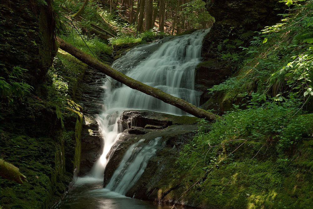
About Leavitt Falls
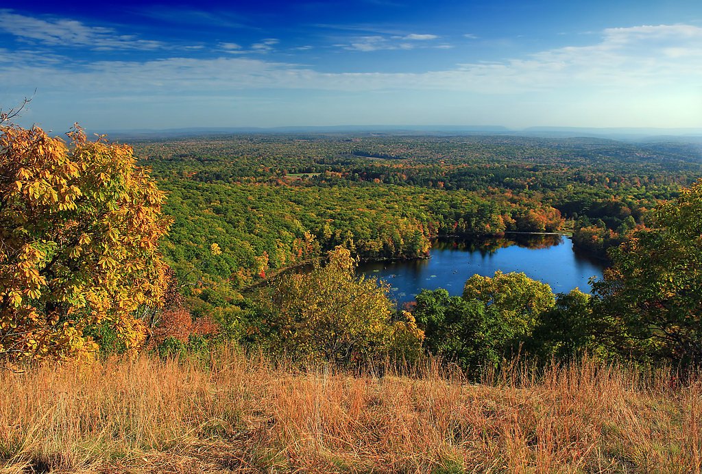
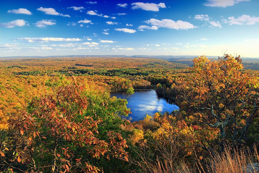
Leavitt Falls is a peaceful, picture-book cascade tucked into the woodlands of Pennsylvania, beloved by hikers and photographers for its quiet pools and mossy rock ledges. The setting feels remote yet approachable, offering a rewarding view without requiring technical scrambling; it’s the sort of spot where a short walk turns into a lingering break to enjoy the sound of falling water. Access to the falls is via a 2.4-mile out-and-back trail that climbs roughly 350 feet and is rated moderate—perfect for hikers who want a bit of elevation without a full-day commitment. There’s no developed camping immediately adjacent to the falls; the nearest established option is Alosa Campsites about 27.05 km away, so plan accordingly and bring what you need for a comfortable visit.
The Setting
Leavitt Falls sits at 1,316 feet along the Brodhead Creek, in the foothills of Pennsylvania.
Trail & Hike Details
The Approach
The moderate 2.4-mile out-and-back trail gains 350 feet of elevation on the way to the falls.
Trail Description
The trail to Leavitt Falls is a 2.4-mile out-and-back route with approximately 350 feet of elevation gain and a moderate difficulty rating. Surface, grade, and any official USFS trail class or number are not documented in the provided data, so trail conditions can vary; hikers should be prepared for typical natural-trail features and check local resources or recent trip reports before heading out. Expect a moderate climb on the approach and plan for sturdy footwear, water, and seasonal weather changes.
What to Expect
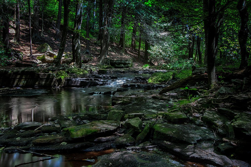
Visitors can expect a peaceful natural setting with the sound of cascading water. The area may have uneven terrain and limited facilities.
Accessibility
The trail is not wheelchair accessible. Uneven terrain and elevation changes require steady footing.
Frequently Asked Questions
🐶 Are Dogs Allowed at Leavitt Falls?
❌ Dogs are not allowed
Are There Any Fees or Permits Required?
🆖 No fees required
🏊 Is There Swimming at Leavitt Falls?
❌ Swimming is not allowed
When to Visit
Spring and early summer are typically the best times to visit, as the waterfall may have higher flow due to seasonal rainfall.
Seasonal Access
The best time to visit is Spring, Summer, and Fall. Winter access may be limited.
Safety Information
Visitors should be cautious of slippery rocks, uneven terrain, and changing weather conditions. Cell service may be limited in the area.
Current Water Conditions
27 ft³/s
Current discharge — how much water is flowing
Lower than usual for this time of year
Based on 68 years of record
1.65 ft
Water depth at gauge
69°F
CoolRefreshing for swimming
7-Day Discharge Trend
What does this mean for your visit?
Flow is lower than usual for this time of year. Water temperature is a refreshing 69 degrees F, good for a quick swim. Mineral content is typical.
Water Quality
Conductance
Dissolved minerals in the water
About This Gauge
This gauge is on a nearby waterway and may not reflect exact conditions at the falls.
7-Day Flow Outlook
Based on the USGS gauge Brodhead Creek near Analomink, PA (15 km away).
Today
Low
30 cfs
3/10Tomorrow
Moderate
30 cfs
4/10Thu
Moderate
30 cfs
4/10Fri
Moderate
31 cfs
4/10Sat
Moderate
30 cfs
4/10Sun
Moderate
29 cfs
4/10Mon
Moderate
27 cfs
4/10Best window: Tomorrow — moderate flow, chance showers and thunderstorms (trip score 4/10).
Best time of year: this gauge typically runs highest from late February to late May, peaking in April.
How we calculate this
This is a transparent outlook, not a precise forecast. We take the waterfall's current flow strength (how it ranks against its historical normal for today, from the nearest USGS stream gauge), carry that ranking forward along the gauge's seasonal curve, and nudge it for forecast rain. Confidence is highest for the next day or two and falls further out. Always check official conditions and your own judgment before visiting — high flows can be dangerous.
Know when to go.
Get a free email alert when waterfalls near Mountainhome hit peak flow. We only send when conditions are worth the trip — no weekly newsletters, no spam.
Weather Forecast
Location & Access
Getting There
Specific directions to Leavitt Falls are not well-documented. Visitors are advised to consult local maps or guides for the most accurate route.
Get Directions on Google MapsParking
Parking availability is unclear. Visitors should plan ahead and check for nearby parking options.
Elevation
1,316 feet above sea level
Coordinates
41.222313° N, -75.241570° W
Visitor Tips & Gear
Wear sturdy footwear and bring water. Check weather conditions before visiting, as trails may become slippery after rain.
As an Amazon Associate, we earn from qualifying purchases.
With 2.4 miles and 350 ft of elevation gain, sturdy boots and trekking poles will help on this moderate trail. Sun exposure on the trail makes good sun protection a must in summer.

Polarized Sunglasses (Knockaround)
Cuts glare off the water so you actually see the falls — and your photos turn out better too.

Columbia Watertight II Rain Jacket
Packs into its own pocket, seam-sealed, and keeps you dry from spray and surprise rain.

Earth Pak Waterproof Dry Bag
Keeps your phone and gear dry when waterfall mist soaks everything else.

Waterproof Phone Pouch (AiRunTech)
Cheap insurance — take photos right next to the falls without killing your phone.

Timberland Euro Sprint Mid Waterproof
Trusted waterproof boot with premium leather and grippy rubber sole — reliable on rocky, wet trails.

TrailBuddy Trekking Poles
Lightweight aluminum, cork grips, and flip-locks that actually hold — a best-seller for good reason.
Where to Stay

Pocono Mountain Villas MOD Collection by Sonesta

Serenity Falls - Stylish 4Bdr Mountain Retreat, Hot Tub, Pool

The Penn Stroud, Stroudsburg - Poconos, an Ascend Collection Hotel

Brookview Manor Inn
Browse vacation cabins and private rentals nearby
Unique outdoor stays — tents, yurts, and treehouses
Rent a campervan or RV for your waterfall road trip
Some links are affiliate links. We may earn a commission at no extra cost to you.
Nearby Campground
Alosa Campsites
16.8 miles away · 6 sites
Overview The Alosa Campsites are boat-in only sites located on the west (Pennsylvanian) shore of the Delaware River near Bushkill, Pennsylvania. The side of the river with the campsites will be on your right while traveling downstream. This section of the river offers unspoiled views, excellent boating, fishing, and birding opportunities within the Delaware Water Gap National Recreation Area and the Middle Delaware National Scenic and Recreational River. These reservation-only campsites are avail
Book on Recreation.govAdditional Information
Nearby Attractions
Nearby attractions are not well-documented. Visitors may explore other natural areas in Pennsylvania.
Wildlife
The area may host typical Pennsylvania wildlife such as birds, deer, and small mammals.
Cities near Leavitt Falls
Nearby Waterfalls
Other waterfalls named Leavitt Falls
1 other waterfall shares this name across the U.S.
Writing about Leavitt Falls? Embed this waterfall on your site for free.