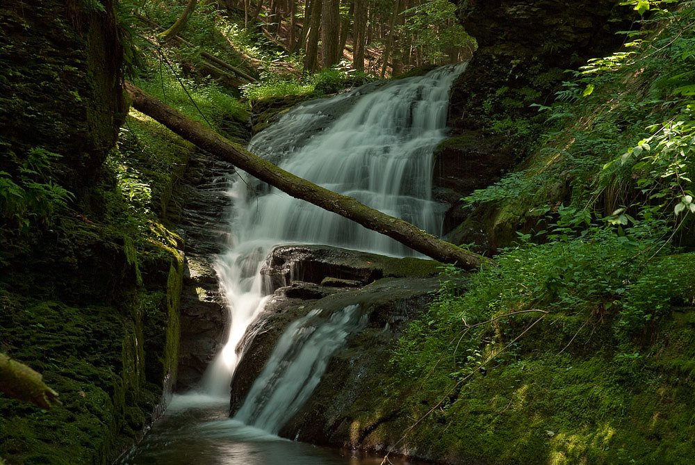
Spruce Cabin Falls
By Armen Suny · Last verified May 2026
Difficulty
Moderate
Trail Length
2.4 miles
Trail Type
Out And Back
Elevation Gain
350 ft
About Spruce Cabin Falls
Spruce Cabin Falls is a picturesque cascade tucked into the Rock Run area of Loyalsock State Forest in Pennsylvania. The falls drop over mossy ledges into a quiet pool, surrounded by the forest’s lush understory and the hush of woodland — a popular little destination for hikers seeking a peaceful waterside spot without venturing far off the beaten path. Reaching the falls rewards a short, scenic hike: the route is a moderate outing that climbs through shaded forest and rocky stretches before opening to the stream and falls. Because the falls sit on public lands within Loyalsock State Forest, they make a great half-day trip for local hikers and photographers looking for a tranquil waterfall experience in the Loyalsock watershed.
The Setting
Spruce Cabin Falls sits at 945 feet along the Brodhead Creek, in the foothills of Pennsylvania.
Trail & Hike Details
The Approach
The moderate 2.4-mile out-and-back trail gains 350 feet of elevation on the way to the falls.
Trail Description
Out-and-back, 2.4 miles round-trip with about 350 feet of elevation gain; rated moderate. The tread is a forest footpath featuring rocky, uneven sections and a few occasional stream crossings; much of the route is well-shaded. Expect short steep pitches and natural surface conditions typical of state forest hiking — suitable for hikers comfortable with uneven footing and loose rock.
What to Expect
Dogs are welcome.
Accessibility
The trail is not wheelchair accessible. Uneven terrain and elevation changes require steady footing.
Frequently Asked Questions
🐶 Are Dogs Allowed at Spruce Cabin Falls?
✅ Dogs are allowed
Are There Any Fees or Permits Required?
🆖 No fees required
🏊 Is There Swimming at Spruce Cabin Falls?
❌ Swimming is not allowed
When to Visit
Spring and early summer are ideal for visiting, as the waterfall flow is typically strongest during these seasons. Fall offers stunning foliage, while winter may provide unique icy views, though trail conditions can be challenging.
Seasonal Access
The best time to visit is Spring, Summer, and Fall. Winter access may be limited.
Safety Information
Be cautious of slippery rocks near the waterfall and stream crossings. Check weather conditions before visiting, as heavy rain can make trails hazardous. Cell service may be limited in the area.
Current Water Conditions
27 ft³/s
Current discharge — how much water is flowing
Lower than usual for this time of year
Based on 68 years of record
1.65 ft
Water depth at gauge
67°F
CoolRefreshing for swimming
7-Day Discharge Trend
What does this mean for your visit?
Flow is lower than usual for this time of year. Water temperature is a refreshing 67 degrees F, good for a quick swim. Mineral content is typical.
Water Quality
Conductance
Dissolved minerals in the water
About This Gauge
This gauge is on a nearby waterway and may not reflect exact conditions at the falls.
7-Day Flow Outlook
Based on the USGS gauge Brodhead Creek near Analomink, PA (11 km away).
Today
Barely Flowing
27 cfs
5/10Tomorrow
Low
28 cfs
3/10Thu
Low
27 cfs
6/10Fri
Low
29 cfs
3/10Sat
Moderate
30 cfs
4/10Sun
Moderate
29 cfs
4/10Mon
Moderate
27 cfs
4/10Best window: Thu — low flow, sunny (trip score 6/10).
Best time of year: this gauge typically runs highest from late February to late May, peaking in April.
How we calculate this
This is a transparent outlook, not a precise forecast. We take the waterfall's current flow strength (how it ranks against its historical normal for today, from the nearest USGS stream gauge), carry that ranking forward along the gauge's seasonal curve, and nudge it for forecast rain. Confidence is highest for the next day or two and falls further out. Always check official conditions and your own judgment before visiting — high flows can be dangerous.
Know when to go.
Get a free email alert when waterfalls near Mountainhome hit peak flow. We only send when conditions are worth the trip — no weekly newsletters, no spam.
Weather Forecast
Location & Access
Getting There
Spruce Cabin Falls is located near the Rock Run area in Loyalsock State Forest. Access is typically via forestry roads, and visitors should consult local maps or GPS for precise directions.
Get Directions on Google MapsParking
Parking is available at designated pull-offs or trailheads near the Rock Run area. Spaces may be limited, especially during peak seasons.
Elevation
945 feet above sea level
Coordinates
41.179535° N, -75.241014° W
Visitor Tips & Gear
Wear sturdy hiking shoes as the trail can be rocky and uneven. Bring bug spray during warmer months, and be cautious of slippery rocks near the waterfall.
As an Amazon Associate, we earn from qualifying purchases.
With 2.4 miles and 350 ft of elevation gain, sturdy boots and trekking poles will help on this moderate trail. Sun exposure on the trail makes good sun protection a must in summer.

Columbia Watertight II Rain Jacket
Packs into its own pocket, seam-sealed, and keeps you dry from spray and surprise rain.

Earth Pak Waterproof Dry Bag
Keeps your phone and gear dry when waterfall mist soaks everything else.

Waterproof Phone Pouch (AiRunTech)
Cheap insurance — take photos right next to the falls without killing your phone.

Timberland Euro Sprint Mid Waterproof
Trusted waterproof boot with premium leather and grippy rubber sole — reliable on rocky, wet trails.

TrailBuddy Trekking Poles
Lightweight aluminum, cork grips, and flip-locks that actually hold — a best-seller for good reason.

Polarized Sunglasses (Knockaround)
Cuts glare off the water so you actually see the falls — and your photos turn out better too.
Where to Stay

Pocono Mountain Villas MOD Collection by Sonesta

Serenity Falls - Stylish 4Bdr Mountain Retreat, Hot Tub, Pool

The Penn Stroud, Stroudsburg - Poconos, an Ascend Collection Hotel

Brookview Manor Inn
Browse vacation cabins and private rentals nearby
Unique outdoor stays — tents, yurts, and treehouses
Rent a campervan or RV for your waterfall road trip
Some links are affiliate links. We may earn a commission at no extra cost to you.
Nearby Campground
Alosa Campsites
15.3 miles away · 6 sites
Overview The Alosa Campsites are boat-in only sites located on the west (Pennsylvanian) shore of the Delaware River near Bushkill, Pennsylvania. The side of the river with the campsites will be on your right while traveling downstream. This section of the river offers unspoiled views, excellent boating, fishing, and birding opportunities within the Delaware Water Gap National Recreation Area and the Middle Delaware National Scenic and Recreational River. These reservation-only campsites are avail
Book on Recreation.govAdditional Information
Nearby Attractions
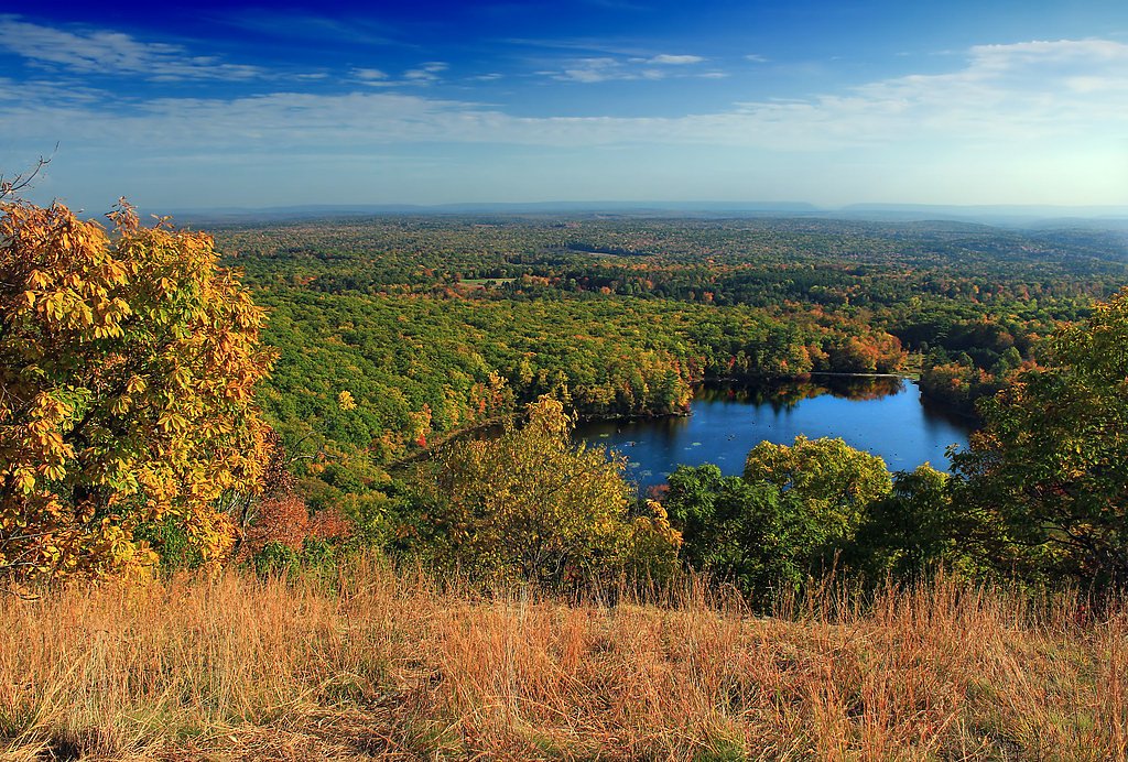
Other waterfalls and scenic spots in the Loyalsock State Forest, including Angel Falls and the Loyalsock Trail.
Wildlife
The area is home to a variety of wildlife, including deer, birds, and small mammals. Be cautious of ticks during warmer months.
Cities near Spruce Cabin Falls
Nearby Waterfalls
Writing about Spruce Cabin Falls? Embed this waterfall on your site for free.