Ladder Creek Falls
Washington • North Cascades National Park
By Armen Suny · Last verified Oct 2026
LiDAR & 3D terrain


Photo Credits (5)
Difficulty
Easy
Trail Length
0.5 miles
Trail Type
Out And Back
About Ladder Creek Falls
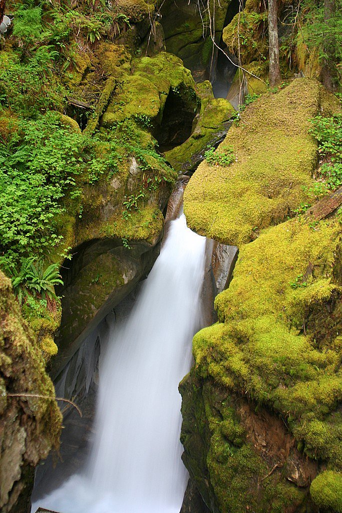
Ladder Creek Falls tumbles just outside Newhalem, Washington, within the Ross Lake National Recreation Area and the broader North Cascades National Park Complex. Managed by the National Park Service, the falls spill from Ladder Creek — a tributary of the Skagit River — into a series of picturesque cascades and viewing platforms. The site is especially famous for its nighttime illumination, when colorful lights bathe the falls and create a magical, almost theatrical atmosphere for evening visitors. The approach is short and rewarding, making Ladder Creek Falls a popular stop for families and day-hikers exploring the North Cascades. The maintained trail and a suspension bridge offer scenic river crossings and multiple viewpoints of the falls. If you want to camp nearby, the Lower Goodell Group Campground sits only about 1.23 km away, making an overnight stay convenient for those who want to enjoy the park beyond the day visit.
The Setting
Ladder Creek Falls sits at 495 feet within North Cascades National Park, in the coastal lowlands of Washington.
Nearby Falls Worth Visiting
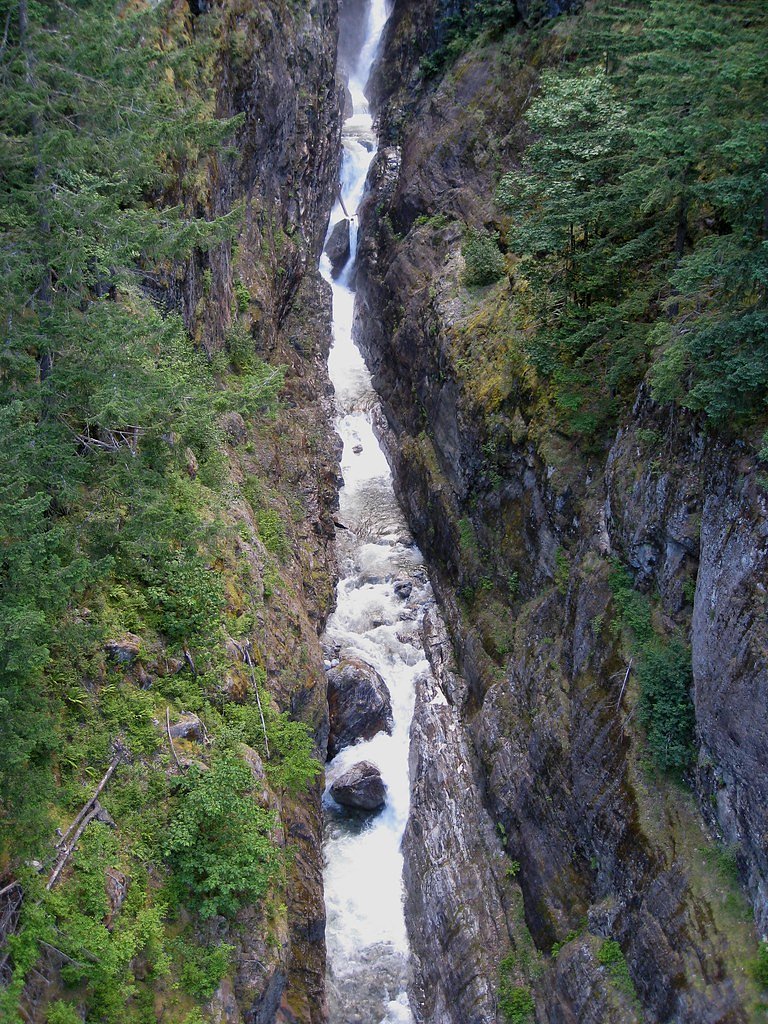
Gorge Creek Falls (242 ft) lies 2.8 miles to the northeast. Also nearby: John Pierce Waterfall (66 ft, 8.9 mi).
Trail & Hike Details
Trail Description
The path is well-maintained and begins near the Gorge Powerhouse, taking hikers across a suspension bridge over the Skagit River and up a series of steps to established viewpoints of the falls. The trail is graded for moderate hiking effort (steady inclines but no technical scrambling) and is lit at night, enhancing the falls’ famed colorful illumination and making evening visits accessible for those prepared with proper footwear and lighting.
What to Expect
Dogs are welcome.
Accessibility
The trail is short and relatively flat, but the surface may be uneven. Contact the managing agency for accessibility details.
Frequently Asked Questions
🐶 Are Dogs Allowed at Ladder Creek Falls?
✅ Dogs are allowed
Leashed pets are allowed in Ross Lake National Recreation Area, but not in the adjoining North Cascades National Park except on the Pacific Crest Trail.
Are There Any Fees or Permits Required?
🆖 No fees required
🏊 Is There Swimming at Ladder Creek Falls?
❌ Swimming is not allowed
When to Visit
The best time to visit is during the evening in spring, summer, or fall to experience the illuminated waterfall. However, the falls can also be enjoyed during the day year-round.
Seasonal Access
The best time to visit is Spring, Summer, and Fall. Winter access may be limited. Check with North Cascades National Park for current conditions.
Safety Information
The trail may be slippery, especially after rain. Use caution when crossing the suspension bridge and walking near the falls. Stay on designated paths to avoid accidents.
Current Water Conditions
These readings come from the USGS gauge on Skagit River, 0.2 miles away, not on Ladder Creek Falls's own stream. Use them as a sign of whether the area is running wet or dry.
2,980 ft³/s
Current discharge — how much water is flowing
Lower than usual for this time of year
Based on 66 years of record
83.48 ft
Water depth at gauge
50°F
Very coldExpect numbness within minutes
7-Day Discharge Trend
What does this mean for your visit?
Flow is lower than usual for this time of year. Water temperature is very cold at 50 degrees F, expect numbness within minutes.
About This Gauge
7-Day Flow Outlook
Based on the USGS gauge SKAGIT RIVER AT NEWHALEM, WA (0 km away).
Today
Moderate
2980 cfs
8/10Tomorrow
Moderate
3352 cfs
6/10Sat
Moderate
3506 cfs
6/10Sun
Moderate
3468 cfs
6/10Mon
Moderate
3253 cfs
6/10Tue
Moderate
3042 cfs
9/10Wed
Moderate
2964 cfs
6/10Best window: Tue — moderate flow, mostly sunny (trip score 9/10).
Best time of year: this gauge typically runs highest from early January to mid February, peaking in January.
How we calculate this
This is a transparent outlook, not a precise forecast. We take the waterfall's current flow strength (how it ranks against its historical normal for today, from the nearest USGS stream gauge), carry that ranking forward along the gauge's seasonal curve, and nudge it for forecast rain. Confidence is highest for the next day or two and falls further out. Always check official conditions and your own judgment before visiting — high flows can be dangerous.
Know when to go.
Get a free email alert when waterfalls near Marblemount hit peak flow. We only send when conditions are worth the trip — no weekly newsletters, no spam.
Is Ladder Creek Falls Frozen?
Updated about 5 hours agoNot frozen highs above freezing lately north-facing, shaded big river, rarely freezes solid
Ladder Creek Falls is not frozen right now; highs have been above freezing. Yesterday ran 65°F to 57°F.
- Days below freezing
- 0 of the last 14
- Current cold streak
- 0 days
- Freezing days ahead
- 0 of the next 7
- Flow
- 3290 ft³/s
Winter safety. Frozen falls are the one waterfall trip with a documented injury pattern: falling ice, and ice-glazed rock and trail. Wear microspikes, keep well back from the base and from overhangs, and never walk out on ice over moving water.
Estimate from Open-Meteo daily temperatures at the falls, the LiDAR-measured facing direction, and the nearest stream gauge. It is a likelihood, not a report from the trail. See every frozen waterfall in Washington.
Weather Forecast
The Terrain, Seen by LiDAR
Aircraft-mounted lasers measured this ground to within inches. Trees and buildings are digitally stripped away, leaving the bare shape of the land the water has carved.
1-meter lidar shows the creek losing roughly 32 feet through Ladder Creek Falls over a long run of ledges. Elevation at the pin is about 497 feet.
The ground changes about 70 feet in the 500 feet above the falls and 23 feet in the 500 feet below. The falls face north and stay mostly shaded, with soft, even light all day.
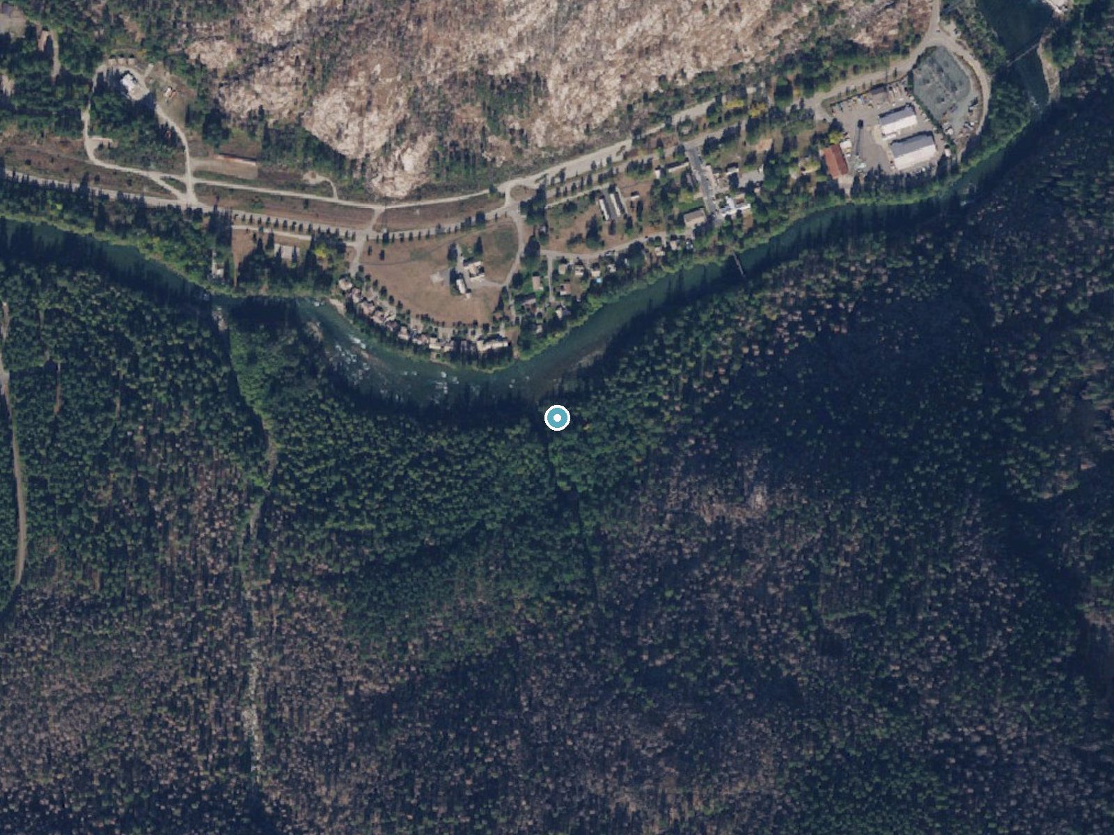
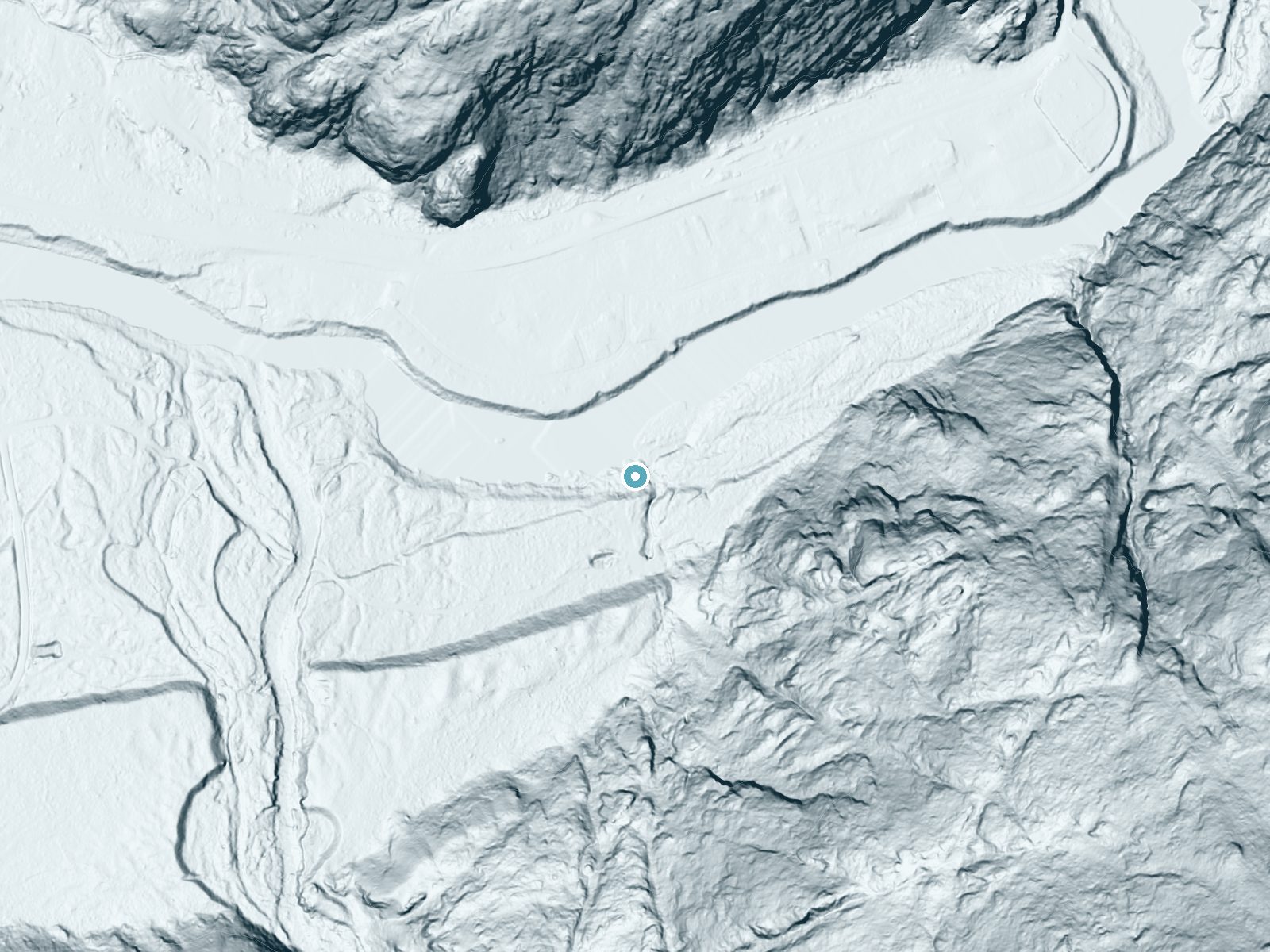
Drag to compare. The dot marks the waterfall. The frame is about a mile across.
- Ground elevation
- 497 feet
- Measured by 1-meter lidar
- Drop at the falls
- About 32 feet
- Change in ground height within ~250 feet of the falls
- Faces
- North
- Mostly shaded, so the light stays soft and even all day.
A slice through the lidar ground surface, from above the falls to downstream (heading north).
Elevation data: USGS 3D Elevation Program. Aerial imagery: USGS The National Map. Public domain.
Location & Access
Getting There
Ladder Creek Falls is located behind the Gorge Powerhouse in Newhalem, Washington. Visitors can access the falls by crossing a suspension bridge over the Skagit River from the parking area near the powerhouse.
Get Directions on Google MapsParking
Parking is available near the Gorge Powerhouse in Newhalem. The parking area is free and typically has ample space.
Elevation
495 feet above sea level
Coordinates
48.670126° N, -121.249846° W
Land Management
Managed by NPS
Visitor Tips & Gear
Visit during the evening to enjoy the illuminated waterfall display. Wear sturdy shoes as the trail may be slippery, especially after rain. Bring a flashlight if visiting at night, as some areas may be dimly lit.
Where to Stay
North Cascades Inn
Mystic Ivy
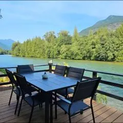
North Cascades Riverhouse retreat - hot tub, sauna
Browse vacation cabins and private rentals nearby
Unique outdoor stays — tents, yurts, and treehouses
Rent a campervan or RV for your waterfall road trip
Some links are affiliate links. We may earn a commission at no extra cost to you.
Nearby Campground
LOWER GOODELL GROUP CAMPGROUND
0.8 miles away · 2 sites
Overview Lower Goodell Group Campground requires reservations when the campground is open from late May to early September each year. Reservations can be made 12 months in advance. Lower Goodell Group Campground is comprised of 2 group sites, each with 5 individual areas for tents or small RVs, near the town of Newhalem, along the Skagit River. It is surrounded by forest and is situated on the banks of Goodell Creek. It is private and secluded, yet the town of Newhalem, North Cascades Visitor Cen
Book on Recreation.govNearby Hot Springs
Hot springs near Concrete, Washington
Baker Hot Spring
Baker Hot Spring emerges at 108 degrees Fahrenheit on US Forest Service land in Mt. Baker National Forest, flowing 59.5 degrees...
Sulphur Creek Hot Springs
Sulphur Creek Hot Springs flows at 99 degrees Fahrenheit at 2,973 feet elevation in Mount Baker National Forest's remote backco...

Sherman Crater Fumaroles
Sherman Crater Fumaroles register 266 degrees Fahrenheit at 9,463 feet elevation within the active volcanic crater atop Mount B...
Dorr Fumarole Field
Dorr Fumarole Field reaches 194 degrees at 8,168 feet elevation on Mount Baker's active volcanic slopes, producing superheated ...
Kennedy Hot Spring
Kennedy Hot Spring flows at 100 degrees at 3,520 feet elevation in the Mt. Baker National Forest, emerging 58.7 degrees above a...
Gamma Hot Springs
Gamma Hot Springs produces 140-degree water at 5,397 feet elevation in the Mt. Baker National Forest, emerging 104.6 degrees ab...
Looking for a soak after your hike? Explore more hot springs near Concrete, Washington on SoakingSprings.
Explore Washington springsAdditional Information
Nearby Attractions
Nearby attractions include the Gorge Powerhouse, the Skagit River, and other trails within the North Cascades National Park Complex.
Wildlife
The area is home to various bird species and small mammals. Visitors may also spot fish in the Skagit River.
Cities near Ladder Creek Falls
Nearby Waterfalls
Writing about Ladder Creek Falls? Embed this waterfall on your site for free.