John Pierce Waterfall
Washington • North Cascades National Park
By Armen Suny · Last verified Sep 2026
LiDAR & 3D terrain


Photo Credits (5)
Difficulty
Easy
Trail Length
0.5 miles
Trail Type
Out And Back
About John Pierce Waterfall
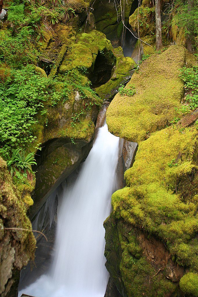
Tucked into the Ross Lake National Recreation Area and managed by the National Park Service, John Pierce Waterfall is a small, serene cascade that rewards hikers seeking a quiet slice of the North Cascades landscape. The falls are a lesser-known gem within the North Cascades National Park area, offering a picture-perfect scene of mossy rock and forested banks that looks especially lush after rain. Its modest size and tranquil setting make it a great spot for photography, a peaceful picnic, or a short nature respite away from busier trails. The hike to the falls is short but satisfying, so it pairs well with an overnight at nearby Colonial Creek South Campground, which lies about 3.98 km away. Because the site sits within the NPS-managed Ross Lake NRA, visitors should follow park regulations and Leave No Trace principles. Expect a quiet experience most of the year—ideal for hikers who prefer solitude and a close-up look at Cascades forest character without a long, strenuous approach.
The Setting
John Pierce Waterfall sits at 1,578 feet within North Cascades National Park, fed by the Thunder Creek, in the hills of Washington.
Nearby Falls Worth Visiting
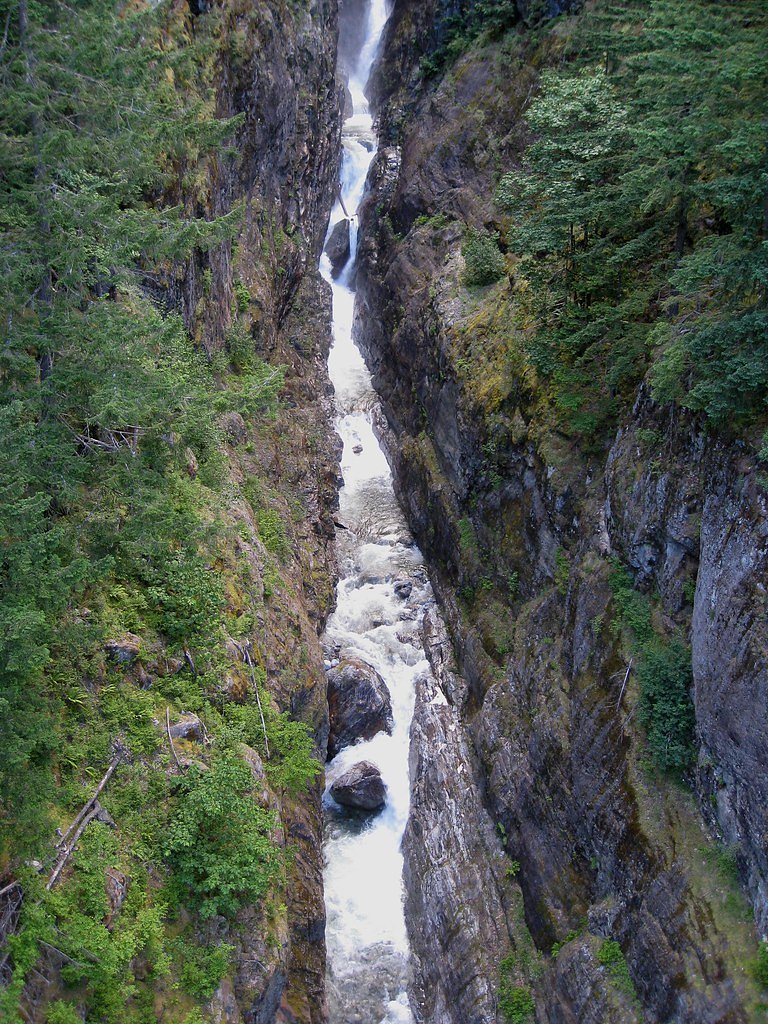
Gorge Creek Falls (242 ft) lies 6.5 miles to the west.
Trail & Hike Details
Trail Description
This is a 2.4-mile out-and-back route with roughly 350 feet of elevation gain and is rated moderate. The path wanders through dense forest and can become muddy after rain, so sturdy footwear is recommended. The trail is relatively short and finishes at the base of the waterfall, which is surrounded by lush greenery; steady hikers should find the route straightforward. There is nearby camping at Colonial Creek South Campground (about 3.98 km away) if you want to extend your visit into an overnight stay.
What to Expect
Dogs are welcome.
Accessibility
The trail is short and relatively flat, but the surface may be uneven. Contact the managing agency for accessibility details.
Frequently Asked Questions
🐶 Are Dogs Allowed at John Pierce Waterfall?
✅ Dogs are allowed
Are There Any Fees or Permits Required?
🆖 No fees required
🏊 Is There Swimming at John Pierce Waterfall?
❌ Swimming is not allowed
When to Visit
Spring and early summer are ideal times to visit, as the waterfall is typically more active due to seasonal rainfall.
Seasonal Access
The best time to visit is Spring, Summer, Fall, and Winter. Check with North Cascades National Park for current conditions.
Safety Information
The trail may be slippery after rain, so caution is advised. Avoid getting too close to the waterfall, as rocks may be unstable.
Current Water Conditions
449 ft³/s
Current discharge — how much water is flowing
About average for this time of year
Based on 95 years of record
7.57 ft
Water depth at gauge
7-Day Discharge Trend
What does this mean for your visit?
Flow is about average for this time of year.
About This Gauge
7-Day Flow Outlook
Based on the USGS gauge THUNDER CREEK NEAR NEWHALEM, WA (5 km away).
Today
Roaring
512 cfs
6/10Tomorrow
Roaring
474 cfs
9/10Sun
Strong
425 cfs
10/10Mon
Roaring
461 cfs
6/10Tue
Roaring
447 cfs
6/10Wed
Roaring
461 cfs
6/10Thu
Roaring
447 cfs
6/10Best window: Sun — strong flow, sunny (trip score 10/10).
Best time of year: this gauge typically runs highest from late May to mid August, peaking in June.
How we calculate this
This is a transparent outlook, not a precise forecast. We take the waterfall's current flow strength (how it ranks against its historical normal for today, from the nearest USGS stream gauge), carry that ranking forward along the gauge's seasonal curve, and nudge it for forecast rain. Confidence is highest for the next day or two and falls further out. Always check official conditions and your own judgment before visiting — high flows can be dangerous.
Know when to go.
Get a free email alert when waterfalls near Marblemount hit peak flow. We only send when conditions are worth the trip — no weekly newsletters, no spam.
Weather Forecast
The Terrain, Seen by LiDAR
Aircraft-mounted lasers measured this ground to within inches. Trees and buildings are digitally stripped away, leaving the bare shape of the land the water has carved.
The laser survey finds one clean step here: roughly 589 feet of drop concentrated at the brink. Elevation at the pin is about 1,587 feet.
The whole reach is steep: about 421 feet of descent in the 500 feet above the falls and another 358 feet in the 500 feet below. The falls face west and glow in afternoon and evening light.
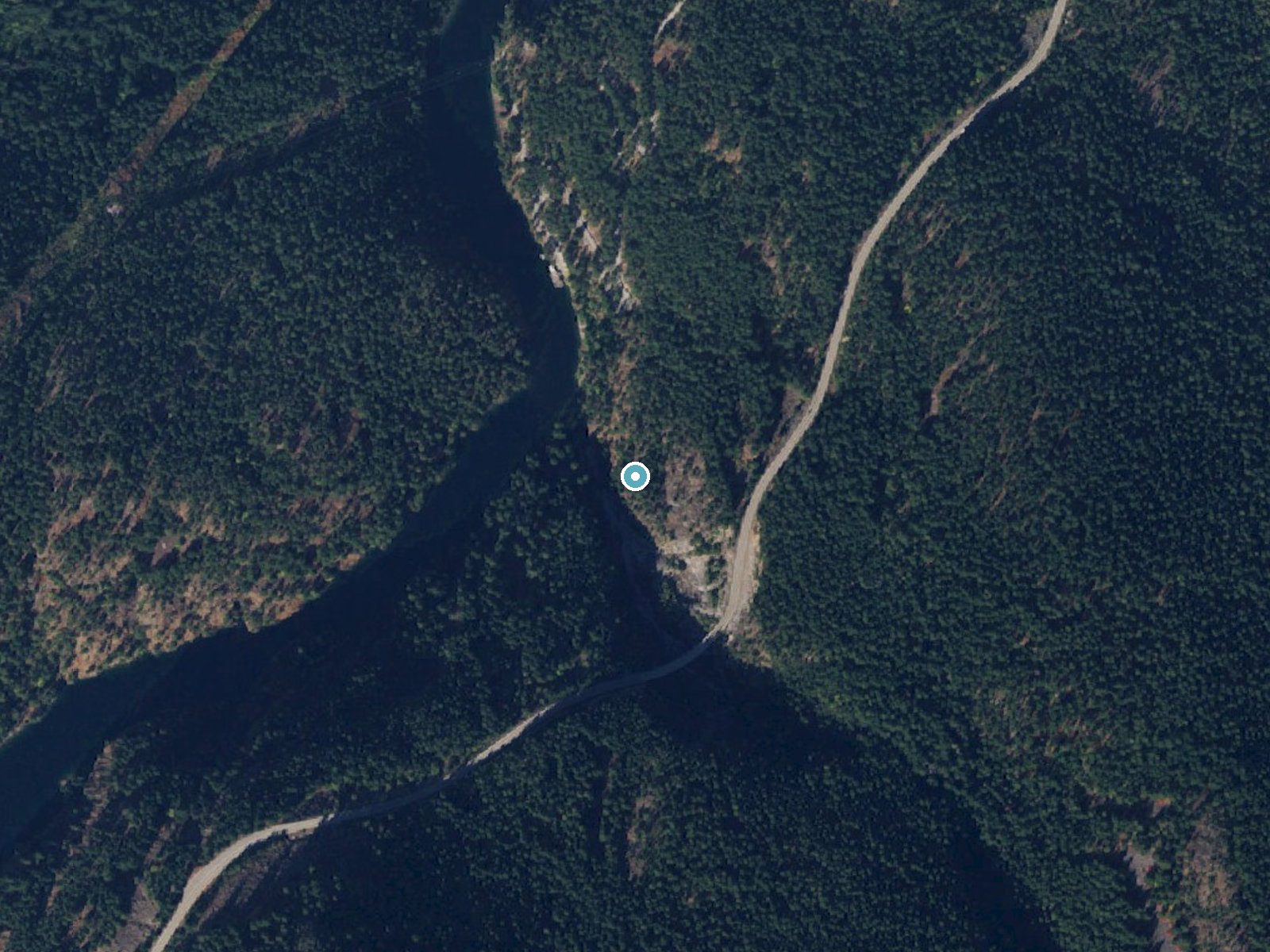
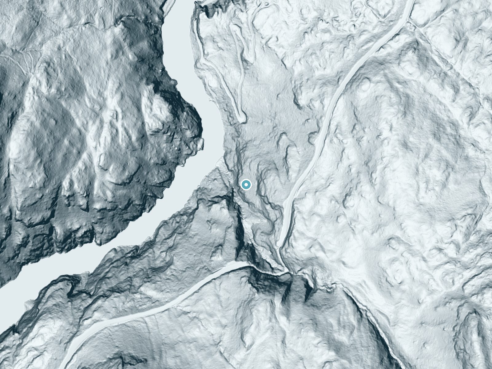
Drag to compare. The dot marks the waterfall. The frame is about a mile across.
- Ground elevation
- 1,587 feet
- Measured by 1-meter lidar
- Drop at the falls
- About 589 feet
- Change in ground height within ~250 feet of the falls
- Faces
- West
- Glows in afternoon and evening light.
A slice through the lidar ground surface, from above the falls to downstream (heading west).
Elevation data: USGS 3D Elevation Program. Aerial imagery: USGS The National Map. Public domain.
Location & Access
Getting There
John Pierce Waterfall is located near the town of Fall City, Washington. It can be accessed via local roads, but specific directions may vary depending on your starting point. Visitors are advised to use GPS or consult local maps for the most accurate route.
Get Directions on Google MapsParking
Parking availability is limited and may consist of roadside pullouts or small parking areas. Visitors should plan accordingly and avoid blocking traffic or private property.
Elevation
1,578 feet above sea level
Coordinates
48.721241° N, -121.070676° W
Land Management
Managed by NPS
Visitor Tips & Gear
Wear sturdy shoes, as the trail may be muddy or slippery. Bring a camera to capture the scenic beauty, and consider visiting after a rainy period for the best waterfall flow.
Where to Stay
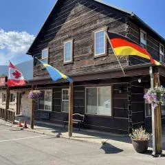
North Cascades Inn
Mystic Ivy
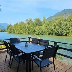
North Cascades Riverhouse retreat - hot tub, sauna
Browse vacation cabins and private rentals nearby
Unique outdoor stays — tents, yurts, and treehouses
Rent a campervan or RV for your waterfall road trip
Some links are affiliate links. We may earn a commission at no extra cost to you.
Nearby Campground
Colonial Creek South Campground
2.5 miles away · 94 sites
Overview Colonial Creek South Campground requires reservations during the peak season, from late May through early September of each year. Important changes to booking windows: To better serve visitors, Colonial Creek South Campground will release campsites in two staggered block releases. These block releases will be 6 months in advance and 7 days in advance. Campsites #64 - #95 and #116 - #164 are available for reservations 6 months in advance. Campsites #96 - #113 are available for reservat
Book on Recreation.govNearby Hot Springs
Hot springs near Concrete, Washington
Sulphur Creek Hot Springs
Sulphur Creek Hot Springs flows at 99 degrees Fahrenheit at 2,973 feet elevation in Mount Baker National Forest's remote backco...
Baker Hot Spring
Baker Hot Spring emerges at 108 degrees Fahrenheit on US Forest Service land in Mt. Baker National Forest, flowing 59.5 degrees...
Gamma Hot Springs
Gamma Hot Springs produces 140-degree water at 5,397 feet elevation in the Mt. Baker National Forest, emerging 104.6 degrees ab...

Sherman Crater Fumaroles
Sherman Crater Fumaroles register 266 degrees Fahrenheit at 9,463 feet elevation within the active volcanic crater atop Mount B...
Dorr Fumarole Field
Dorr Fumarole Field reaches 194 degrees at 8,168 feet elevation on Mount Baker's active volcanic slopes, producing superheated ...
Kennedy Hot Spring
Kennedy Hot Spring flows at 100 degrees at 3,520 feet elevation in the Mt. Baker National Forest, emerging 58.7 degrees above a...
Looking for a soak after your hike? Explore more hot springs near Concrete, Washington on SoakingSprings.
Explore Washington springsAdditional Information
Nearby Attractions
Nearby attractions include Snoqualmie Falls and the town of Fall City, which offers dining and shopping options.
Wildlife
The area is home to various birds, small mammals, and forest wildlife. Visitors may spot deer or hear birdsong during their visit.
Cities near John Pierce Waterfall
Nearby Waterfalls
Writing about John Pierce Waterfall? Embed this waterfall on your site for free.