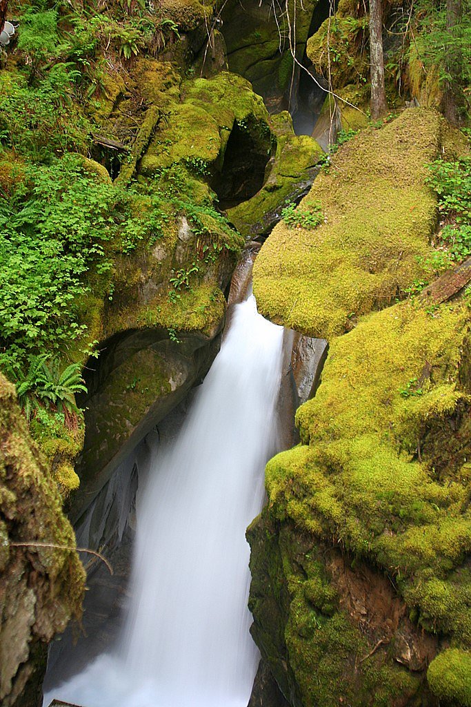
Gorge Creek Falls
Washington • North Cascades National Park • 242 ft
By Armen Suny · Last verified Mar 2026
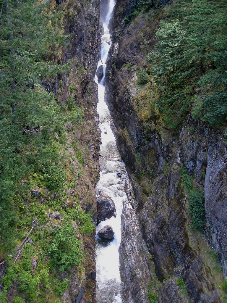
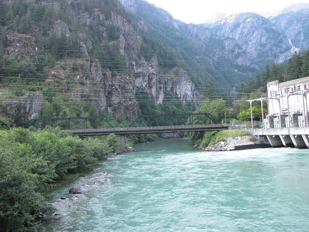
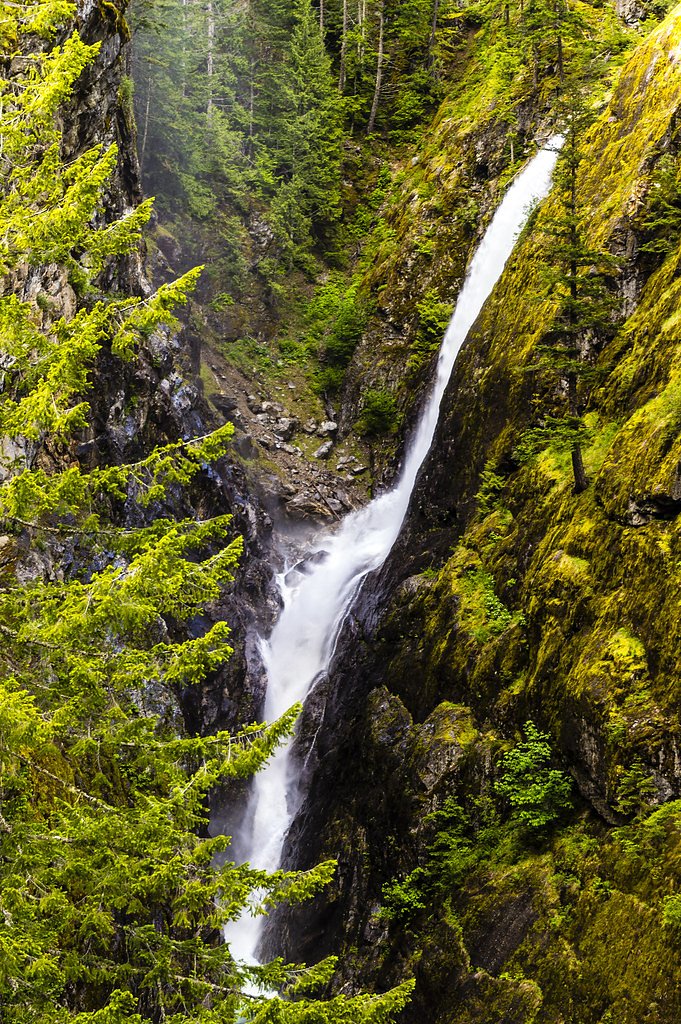


Photo Credits (5)
Difficulty
Moderate
Trail Length
2.4 miles
Trail Type
Out And Back
Elevation Gain
350 ft
About Gorge Creek Falls
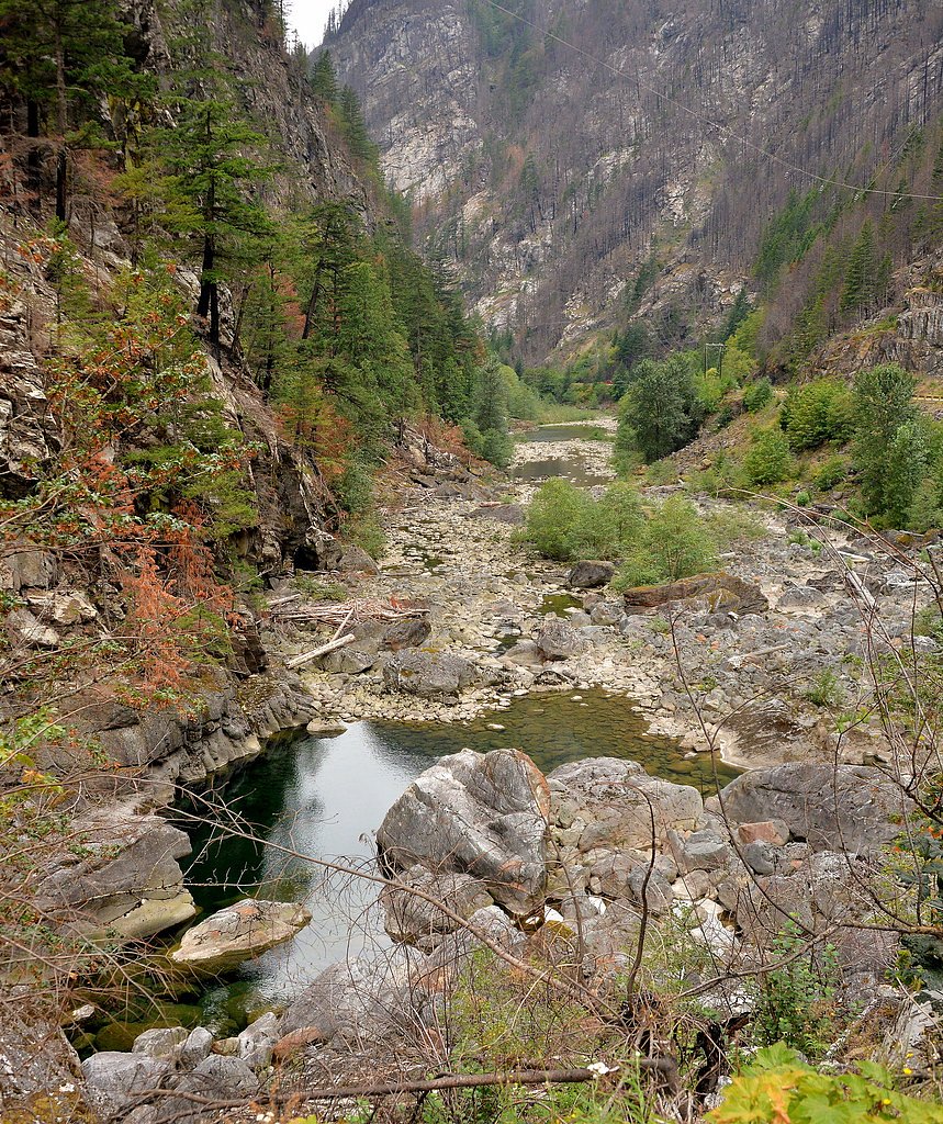
Gorge Creek Falls drops a dramatic 242 feet into a narrow gorge in the North Cascades region, offering one of the more memorable cascades along the Skagit River system. Nestled within the Ross Lake National Recreation Area and managed by the National Park Service, the falls are a rewarding destination for hikers and sightseers who want a striking waterfall without a full backcountry trek. The scene—white water plunging into a steep, rocky chasm—makes for excellent photos and a refreshing roadside stop on clear days. The trail to the falls is a popular moderate hike rather than a simple viewpoint-only stop, and nearby camping at Gorge Lake Campground sits about 4.6 km away for those who want to make an overnight trip of it. Trails in this part of the North Cascades often feel remote despite being accessible, so plan for changing weather, bring layers, and allow time to enjoy the viewpoints and the sound of the gorge below.
The Setting
Gorge Creek Falls sits at 1,089 feet within North Cascades National Park, fed by the Skagit River, in the foothills of Washington. At 242 feet, it is among the taller waterfalls in Washington.
Height: 242 feet
Trail & Hike Details
The Approach
The moderate 2.4-mile out-and-back trail gains 350 feet of elevation on the way to the falls.
Trail Description
The official route is a 2.4-mile out-and-back hike with approximately 350 feet of elevation gain and is rated moderate in difficulty. The trail climbs through forested sections before opening to viewpoints overlooking the 242-foot Gorge Creek Falls and the deep channel it has carved. Surface, grade, and technical class details are not provided in the available data; expect a maintained hiking trail with some uphill stretches and typical mountain trail footing. Managed as part of Ross Lake National Recreation Area by the National Park Service, the trail is suitable for most hikers who are comfortable with a moderate, short mountain hike.
What to Expect
The falls plunge 242 feet. Dogs are welcome.
Accessibility
The trail is not wheelchair accessible. Uneven terrain and elevation changes require steady footing.
Frequently Asked Questions
🐶 Are Dogs Allowed at Gorge Creek Falls?
✅ Dogs are allowed
Are There Any Fees or Permits Required?
🆖 No fees required
🏊 Is There Swimming at Gorge Creek Falls?
❌ Swimming is not allowed
When to Visit
Spring and early summer are ideal times to visit, as the waterfall is typically at its fullest due to snowmelt. However, the falls are accessible and beautiful year-round.
Seasonal Access
The best time to visit is Spring, Summer, Fall, and Winter. Check with North Cascades National Park for current conditions.
Safety Information
Water temperature is currently 46°F — cold enough to cause numbness quickly. Avoid prolonged water contact and use caution near the falls.
Stay on designated paths and avoid getting too close to the edge of the gorge. Exercise caution during winter months when paths may be icy.
Current Water Conditions
3,930 ft³/s
Current discharge — how much water is flowing
About average for this time of year
Based on 65 years of record
84.08 ft
Water depth at gauge
46°F
Very coldExpect numbness within minutes
7-Day Discharge Trend
What does this mean for your visit?
Flow is about average for this time of year. Water temperature is very cold at 46 degrees F, expect numbness within minutes.
About This Gauge
Know when to go.
Get a free email alert when waterfalls near Marblemount hit peak flow. We only send when conditions are worth the trip — no weekly newsletters, no spam.
Weather Forecast
Location & Access
Getting There
Gorge Creek Falls is located along the North Cascades Highway (State Route 20) near the Gorge Lake Overlook. The falls can be accessed by a short walk from the parking area.
Get Directions on Google MapsParking
There is a designated parking area near the Gorge Lake Overlook, which provides easy access to the falls.
Elevation
1089 feet above sea level
Coordinates
48.701516° N, -121.210401° W
Land Management
Managed by NPS
Visitor Tips & Gear
Visit early in the day to avoid crowds, especially during the summer months. Bring a camera to capture the stunning views. Be cautious near the edges of the gorge and stay on designated paths.
As an Amazon Associate, we earn from qualifying purchases.
With 2.4 miles and 350 ft of elevation gain, sturdy boots and trekking poles will help on this moderate trail. Icy conditions are common in winter — traction cleats are a smart addition.
America the Beautiful Annual Pass
Covers entrance fees at 2,000+ federal recreation sites — required at most National Parks.

Columbia Watertight II Rain Jacket
Packs into its own pocket, seam-sealed, and keeps you dry from spray and surprise rain.

Polarized Sunglasses (Knockaround)
Cuts glare off the water so you actually see the falls — and your photos turn out better too.

Earth Pak Waterproof Dry Bag
Keeps your phone and gear dry when waterfall mist soaks everything else.

Waterproof Phone Pouch (AiRunTech)
Cheap insurance — take photos right next to the falls without killing your phone.

Timberland Euro Sprint Mid Waterproof
Trusted waterproof boot with premium leather and grippy rubber sole — reliable on rocky, wet trails.

TrailBuddy Trekking Poles
Lightweight aluminum, cork grips, and flip-locks that actually hold — a best-seller for good reason.
Where to Stay

North Cascades Inn

Mystic Ivy

North Cascades Riverhouse retreat - hot tub, sauna
Browse vacation cabins and private rentals nearby
Unique outdoor stays — tents, yurts, and treehouses
Rent a campervan or RV for your waterfall road trip
Some links are affiliate links. We may earn a commission at no extra cost to you.
Nearby Campground
Gorge Lake Campground
2.9 miles away · 8 sites
Overview Gorge Lake Campground is a small, primitive campground with 8 sites. The campground is set on a steep bank overlooking Gorge Lake. The sites are small and do not accommodate large RVs or trailers. There is an accessible boat ramp at the lower end of the campground. Recreation The campground has an accessible boat launch and small dock. This boat launch is not recommended for large powerboats. Ideal for canoes, kayaks, paddle boards, and small power boats. Practice boating safety while
Book on Recreation.govNearby Hot Springs
Hot springs near Marblemount, Washington
Baker Hot Spring
Baker Hot Spring emerges at 108 degrees Fahrenheit on US Forest Service land in Mt. Baker National Forest, flowing 59.5 degrees...
Sulphur Creek Hot Springs
Sulphur Creek Hot Springs flows at 99 degrees Fahrenheit at 2,973 feet elevation in Mount Baker National Forest's remote backco...

Sherman Crater Fumaroles
Sherman Crater Fumaroles register 266 degrees Fahrenheit at 9,463 feet elevation within the active volcanic crater atop Mount B...
Kennedy Hot Spring
Kennedy Hot Spring flows at 100 degrees at 3,520 feet elevation in the Mt. Baker National Forest, emerging 58.7 degrees above a...
Dorr Fumarole Field
Dorr Fumarole Field reaches 194 degrees at 8,168 feet elevation on Mount Baker's active volcanic slopes, producing superheated ...
Gamma Hot Springs
Gamma Hot Springs produces 140-degree water at 5,397 feet elevation in the Mt. Baker National Forest, emerging 104.6 degrees ab...
Looking for a soak after your hike? Explore more hot springs near Marblemount, Washington on SoakingSprings.
Explore Washington springsAdditional Information
Nearby Attractions
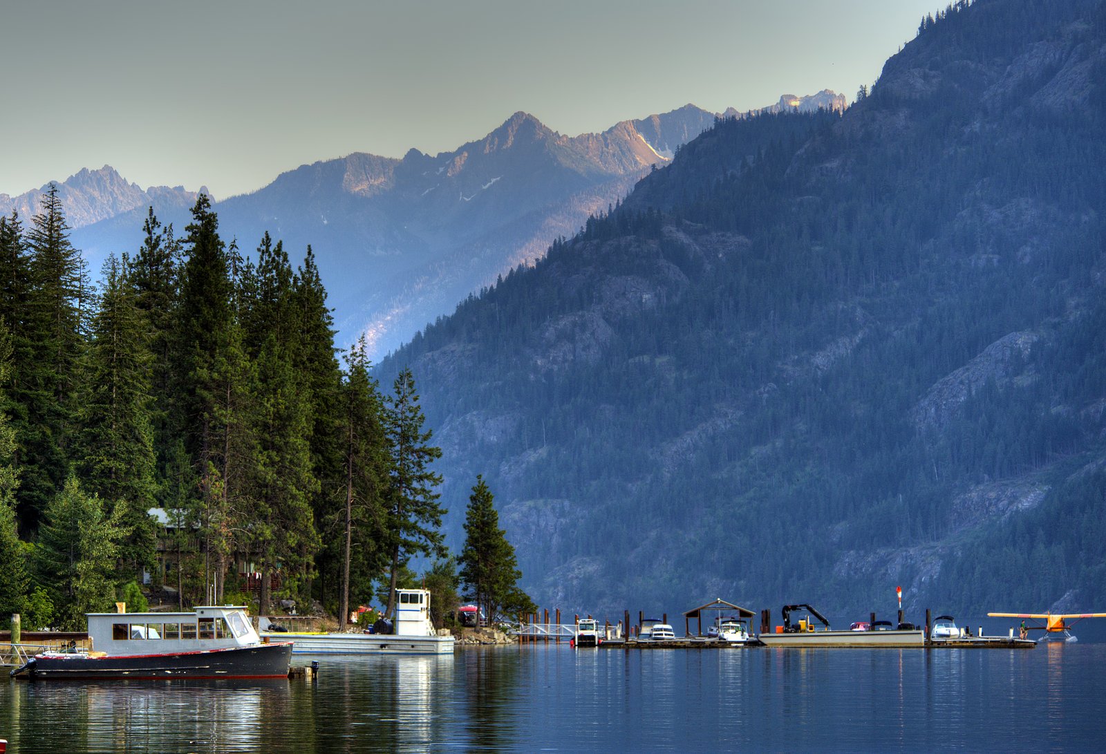
Nearby attractions include Diablo Lake Overlook, Ross Lake, and other scenic spots along the North Cascades Highway.
Wildlife
Visitors may spot birds, deer, and other wildlife typical of the North Cascades region.
Cities near Gorge Creek Falls
Nearby Waterfalls
Writing about Gorge Creek Falls? Embed this waterfall on your site for free.