Photo Credits (5)
Difficulty
Moderate
Trail Length
2.4 miles
Trail Type
Out And Back
Elevation Gain
350 ft
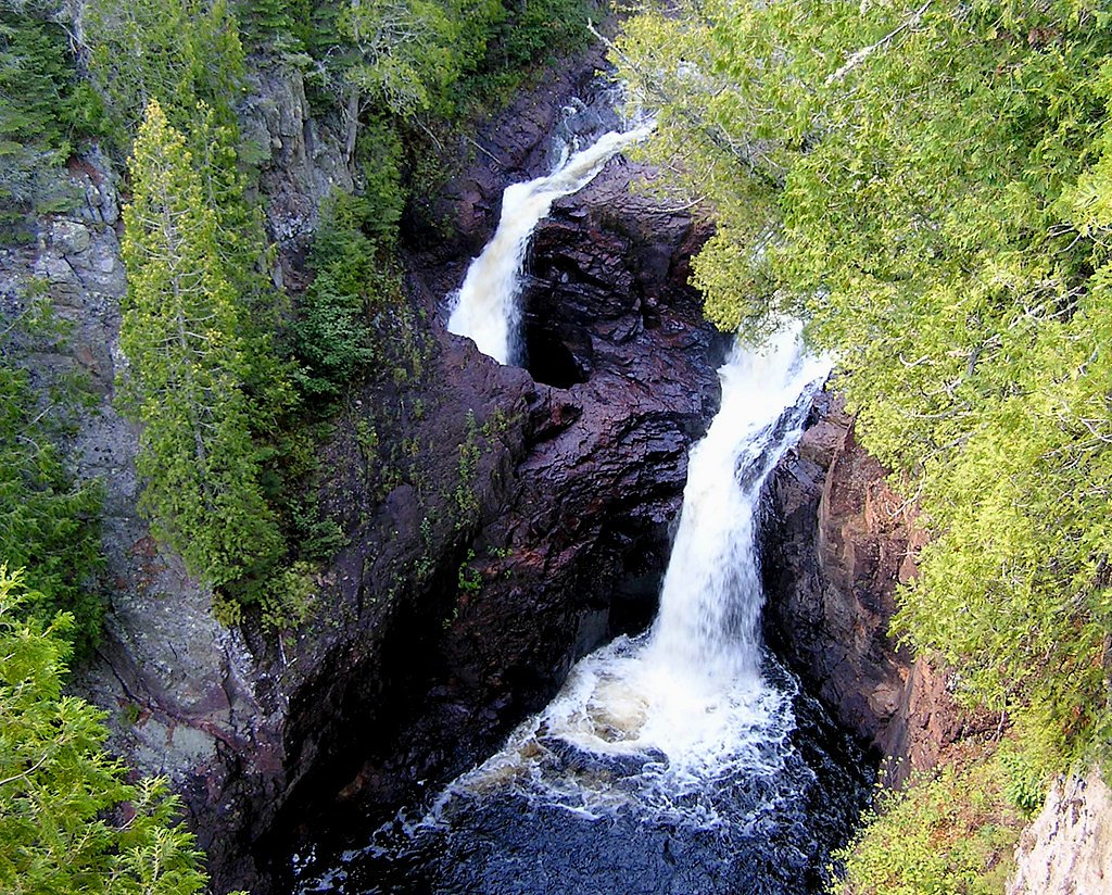
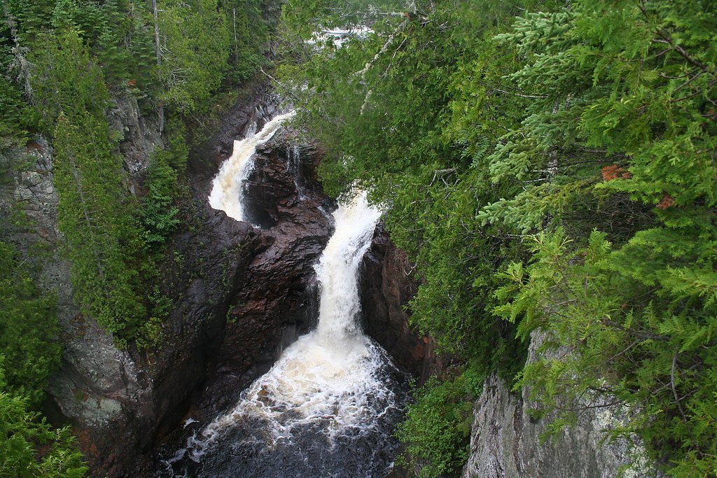
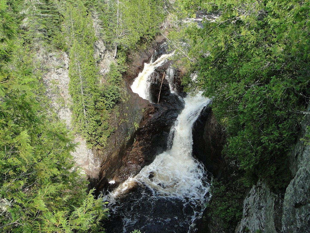
About Kettle Falls
Kettle Falls sits within Voyageurs National Park in northern Minnesota and is best known as a broad series of rapids and cascading drops where the Namakan River flows into Rainy Lake. More a scenic run of whitewater than a single vertical plunge, the falls have long been a focal point for boaters and visitors exploring the park’s interconnected waterways. The nearby historic Kettle Falls Hotel and portage site underscore the area’s cultural past, while the surrounding spruce–fir and mixed hardwood forest frame dramatic seasonal color and abundant wildlife viewing opportunities. Visitors typically reach the site by boat and step ashore at a short dock before following a well-maintained path to overlooks that peer down onto the rapids. Many hikers extend the outing into a roughly 2.4-mile out-and-back route (about 350 feet of elevation gain) that’s rated moderate — a great half-day trip for photographers, birders, and anyone wanting a quiet, water-centered experience inside Voyageurs National Park.
The Setting
Kettle Falls sits at 1,119 feet within Voyageurs National Park, in the foothills of Minnesota.
Trail & Hike Details
The Approach
The moderate 2.4-mile out-and-back trail gains 350 feet of elevation on the way to the falls.
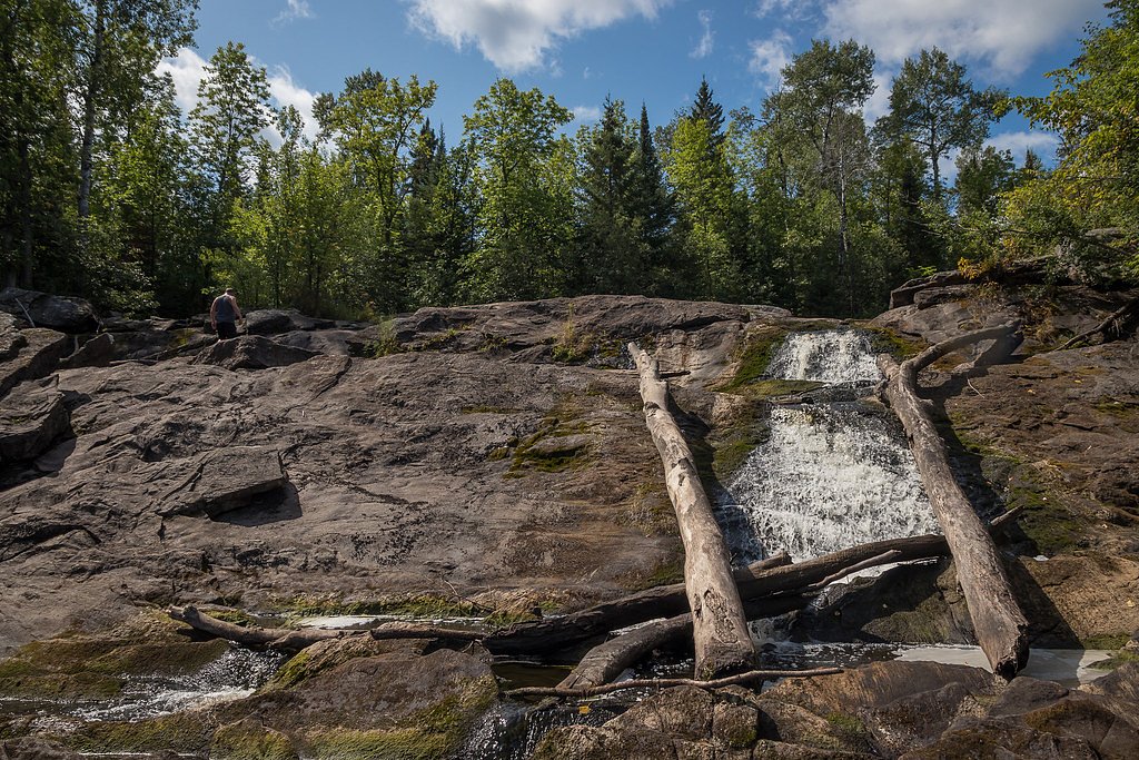
Trail Description
Trail length: 2.4 miles round-trip. Elevation gain: ~350 ft. Difficulty: Moderate. Trail type: Out-and-back. The route begins at the dock and follows a well-maintained footpath that offers repeated views of the Namakan River as it spills into Rainy Lake. Footing is generally good and the trail is non-technical, though hikers will encounter some steady uphill sections that account for the listed elevation gain. Expect classic northern-woods scenery—mixed hardwoods and conifers—with several clear viewpoints for photography and wildlife observation. Managed as part of Voyageurs National Park, the trail is best enjoyed outside of high water or ice conditions.
What to Expect
Visitors can expect a serene and remote experience at Kettle Falls. The falls themselves are a series of rapids rather than a dramatic drop, but the surrounding scenery and historical significance make it a worthwhile destination. The nearby Kettle Falls Hotel adds to the charm of the area.
Accessibility
The trail is not wheelchair accessible. Uneven terrain and elevation changes require steady footing.
Frequently Asked Questions
🐶 Are Dogs Allowed at Kettle Falls?
❌ Dogs are not allowed
Are There Any Fees or Permits Required?
🤑 Fee: $0.00
🏊 Is There Swimming at Kettle Falls?
❌ Swimming is not allowed
When to Visit
The best time to visit Kettle Falls is during the summer months (June through August) when the weather is warm, and boat access is readily available.
Seasonal Access
The best time to visit is Spring, Summer, and Fall. Winter access may be limited. Check with Voyageurs National Park for current conditions.
Safety Information
Exercise caution near the water, as the currents can be strong. Be prepared for mosquitoes and other insects during the warmer months. Always wear a life jacket when traveling by boat.
Know when to go.
Get a free email alert when waterfalls near Orr hit peak flow. We only send when conditions are worth the trip — no weekly newsletters, no spam.
Weather Forecast
Location & Access
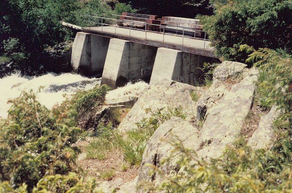
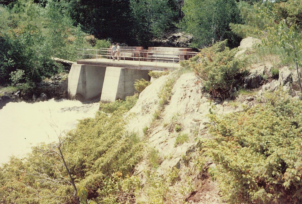
Getting There
Kettle Falls is accessible only by boat or floatplane. Visitors typically depart from one of the park's visitor centers or marinas, such as the Ash River Visitor Center or Crane Lake. Guided tours and water taxis are available during the warmer months.
Get Directions on Google MapsParking
Parking is available at Voyageurs National Park visitor centers or marinas where boat access begins.
Elevation
1,119 feet above sea level
Coordinates
48.499350° N, -92.639041° W
Visitor Tips & Gear
Plan your visit during the summer months for the best weather and accessibility. Bring insect repellent, as mosquitoes can be prevalent. Consider booking a guided boat tour for a more informative experience.
As an Amazon Associate, we earn from qualifying purchases.
With 2.4 miles and 350 ft of elevation gain, sturdy boots and trekking poles will help on this moderate trail. Sun exposure on the trail makes good sun protection a must in summer.

Polarized Sunglasses (Knockaround)
Cuts glare off the water so you actually see the falls — and your photos turn out better too.

Columbia Watertight II Rain Jacket
Packs into its own pocket, seam-sealed, and keeps you dry from spray and surprise rain.

Earth Pak Waterproof Dry Bag
Keeps your phone and gear dry when waterfall mist soaks everything else.

Waterproof Phone Pouch (AiRunTech)
Cheap insurance — take photos right next to the falls without killing your phone.

Timberland Euro Sprint Mid Waterproof
Trusted waterproof boot with premium leather and grippy rubber sole — reliable on rocky, wet trails.

TrailBuddy Trekking Poles
Lightweight aluminum, cork grips, and flip-locks that actually hold — a best-seller for good reason.
Where to Stay

Lakeside 1 Bedroom Bear Paw Cabin On Kab

Lakeside 2 Bedroom Pelican Cabin On Kab

2 Bedroom Loon Villa In Voyageurs National Park

2 Bedroom Walleye Villa In Voyageurs National Park
Browse vacation cabins and private rentals nearby
Unique outdoor stays — tents, yurts, and treehouses
Rent a campervan or RV for your waterfall road trip
Some links are affiliate links. We may earn a commission at no extra cost to you.
Nearby Campground
ECHO LAKE (MINN)
23.7 miles away · 26 sites
Overview Echo Lake is located on the west end of the Echo Trail, a remote country road that traverses through the heart of the Western Superior National Forest. This quiet campground, where the sounds of birds and the wind are often heard, is a peaceful alternative to the hustle and bustle of the area's resort scene. A variety of campsites, activities and amenities offer a comfortable stay for RV, trailer and tent campers. Superior National Forest, located in northeastern Minnesota's arrowhead re
Book on Recreation.govAdditional Information
Nearby Attractions
Kettle Falls Hotel, Rainy Lake, Namakan Lake, and other areas within Voyageurs National Park.
Wildlife
The area is home to a variety of wildlife, including bald eagles, loons, black bears, and white-tailed deer.
Cities near Kettle Falls
Nearby Waterfalls
Other waterfalls named Kettle Falls
2 other waterfalls share this name across the U.S.
Writing about Kettle Falls? Embed this waterfall on your site for free.