
Photo Credits (2)
Difficulty
Moderate
Trail Length
2.4 miles
Trail Type
Out And Back
Elevation Gain
350 ft
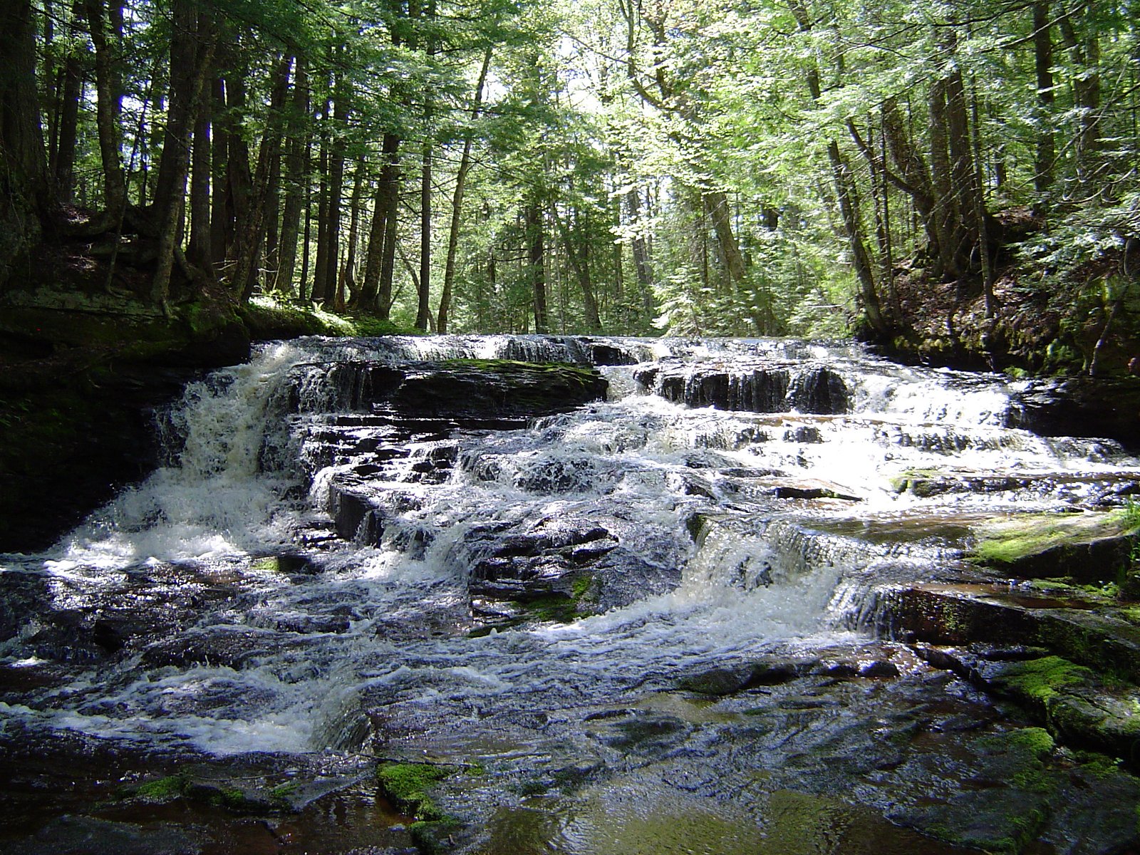
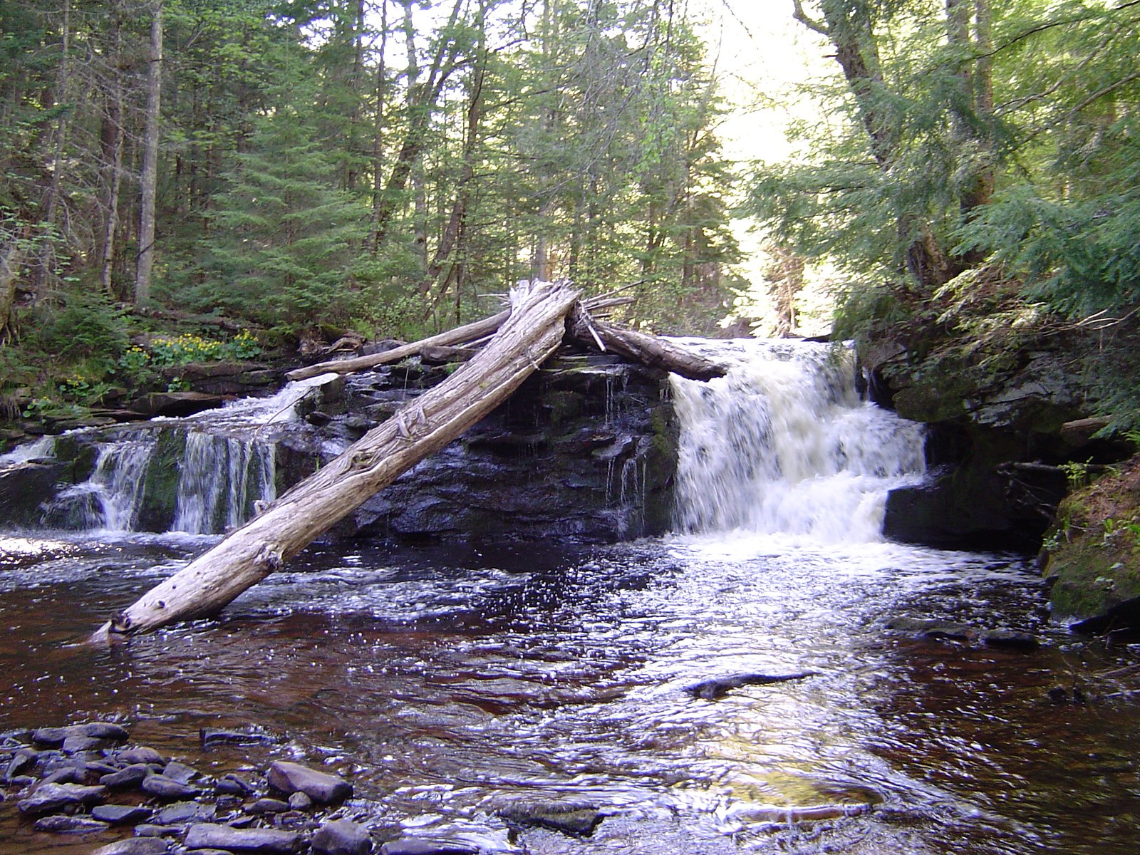
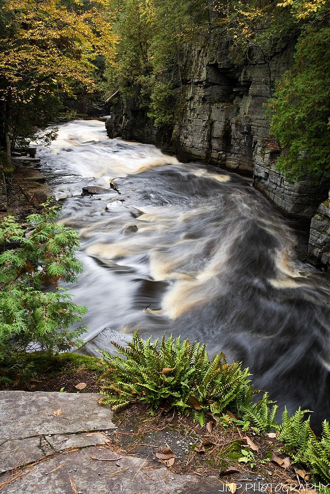
About Hogger Falls
Tucked into the Ottawa National Forest and managed by the U.S. Forest Service, Hogger Falls is a quiet, wooded cascade that rewards hikers with a peaceful slice of northern Michigan wilderness. The falls are reached via USFS trail NFST-T1780-A4 (Trail #T1780-A4), which threads through mature hardwoods and fern-strewn understory—an inviting outing for anyone seeking a less-crowded waterfall experience. The setting feels remote without being rugged, making it a good choice for photographers, birders, or a relaxed day hike. The approach to Hogger Falls is a moderate outing: the route described by forest data is about 2.4 miles with roughly 350 feet of elevation gain and is typically hiked as an out-and-back. Because the trail is maintained by the Forest Service, you’ll be following an official route through public National Forest lands; check local conditions and maps before you go, especially in wet seasons when forest trails can be slick.
The Setting
Hogger Falls sits at 1,040 feet within Ottawa National Forest, fed by the Sturgeon River, in the foothills of Michigan.
Trail & Hike Details
The Approach
The moderate hike follows Nfst T1780 A4 (#T1780-A4), a 2.4-mile out-and-back trail over natural surface. Expect 350 feet of elevation gain with grades of 0-5%. The trail is developed (Class 3).
USFS Trail
NFST-T1780-A4 #T1780-A4
Trail Class
Developed
Surface
Avg Grade
USFS Segment
0.31 miTrail Description
USFS trail NFST-T1780-A4 (Trail #T1780-A4) is classified as Class 3 and is surfaced with native material. The typical grade along the trail is 0–5%, and USFS GIS data shows a 0.31-mile mapped segment for this trail number. The commonly reported hike to Hogger Falls is 2.4 miles with about 350 feet of elevation gain and is rated moderate; the route is usually done as an out-and-back. Expect a natural tread (dirt, roots, occasional rock) rather than paved or gravel surfaces. The Class 3 designation and modest grade indicate sections that may require steady footing and basic route-finding; bring sturdy shoes, water, and map or GPS and consult the Ottawa National Forest/USFS resources for current trail conditions before heading out.
What to Expect
Expect a peaceful and remote waterfall experience surrounded by natural beauty. The area may be less crowded due to its relative obscurity.
Accessibility
The trail is not wheelchair accessible. Uneven terrain and elevation changes require steady footing.
Frequently Asked Questions
🐶 Are Dogs Allowed at Hogger Falls?
❌ Dogs are not allowed
Are There Any Fees or Permits Required?
🆖 No fees required
🏊 Is There Swimming at Hogger Falls?
❌ Swimming is not allowed
When to Visit
Spring and early summer are typically the best times to visit, as water flow is likely to be higher due to snowmelt and rainfall.
Seasonal Access
The best time to visit is Spring, Summer, and Fall. Winter access may be limited. Check with Ottawa National Forest for seasonal road closures.
Safety Information
The trail may be unmarked or uneven, so visitors should exercise caution. Bring adequate supplies and let someone know your plans before visiting.
Current Water Conditions
409 ft³/s
Current discharge — how much water is flowing
About average for this time of year
Based on 93 years of record
4.75 ft
Water depth at gauge
63°F
CoolRefreshing for swimming
7-Day Discharge Trend
What does this mean for your visit?
Flow is about average for this time of year. Water temperature is a refreshing 63 degrees F, good for a quick swim.
About This Gauge
This gauge is on a nearby waterway and may not reflect exact conditions at the falls.
7-Day Flow Outlook
Based on the USGS gauge STURGEON RIVER NEAR ALSTON, MI (11 km away).
Today
Moderate
458 cfs
4/10Tomorrow
Low
450 cfs
6/10Sun
Low
431 cfs
4/10Mon
Moderate
505 cfs
4/10Tue
Moderate
531 cfs
4/10Wed
Moderate
513 cfs
4/10Thu
Moderate
505 cfs
4/10Best window: Tomorrow — low flow, sunny (trip score 6/10).
Best time of year: this gauge typically runs highest from late March to mid June, peaking in April.
How we calculate this
This is a transparent outlook, not a precise forecast. We take the waterfall's current flow strength (how it ranks against its historical normal for today, from the nearest USGS stream gauge), carry that ranking forward along the gauge's seasonal curve, and nudge it for forecast rain. Confidence is highest for the next day or two and falls further out. Always check official conditions and your own judgment before visiting — high flows can be dangerous.
Know when to go.
Get a free email alert when waterfalls near Pelkie hit peak flow. We only send when conditions are worth the trip — no weekly newsletters, no spam.
Weather Forecast
Location & Access
Getting There
Hogger Falls is located in Michigan, but specific directions to the site are not widely documented. Visitors may need to consult local maps or guides for precise access details.
Get Directions on Google MapsParking
Parking availability is unclear, but visitors should expect limited or informal parking options near the trailhead.
Elevation
1,040 feet above sea level
Coordinates
46.722436° N, -88.804581° W
Land Management
Managed by USFS
Visitor Tips & Gear
Bring a detailed map or GPS device as the trail may not be well-marked. Wear sturdy footwear and be prepared for varying trail conditions.
As an Amazon Associate, we earn from qualifying purchases.
With 2.4 miles and 350 ft of elevation gain, sturdy boots and trekking poles will help on this moderate trail. Sun exposure on the trail makes good sun protection a must in summer.

Polarized Sunglasses (Knockaround)
Cuts glare off the water so you actually see the falls — and your photos turn out better too.

Columbia Watertight II Rain Jacket
Packs into its own pocket, seam-sealed, and keeps you dry from spray and surprise rain.

Earth Pak Waterproof Dry Bag
Keeps your phone and gear dry when waterfall mist soaks everything else.

Waterproof Phone Pouch (AiRunTech)
Cheap insurance — take photos right next to the falls without killing your phone.

Timberland Euro Sprint Mid Waterproof
Trusted waterproof boot with premium leather and grippy rubber sole — reliable on rocky, wet trails.

TrailBuddy Trekking Poles
Lightweight aluminum, cork grips, and flip-locks that actually hold — a best-seller for good reason.
Where to Stay

Two Rivers Motel and Cabins of Kenton, MI

Tiny Woodland Cottage Retreat with Yard in Pelkie

UP Escape in the Pines

Sandy Hollow
Browse vacation cabins and private rentals nearby
Unique outdoor stays — tents, yurts, and treehouses
Rent a campervan or RV for your waterfall road trip
Some links are affiliate links. We may earn a commission at no extra cost to you.
Nearby Campground
Sturgeon River Gorge Wilderness
8.8 miles away · 0 sites
The Wild and Scenic Sturgeon River rushes out of the northern portion of this wilderness, over the 20 foot volcanic outcroppings of Sturgeon Falls, and through a gorge that reaches 350 feet in depth and a mile in width. Throughout this rugged, steep Wilderness, the Sturgeon and Little Silver Rivers and their tributaries have carved falls, rapids, ponds, oxbows, and terraces. Stunning views are possible from the eastern rim of the gorge. Except for a few naturally bare slopes, most of the land is
Book on Recreation.govAdditional Information
Nearby Attractions
Nearby attractions are not well-documented, but visitors may explore other natural areas in Michigan.
Wildlife
The area may host typical Michigan wildlife such as deer, birds, and small mammals. Be cautious of ticks and other insects.
Cities near Hogger Falls
Nearby Waterfalls

Writing about Hogger Falls? Embed this waterfall on your site for free.