
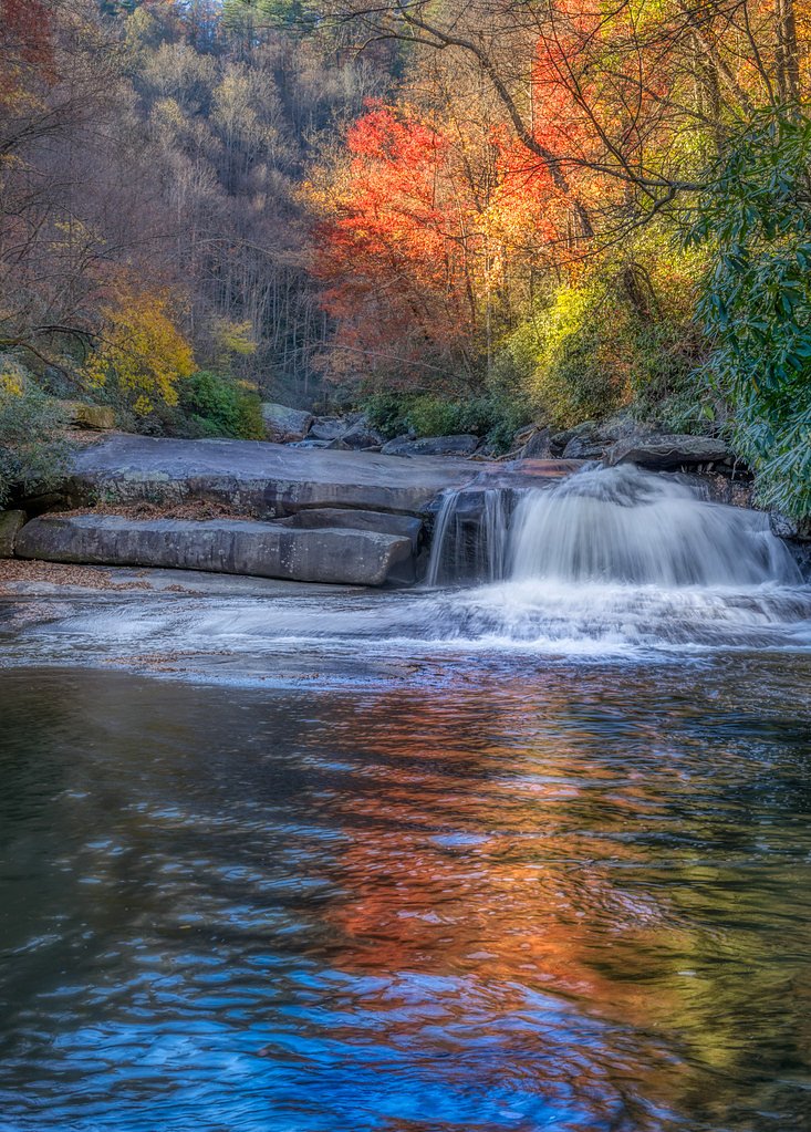
Hickorynut Falls
North Carolina • 404 ft
By Armen Suny · Last verified Mar 2026
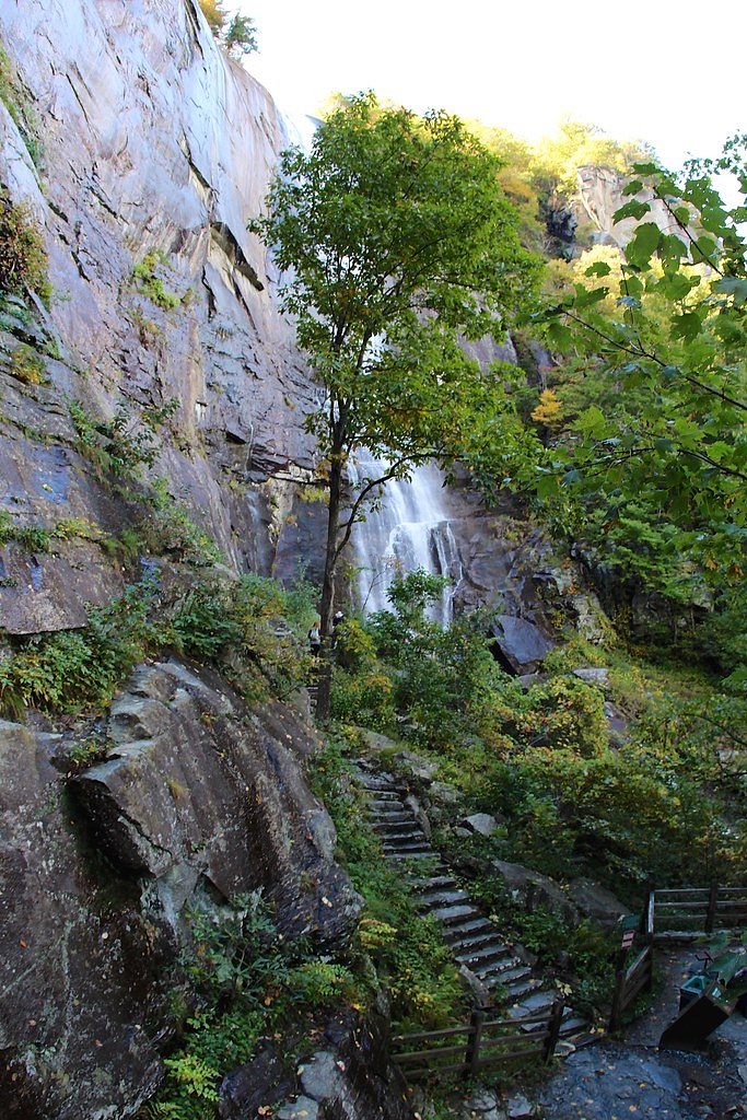
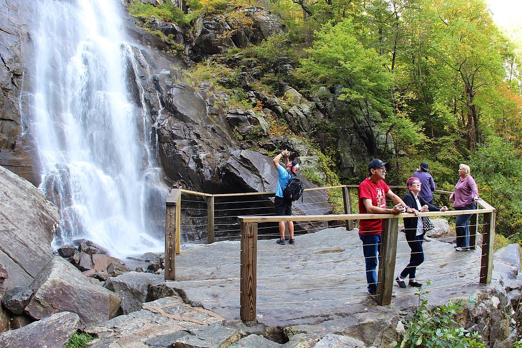
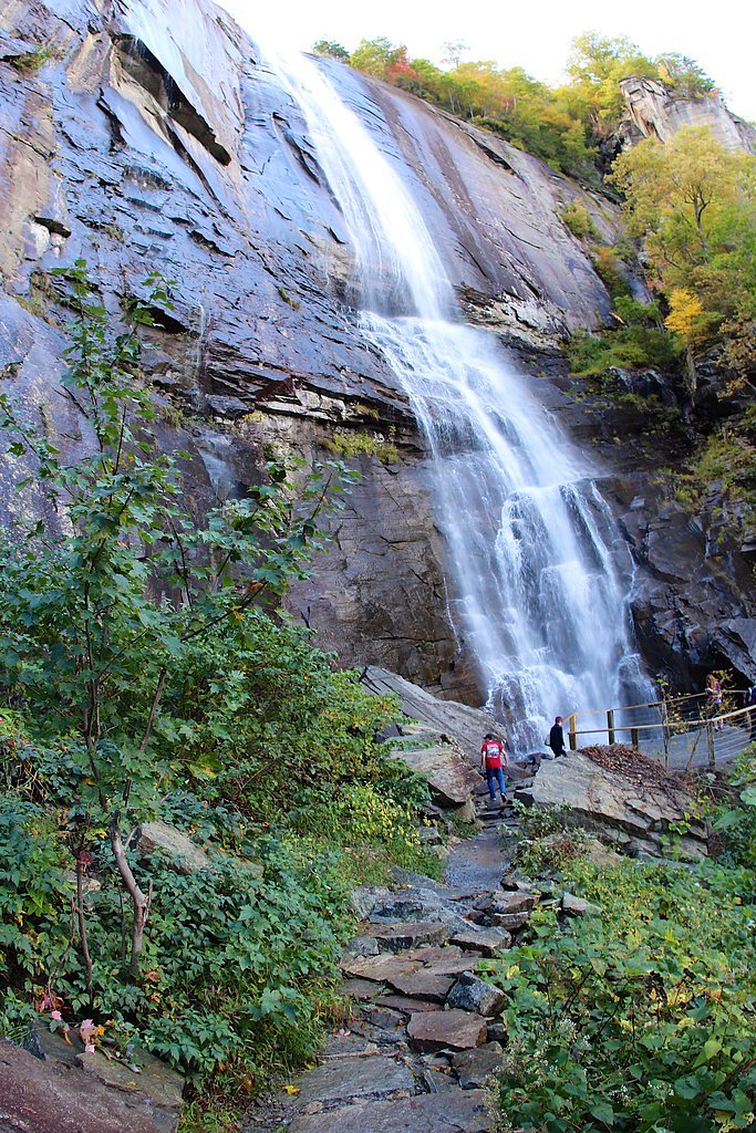
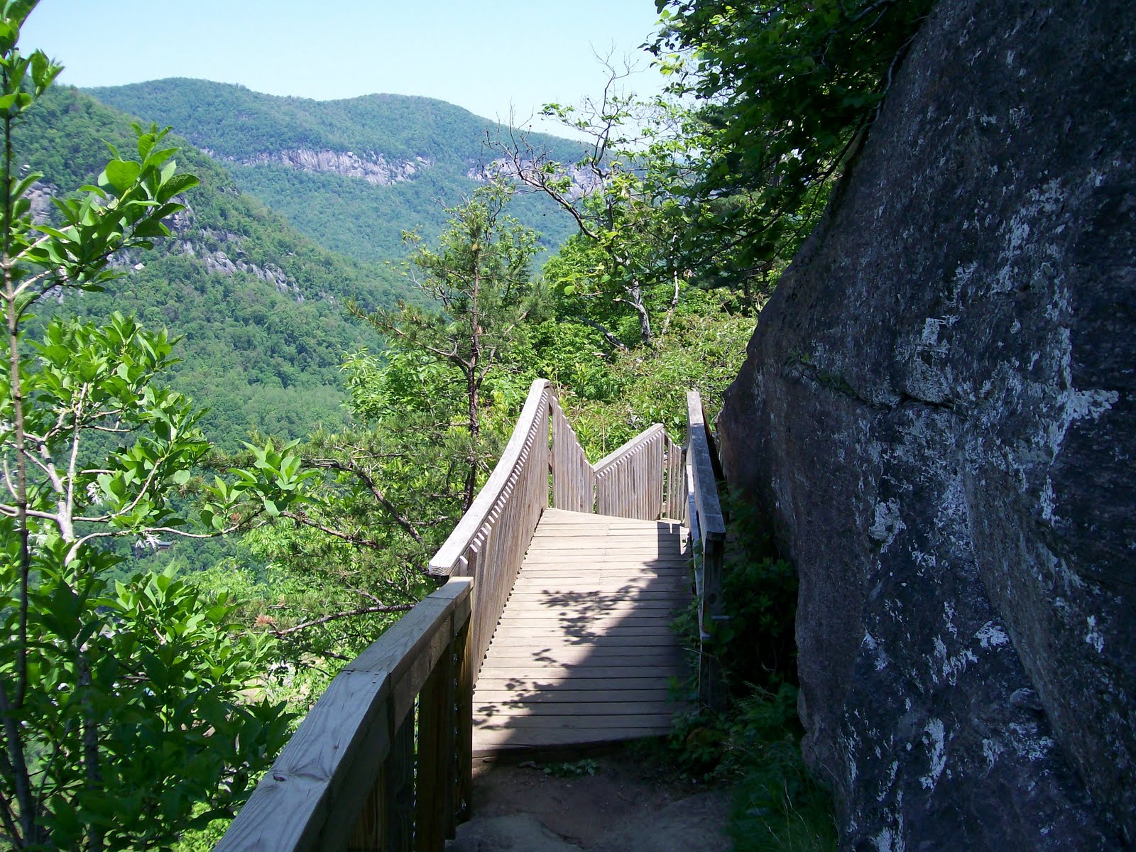
Photo Credits (4)
Difficulty
Easy
Trail Length
1.4 miles
Trail Type
Out And Back
Elevation Gain
200 ft
About Hickorynut Falls
Hickorynut Falls is a stunning 404-foot waterfall located within Chimney Rock State Park in North Carolina. It is one of the tallest waterfalls in the eastern United States and is accessible via a relatively short hiking trail.
The Setting
Hickorynut Falls sits at 2,434 feet within Chimney Rock State Park, fed by the Cove Creek, in the hills of North Carolina. At 404 feet, it is among the taller waterfalls in North Carolina.
Height: 404 feet
Trail & Hike Details
The Approach
The easy 1.4-mile out-and-back trail gains 200 feet of elevation on the way to the falls.
Trail Description
The Hickorynut Falls Trail is a well-maintained, easy out-and-back trail that leads to the base of the waterfall. The trail is mostly shaded and features a gentle incline, making it suitable for most visitors, including families with children.
What to Expect
The falls plunge a dramatic 404 feet. Dogs are welcome.
Accessibility
The trail is not wheelchair accessible. Uneven terrain and elevation changes require steady footing.
Frequently Asked Questions
🐶 Are Dogs Allowed at Hickorynut Falls?
✅ Dogs are allowed
Are There Any Fees or Permits Required?
🤑 Fee: $17.00
🏊 Is There Swimming at Hickorynut Falls?
❌ Swimming is not allowed
When to Visit
Spring and early summer are ideal for visiting Hickorynut Falls, as the waterfall flow is typically strongest during these seasons. Fall offers beautiful foliage, while winter provides a quieter experience.
Seasonal Access
The best time to visit is Spring, Summer, and Fall. Winter access may be limited.
Safety Information
The trail can be slippery after rain, so exercise caution. Stay on marked trails and avoid climbing on rocks near the waterfall. Be aware of falling debris near the base of the falls.
Current Water Conditions
49 ft³/s
Current discharge — how much water is flowing
Lower than usual for this time of year
Based on 75 years of record
2.00 ft
Water depth at gauge
7-Day Discharge Trend
What does this mean for your visit?
Flow is lower than usual for this time of year.
About This Gauge
This gauge is on a nearby waterway and may not reflect exact conditions at the falls.
7-Day Flow Outlook
Based on the USGS gauge COVE CREEK NEAR LAKE LURE, NC (13 km away).
Today
Roaring
56 cfs
6/10Tomorrow
Roaring
55 cfs
6/10Tue
Roaring
62 cfs
6/10Wed
Strong
52 cfs
10/10Thu
Strong
50 cfs
10/10Fri
Roaring
57 cfs
6/10Sat
Roaring
60 cfs
6/10Best window: Wed — strong flow, sunny (trip score 10/10).
Best time of year: this gauge typically runs highest from mid February to early May, peaking in April.
How we calculate this
This is a transparent outlook, not a precise forecast. We take the waterfall's current flow strength (how it ranks against its historical normal for today, from the nearest USGS stream gauge), carry that ranking forward along the gauge's seasonal curve, and nudge it for forecast rain. Confidence is highest for the next day or two and falls further out. Always check official conditions and your own judgment before visiting — high flows can be dangerous.
Know when to go.
Get a free email alert when waterfalls near Chimney Rock Village hit peak flow. We only send when conditions are worth the trip — no weekly newsletters, no spam.
Weather Forecast
Location & Access
Getting There
Hickorynut Falls is located within Chimney Rock State Park, which is accessible via Chimney Rock Village off Highway 64/74A. The park entrance is well-marked, and visitors can follow signs to the parking area.
Get Directions on Google MapsParking
Parking is available at Chimney Rock State Park near the visitor center. From there, the trailhead to Hickorynut Falls is clearly marked.
Elevation
2,434 feet above sea level
Coordinates
35.432946° N, -82.259504° W
Land Management
Managed by UNK
Visitor Tips & Gear
Arrive early to avoid crowds, especially during weekends and peak seasons. Wear sturdy shoes as the trail can be muddy after rain. Bring water and a camera to capture the beautiful scenery.
As an Amazon Associate, we earn from qualifying purchases.
This easy 1.4 miles hike is straightforward — comfortable trail shoes and plenty of water should do. Sun exposure on the trail makes good sun protection a must in summer.

Polarized Sunglasses (Knockaround)
Cuts glare off the water so you actually see the falls — and your photos turn out better too.

Columbia Watertight II Rain Jacket
Packs into its own pocket, seam-sealed, and keeps you dry from spray and surprise rain.

Earth Pak Waterproof Dry Bag
Keeps your phone and gear dry when waterfall mist soaks everything else.

Waterproof Phone Pouch (AiRunTech)
Cheap insurance — take photos right next to the falls without killing your phone.

JOBY GorillaPod Starter Kit
Wraps around railings and rocks for long-exposure waterfall shots — no flat surface needed.

Osprey Daylite Daypack
Light, organized, and just the right size for a day hike — fits water, snacks, and layers.
Where to Stay

1850s Settlers Cabin at Wethero Ridge

Lake Lure Inn and Spa

Fox Run at Lake Lure

The Chimney Rock Inn & Cottages
Browse vacation cabins and private rentals nearby
Unique outdoor stays — tents, yurts, and treehouses
Rent a campervan or RV for your waterfall road trip
Some links are affiliate links. We may earn a commission at no extra cost to you.
Nearby Campground
CURTIS CREEK CAMPGROUND (NC)
17.1 miles away · 24 sites
Overview Curtis Creek Campground is nestled in the mountains at the base of the Blue Ridge just minutes from the quaint town of Old Fort and less than an hour from the popular city of Asheville. Located in the first tract of National Forest land in the eastern US at the site of an old Civilian Conservation Corp (CCC) camp, the campground is surrounded by old growth forests and roaring trout streams. The gravel road through the campground ascends to the Blue Ridge Parkway, providing easy access to
Book on Recreation.govNearby Hot Springs
Hot springs near Chimney Rock Village, North Carolina

Looking for a soak after your hike? Explore more hot springs near Chimney Rock Village, North Carolina on SoakingSprings.
Explore North Carolina springsAdditional Information
Nearby Attractions
Chimney Rock itself, which offers panoramic views of the surrounding area, and Lake Lure, a popular spot for boating and picnicking.
Wildlife
The area is home to a variety of wildlife, including birds, squirrels, and occasionally deer. Keep an eye out for native plants and wildflowers along the trail.
Cities near Hickorynut Falls
Nearby Waterfalls

Writing about Hickorynut Falls? Embed this waterfall on your site for free.