
Photo Credits (5)
Difficulty
Easy
Trail Length
1.0 miles
Trail Type
Out And Back
Elevation Gain
150 ft
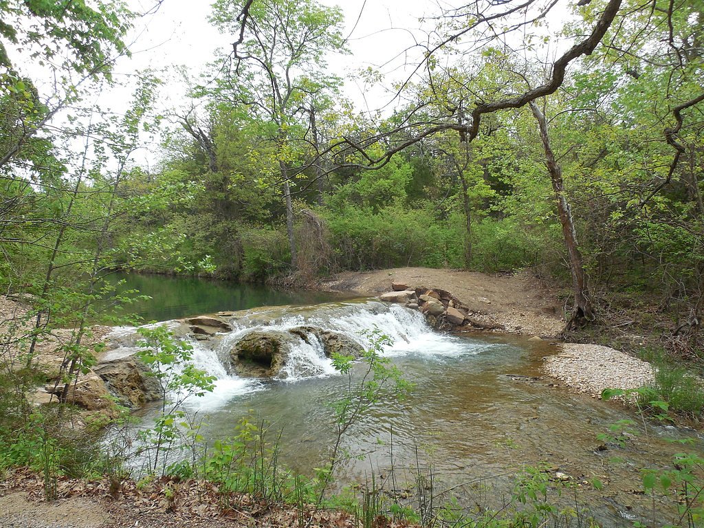
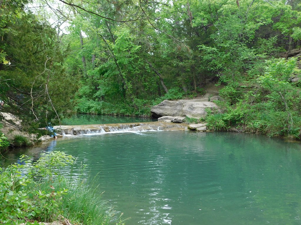
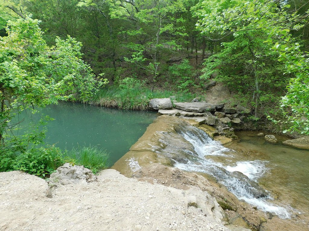
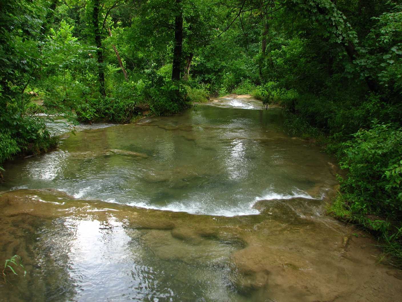
About Garfield Falls
Garfield Falls is a compact, photogenic cascade tucked into wooded terrain in Oklahoma, a favorite quick escape for hikers and photographers looking for a short nature outing. The falls' intimate setting and accessible approach make it easy to enjoy a peaceful visit without a long trek, rewarding visitors with pleasant water views and photogenic angles after a brief walk. The waterfall sits on land owned by DESG within the Chickasaw Oklahoma Tribal Statistical Area and is managed by tribal authorities (designation: TRIB/TRIBL). For those planning to stay overnight, Cold Springs Campground (Chickasaw) is just 1.13 km away, offering convenient nearby camping and making Garfield Falls a nice option for a short day hike from camp.
The Setting
Garfield Falls sits at 991 feet within Chickasaw Oklahoma Tribal Statistical Area, fed by the Rock Creek, in the foothills of Oklahoma.
Trail & Hike Details
The Approach
The easy 1.0-mile out-and-back trail gains 150 feet of elevation on the way to the falls.
Trail Description
The trail to Garfield Falls is a short 1.0-mile out-and-back route with approximately 150 feet of elevation gain and is rated easy, making it suitable for most hikers and families. This brief, straightforward hike is an accessible way to reach the waterfall without a long climb. Specific details on trail surface, grade, and any USFS trail classification or route number are not provided in the available data. Visitors should plan for a short natural trail and check local tribal land guidance or campground information before heading out.
What to Expect
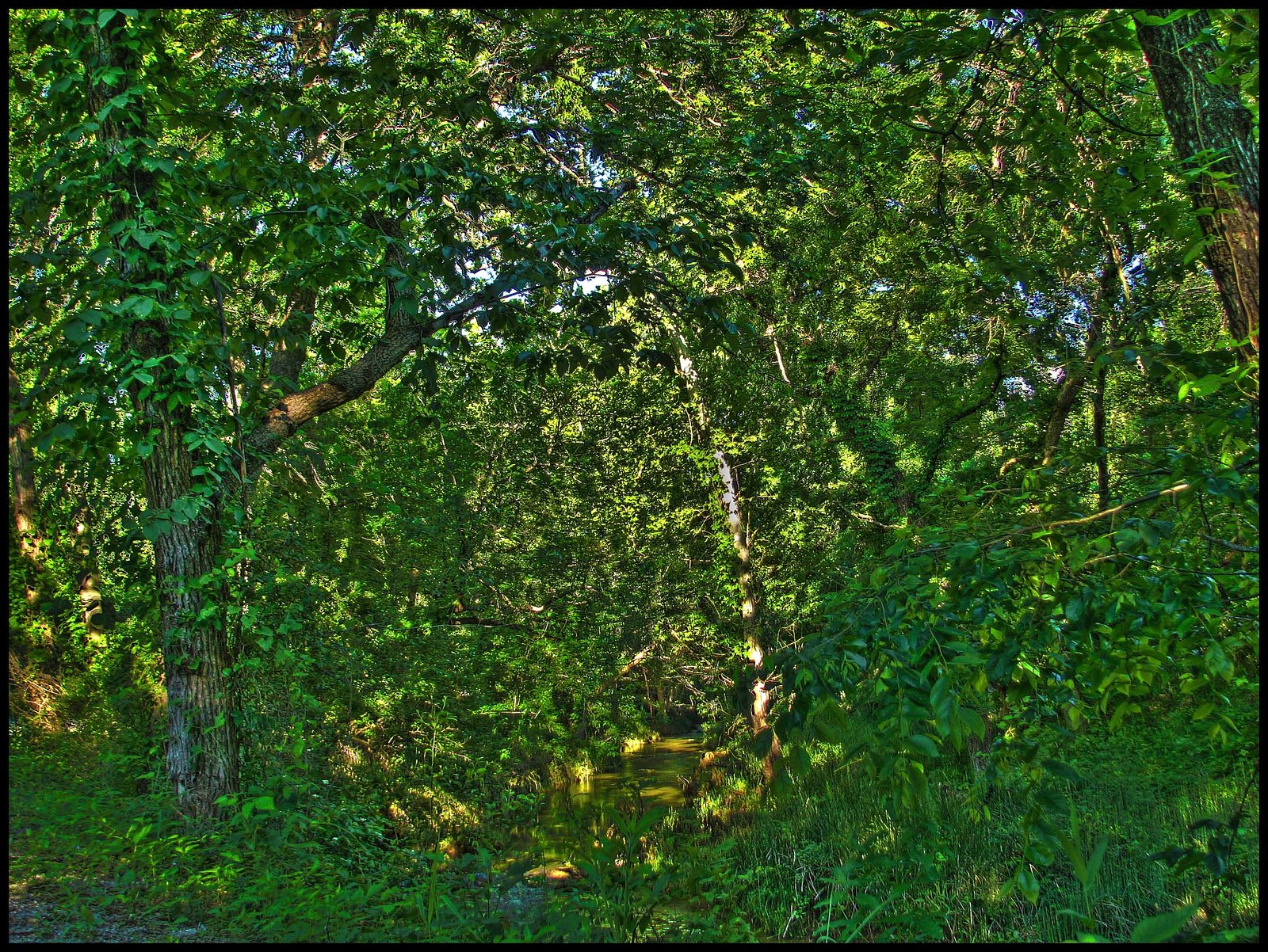
Visitors can expect a peaceful natural setting with a waterfall surrounded by lush vegetation. The area may be remote and less developed.
Accessibility
The trail is not wheelchair accessible. Uneven terrain and elevation changes require steady footing.
Frequently Asked Questions
🐶 Are Dogs Allowed at Garfield Falls?
❌ Dogs are not allowed
Are There Any Fees or Permits Required?
🆖 No fees required
🏊 Is There Swimming at Garfield Falls?
❌ Swimming is not allowed
When to Visit
Spring and early summer are typically the best times to visit, as water flow may be higher due to seasonal rainfall.
Seasonal Access
The best time to visit is Spring, Summer, and Fall. Winter access may be limited.
Safety Information
The area may have uneven terrain, slippery rocks, and limited cell service. Visitors should exercise caution and inform someone of their plans.
Current Water Conditions
14 ft³/s
Current discharge — how much water is flowing
About average for this time of year
Based on 36 years of record
5.57 ft
Water depth at gauge
7-Day Discharge Trend
What does this mean for your visit?
Flow is about average for this time of year.
About This Gauge
7-Day Flow Outlook
Based on the USGS gauge Rock Creek at Sulphur, OK (3 km away).
Today
Moderate
14 cfs
8/10Tomorrow
Moderate
14 cfs
8/10Sun
Moderate
15 cfs
4/10Mon
Moderate
16 cfs
6/10Tue
Moderate
14 cfs
8/10Wed
Moderate
12 cfs
8/10Thu
Moderate
12 cfs
8/10Best window: Today — moderate flow, sunny (trip score 8/10).
Best time of year: this gauge typically runs highest from late April to mid June, peaking in March.
How we calculate this
This is a transparent outlook, not a precise forecast. We take the waterfall's current flow strength (how it ranks against its historical normal for today, from the nearest USGS stream gauge), carry that ranking forward along the gauge's seasonal curve, and nudge it for forecast rain. Confidence is highest for the next day or two and falls further out. Always check official conditions and your own judgment before visiting — high flows can be dangerous.
Know when to go.
Get a free email alert when waterfalls near Sulphur hit peak flow. We only send when conditions are worth the trip — no weekly newsletters, no spam.
Weather Forecast
Location & Access
Getting There
The exact location and directions to Garfield Falls are not well-documented. Visitors are advised to consult local resources or maps for guidance.
Get Directions on Google MapsParking
Parking availability is unclear. Visitors should prepare for limited or informal parking options near the trailhead.
Elevation
991 feet above sea level
Coordinates
34.502312° N, -96.955571° W
Land Management
Managed by TRIB
Visitor Tips & Gear
Bring a map or GPS device as the location may be difficult to find. Wear sturdy footwear and be prepared for uneven terrain.
As an Amazon Associate, we earn from qualifying purchases.
This easy 1.0 miles hike is straightforward — comfortable trail shoes and plenty of water should do. Sun exposure on the trail makes good sun protection a must in summer.

Polarized Sunglasses (Knockaround)
Cuts glare off the water so you actually see the falls — and your photos turn out better too.

Columbia Watertight II Rain Jacket
Packs into its own pocket, seam-sealed, and keeps you dry from spray and surprise rain.

Earth Pak Waterproof Dry Bag
Keeps your phone and gear dry when waterfall mist soaks everything else.

Waterproof Phone Pouch (AiRunTech)
Cheap insurance — take photos right next to the falls without killing your phone.

JOBY GorillaPod Starter Kit
Wraps around railings and rocks for long-exposure waterfall shots — no flat surface needed.

Osprey Daylite Daypack
Light, organized, and just the right size for a day hike — fits water, snacks, and layers.
Where to Stay

Comfort Inn & Suites Pauls Valley - City Lake

Turner Falls Park Villa

Village Inn

Holiday Inn Express and Suites Hotel - Pauls Valley by IHG
Browse vacation cabins and private rentals nearby
Unique outdoor stays — tents, yurts, and treehouses
Rent a campervan or RV for your waterfall road trip
Some links are affiliate links. We may earn a commission at no extra cost to you.
Nearby Campground
Cold Springs Campground (Chickasaw)
0.7 miles away · 64 sites
Overview Cold Springs Campground is a popular summer campground conveniently located 5-7 minutes from the town of Sulphur. Travertine Creek, directly across from Cold Springs, provides several refreshing spring-fed swimming areas to escape the summer heat. Other nearby attractions, such as Little Niagara and the Travertine Nature Center, make this campground an ideal location for both seasoned and first-time campers.El Camping Cold Springs es un popular camping de verano, convenientemente ubicado
Book on Recreation.govAdditional Information
Nearby Attractions
Other natural attractions in Oklahoma may be nearby, but specific recommendations are not available.
Wildlife
The area may host a variety of local wildlife, including birds and small mammals.
Cities near Garfield Falls
Nearby Waterfalls
Other waterfalls named Garfield Falls
1 other waterfall shares this name across the U.S.
Writing about Garfield Falls? Embed this waterfall on your site for free.