
Photo Credits (5)
Difficulty
Moderate
Trail Length
2.4 miles
Trail Type
Out And Back
Elevation Gain
350 ft
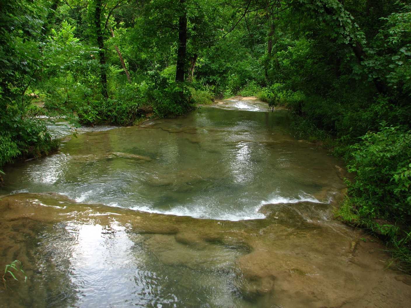
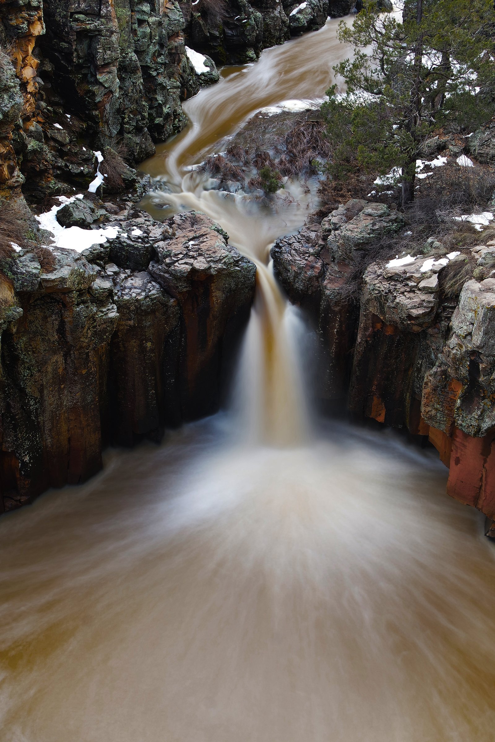
About Sycamore Falls
Sycamore Falls is a seasonal cascade tucked into the rugged terrain of the Wichita Mountains area in southwestern Oklahoma. The fall’s flow depends on recent rainfall, so it’s most impressive in the weeks after storms when runoff breathes life into the drop. The site sits within the Chickasaw Oklahoma Tribal Statistical Area and is on land designated TRIB, managed by tribal authorities — visitors should be mindful that this waterfall and its immediate surroundings are on Chickasaw tribal land. The hike to Sycamore Falls rewards a short stretch of effort with quiet, scenic rock outcrops and a peaceful pool at the base when water is present. Cold Springs Campground (Chickasaw) is only about 1.17 km away, making an overnight stay convenient for those who want to catch the falls at first light or after a rainy day. Plan visits after precipitation for the best viewing, and respect local land use guidelines while on tribal lands.
The Setting
Sycamore Falls sits at 1,007 feet within Chickasaw Oklahoma Tribal Statistical Area, fed by the Rock Creek, in the foothills of Oklahoma.
Trail & Hike Details
The Approach
The moderate 2.4-mile out-and-back trail gains 350 feet of elevation on the way to the falls.
Trail Description
The trail to Sycamore Falls is an out-and-back route of about 2.4 miles round-trip with roughly 350 feet of elevation gain, rated moderate. The tread is primarily natural and can be uneven, especially as you approach the waterfall where rock and roots are common; sturdy footwear is recommended. Because the falls are seasonal, the destination may be reduced to a dry cascade during prolonged dry spells — time your hike after rain for the fullest experience. Cold Springs Campground is roughly 1.17 km away, providing nearby camping options for overnight trips.
What to Expect
Dogs are welcome.
Accessibility
The trail is not wheelchair accessible. Uneven terrain and elevation changes require steady footing.
Frequently Asked Questions
🐶 Are Dogs Allowed at Sycamore Falls?
✅ Dogs are allowed
Are There Any Fees or Permits Required?
🆖 No fees required
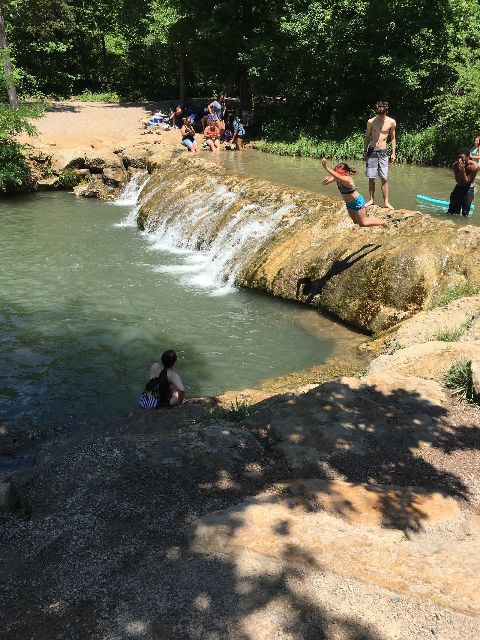
🏊 Is There Swimming at Sycamore Falls?
❌ Swimming is not allowed
When to Visit
The best time to visit is in the spring or after significant rainfall, as the waterfall is seasonal and dependent on precipitation.
Seasonal Access
The best time to visit is Spring, Summer, and Fall. Winter access may be limited.
Safety Information
Be cautious of uneven terrain and potential slippery rocks near the falls. Watch for wildlife, and avoid approaching or feeding animals. Carry sufficient water, especially during warmer months.
Current Water Conditions
14 ft³/s
Current discharge — how much water is flowing
About average for this time of year
Based on 36 years of record
5.57 ft
Water depth at gauge
7-Day Discharge Trend
What does this mean for your visit?
Flow is about average for this time of year.
About This Gauge
7-Day Flow Outlook
Based on the USGS gauge Rock Creek at Sulphur, OK (3 km away).
Today
Moderate
14 cfs
8/10Tomorrow
Moderate
14 cfs
8/10Sun
Moderate
15 cfs
4/10Mon
Moderate
16 cfs
6/10Tue
Moderate
14 cfs
8/10Wed
Moderate
12 cfs
8/10Thu
Moderate
12 cfs
8/10Best window: Today — moderate flow, sunny (trip score 8/10).
Best time of year: this gauge typically runs highest from late April to mid June, peaking in March.
How we calculate this
This is a transparent outlook, not a precise forecast. We take the waterfall's current flow strength (how it ranks against its historical normal for today, from the nearest USGS stream gauge), carry that ranking forward along the gauge's seasonal curve, and nudge it for forecast rain. Confidence is highest for the next day or two and falls further out. Always check official conditions and your own judgment before visiting — high flows can be dangerous.
Know when to go.
Get a free email alert when waterfalls near Sulphur hit peak flow. We only send when conditions are worth the trip — no weekly newsletters, no spam.
Weather Forecast
Location & Access
Getting There
Sycamore Falls is located within the Wichita Mountains Wildlife Refuge. Visitors can access the area by driving to the refuge, which is near Lawton, Oklahoma. Specific directions to the falls may vary, as it is not always marked on maps. It is recommended to consult local guides or park staff for precise directions.
Get Directions on Google MapsParking
Parking is available at designated areas within the Wichita Mountains Wildlife Refuge. Visitors should check for signs indicating parking restrictions.
Elevation
1,007 feet above sea level
Coordinates
34.505089° N, -96.954738° W
Land Management
Managed by TRIB
Visitor Tips & Gear
Visit after recent rainfall to ensure the waterfall is flowing. Wear sturdy shoes, as the terrain near the falls can be uneven. Bring water and sunscreen, as the trail may have limited shade.
As an Amazon Associate, we earn from qualifying purchases.
With 2.4 miles and 350 ft of elevation gain, sturdy boots and trekking poles will help on this moderate trail. Sun exposure on the trail makes good sun protection a must in summer.

Polarized Sunglasses (Knockaround)
Cuts glare off the water so you actually see the falls — and your photos turn out better too.

Columbia Watertight II Rain Jacket
Packs into its own pocket, seam-sealed, and keeps you dry from spray and surprise rain.

Earth Pak Waterproof Dry Bag
Keeps your phone and gear dry when waterfall mist soaks everything else.

Waterproof Phone Pouch (AiRunTech)
Cheap insurance — take photos right next to the falls without killing your phone.

Timberland Euro Sprint Mid Waterproof
Trusted waterproof boot with premium leather and grippy rubber sole — reliable on rocky, wet trails.

TrailBuddy Trekking Poles
Lightweight aluminum, cork grips, and flip-locks that actually hold — a best-seller for good reason.
Where to Stay

Comfort Inn & Suites Pauls Valley - City Lake

Turner Falls Park Villa

Village Inn

Holiday Inn Express and Suites Hotel - Pauls Valley by IHG
Browse vacation cabins and private rentals nearby
Unique outdoor stays — tents, yurts, and treehouses
Rent a campervan or RV for your waterfall road trip
Some links are affiliate links. We may earn a commission at no extra cost to you.
Nearby Campground
Cold Springs Campground (Chickasaw)
0.7 miles away · 64 sites
Overview Cold Springs Campground is a popular summer campground conveniently located 5-7 minutes from the town of Sulphur. Travertine Creek, directly across from Cold Springs, provides several refreshing spring-fed swimming areas to escape the summer heat. Other nearby attractions, such as Little Niagara and the Travertine Nature Center, make this campground an ideal location for both seasoned and first-time campers.El Camping Cold Springs es un popular camping de verano, convenientemente ubicado
Book on Recreation.govAdditional Information
Nearby Attractions
Other attractions in the Wichita Mountains Wildlife Refuge include Mount Scott, the Holy City of the Wichitas, and the Quanah Parker Lake.
Wildlife
The refuge is home to a variety of wildlife, including bison, elk, deer, and numerous bird species. Visitors should maintain a safe distance from all wildlife.
Cities near Sycamore Falls
Nearby Waterfalls

Writing about Sycamore Falls? Embed this waterfall on your site for free.