Photo Credits (5)
Difficulty
Moderate
Trail Length
4.0 miles
Trail Type
Out And Back
Elevation Gain
500 ft
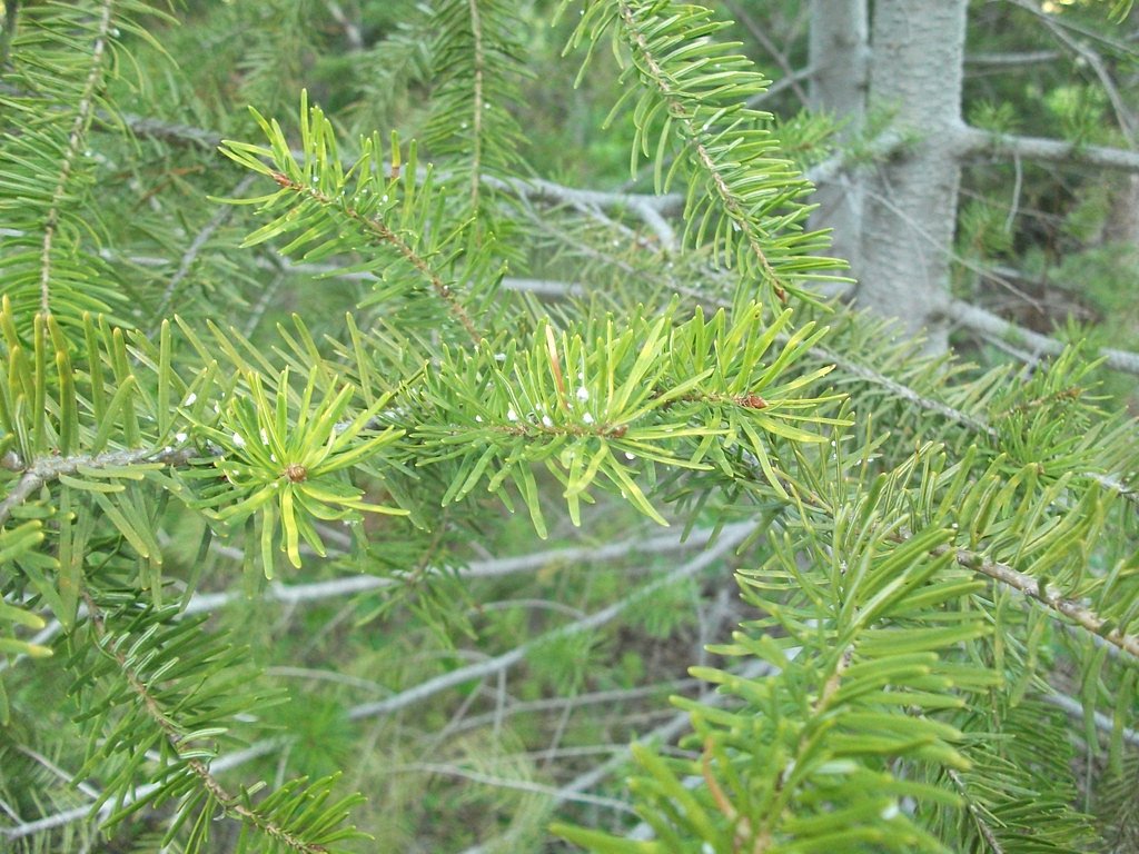
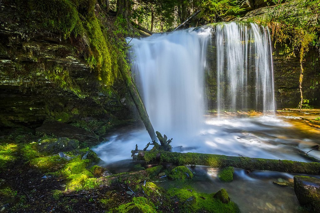
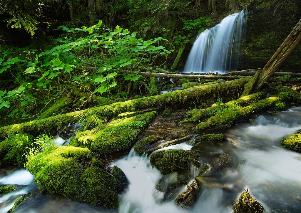
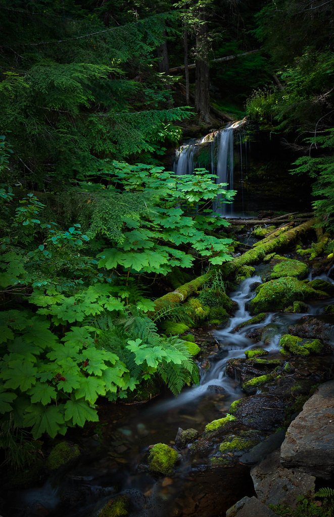
About Fern Falls
Fern Falls is a quiet, photogenic cascade tucked into the Boise National Forest and managed by the U.S. Forest Service. The falls sit amid dense forest and offer a peaceful reward for a moderate hike; many visitors describe the setting as lush and restorative, ideal for a half-day outing. The most direct approach follows a portion of the USFS South Fork Payette River Trail (Trail #7452), which leads you through classic inland Pacific Northwest woods and riparian scenery to the falls. The hike to Fern Falls is an out-and-back route of about 4.0 miles with roughly 500 feet of elevation gain and is generally rated moderate. The South Fork Payette River Trail is listed by the Forest Service at 16.62 GIS miles in total, so the falls are accessed via a maintained segment of that longer trail. Note that the nearest developed camping is at Yellowbelly Lake, about 17.5 km away, so plan overnight stays accordingly.
The Setting
Fern Falls sits at 6,381 feet within Boise National Forest, fed by the Valley Creek, in the high mountains of Idaho.
Trail & Hike Details
The Approach
The moderate hike follows South Fork Payette River (#7452), a 4.0-mile out-and-back trail over natural surface. Expect 500 feet of elevation gain with grades of 12-20%. The trail is developed (Class 3).
USFS Trail
SOUTH FORK PAYETTE RIVER #7452
Trail Class
Developed
Surface
Avg Grade
USFS Segment
16.62 miTrail Description
Trail: South Fork Payette River Trail (USFS Trail #7452). Route type: out-and-back ~4.0 miles with ~500 ft elevation gain; difficulty: moderate. Surface: native material (natural tread); expect an unpaved, natural trail surface. Class: 3 (moderately rugged); typical grade: 12–20%. The full USFS listing shows Trail #7452 at 16.62 GIS miles, with the Fern Falls access following a maintained segment of that route. Hikers should be prepared for natural, uneven tread and basic backcountry conditions managed by the U.S. Forest Service in Boise National Forest.
What to Expect
Dogs are welcome.
Accessibility
The trail is not wheelchair accessible. Uneven terrain and elevation changes require steady footing.
Frequently Asked Questions
🐶 Are Dogs Allowed at Fern Falls?
✅ Dogs are allowed
Are There Any Fees or Permits Required?
🆖 No fees required
🏊 Is There Swimming at Fern Falls?
❌ Swimming is not allowed
When to Visit
Spring and early summer are ideal for visiting Fern Falls, as the waterfall is typically at its fullest during this time due to snowmelt.
Seasonal Access
The best time to visit is Spring, Summer, and Fall. Access roads and trails may close during winter due to snow. Check with Boise National Forest for seasonal road closures.
Safety Information
Hikers should be cautious of slippery rocks near the waterfall and be prepared for changing weather conditions. Carry bear spray and know how to use it, as the area is within bear country.
Current Water Conditions
Based on a USGS gauge 15.3 miles away
343 ft³/s
Current discharge — how much water is flowing
About average for this time of year
Based on 88 years of record
1.58 ft
Water depth at gauge
7-Day Discharge Trend
What does this mean for your visit?
Flow is about average for this time of year.
About This Gauge
This gauge is on a regional waterway. Conditions at the falls may differ, especially after local rain.
7-Day Flow Outlook
Based on the USGS gauge VALLEY CREEK AT STANLEY ID (25 km away).
Today
Roaring
391 cfs
6/10Tomorrow
Roaring
369 cfs
6/10Mon
Roaring
349 cfs
6/10Tue
Roaring
327 cfs
6/10Wed
Roaring
332 cfs
6/10Thu
Roaring
329 cfs
6/10Fri
Roaring
323 cfs
6/10Best window: Today — roaring flow, widespread showers and thunderstorms (trip score 6/10).
Best time of year: this gauge typically runs highest from mid April to mid July, peaking in June.
How we calculate this
This is a transparent outlook, not a precise forecast. We take the waterfall's current flow strength (how it ranks against its historical normal for today, from the nearest USGS stream gauge), carry that ranking forward along the gauge's seasonal curve, and nudge it for forecast rain. Confidence is highest for the next day or two and falls further out. Always check official conditions and your own judgment before visiting — high flows can be dangerous.
Know when to go.
Get a free email alert when waterfalls near Stanley hit peak flow. We only send when conditions are worth the trip — no weekly newsletters, no spam.
Weather Forecast
Location & Access
Getting There
Fern Falls is accessed via the Selway River Trail, which begins near the Selway River in the Selway-Bitterroot Wilderness. The trailhead is located off Selway Road, approximately 20 miles from Lowell, Idaho.
Get Directions on Google MapsParking
Parking is available at the Selway River Trailhead, but spaces may be limited during peak seasons.
Elevation
6,381 feet above sea level
Coordinates
44.033332° N, -115.089993° W
Land Management
Managed by USFS
Visitor Tips & Gear
Start early to avoid crowds and ensure you have enough daylight for the hike. Wear sturdy hiking boots and bring plenty of water. Bug spray is recommended during warmer months.
This trail sits at 6,381 ft above sea level
Elevated TrailUV radiation is roughly 26% stronger at this elevation than at sea level, and the dry air accelerates dehydration. Extra sun protection and fluids go a long way.
As an Amazon Associate, we earn from qualifying purchases.

Coppertone Sport SPF 50 Sunscreen
UV intensity jumps ~4% per 1,000 ft — at this elevation you can burn in half the time.

Sun Bum SPF 30 Lip Balm (3-Pack)
Lips have almost no natural UV protection and burn fast in thin, dry mountain air.

Liquid I.V. Electrolyte Packets
You lose moisture ~2x faster at elevation — electrolytes help you absorb water efficiently.

ROCKNIGHT Polarized UV400 Sunglasses
High-altitude glare off rock and water is intense — UV400 lenses block 99%+ of UVA/UVB.
As an Amazon Associate, we earn from qualifying purchases.
With 4.0 miles and 500 ft of elevation gain, sturdy boots and trekking poles will help on this moderate trail. Sun exposure on the trail makes good sun protection a must in summer.

Polarized Sunglasses (Knockaround)
Cuts glare off the water so you actually see the falls — and your photos turn out better too.

Columbia Watertight II Rain Jacket
Packs into its own pocket, seam-sealed, and keeps you dry from spray and surprise rain.

Earth Pak Waterproof Dry Bag
Keeps your phone and gear dry when waterfall mist soaks everything else.

Waterproof Phone Pouch (AiRunTech)
Cheap insurance — take photos right next to the falls without killing your phone.

Timberland Euro Sprint Mid Waterproof
Trusted waterproof boot with premium leather and grippy rubber sole — reliable on rocky, wet trails.

TrailBuddy Trekking Poles
Lightweight aluminum, cork grips, and flip-locks that actually hold — a best-seller for good reason.
Where to Stay

Redfish Riverside Inn

Stanley High Country Inn

Timberhaven Cabin

Lowman Outdoor Retreat Walk to Hot Springs!
Browse vacation cabins and private rentals nearby
Unique outdoor stays — tents, yurts, and treehouses
Rent a campervan or RV for your waterfall road trip
Some links are affiliate links. We may earn a commission at no extra cost to you.
Nearby Campground
Nearby Hot Springs
Hot springs near Stanley, Idaho
Grandjean Hot Spring
Grandjean Hot Spring sits at 5,000 feet in the Boise National Forest, just 60 feet from the road in some of the most dramatic h...
Sacajawea Hot Springs
Sacajawea Hot Springs blasts out at 153 degrees Fahrenheit at 5,000 feet elevation in the Boise National Forest, making it dang...
Atlanta Hot Springs
Atlanta Hot Springs reaches 140 degrees Fahrenheit, hot enough to scald, in the remote mining town of Atlanta in the Boise Nati...
Leggit Creek Hot Spring
Leggit Creek Hot Spring sits at 6,686 feet in the Boise National Forest, one of the higher-elevation thermal features in Idaho....
Rosalys Warm Spring
Rosalys Warm Spring surfaces at 106 degrees Fahrenheit and 6,560 feet elevation near Sun Valley, one of the higher-altitude the...
Queens River Hot Spring
Queens River Hot Spring registers 123 degrees Fahrenheit according to recent USGS measurements, with an alkaline pH of 9.6 and ...
Looking for a soak after your hike? Explore more hot springs near Stanley, Idaho on SoakingSprings.
Explore Idaho springsAdditional Information
Nearby Attractions
The Selway River and other trails in the Selway-Bitterroot Wilderness offer additional hiking and fishing opportunities.
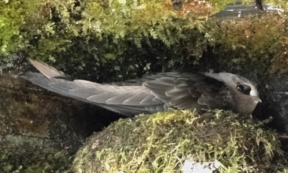
Wildlife
The area is home to a variety of wildlife, including deer, elk, and birds. Bears may also be present, so proper precautions should be taken.
Cities near Fern Falls
Nearby Waterfalls
Other waterfalls named Fern Falls
3 other waterfalls share this name across the U.S.
Writing about Fern Falls? Embed this waterfall on your site for free.