Photo Credits (5)
Difficulty
Moderate
Trail Length
3.4 miles
Trail Type
Out And Back
Elevation Gain
500 ft
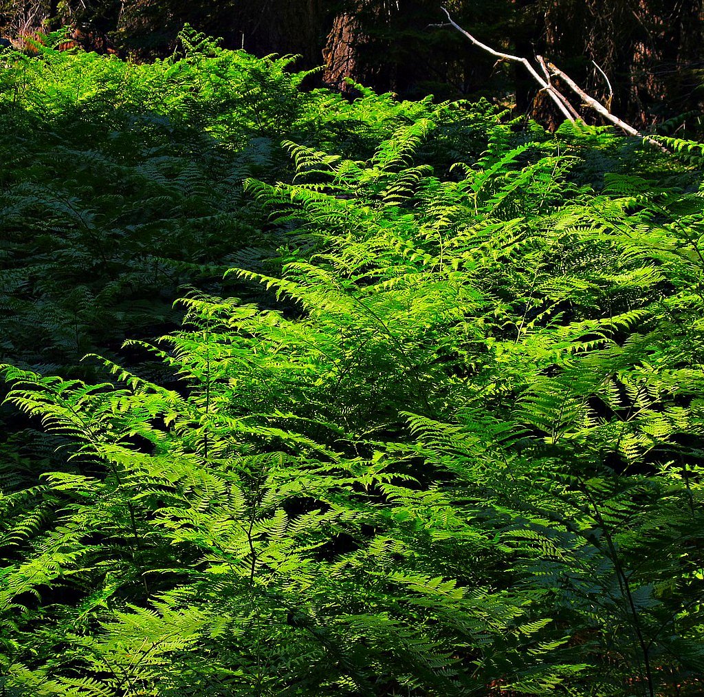
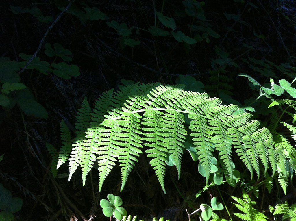
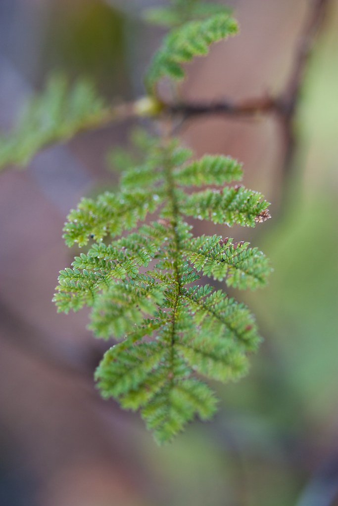
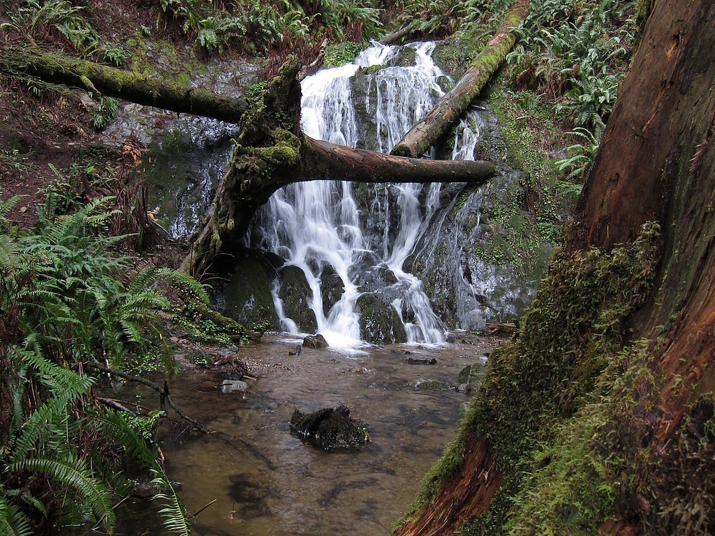
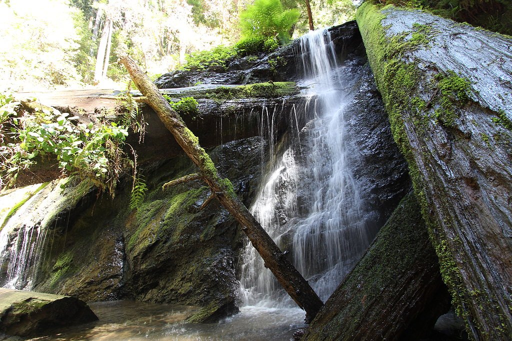
About Fern Falls
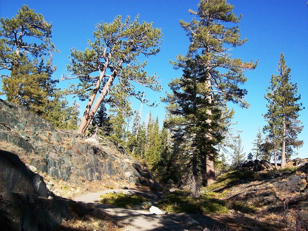
Fern Falls is a tucked-away cascade in Plumas National Forest, managed by the U.S. Forest Service. Nestled among ferns and mixed conifer, the falls make a tranquil destination for photographers and nature seekers looking for a short, scenic escape. The official approach is signed as the Fern Falls Trail (USFS Trail #12E41), and the landscape’s quiet, wooded character rewards hikers with a peaceful punctuure of water and greenery. Most visitors reach the falls via a moderate out-and-back route totaling about 3.4 miles with roughly 500 feet of elevation gain. The USFS maps a short 0.13-mile native-surface segment as the official Fern Falls Trail spur; that short stretch leads to the waterfall and is managed by the Forest Service. If you’re camping, Packsaddle Campground lies nearby—about 9.99 km from the trailhead—making an overnight stay a convenient option for a sunrise or dusk visit.
The Setting
Fern Falls sits at 5,958 feet within Plumas National Forest, in the high mountains of California.
Trail & Hike Details
The Approach
The moderate hike follows Fern Falls Trail (#12E41), a 3.4-mile out-and-back trail over natural surface. Expect 500 feet of elevation gain with grades of 5-8%. The trail is developed (Class 3).
USFS Trail
FERN FALLS TRAIL #12E41
Trail Class
Developed
Surface
Avg Grade
USFS Segment
0.13 miTrail Description
Trail name/number: Fern Falls Trail (USFS Trail #12E41). Trail type: out-and-back; total route length: 3.4 miles; elevation gain: ~500 ft; difficulty: moderate. USFS-mapped trail segment (GIS) is 0.13 miles on native material. Official trail class: 3, with a typical grade of 5–8%. Expect naturally surfaced tread (native material) and moderate grades consistent with a short forest hike; the route is managed by the U.S. Forest Service within Plumas National Forest.
What to Expect
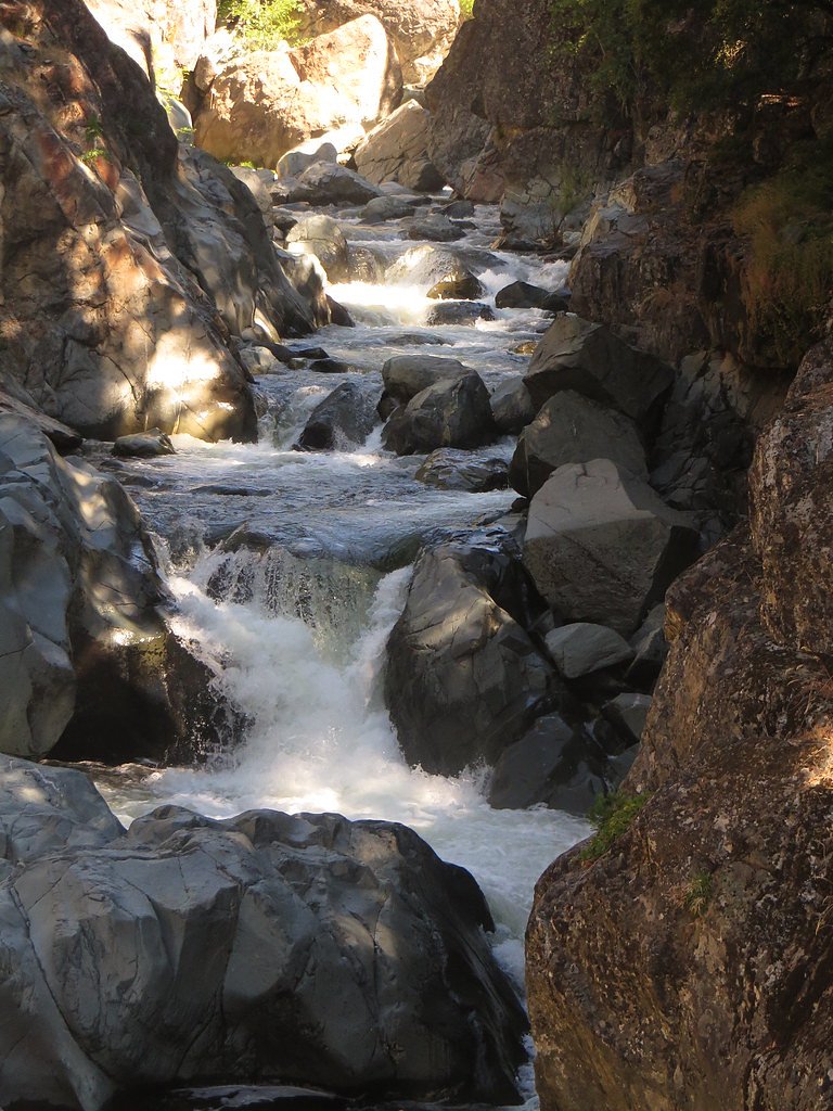
Visitors can expect a peaceful hike through a forested area with opportunities to see wildlife and enjoy the sounds of nature. Fern Falls itself is a cascading waterfall surrounded by lush greenery, offering a tranquil spot for relaxation and photography.
Accessibility
The trail is not wheelchair accessible. Uneven terrain and elevation changes require steady footing.
Frequently Asked Questions
🐶 Are Dogs Allowed at Fern Falls?
❌ Dogs are not allowed
Are There Any Fees or Permits Required?
🤑 Fee: $30.00
🏊 Is There Swimming at Fern Falls?
❌ Swimming is not allowed
When to Visit
The best time to visit Fern Falls is during late spring or early summer when the water flow is strongest, and the surrounding vegetation is lush and vibrant.
Seasonal Access
The best time to visit is Spring, Summer, and Fall. Access roads and trails may close during winter due to snow. Check with Plumas National Forest for seasonal road closures.
Safety Information
Be cautious of slippery rocks near the waterfall. Check weather conditions before your visit, as the trail may be icy or muddy during certain times of the year. Carry a map or GPS device, as cell service may be limited.
Know when to go.
Get a free email alert when waterfalls near Graeagle hit peak flow. We only send when conditions are worth the trip — no weekly newsletters, no spam.
Weather Forecast
Location & Access
Getting There
Fern Falls is located within the Lassen Volcanic National Park in Northern California. Visitors can access the falls via the park's trail system, with the most common route starting from the trailhead near the Kings Creek Picnic Area.
Get Directions on Google MapsParking
Parking is available at the Kings Creek Picnic Area, which serves as the starting point for the trail to Fern Falls. Parking spaces may be limited during peak seasons.
Elevation
5,958 feet above sea level
Coordinates
39.713699° N, -120.666285° W
Land Management
Managed by USFS
Visitor Tips & Gear
Start your hike early in the day to avoid crowds and ensure you have enough time to enjoy the falls. Wear sturdy hiking shoes, as the trail can be uneven in places. Bring plenty of water and snacks, especially during warmer months.
This trail sits at 5,958 ft above sea level
Elevated TrailUV radiation is roughly 24% stronger at this elevation than at sea level, and the dry air accelerates dehydration. Extra sun protection and fluids go a long way.
As an Amazon Associate, we earn from qualifying purchases.

Coppertone Sport SPF 50 Sunscreen
UV intensity jumps ~4% per 1,000 ft — at this elevation you can burn in half the time.

Sun Bum SPF 30 Lip Balm (3-Pack)
Lips have almost no natural UV protection and burn fast in thin, dry mountain air.

Liquid I.V. Electrolyte Packets
You lose moisture ~2x faster at elevation — electrolytes help you absorb water efficiently.

ROCKNIGHT Polarized UV400 Sunglasses
High-altitude glare off rock and water is intense — UV400 lenses block 99%+ of UVA/UVB.
As an Amazon Associate, we earn from qualifying purchases.
With 3.4 miles and 500 ft of elevation gain, sturdy boots and trekking poles will help on this moderate trail. Sun exposure on the trail makes good sun protection a must in summer.

Polarized Sunglasses (Knockaround)
Cuts glare off the water so you actually see the falls — and your photos turn out better too.

Columbia Watertight II Rain Jacket
Packs into its own pocket, seam-sealed, and keeps you dry from spray and surprise rain.

Earth Pak Waterproof Dry Bag
Keeps your phone and gear dry when waterfall mist soaks everything else.

Waterproof Phone Pouch (AiRunTech)
Cheap insurance — take photos right next to the falls without killing your phone.

Timberland Euro Sprint Mid Waterproof
Trusted waterproof boot with premium leather and grippy rubber sole — reliable on rocky, wet trails.

TrailBuddy Trekking Poles
Lightweight aluminum, cork grips, and flip-locks that actually hold — a best-seller for good reason.
Where to Stay

Family Haven in Graeagle CA w/King Bed Suite

Dafna, Unit 3 - Two Bedroom, One Bath

Golf & Mountain Views - Retreat in Clio

Quiet Home w/ Graeagle Meadows Golf Course View!
Browse vacation cabins and private rentals nearby
Unique outdoor stays — tents, yurts, and treehouses
Rent a campervan or RV for your waterfall road trip
Some links are affiliate links. We may earn a commission at no extra cost to you.
Nearby Campground
PACKSADDLE
6.2 miles away · 18 sites
Overview Packsaddle Campground is located in the Packer Lake area near the Sierra Buttes, north of the Yuba River. Visitors enjoy a wide variety of recreational activities in the area, including hiking, horseback riding, hunting, fishing, canoeing and gold panning. This facility is operated and maintained by the Tahoe National Forest. Recreation A large network of trails is available in the area, including Deer Lake Trail. This 2.9-mile trail is open to hiking, horseback riding and mountain bikin
Book on Recreation.govNearby Hot Springs
Hot springs near Graeagle, California
Mclear Warm Springs
McLear Warm Springs flows at 86°F in the high Sierra Nevada near Portola, generating a remarkable 36.5-degree temperature rise ...
Marble Hot Springs
Marble Hot Springs sits at 4,883 feet elevation in the northern Sierra Nevada, just 59 feet from Marble Hot Springs Road near P...
Campbell Hot Springs
Campbell Hot Springs produces 111-degree water near Sierraville at modest elevation with low mineral content and nearby campgro...
Spring
This thermal spring emerges at 99°F along the Feather River Highway in Plumas County, delivering water 44 degrees warmer than a...
Indian Valley Hot Springs
Indian Valley Hot Springs flows at 106 degrees Fahrenheit from the Sierra Nevada foothills at 3,900 feet elevation, with a 53-d...
Zamboni Hot Springs
Zamboni Hot Springs sits at 4,856 feet in the Sierra Nevada foothills near Cold Springs, though recent USGS measurements show c...
Looking for a soak after your hike? Explore more hot springs near Graeagle, California on SoakingSprings.
Explore California springsAdditional Information
Nearby Attractions
Other attractions in Lassen Volcanic National Park include Kings Creek Falls, Bumpass Hell, and Lassen Peak.
Wildlife
Visitors may encounter deer, squirrels, and a variety of birds along the trail. Be cautious of bears and other wildlife, and store food properly.
Cities near Fern Falls
Nearby Waterfalls
Other waterfalls named Fern Falls
3 other waterfalls share this name across the U.S.
Writing about Fern Falls? Embed this waterfall on your site for free.