
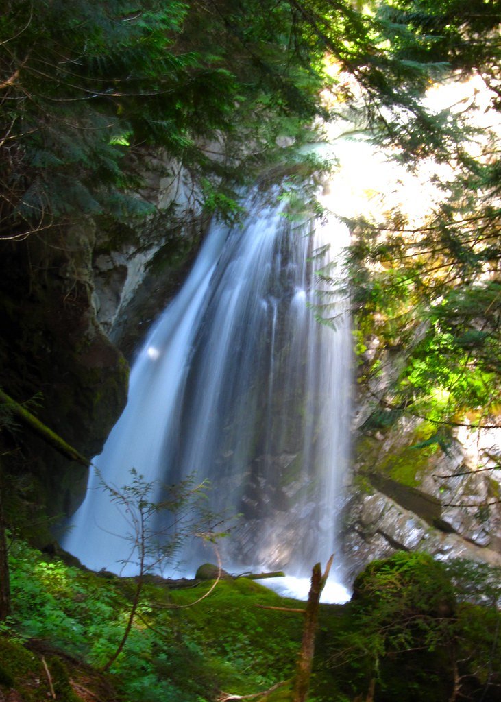
Fairy Falls
Washington • Mount Rainier National Park
By Armen Suny · Last verified Mar 2026
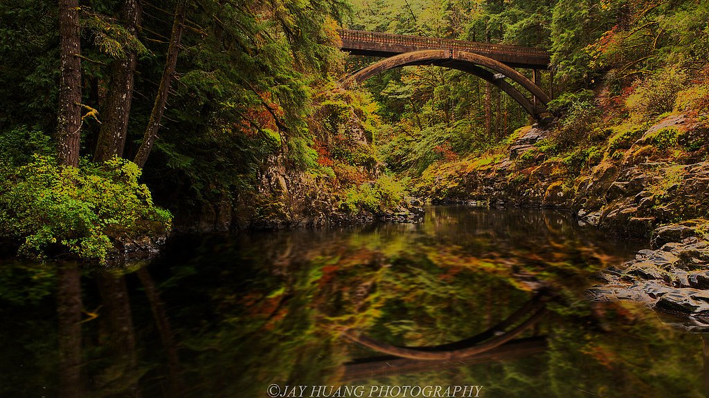
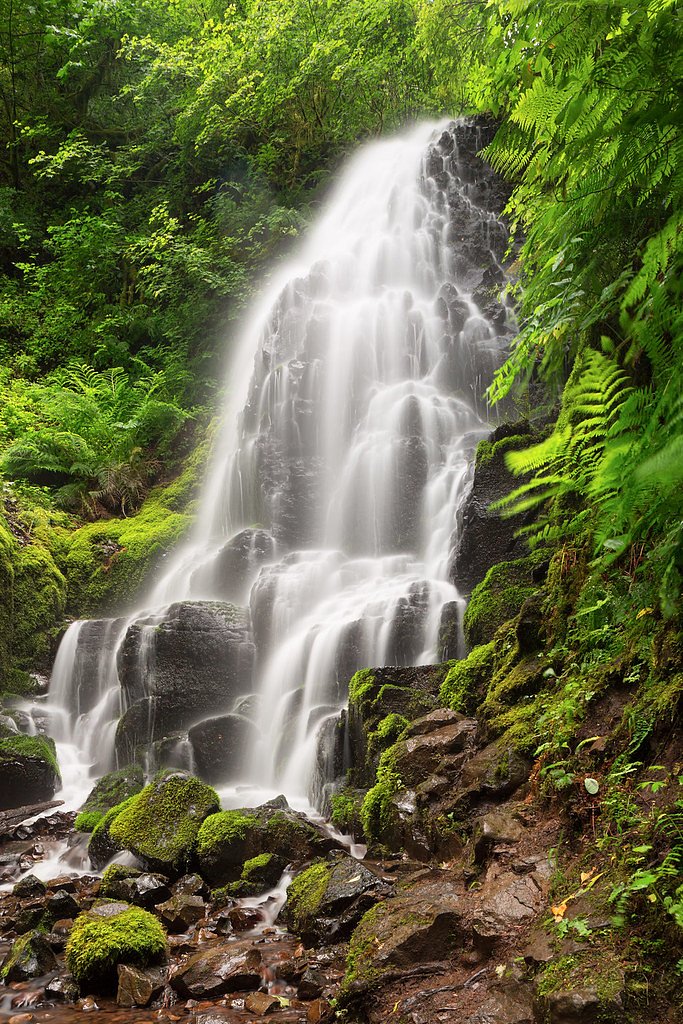

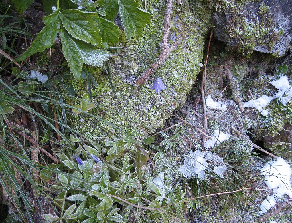

Photo Credits (5)
Difficulty
Moderate
Trail Length
3.5 miles
Trail Type
Out And Back
Elevation Gain
700 ft
About Fairy Falls
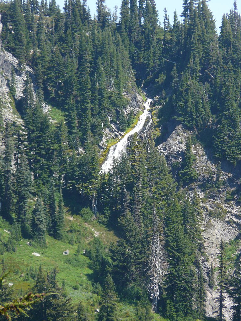
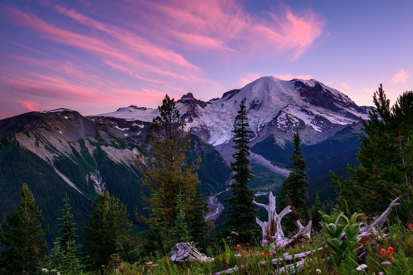
Tucked into Mount Rainier National Park (managed by the National Park Service) in Pierce County, Fairy Falls is a dramatic horsetail waterfall that plunges about 680 feet (210 m) down into a narrow, wooded canyon. Fed by an unnamed tributary of the Cowlitz River, the cascade narrows to roughly 20 feet (6.1 m) across as it threads the canyon, creating a striking vertical ribbon of water framed by old-growth forest. The falls sit in the same Stevens Creek drainage historically fed by the Paradise Glacier, which once supplied the two forks above the tree line that formed Upper Stevens Creek Falls and Fairy Falls. Visitors will find the setting quietly wild and moss-draped—an appealing destination for hikers who want a moody, high-drop waterfall without leaving the park’s established trails and protections.
The Setting
Fairy Falls sits at 5,669 feet within Mount Rainier National Park, fed by the Cowlitz River, in the high mountains of Washington.
Trail & Hike Details
The Approach
The moderate 3.5-mile out-and-back trail gains 700 feet of elevation on the way to the falls.
Trail Description
The access route to Fairy Falls is an out-and-back hike of approximately 3.5 miles round trip with about 700 feet of elevation gain; difficulty is commonly rated moderate. The tread goes through dense forest with shaded sections and occasional viewpoints into the narrow canyon; after rain, parts of the trail can be muddy or slippery. This route lies within Mount Rainier National Park and is managed by the NPS; there is no USFS trail number or USFS surface/grade/class data for this NPS-managed trail.
What to Expect
Dogs are welcome.
Accessibility
The trail is not wheelchair accessible. Uneven terrain and elevation changes require steady footing.
Frequently Asked Questions
🐶 Are Dogs Allowed at Fairy Falls?
✅ Dogs are allowed
Are There Any Fees or Permits Required?
🆖 No fees required
🏊 Is There Swimming at Fairy Falls?
❌ Swimming is not allowed
When to Visit
Spring and early summer are ideal times to visit, as the waterfall flow is typically strongest due to snowmelt and rainfall.
Seasonal Access
The best time to visit is Spring, Summer, and Fall. Access roads and trails may close during winter due to snow. Check with Mount Rainier National Park for current conditions.
Safety Information
The trail may be slippery after rain, and there are some steep sections. Stay on marked trails to avoid damaging the environment or getting lost. Cell service may be limited in the area.
Current Water Conditions
1,080 ft³/s
Current discharge — how much water is flowing
Much lower than usual for this time of year
Based on 96 years of record
1.56 ft
Water depth at gauge
7-Day Discharge Trend
What does this mean for your visit?
Flow is well below normal for this time of year, so the waterfall may be a trickle.
About This Gauge
This gauge is on a nearby waterway and may not reflect exact conditions at the falls.
7-Day Flow Outlook
Based on the USGS gauge COWLITZ RIVER AT PACKWOOD, WA (20 km away).
Today
Low
1177 cfs
4/10Tomorrow
Moderate
1245 cfs
4/10Sat
Moderate
1161 cfs
5/10Sun
Low
1083 cfs
4/10Mon
Moderate
1069 cfs
5/10Tue
Moderate
1059 cfs
5/10Wed
Moderate
1064 cfs
5/10Best window: Sat — moderate flow, light snow likely (trip score 5/10).
Best time of year: this gauge typically runs highest from mid April to mid July, peaking in June.
How we calculate this
This is a transparent outlook, not a precise forecast. We take the waterfall's current flow strength (how it ranks against its historical normal for today, from the nearest USGS stream gauge), carry that ranking forward along the gauge's seasonal curve, and nudge it for forecast rain. Confidence is highest for the next day or two and falls further out. Always check official conditions and your own judgment before visiting — high flows can be dangerous.
Know when to go.
Get a free email alert when waterfalls near Packwood hit peak flow. We only send when conditions are worth the trip — no weekly newsletters, no spam.
Weather Forecast
Location & Access
Getting There
Fairy Falls is located near the town of Washougal, Washington, within the Columbia River Gorge area. Access is typically via a trailhead in the Cape Horn area, though specific directions may vary depending on the trail chosen.
Get Directions on Google MapsParking
Parking is available at designated trailheads in the Cape Horn area. Spaces may be limited during peak seasons, so arriving early is recommended.
Elevation
5,669 feet above sea level
Coordinates
46.794554° N, -121.699815° W
Land Management
Managed by NPS
Visitor Tips & Gear
Wear sturdy hiking shoes, as the trail can be uneven or muddy. Bring water and snacks, and consider visiting early in the day to avoid crowds. Check weather conditions before heading out, as rain can make the trail slippery.
This trail sits at 5,669 ft above sea level
Elevated TrailUV radiation is roughly 23% stronger at this elevation than at sea level, and the dry air accelerates dehydration. Extra sun protection and fluids go a long way.
As an Amazon Associate, we earn from qualifying purchases.

Coppertone Sport SPF 50 Sunscreen
UV intensity jumps ~4% per 1,000 ft — at this elevation you can burn in half the time.

Sun Bum SPF 30 Lip Balm (3-Pack)
Lips have almost no natural UV protection and burn fast in thin, dry mountain air.

Liquid I.V. Electrolyte Packets
You lose moisture ~2x faster at elevation — electrolytes help you absorb water efficiently.

ROCKNIGHT Polarized UV400 Sunglasses
High-altitude glare off rock and water is intense — UV400 lenses block 99%+ of UVA/UVB.
As an Amazon Associate, we earn from qualifying purchases.
With 3.5 miles and 700 ft of elevation gain, sturdy boots and trekking poles will help on this moderate trail. Sun exposure on the trail makes good sun protection a must in summer.
America the Beautiful Annual Pass
Covers entrance fees at 2,000+ federal recreation sites — required at most National Parks.

Polarized Sunglasses (Knockaround)
Cuts glare off the water so you actually see the falls — and your photos turn out better too.

Columbia Watertight II Rain Jacket
Packs into its own pocket, seam-sealed, and keeps you dry from spray and surprise rain.

Earth Pak Waterproof Dry Bag
Keeps your phone and gear dry when waterfall mist soaks everything else.

Waterproof Phone Pouch (AiRunTech)
Cheap insurance — take photos right next to the falls without killing your phone.

Timberland Euro Sprint Mid Waterproof
Trusted waterproof boot with premium leather and grippy rubber sole — reliable on rocky, wet trails.

TrailBuddy Trekking Poles
Lightweight aluminum, cork grips, and flip-locks that actually hold — a best-seller for good reason.
Where to Stay

Mountain Meadows Inn & Chalet Suites

Tiny Timber

Gateway Inn & Cabins

Rainier Spa Cabin 7 Minutes to Park
Browse vacation cabins and private rentals nearby
Unique outdoor stays — tents, yurts, and treehouses
Rent a campervan or RV for your waterfall road trip
Some links are affiliate links. We may earn a commission at no extra cost to you.
Nearby Campground
La Wis Wis Campground
9.9 miles away · 113 sites
Overview Situated at the confluence of three waterways near Mount Rainier, La Wis Wis is nestled under a canopy of towering Douglas firs and red cedars. The handful of sites that dot the riverbank enjoy the most sunshine. With an abundance of activities nearby, La Wis Wis is a popular destination for long-stay camping. Its proximity to Mount Rainier National Park makes it an excellent base for exploring all of the area's natural wonders. Recreation Hikers can easily access the Blue Hole Trail and
Book on Recreation.govNearby Hot Springs
Hot springs near Packwood, Washington

Mt Rainier Fumaroles
Mount Rainier fumaroles reach 162 degrees at 14,217 feet elevation, emerging 154.8 degrees above ambient at Washington's highes...

Longmire Mineral Springs
Longmire Mineral Springs flows at 77 degrees within Mount Rainier National Park at 2,758 feet elevation, emerging 31.9 degrees ...

Ohanapecosh Hot Springs
Ohanapecosh Hot Springs flows at 122 degrees within Mount Rainier National Park at 1,920 feet elevation, emerging 74.5 degrees ...
Packwood Hot Spring
Packwood Hot Spring flows at 100 degrees at 1,002 feet elevation in the lower Cascade foothills near Morton, emerging 49.8 degr...
Orr Creek Warm Springs
Orr Creek Warm Springs emerges at 72 degrees in the Gifford Pinchot National Forest at 2,910 feet elevation, flowing 26.5 degre...
Lester Hot Springs
This 120-degree spring sits within the City of Tacoma Watershed at 1,582 feet elevation, emerging 72.3 degrees above ambient in...
Looking for a soak after your hike? Explore more hot springs near Packwood, Washington on SoakingSprings.
Explore Washington springsAdditional Information
Nearby Attractions
Cape Horn Trail, Beacon Rock State Park, Multnomah Falls (in nearby Oregon).
Wildlife
The area is home to a variety of birds, deer, and small mammals. Keep an eye out for native flora and fauna along the trail.
Cities near Fairy Falls
Nearby Waterfalls

Other waterfalls named Fairy Falls
1 other waterfall shares this name across the U.S.
Writing about Fairy Falls? Embed this waterfall on your site for free.