Washington Cascades
Washington • Mount Rainier National Park
By Armen Suny · Last verified Mar 2026

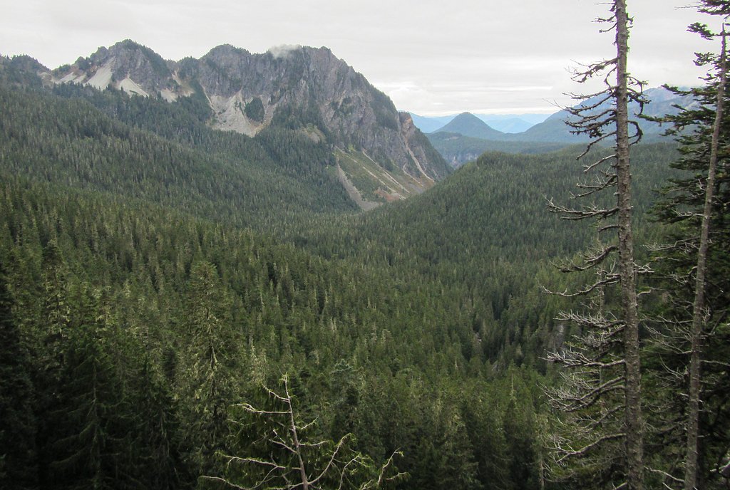
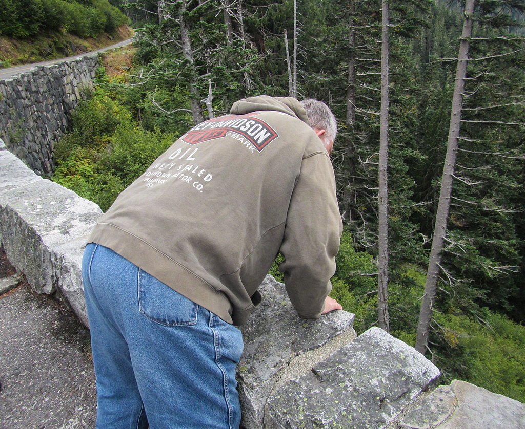
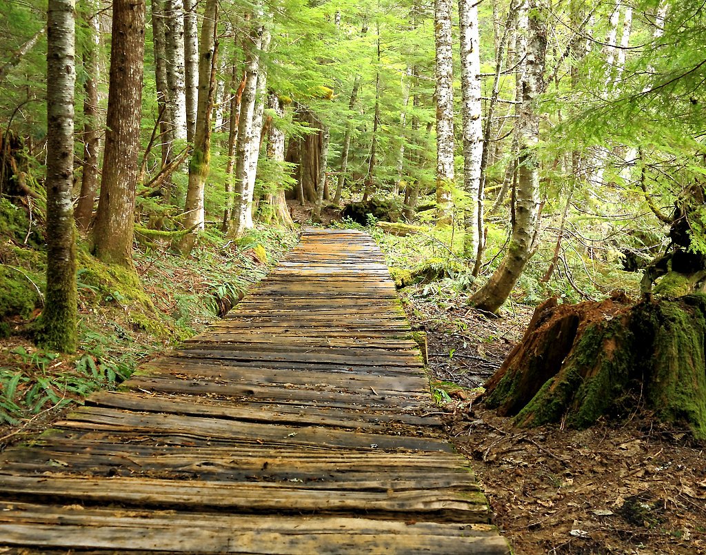

Photo Credits (5)
Difficulty
Moderate
Trail Length
2.4 miles
Trail Type
Out And Back
Elevation Gain
350 ft
About Washington Cascades
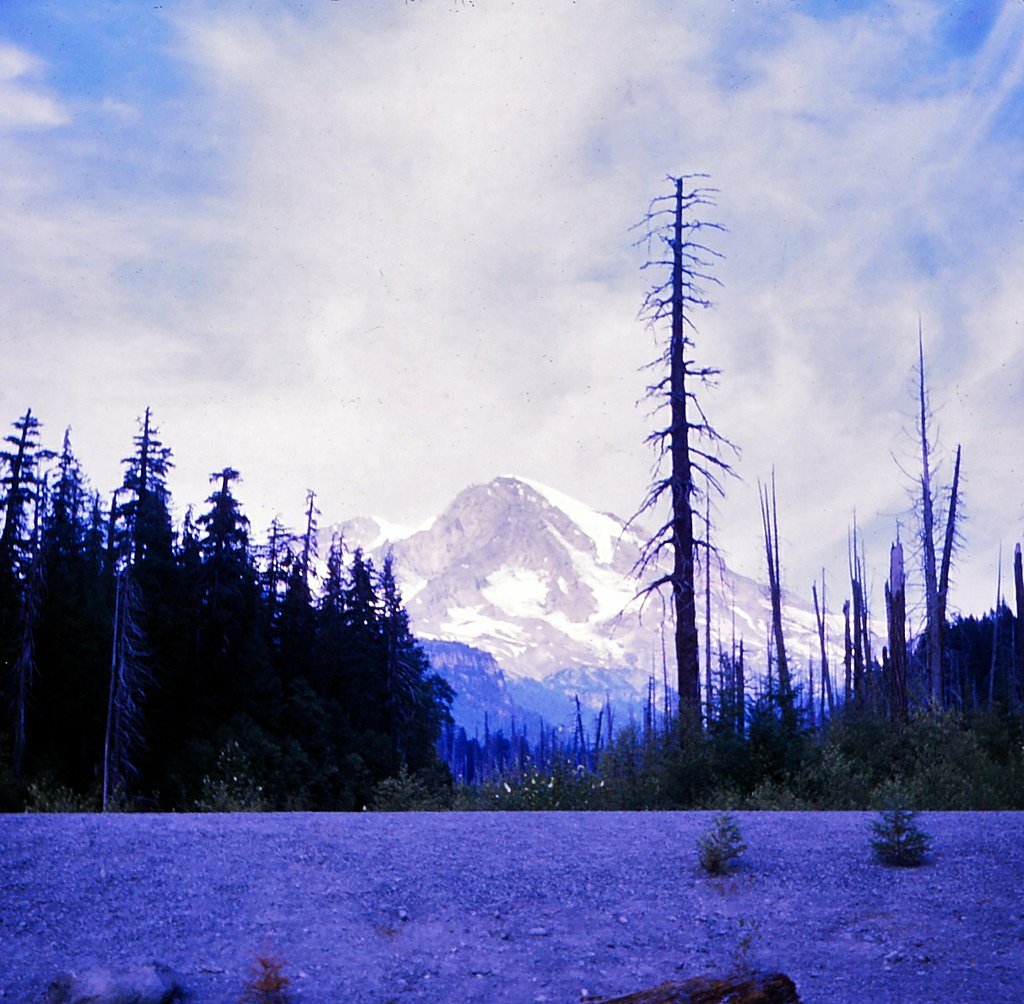
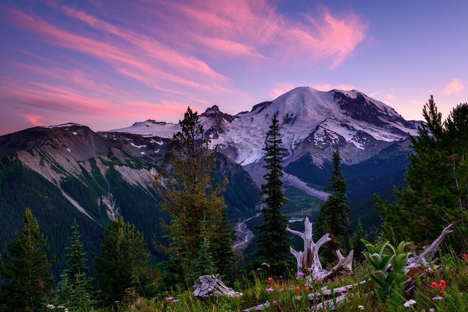
The waterfalls of the Washington Cascades are a showpiece of Mount Rainier National Park, managed by the National Park Service. From easy roadside cascades to streams that tumble through old-growth forest, these falls are largely fed by snowmelt and seasonal rains—so plan a visit in spring and early summer when flows are at their fullest. The park setting gives many viewpoints a dramatic backdrop of ridgelines and subalpine meadows, making short stops and longer hikes equally rewarding. For those planning an overnight or car-camping base, Cougar Rock Campground is just 4.09 km away, putting several popular waterfall trails within easy reach. Whether you’re looking for a brief, family-friendly stroll or a moderate hike that gains a few hundred feet, the park offers accessible options under NPS stewardship and well-signed routes into the forested drainage areas that feed the cascades.
The Setting
Washington Cascades sits at 4,662 feet within Mount Rainier National Park, fed by the Cowlitz River, in the mountains of Washington.
Nearby Falls Worth Visiting
Narada Falls (188 ft) lies 0.2 miles to the southwest. Also nearby: Madcap Falls (25 ft, 1.3 mi).
Trail & Hike Details
The Approach
The moderate 2.4-mile out-and-back trail gains 350 feet of elevation on the way to the falls.
Trail Description
This representative waterfall route in Mount Rainier National Park is an out-and-back trail of 2.4 miles with about 350 feet of elevation gain, classified as moderate difficulty. The distance and gain produce a gentle average grade (approximately 2.8%), making it a good choice for hikers who want a manageable climb with rewarding waterfall viewpoints; the route is non-technical and suitable for most hikers in reasonable condition. Trail surface and specific trail class details are not listed in the supplied park data; expect typical park tread (natural dirt and roots) and seasonal variability in footing near streams. The trail is managed by the National Park Service within Mount Rainier National Park; no USFS trail number was provided for this route. Cougar Rock Campground, about 4.1 km away, serves as a convenient nearby camping option.
What to Expect
Expect stunning views of waterfalls surrounded by dense forests, moss-covered rocks, and vibrant greenery. Trails may be muddy or slippery, especially during the rainy season or after snowmelt.
Accessibility
The trail is not wheelchair accessible. Uneven terrain and elevation changes require steady footing.
Frequently Asked Questions
🐶 Are Dogs Allowed at Washington Cascades?
❌ Dogs are not allowed
Are There Any Fees or Permits Required?
🆖 No fees required
🏊 Is There Swimming at Washington Cascades?
❌ Swimming is not allowed
When to Visit
Spring and early summer are the best times to visit, as waterfalls are typically at their fullest due to snowmelt. Fall offers beautiful foliage, while winter may provide unique frozen waterfall views, though access can be limited.
Seasonal Access
The best time to visit is Spring, Summer, and Fall. Winter access may be limited. Check with Mount Rainier National Park for current conditions.
Safety Information
Trails may be slippery, especially near waterfalls. Watch for loose rocks and wet surfaces. Be cautious of strong currents and avoid climbing on rocks near the falls. Check weather conditions before heading out, as sudden changes can occur.
Current Water Conditions
1,080 ft³/s
Current discharge — how much water is flowing
Much lower than usual for this time of year
Based on 96 years of record
1.56 ft
Water depth at gauge
7-Day Discharge Trend
What does this mean for your visit?
Flow is well below normal for this time of year, so the waterfall may be a trickle.
About This Gauge
This gauge is on a nearby waterway and may not reflect exact conditions at the falls.
7-Day Flow Outlook
Based on the USGS gauge COWLITZ RIVER AT PACKWOOD, WA (19 km away).
Today
Low
1177 cfs
4/10Tomorrow
Moderate
1245 cfs
4/10Sat
Moderate
1203 cfs
5/10Sun
Moderate
1103 cfs
5/10Mon
Moderate
1069 cfs
5/10Tue
Moderate
1059 cfs
5/10Wed
Moderate
1064 cfs
5/10Best window: Sat — moderate flow, rain and snow likely (trip score 5/10).
Best time of year: this gauge typically runs highest from mid April to mid July, peaking in June.
How we calculate this
This is a transparent outlook, not a precise forecast. We take the waterfall's current flow strength (how it ranks against its historical normal for today, from the nearest USGS stream gauge), carry that ranking forward along the gauge's seasonal curve, and nudge it for forecast rain. Confidence is highest for the next day or two and falls further out. Always check official conditions and your own judgment before visiting — high flows can be dangerous.
Know when to go.
Get a free email alert when waterfalls near Packwood hit peak flow. We only send when conditions are worth the trip — no weekly newsletters, no spam.
Weather Forecast
Location & Access
Getting There
The Washington Cascades span a large area in the state of Washington. Specific waterfalls can be accessed via various highways, including I-90, US-2, and SR-20. Popular destinations include Snoqualmie Falls, Wallace Falls, and Franklin Falls.
Get Directions on Google MapsParking
Parking availability varies by location. Some waterfalls, like Snoqualmie Falls, have dedicated parking lots, while others may require roadside parking or access through trailheads.
Elevation
4,662 feet above sea level
Coordinates
46.777609° N, -121.742872° W
Land Management
Managed by NPS
Visitor Tips & Gear
Wear sturdy hiking shoes, especially for trails with uneven or wet terrain. Check trail conditions before visiting, as some trails may be closed due to weather or maintenance. Arrive early to secure parking, especially at popular locations.
As an Amazon Associate, we earn from qualifying purchases.
With 2.4 miles and 350 ft of elevation gain, sturdy boots and trekking poles will help on this moderate trail. Sun exposure on the trail makes good sun protection a must in summer.
America the Beautiful Annual Pass
Covers entrance fees at 2,000+ federal recreation sites — required at most National Parks.

Polarized Sunglasses (Knockaround)
Cuts glare off the water so you actually see the falls — and your photos turn out better too.

Columbia Watertight II Rain Jacket
Packs into its own pocket, seam-sealed, and keeps you dry from spray and surprise rain.

Earth Pak Waterproof Dry Bag
Keeps your phone and gear dry when waterfall mist soaks everything else.

Waterproof Phone Pouch (AiRunTech)
Cheap insurance — take photos right next to the falls without killing your phone.

Timberland Euro Sprint Mid Waterproof
Trusted waterproof boot with premium leather and grippy rubber sole — reliable on rocky, wet trails.

TrailBuddy Trekking Poles
Lightweight aluminum, cork grips, and flip-locks that actually hold — a best-seller for good reason.
Where to Stay

Mountain Meadows Inn & Chalet Suites

Tiny Timber

Gateway Inn & Cabins

Rainier Spa Cabin 7 Minutes to Park
Browse vacation cabins and private rentals nearby
Unique outdoor stays — tents, yurts, and treehouses
Rent a campervan or RV for your waterfall road trip
Some links are affiliate links. We may earn a commission at no extra cost to you.
Nearby Campground
COUGAR ROCK CAMPGROUND
2.5 miles away · 184 sites
Overview Cougar Rock Campground, on the southwest side of Mt. Rainier National Park, is conveniently located near Paradise. Individual campsites are reservable on this page. Group campsite reservations can be made via Cougar Rock Group Campground. Paradise is the most popular destination in the park, with a lodge and visitor center, many miles of hiking trails and a commanding view of the mountain-the highest in the state and Cascade range. The main attraction at Mount Rainier National Park is t
Book on Recreation.govNearby Hot Springs
Hot springs near Packwood, Washington

Longmire Mineral Springs
Longmire Mineral Springs flows at 77 degrees within Mount Rainier National Park at 2,758 feet elevation, emerging 31.9 degrees ...

Mt Rainier Fumaroles
Mount Rainier fumaroles reach 162 degrees at 14,217 feet elevation, emerging 154.8 degrees above ambient at Washington's highes...

Ohanapecosh Hot Springs
Ohanapecosh Hot Springs flows at 122 degrees within Mount Rainier National Park at 1,920 feet elevation, emerging 74.5 degrees ...
Packwood Hot Spring
Packwood Hot Spring flows at 100 degrees at 1,002 feet elevation in the lower Cascade foothills near Morton, emerging 49.8 degr...
Orr Creek Warm Springs
Orr Creek Warm Springs emerges at 72 degrees in the Gifford Pinchot National Forest at 2,910 feet elevation, flowing 26.5 degre...
Lester Hot Springs
This 120-degree spring sits within the City of Tacoma Watershed at 1,582 feet elevation, emerging 72.3 degrees above ambient in...
Looking for a soak after your hike? Explore more hot springs near Packwood, Washington on SoakingSprings.
Explore Washington springsAdditional Information
Nearby Attractions
Nearby attractions include Mount Rainier National Park, North Cascades National Park, and various hiking trails throughout the region.
Wildlife
The area is home to diverse wildlife, including deer, black bears, mountain goats, and a variety of bird species. Always practice safe wildlife viewing and keep a respectful distance.
Cities near Washington Cascades
Nearby Waterfalls

Writing about Washington Cascades? Embed this waterfall on your site for free.