Rumford Falls
Maine • 176 ft
By Armen Suny · Last verified Mar 2026
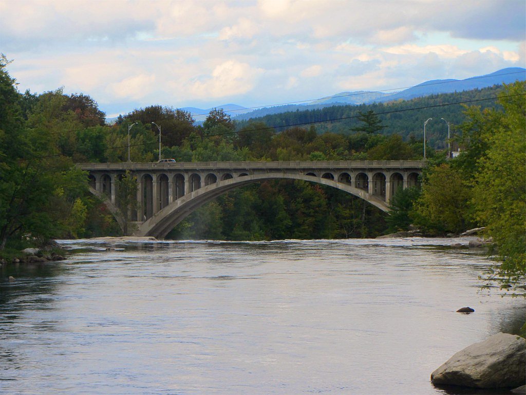
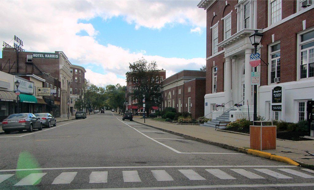


Photo Credits (5)
Difficulty
Drive Up
Trail Length
0.1 miles
Trail Type
Out And Back
Elevation Gain
20 ft
About Rumford Falls
Rumford Falls, located in the town of Rumford, Maine, is a series of cascading waterfalls on the Androscoggin River. It is one of the tallest waterfalls in Maine when considering the total drop across its multiple cascades. The falls are a significant historical and industrial landmark, as they were once used to power local mills.
The Setting
Rumford Falls sits at 505 feet along the Androscoggin River, in the foothills of Maine. At 176 feet, it is among the taller waterfalls in Maine.
Height: 176 feet
Trail & Hike Details
The Approach
No hiking required. Rumford Falls is accessible by vehicle with a roadside viewing area.
Trail Description
Rumford Falls does not require a hike to access. Visitors can view the falls from a designated viewing area near the parking lot. There are no formal trails leading to the falls, as they are primarily a roadside attraction.
What to Expect
The falls plunge 176 feet. Dogs are welcome.
Accessibility
This waterfall is viewable from a vehicle-accessible area. No hiking is required.
Frequently Asked Questions
🐶 Are Dogs Allowed at Rumford Falls?
✅ Dogs are allowed
Are There Any Fees or Permits Required?
🆖 No fees required
🏊 Is There Swimming at Rumford Falls?
❌ Swimming is not allowed
When to Visit
Spring is the best time to visit Rumford Falls due to the high water flow from snowmelt. Summer and fall also offer pleasant views, while winter may provide unique frozen waterfall scenery.
Seasonal Access
The best time to visit is Spring, Summer, and Fall. Winter access may be limited.
Safety Information
Stay within designated viewing areas and avoid venturing too close to the riverbanks, as the rocks can be slippery and the currents are strong. Be aware of dam operations, which can cause sudden changes in water levels.
Current Water Conditions
6,250 ft³/s
Current discharge — how much water is flowing
Much higher than usual for this time of year
Based on 124 years of record
5.62 ft
Water depth at gauge
7-Day Discharge Trend
What does this mean for your visit?
The water is flowing much higher than usual, expect an impressive display.
About This Gauge
7-Day Flow Outlook
Based on the USGS gauge Androscoggin River at Rumford, Maine (1 km away).
Today
Moderate
7342 cfs
4/10Tomorrow
Moderate
6632 cfs
6/10Tue
Moderate
6615 cfs
5/10Wed
Moderate
7228 cfs
4/10Thu
Moderate
7470 cfs
4/10Fri
Moderate
7324 cfs
4/10Sat
Moderate
6682 cfs
5/10Best window: Tomorrow — moderate flow, patchy fog then mostly sunny (trip score 6/10).
Best time of year: this gauge typically runs highest from mid March to mid June, peaking in April.
How we calculate this
This is a transparent outlook, not a precise forecast. We take the waterfall's current flow strength (how it ranks against its historical normal for today, from the nearest USGS stream gauge), carry that ranking forward along the gauge's seasonal curve, and nudge it for forecast rain. Confidence is highest for the next day or two and falls further out. Always check official conditions and your own judgment before visiting — high flows can be dangerous.
Know when to go.
Get a free email alert when waterfalls near Bethel hit peak flow. We only send when conditions are worth the trip — no weekly newsletters, no spam.
Weather Forecast
Location & Access
Getting There
Rumford Falls is easily accessible from downtown Rumford, Maine. The falls are located near the intersection of Route 2 and Route 108, with clear signage pointing to the area.
Get Directions on Google MapsParking
There is a small parking area near the falls, which is free of charge. Visitors can park close to the viewing area.
Elevation
505 feet above sea level
Coordinates
44.539508° N, -70.544232° W
Visitor Tips & Gear
Visit in the spring for the most impressive water flow. Bring a camera to capture the scenic views. Be cautious near the riverbanks, as the rocks can be slippery.
As an Amazon Associate, we earn from qualifying purchases.
For this easy 0.1 miles trail, lightweight trail shoes and a water bottle are usually sufficient. Sun exposure on the trail makes good sun protection a must in summer.

Polarized Sunglasses (Knockaround)
Cuts glare off the water so you actually see the falls — and your photos turn out better too.

Columbia Watertight II Rain Jacket
Packs into its own pocket, seam-sealed, and keeps you dry from spray and surprise rain.

Earth Pak Waterproof Dry Bag
Keeps your phone and gear dry when waterfall mist soaks everything else.

Waterproof Phone Pouch (AiRunTech)
Cheap insurance — take photos right next to the falls without killing your phone.

JOBY GorillaPod Starter Kit
Wraps around railings and rocks for long-exposure waterfall shots — no flat surface needed.

OR Sombriolet Sun Hat
UPF 50+ sun protection with vents so your head doesn't cook on exposed trail sections.
Where to Stay

Best Western Plus Rumford Falls

Charming Home Near Ski Areas

Comfort Inn & Suites Wilton

Wilson Lake Inn
Browse vacation cabins and private rentals nearby
Unique outdoor stays — tents, yurts, and treehouses
Rent a campervan or RV for your waterfall road trip
Some links are affiliate links. We may earn a commission at no extra cost to you.
Additional Information
Nearby Attractions
Nearby attractions include Black Mountain of Maine for skiing and hiking, and the Rumford Historical Society Museum.
Wildlife
The area around the falls is home to common river wildlife such as ducks, herons, and fish. Bald eagles are occasionally spotted in the region.
Cities near Rumford Falls
Nearby Waterfalls
Writing about Rumford Falls? Embed this waterfall on your site for free.