Devils Washboard Falls
By Armen Suny · Last verified May 2026
Difficulty
Easy
Trail Length
1.0 miles
Trail Type
Out And Back
Elevation Gain
200 ft
About Devils Washboard Falls
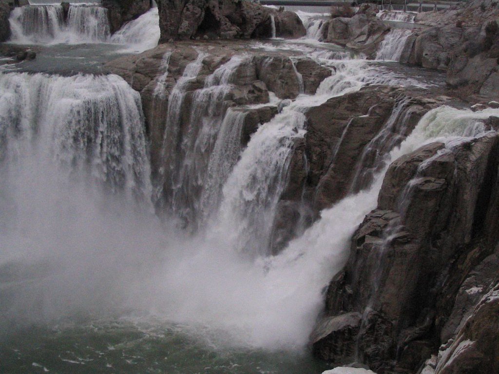
Devils Washboard Falls is a scenic waterfall located in Idaho, known for its unique cascading rock formations that resemble a washboard. It is a lesser-known destination, offering a serene and picturesque experience for visitors.
The Setting
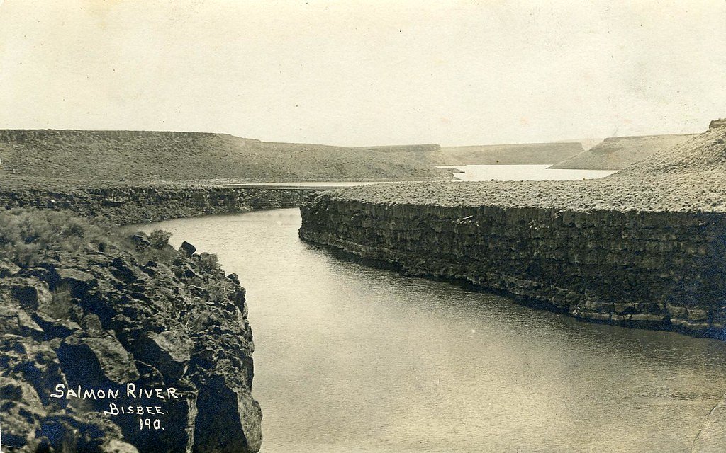
Devils Washboard Falls sits at 2,959 feet along the Snake River, in the hills of Idaho.
Trail & Hike Details
The Approach
The easy 1.0-mile out-and-back trail gains 200 feet of elevation on the way to the falls.
Trail Description
The trail to Devils Washboard Falls is relatively short and easy, making it suitable for most visitors. It passes through a forested area and may involve some uneven terrain. The trail is not heavily trafficked, providing a peaceful hiking experience.
What to Expect
Visitors can expect to see a unique waterfall cascading over rock formations that resemble a washboard. The area is surrounded by lush vegetation, and the sound of the water creates a tranquil atmosphere.
Accessibility
The trail is not wheelchair accessible. Uneven terrain and elevation changes require steady footing.
Frequently Asked Questions
🐶 Are Dogs Allowed at Devils Washboard Falls?
❌ Dogs are not allowed
Are There Any Fees or Permits Required?
🆖 No fees required
🏊 Is There Swimming at Devils Washboard Falls?
❌ Swimming is not allowed
When to Visit
Spring and early summer are the best times to visit, as the waterfall is typically at its fullest due to snowmelt. Fall offers beautiful foliage, while winter access may be limited due to snow.
Seasonal Access
The best time to visit is Spring, Summer, and Fall. Winter access may be limited.
Safety Information
Visitors should exercise caution on uneven terrain and near the water. Check weather and road conditions before visiting, as the area can become slippery or inaccessible during rain or snow.
Current Water Conditions
1,640 ft³/s
Current discharge — how much water is flowing
Much lower than usual for this time of year
Based on 79 years of record
1.06 ft
Water depth at gauge
7-Day Discharge Trend
What does this mean for your visit?
Flow is well below normal for this time of year, so the waterfall may be a trickle.
About This Gauge
7-Day Flow Outlook
Based on the USGS gauge SNAKE RIVER NR BUHL ID (5 km away).
Today
Roaring
1640 cfs
9/10Tomorrow
Roaring
1745 cfs
6/10Tue
Roaring
1588 cfs
9/10Wed
Roaring
1768 cfs
6/10Thu
Roaring
1728 cfs
6/10Fri
Roaring
1588 cfs
9/10Sat
Roaring
1521 cfs
9/10Best window: Today — roaring flow, sunny (trip score 9/10).
Best time of year: this gauge typically runs highest from late December to early February, peaking in April.
How we calculate this
This is a transparent outlook, not a precise forecast. We take the waterfall's current flow strength (how it ranks against its historical normal for today, from the nearest USGS stream gauge), carry that ranking forward along the gauge's seasonal curve, and nudge it for forecast rain. Confidence is highest for the next day or two and falls further out. Always check official conditions and your own judgment before visiting — high flows can be dangerous.
Know when to go.
Get a free email alert when waterfalls near Buhl hit peak flow. We only send when conditions are worth the trip — no weekly newsletters, no spam.
Weather Forecast
Location & Access
Getting There
The waterfall is located in a remote area of Idaho. Access typically involves driving on forest service roads, and the exact route may vary depending on the starting point. Visitors are advised to use a reliable map or GPS device to navigate.
Get Directions on Google MapsParking
Parking availability is limited and may consist of small pull-offs along the road. Visitors should ensure they park safely without blocking access.
Elevation
2,959 feet above sea level
Coordinates
42.669071° N, -114.778663° W
Visitor Tips & Gear
Wear sturdy shoes as the trail may have uneven sections. Bring insect repellent during warmer months, as bugs can be present. Check road conditions before visiting, especially in winter or after heavy rains.
As an Amazon Associate, we earn from qualifying purchases.
This easy 1.0 miles hike is straightforward — comfortable trail shoes and plenty of water should do. Sun exposure on the trail makes good sun protection a must in summer.

Columbia Watertight II Rain Jacket
Packs into its own pocket, seam-sealed, and keeps you dry from spray and surprise rain.

Earth Pak Waterproof Dry Bag
Keeps your phone and gear dry when waterfall mist soaks everything else.

Waterproof Phone Pouch (AiRunTech)
Cheap insurance — take photos right next to the falls without killing your phone.

Polarized Sunglasses (Knockaround)
Cuts glare off the water so you actually see the falls — and your photos turn out better too.

Osprey Daylite Daypack
Light, organized, and just the right size for a day hike — fits water, snacks, and layers.

OR Sombriolet Sun Hat
UPF 50+ sun protection with vents so your head doesn't cook on exposed trail sections.
Where to Stay

Oregon Trail Inn

La Quinta by Wyndham Twin Falls

Comfort Inn & Suites Jerome - Twin Falls

Hilton Garden Inn Twin Falls
Browse vacation cabins and private rentals nearby
Unique outdoor stays — tents, yurts, and treehouses
Rent a campervan or RV for your waterfall road trip
Some links are affiliate links. We may earn a commission at no extra cost to you.
Nearby Hot Springs
Hot springs near Buhl, Idaho
Banbury Hot Spring
Banbury Hot Spring fires out at 138 degrees Fahrenheit near Buhl in Twin Falls County, one of the hottest thermal features in t...
Hot Sulphur (Miracle Hot) Springs
Known locally as Miracle Hot Springs, this Twin Falls County source flows at 131 degrees Fahrenheit near Buhl in the Snake Rive...
Salmon Falls Hot Spring
Salmon Falls Hot Spring pushes 153-degree water to the surface just six feet from North 1000 East road in Twin Falls County, on...
Poison Springs
Poison Springs sits on BLM land near Buhl in Twin Falls County, Idaho, at 3,388 feet elevation. The original temperature was re...
Hot Sulphur Lake
Hot Sulphur Lake sits right off the road near Gooding at 81 degrees Fahrenheit, making it one of the more accessible and mildly...
White Arrow Hot Spring
White Arrow Hot Spring reaches 145°F, making it dangerously hot for direct contact. Located at 3,300 feet in Gooding County's h...
Looking for a soak after your hike? Explore more hot springs near Buhl, Idaho on SoakingSprings.
Explore Idaho springsAdditional Information
Nearby Attractions
Other waterfalls and hiking trails in the area, as well as opportunities for camping and fishing in nearby forests.
Wildlife
The area is home to various wildlife, including birds, deer, and small mammals. Visitors should be cautious of potential encounters with bears or other larger animals.
Cities near Devils Washboard Falls
Nearby Waterfalls
Writing about Devils Washboard Falls? Embed this waterfall on your site for free.