Cottonwood Falls
By Armen Suny · Last verified May 2026
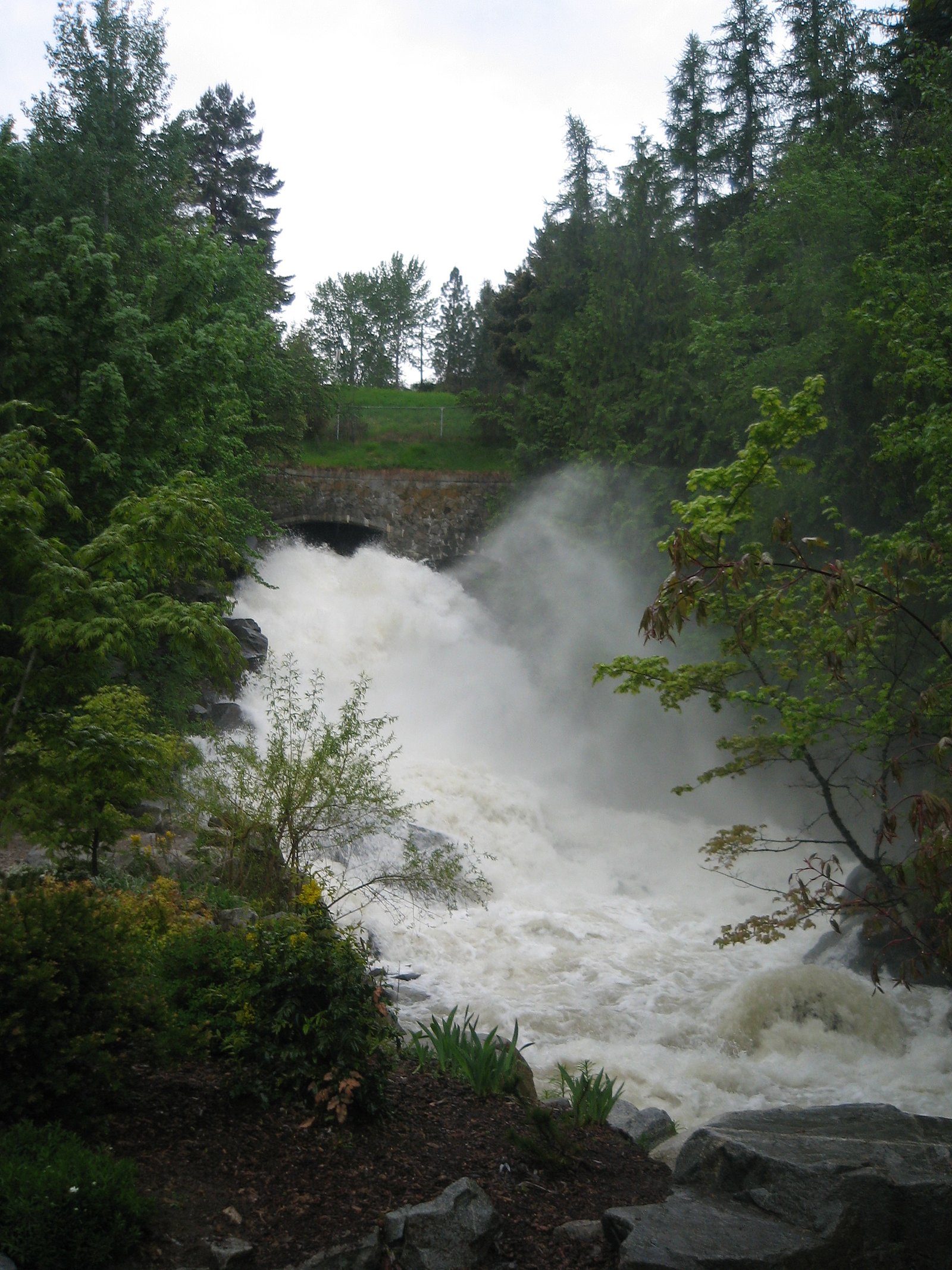
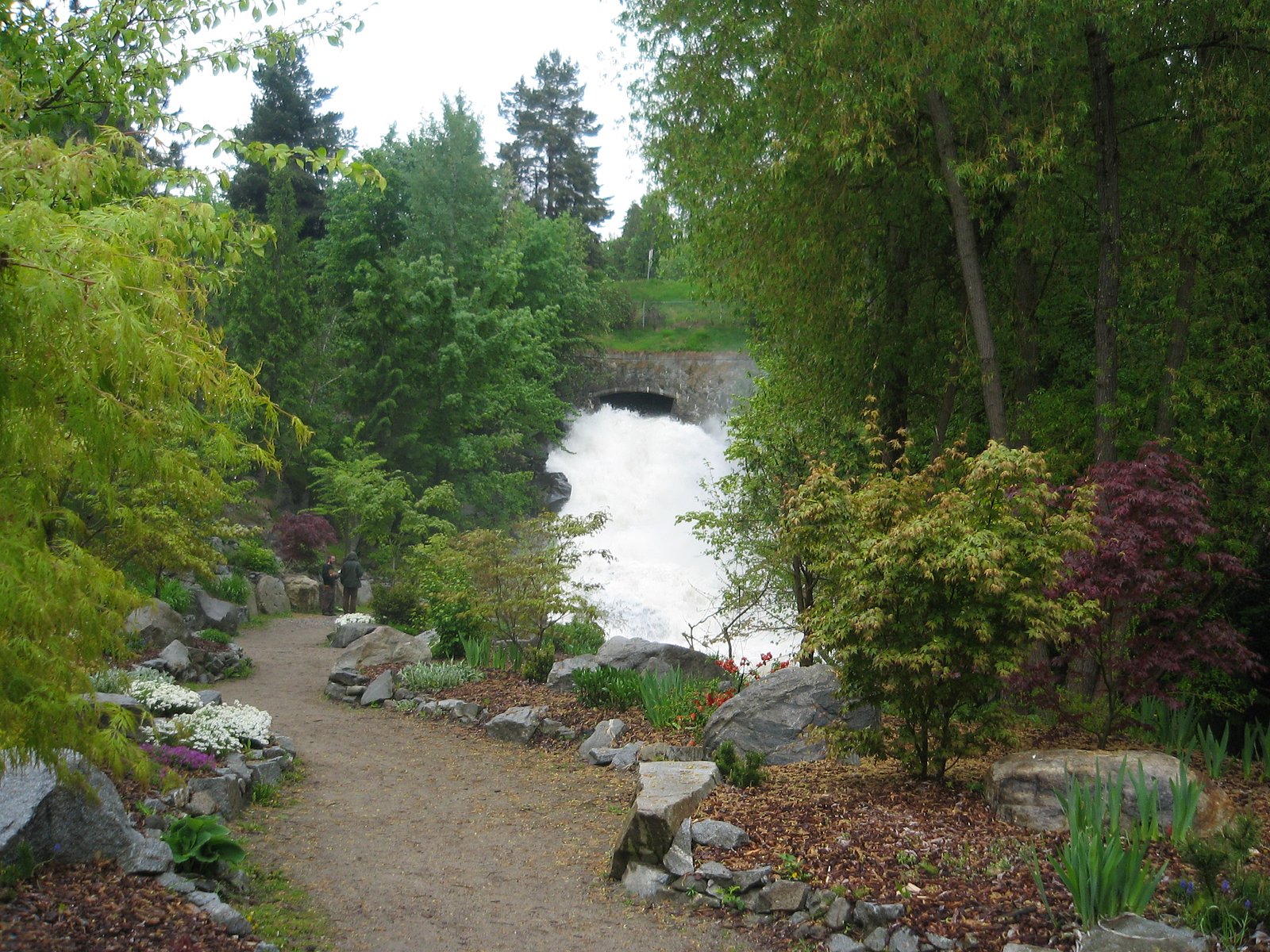
Photo Credits (3)
Difficulty
Moderate
Trail Length
2.4 miles
Trail Type
Out And Back
Elevation Gain
350 ft
About Cottonwood Falls
Cottonwood Falls is a tucked-away waterfall in Wyoming that rewards a short hike with a peaceful cascade set among shady, forested surroundings. The approach is an out-and-back route of about 2.4 miles with roughly 350 feet of elevation gain, making it a moderate outing that offers steady but manageable uphill stretches rather than technical climbing. Its quieter, less-trafficked character makes it a great choice for hikers seeking a mellow nature escape. The trail tracks a creek through wooded terrain, so you’ll enjoy dappled light and the sound of running water on the way to the falls. The route is generally well-marked and accessible to most hikers prepared for a moderate effort; the nearest developed campground, Friend Park Campground, lies about 20.8 km away, so plan logistics accordingly if you’re hoping to camp nearby.
The Setting
Cottonwood Falls sits at 5,499 feet along the North Platte River, in the high mountains of Wyoming.
Trail & Hike Details
The Approach
The moderate 2.4-mile out-and-back trail gains 350 feet of elevation on the way to the falls.
Trail Description
Out-and-back trail of approximately 2.4 miles with about 350 feet of elevation gain, rated moderate. The route follows a forested creek and is generally well-marked, with some steady uphill sections but no technical scrambling indicated. Specific USFS trail surface, grade, or official trail number/details were not provided in the available data.
What to Expect
Dogs are welcome.
Accessibility
The trail is not wheelchair accessible. Uneven terrain and elevation changes require steady footing.
Frequently Asked Questions
🐶 Are Dogs Allowed at Cottonwood Falls?
✅ Dogs are allowed
Are There Any Fees or Permits Required?
🆖 No fees required
🏊 Is There Swimming at Cottonwood Falls?
❌ Swimming is not allowed
When to Visit
The best time to visit Cottonwood Falls is late spring through early fall when the trail is most accessible, and the waterfall flow is at its peak due to snowmelt.
Seasonal Access
The best time to visit is Spring, Summer, and Fall. Access roads and trails may close during winter due to snow.
Safety Information
Be cautious of slippery rocks near the waterfall. Check weather conditions before visiting, as sudden storms can occur. Carry bear spray and know how to use it.
Current Water Conditions
Based on a USGS gauge 23.9 miles away
928 ft³/s
Current discharge — how much water is flowing
Much lower than usual for this time of year
Based on 72 years of record
3.99 ft
Water depth at gauge
7-Day Discharge Trend
What does this mean for your visit?
Flow is well below normal for this time of year, so the waterfall may be a trickle.
About This Gauge
This gauge is on a regional waterway. Conditions at the falls may differ, especially after local rain.
7-Day Flow Outlook
Based on the USGS gauge NORTH PLATTE RIVER AT ORIN, WY (38 km away).
Today
Roaring
904 cfs
9/10Tomorrow
Roaring
890 cfs
9/10Mon
Roaring
900 cfs
9/10Tue
Roaring
886 cfs
9/10Wed
Roaring
982 cfs
6/10Thu
Roaring
929 cfs
9/10Fri
Roaring
865 cfs
9/10Best window: Today — roaring flow, partly sunny (trip score 9/10).
Best time of year: this gauge typically runs highest from mid June to late July, peaking in May.
How we calculate this
This is a transparent outlook, not a precise forecast. We take the waterfall's current flow strength (how it ranks against its historical normal for today, from the nearest USGS stream gauge), carry that ranking forward along the gauge's seasonal curve, and nudge it for forecast rain. Confidence is highest for the next day or two and falls further out. Always check official conditions and your own judgment before visiting — high flows can be dangerous.
Know when to go.
Get a free email alert when waterfalls near El Rancho hit peak flow. We only send when conditions are worth the trip — no weekly newsletters, no spam.
Weather Forecast
Location & Access
Getting There
Cottonwood Falls is located near the town of Centennial, Wyoming, within the Medicine Bow National Forest. Access typically involves driving on forest roads, which may be unpaved and require a high-clearance vehicle depending on conditions.
Get Directions on Google MapsParking
There is limited parking available near the trailhead. Visitors should plan to arrive early, especially during peak seasons, to secure a spot.
Elevation
5,499 feet above sea level
Coordinates
42.312529° N, -105.244074° W
Visitor Tips & Gear
Wear sturdy shoes as the trail may be muddy or uneven in places. Check road and trail conditions before visiting, especially during spring when snowmelt can make access challenging. Bring bug spray during summer months.
This trail sits at 5,499 ft above sea level
Elevated TrailUV radiation is roughly 22% stronger at this elevation than at sea level, and the dry air accelerates dehydration. Extra sun protection and fluids go a long way.
As an Amazon Associate, we earn from qualifying purchases.

Coppertone Sport SPF 50 Sunscreen
UV intensity jumps ~4% per 1,000 ft — at this elevation you can burn in half the time.

Sun Bum SPF 30 Lip Balm (3-Pack)
Lips have almost no natural UV protection and burn fast in thin, dry mountain air.

Liquid I.V. Electrolyte Packets
You lose moisture ~2x faster at elevation — electrolytes help you absorb water efficiently.

ROCKNIGHT Polarized UV400 Sunglasses
High-altitude glare off rock and water is intense — UV400 lenses block 99%+ of UVA/UVB.
As an Amazon Associate, we earn from qualifying purchases.
With 2.4 miles and 350 ft of elevation gain, sturdy boots and trekking poles will help on this moderate trail. Sun exposure on the trail makes good sun protection a must in summer.

Polarized Sunglasses (Knockaround)
Cuts glare off the water so you actually see the falls — and your photos turn out better too.

Columbia Watertight II Rain Jacket
Packs into its own pocket, seam-sealed, and keeps you dry from spray and surprise rain.

Earth Pak Waterproof Dry Bag
Keeps your phone and gear dry when waterfall mist soaks everything else.

Waterproof Phone Pouch (AiRunTech)
Cheap insurance — take photos right next to the falls without killing your phone.

Timberland Euro Sprint Mid Waterproof
Trusted waterproof boot with premium leather and grippy rubber sole — reliable on rocky, wet trails.

TrailBuddy Trekking Poles
Lightweight aluminum, cork grips, and flip-locks that actually hold — a best-seller for good reason.
Where to Stay

Heartland Inn and Suites

Super 8 by Wyndham Wheatland Wyoming

Hudson House Bed and Breakfast

Best Western Torchlite
Browse vacation cabins and private rentals nearby
Unique outdoor stays — tents, yurts, and treehouses
Rent a campervan or RV for your waterfall road trip
Some links are affiliate links. We may earn a commission at no extra cost to you.
Nearby Campground
Friend Park Campground
12.9 miles away · 11 sites
Overview Situated at the base of Laramie Peak, the Friend Park Campground has 11 sites surrounded by firs, pines, and aspens with beautiful Friend Park to the southwest. A favorite of both tent and trailer campers, it is another great location for recreating within the Laramie Peak Unit of the Douglas Ranger District. The campground is popular for OHV riding, fishing, hiking, hunting, mountain biking, or just getting away to relax. Recreation The Laramie Peak area in the Medicine Bow National Fo
Book on Recreation.govNearby Hot Springs
Hot springs near El Rancho, Wyoming
Warm Springs (Immigrants Washtub)
Warm Springs, historically known as Immigrants Washtub, flows at 70°F on National Guard Maneuver Training Center land at Camp G...
Douglas Hot Springs
Douglas Hot Springs flows at 86 degrees Fahrenheit in Converse County near the town of Douglas in east-central Wyoming, where t...
Looking for a soak after your hike? Explore more hot springs near El Rancho, Wyoming on SoakingSprings.
Explore Wyoming springsAdditional Information
Nearby Attractions
Medicine Bow Peak, Snowy Range Scenic Byway, and the town of Centennial.
Wildlife
Visitors may encounter deer, elk, and a variety of bird species. Be cautious of bears and other wildlife in the area.
Cities near Cottonwood Falls
Other waterfalls named Cottonwood Falls
3 other waterfalls share this name across the U.S.
Writing about Cottonwood Falls? Embed this waterfall on your site for free.